Elder Moor

Wood, Forest in Dorset

England

Elder Moor

Deans Drove
Deans Drove Credit: Alex McGregor

Elder Moor is a picturesque woodland area located in the county of Dorset, England. Spanning over a vast expanse of land, it is known for its dense forest and serene natural beauty. The moor is situated near the small village of Elder, which adds to its charm and tranquility.

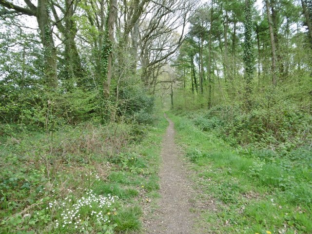
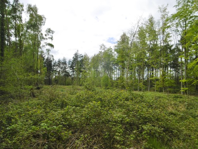
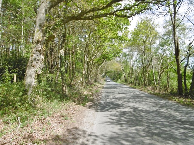
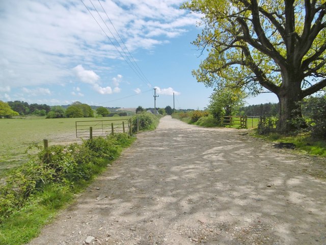
The woodland of Elder Moor is abundant with a wide variety of flora and fauna. Towering oak, beech, and birch trees dominate the landscape, creating a dense canopy that provides shade and shelter for a diverse range of wildlife. The forest floor is adorned with vibrant wildflowers, mosses, and ferns, adding color and texture to the surroundings.

The moor is also home to a rich assortment of animal species. Deer, foxes, and badgers are commonly spotted, while birdwatchers can delight in the sight of rare species such as the Dartford warbler and the nightjar. The tranquil atmosphere and lush vegetation make Elder Moor a popular destination for nature enthusiasts and photographers.

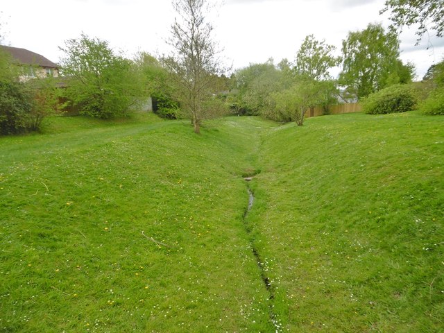
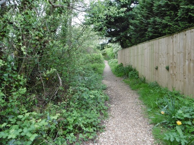
Trails and paths wind their way through the woodland, inviting visitors to explore and experience the serenity of the surroundings. It is a haven for hikers, offering opportunities for both leisurely strolls and more challenging treks. The moor also has a designated picnic area, where visitors can relax and enjoy a meal amidst the tranquil ambiance of the forest.

Elder Moor is a true gem in Dorset, offering a peaceful retreat from the hustle and bustle of modern life. Its natural beauty and diverse wildlife make it a must-visit destination for those seeking a connection with nature.

If you have any feedback on the listing, please let us know in the comments section below.
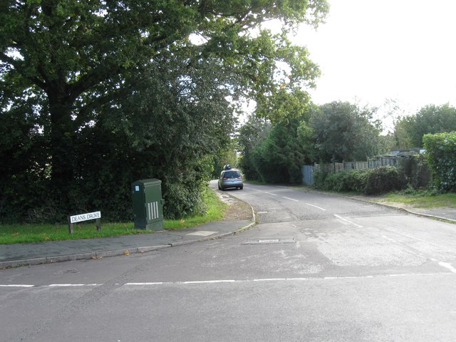
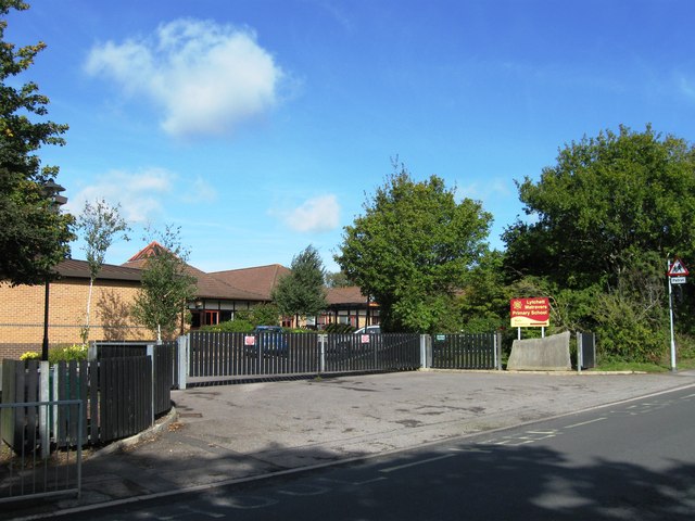
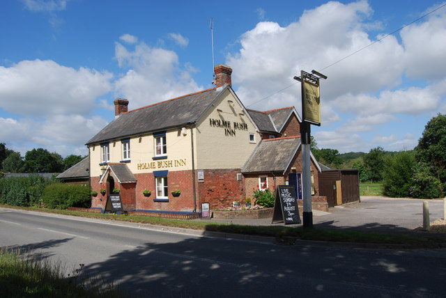
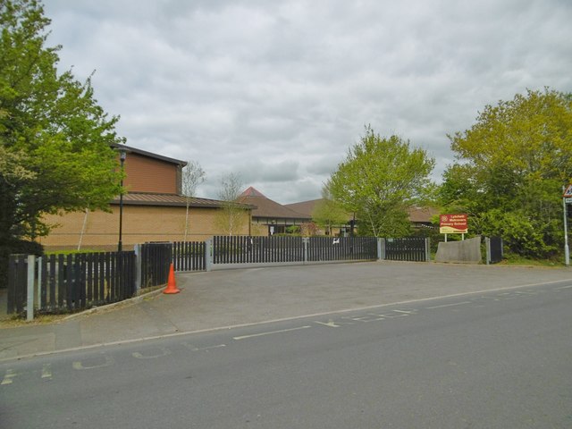
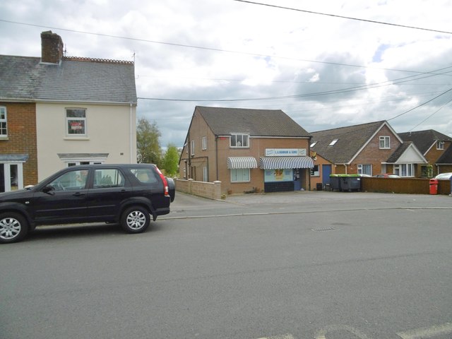
Elder Moor Images

Images are sourced within 2km of 50.757603/-2.061533 or Grid Reference SY9595. Thanks to Geograph Open Source API. All images are credited.

Deans Drove
Deans Drove
Entrance to Lytchett Matravers Primary School
Holme Bush Inn
Holme Bush Inn
Lytchett Matravers, footpath Skirting woodland, from Foxhills Road to Post Green. Note the stitchwort in bloom.
Lytchett Matravers, footpath
Skirting woodland, from Foxhills Road to Post Green. Note the stitchwort in bloom.
Lytchett Matravers, clearing In mixed woodland on the path to Post Green.
Lytchett Matravers, clearing
In mixed woodland on the path to Post Green.
Lytchett Matravers, brook Originating from a spring nearby, flowing down to join Sherford River.
Lytchett Matravers, brook
Originating from a spring nearby, flowing down to join Sherford River.
Lytchett Matravers, footpath From Deans Drove, following the course of <a href="https://www.geograph.org.uk/photo/5353610">SY9494 : Lytchett Matravers, brook</a>.
Lytchett Matravers, footpath
From Deans Drove, following the course of SY9494 : Lytchett Matravers, brook.
Lytchett Matravers, Deans Drove Village road with a hollow (caused or used by <a href="https://www.geograph.org.uk/photo/5353610">SY9494 : Lytchett Matravers, brook</a>) from Foxhills Road to Wareham Road.
Lytchett Matravers, Deans Drove
Village road with a hollow (caused or used by SY9494 : Lytchett Matravers, brook) from Foxhills Road to Wareham Road.
Lytchett Matravers Primary School On Wareham Road: <span class="nowrap"><a title="http://www.lytchettmatraversprimary.org.uk/" rel="nofollow ugc noopener" href="http://www.lytchettmatraversprimary.org.uk/">Link</a><img style="margin-left:2px;" alt="External link" title="External link - shift click to open in new window" src="https://s1.geograph.org.uk/img/external.png" width="10" height="10"/></span>
Lytchett Matravers Primary School
On Wareham Road: LinkExternal link
Lytchett Matravers, store General store and family butchers, on Wareham Road.
Lytchett Matravers, store
General store and family butchers, on Wareham Road.
Corfe Mullen, Rushall Lane Lane from Blandford Road North to Corfe Mullen; plantation, left, and properties and grazing land, right.
Corfe Mullen, Rushall Lane
Lane from Blandford Road North to Corfe Mullen; plantation, left, and properties and grazing land, right.
Corfe Mullen, plantation Stony Down Plantation - conifers with a little hardwood.
Corfe Mullen, plantation
Stony Down Plantation - conifers with a little hardwood.
Corfe Mullen, bridleway Bridleway and access road, from Rushall Lane to Upton Heath.
Corfe Mullen, bridleway
Bridleway and access road, from Rushall Lane to Upton Heath.
Corfe Mullen, crossroads Jubilee Cross - looking from Rushall Lane to Wimborne Road; left and right, Blandford Road North.
Corfe Mullen, crossroads
Jubilee Cross - looking from Rushall Lane to Wimborne Road; left and right, Blandford Road North.
Corfe Mullen, timber Softwood logs awaiting collection in Stony Down Plantation.
Corfe Mullen, timber
Softwood logs awaiting collection in Stony Down Plantation.
Corfe Mullen, bridleway Across Stony Down Plantation, from Rushall Lane to Old Market Road.
Corfe Mullen, bridleway
Across Stony Down Plantation, from Rushall Lane to Old Market Road.
Corfe Mullen, plantation Stony Down Plantation - conifers with patches of hardwood.
Corfe Mullen, plantation
Stony Down Plantation - conifers with patches of hardwood.
Corfe Mullen, track junction From camera and ahead, the bridleway to Old Market Road; left and right, tracks belonging to a local camping business. Upgrading of the tracks seems to have caused local controversy: <span class="nowrap"><a title="https://susanjefferies.mycouncillor.org.uk/2015/10/16/stoney-down-plantation/" rel="nofollow ugc noopener" href="https://susanjefferies.mycouncillor.org.uk/2015/10/16/stoney-down-plantation/">Link</a><img style="margin-left:2px;" alt="External link" title="External link - shift click to open in new window" src="https://s1.geograph.org.uk/img/external.png" width="10" height="10"/></span>
Corfe Mullen, track junction
From camera and ahead, the bridleway to Old Market Road; left and right, tracks belonging to a local camping business. Upgrading of the tracks seems to have caused local controversy: LinkExternal link
Show me another place!

Elder Moor is located at Grid Ref: SY9595 (Lat: 50.757603, Lng: -2.061533)

Unitary Authority: Dorset

Police Authority: Dorset

What 3 Words

///highways.lollipop.tracking. Near Lytchett Matravers, Dorset

Nearby Locations

Elder Moor Barrow Hill

Related Wikis

Barrow Hill, Dorset

Barrow Hill is a small settlement in Dorset, England, situated in the East Dorset administrative district on the A350 road approximately 4 miles (6.4 km...

Lytchett Heath

Lytchett Heath is an area of woods and farmland on the Dorset Heaths between the villages of Lytchett Matravers, Lytchett Minster and the hamlet of Beacon...

Lytchett Matravers

Lytchett Matravers is a large village and civil parish in Dorset, England. The 2011 census recorded the parish as having 1,439 households and a population...

St Aldhelm's Church, Lytchett Heath

St Aldhelm's Church is a private church in Lytchett Heath, Dorset, England. It was designed by George Crickmay for Lord Eustace Cecil and built in 1898...

Nearby Amenities

Located within 500m of 50.757603,-2.061533
Material: wood
Power: pole
Source: bing
Lat/Long: 50.7603114/-2.0623317
Location Transition: yes
Material: wood
Note: Switch goes between overhead and underground cable
Power: pole
Source: survey
Switch: mechanical
Lat/Long: 50.7616026/-2.0603871
Material: wood
Note: Recloser
Power: pole
Source: survey
Switch: yes
Lat/Long: 50.7609171/-2.0613903
Material: wood
Poles: bipole
Power: pole
Source: survey
Transformer: distribution
Voltage Primary: 11000
Voltage Secondary: 400
Voltage Tertiary: 230
Lat/Long: 50.7618875/-2.060245
Fire Hydrant
Emergency: fire_hydrant
Fire Hydrant Diameter: 90
Fire Hydrant Type: underground
Ref: 003854
Source: GPS+GLONASS
Lat/Long: 50.761741/-2.06132
Cables: 3
Material: wood
Power: pole
Source: survey
Voltage: 11000
Lat/Long: 50.7599983/-2.0636916
Material: wood
Power: pole
Lat/Long: 50.7596802/-2.0650193
Material: wood
Power: pole
Lat/Long: 50.7593578/-2.0663711
Material: wood
Power: pole
Source: bing
Lat/Long: 50.7593485/-2.0677055
Fire Hydrant
Emergency: fire_hydrant
Fire Hydrant Diameter: 100
Fire Hydrant Type: underground
Ref: 11764
Source: survey
Lat/Long: 50.7563092/-2.0653945
Power: pole
Source: bing
Lat/Long: 50.7587597/-2.0672938
Power: pole
Source: bing
Lat/Long: 50.7581158/-2.0663537
Power: pole
Source: bing
Lat/Long: 50.7577264/-2.0658146
Power: pole
Source: bing
Lat/Long: 50.757158/-2.0650233
Camera Mount: pole
Camera Type: dome
Height: 8
Man Made: surveillance
Material: wood
Operator: BT OpenReach
Ref: 1
Source: survey
Surveillance: public
Surveillance Type: camera
Utility: telecom
Lat/Long: 50.7534376/-2.0594544
The data included in this document is from www.openstreetmap.org. The data is made available under ODbL.

Have you been to Elder Moor?

Leave your review of Elder Moor below (or comments, questions and feedback).