Clerk's Patch

Wood, Forest in Gloucestershire Cotswold

England

Clerk's Patch

Disused quarry
Disused quarry Credit: don cload

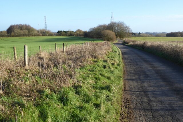
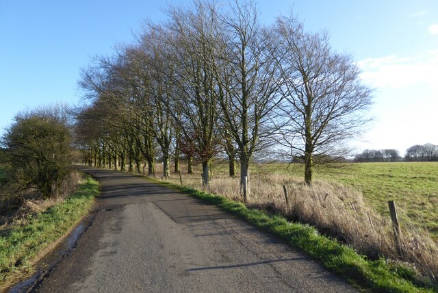
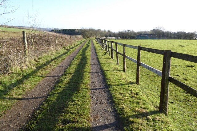
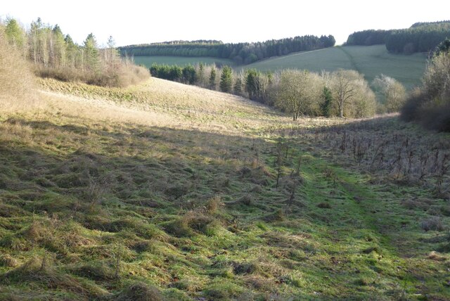
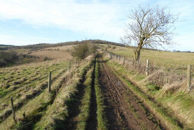
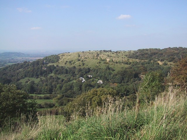
Clerk's Patch is a small woodland area located in the county of Gloucestershire, England. Covering an approximate area of 20 acres, this patch of woodland is situated within the larger Forest of Dean, a renowned ancient woodland and one of the few surviving royal forests in the country.

The woodland in Clerk's Patch is primarily composed of broadleaf trees, such as oak, beech, and birch, creating a diverse and vibrant ecosystem. The forest floor is covered in a thick layer of leaf litter, providing a rich habitat for a variety of plant species, including bluebells, wood sorrel, and wild garlic.

Clerk's Patch is home to numerous wildlife species, making it an important nature reserve within the Forest of Dean. Various bird species can be spotted in the area, including woodpeckers, owls, and warblers. The woodland also provides a habitat for mammals such as deer, badgers, and foxes.

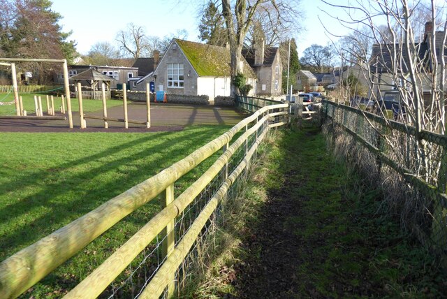
The woodland is accessible to the public, with a network of well-maintained footpaths and trails that allow visitors to explore the natural beauty of Clerk's Patch. The area is popular among hikers, nature enthusiasts, and photographers, who are attracted by its tranquil atmosphere and picturesque scenery.

Clerk's Patch is managed by local conservation organizations, who work to preserve its natural environment and protect its wildlife. They also organize educational programs and guided walks to raise awareness about the importance of woodland conservation and biodiversity.

Overall, Clerk's Patch is a charming and important woodland area within the Forest of Dean, offering visitors the opportunity to immerse themselves in nature and appreciate the beauty of Gloucestershire's woodlands.

If you have any feedback on the listing, please let us know in the comments section below.

Clerk's Patch Images

Images are sourced within 2km of 51.844144/-2.0734173 or Grid Reference SO9516. Thanks to Geograph Open Source API. All images are credited.

Disused quarry
Disused quarry
Manx Loaghtan sheep Manx Loaghtan sheep in a field at Coberley.
Manx Loaghtan sheep
Manx Loaghtan sheep in a field at Coberley.
Manx Loaghtan sheep Manx Loaghtan sheep in a field at Coberley.
Manx Loaghtan sheep
Manx Loaghtan sheep in a field at Coberley.
Manx Loaghtan sheep Manx Loaghtan sheep in a field at Coberley.
Manx Loaghtan sheep
Manx Loaghtan sheep in a field at Coberley.
Minor country road No through road to Birdlip Radio Station.
Minor country road
No through road to Birdlip Radio Station.
Beech trees Beech trees near Birdlip Radio Station.
Beech trees
Beech trees near Birdlip Radio Station.
The Gloucestershire Way The Gloucestershire Way from a track approaching Rushwood Kennels.
The Gloucestershire Way
The Gloucestershire Way from a track approaching Rushwood Kennels.
The Gloucestershire Way The Gloucestershire Way crossing a field between forestry and entering the valley above Coberley known as Coldwell Bottom.
The Gloucestershire Way
The Gloucestershire Way crossing a field between forestry and entering the valley above Coberley known as Coldwell Bottom.
Coldwell Bottom The Gloucestershire Way long distance footpath follows this path above the valley on the right which is called Coldwell Bottom.
Coldwell Bottom
The Gloucestershire Way long distance footpath follows this path above the valley on the right which is called Coldwell Bottom.
Path and gate above Coldwell Bottom The Gloucestershire Way follows this right of way above Coldwell Bottom.
Path and gate above Coldwell Bottom
The Gloucestershire Way follows this right of way above Coldwell Bottom.
Coldwell Bottom View across Coldwell Bottom to the Churn valley beyond, from the Gloucestershire Way.
Coldwell Bottom
View across Coldwell Bottom to the Churn valley beyond, from the Gloucestershire Way.
Gloucestershire Way Gloucestershire Way with Coldwell Bottom below on the left.
Gloucestershire Way
Gloucestershire Way with Coldwell Bottom below on the left.
A junction of paths The right of way on the left passing through the gate is the route of the Gloucestershire Way, alternatively there is a right of way on the right which eventually rejoins the Gloucestershire Way.
A junction of paths
The right of way on the left passing through the gate is the route of the Gloucestershire Way, alternatively there is a right of way on the right which eventually rejoins the Gloucestershire Way.
A junction of rights of way Continuing along this right of way passes Cuckoopen Barn Farm.  The path on the left, out of view is the route of the Gloucestershire Way.  This is almost exactly the same view as when I was last here almost fourteen years ago to the day <a href="https://www.geograph.org.uk/photo/653006">SO9515 : Footpath junction near Coberley</a>.
A junction of rights of way
Continuing along this right of way passes Cuckoopen Barn Farm. The path on the left, out of view is the route of the Gloucestershire Way. This is almost exactly the same view as when I was last here almost fourteen years ago to the day SO9515 : Footpath junction near Coberley.
The Gloucestershire Way The Gloucestershire Way to the west of Coberley and above Coldwell Bottom which is out of view on the left.
The Gloucestershire Way
The Gloucestershire Way to the west of Coberley and above Coldwell Bottom which is out of view on the left.
Dowman's Farm Dowman's Farm in the village of Coberley.
Dowman's Farm
Dowman's Farm in the village of Coberley.
Footpath approaching Dowman's Farm Footpath crossing field approaching Dowman's Farm at Coberley.
Footpath approaching Dowman's Farm
Footpath crossing field approaching Dowman's Farm at Coberley.
Footpath passing Coberley School Footpath passing Coberley Primary School.
Footpath passing Coberley School
Footpath passing Coberley Primary School.
Show me another place!

Clerk's Patch is located at Grid Ref: SO9516 (Lat: 51.844144, Lng: -2.0734173)

Administrative County: Gloucestershire

District: Cotswold

Police Authority: Gloucestershire

What 3 Words

///pitch.stall.galloped. Near Shurdington, Gloucestershire

Nearby Locations

Clerk's Patch

Related Wikis

National Star College

The National Star College (previously known as the Star Centre) is an independent specialist further education college for people with physical disabilities...

Coberley

Coberley is a village and civil parish in the Cotswold District of Gloucestershire in England, 4 miles (6.4 km) south of Cheltenham. It lies at the confluence...

Ullenwood

Ullenwood is a village in the Coberley civil parish, near Cheltenham in Gloucestershire. It is the site of a formerly secret civil defence bunker intended...

The Air Balloon, Birdlip

The Air Balloon is a road junction and former pub Birdlip, Gloucestershire, England. The junction is on the A417 at a significant congestion point. The...

Seven Springs, Gloucestershire

Seven Springs is a hamlet in the heavily wooded parish of Coberley in the Cotswold District of Gloucestershire in England, 4 miles (6.4 km) south of Cheltenham...

Cowley, Gloucestershire

Cowley is a village and civil parish in the Cotswold District of Gloucestershire, England. It lies between the A417 and A435 roads between Cheltenham...

Crickley Hill and Barrow Wake

Crickley Hill and Barrow Wake (grid reference SO929161 & grid reference SO931154) is a 56.8-hectare (140-acre) biological and geological Site of Special...

Devil's Chimney (Gloucestershire)

The Devil's Chimney is a limestone rock formation that stands above a disused quarry in Leckhampton, near Cheltenham, Gloucestershire, England. It is named...

Nearby Amenities

Located within 500m of 51.844144,-2.0734173
Barrier: cattle_grid
Note: Gate and Cattle Grid - access discouraged by sign saying Private Land
Source: survey
Lat/Long: 51.8444565/-2.0690063
Intermittent: no
Natural: spring
Note: The farthest source of the Thames from its mouth that is not intermittent.
Lat/Long: 51.8468514/-2.0780774
Golf: pin
Lat/Long: 51.8482423/-2.0742582
Golf: pin
Lat/Long: 51.8477819/-2.0694507
Glenfall House Ullenwood
Power: pole
Transformer: distribution
Voltage Primary: 11000
Lat/Long: 51.8448715/-2.0697923
Power: pole
Lat/Long: 51.8450819/-2.070827
Power: pole
Lat/Long: 51.8452916/-2.0719273
Power: pole
Lat/Long: 51.8452684/-2.0730096
Power: pole
Lat/Long: 51.8452493/-2.0739095
Power: pole
Lat/Long: 51.8453951/-2.0746417
Power: pole
Lat/Long: 51.8457398/-2.0759346
Power: pole
Lat/Long: 51.8460662/-2.0768546
Byways Ullenwood
Power: pole
Transformer: distribution
Voltage Primary: 11000
Lat/Long: 51.8461747/-2.0771845
Power: pole
Lat/Long: 51.8469651/-2.0783888
South Hill Farm
Power: pole
Transformer: distribution
Voltage Primary: 11000
Lat/Long: 51.8467928/-2.0789178
Power: pole
Lat/Long: 51.8465327/-2.0780756
The data included in this document is from www.openstreetmap.org. The data is made available under ODbL.

Have you been to Clerk's Patch?

Leave your review of Clerk's Patch below (or comments, questions and feedback).