Hannah's Wood
Wood, Forest in Wiltshire
England
Hannah's Wood
Hannah's Wood is a picturesque woodland located in the county of Wiltshire, England. Nestled within the rolling countryside, this enchanting forest spans an area of approximately 50 acres. It is a popular destination for nature enthusiasts, hikers, and those seeking a tranquil escape from the hustle and bustle of everyday life.
The wood boasts a diverse range of tree species, including towering oak, beech, and birch trees. Their branches intertwine to create a canopy that filters the sunlight, casting a dappled glow on the forest floor. This creates a serene and peaceful atmosphere, perfect for leisurely walks or wildlife spotting.
The forest is home to a rich array of flora and fauna, making it a haven for wildlife. Visitors may catch a glimpse of roe deer, squirrels, and a variety of bird species, including woodpeckers and owls. The forest floor is adorned with a carpet of bluebells in the spring, adding a burst of color to the already picturesque landscape.
Hannah's Wood offers several well-maintained footpaths, enabling visitors to explore its natural beauty at their own pace. These trails wind through the forest, leading to hidden glades and secluded spots, providing ample opportunities for quiet contemplation or a picnic amidst nature's embrace.
Overall, Hannah's Wood is a tranquil and idyllic woodland retreat, offering a haven of peace and natural beauty. It is a place where visitors can immerse themselves in the sights and sounds of the forest, reconnecting with nature and finding solace in its serene embrace.
If you have any feedback on the listing, please let us know in the comments section below.
Hannah's Wood Images
Images are sourced within 2km of 51.432141/-2.0817863 or Grid Reference ST9470. Thanks to Geograph Open Source API. All images are credited.
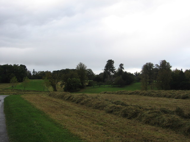
![Bowood House and gardens [41] Looking across the golf course to the clubrooms and hotel. Seen from the footpath.
Bowood is a Georgian country house of circa 1754 with interiors by Robert Adam and a garden designed by Lancelot &#039;Capability&#039; Brown. The existing house is only a small part of the original building which was mostly derelict after use by the RAF and as a school and it was demolished in 1956. Bowood is the home of the Marquis of Lansdowne and it has been open to the public since 1975. The house is listed, grade I, with much detail at: <span class="nowrap"><a title="https://historicengland.org.uk/listing/the-list/list-entry/1253268" rel="nofollow ugc noopener" href="https://historicengland.org.uk/listing/the-list/list-entry/1253268">Link</a><img style="margin-left:2px;" alt="External link" title="External link - shift click to open in new window" src="https://s1.geograph.org.uk/img/external.png" width="10" height="10"/></span> The garden, amounting to some 550 hectares, is on the Register of Historic Parks and Gardens, grade I, with much history and detail at: <span class="nowrap"><a title="https://historicengland.org.uk/listing/the-list/list-entry/1000336" rel="nofollow ugc noopener" href="https://historicengland.org.uk/listing/the-list/list-entry/1000336">Link</a><img style="margin-left:2px;" alt="External link" title="External link - shift click to open in new window" src="https://s1.geograph.org.uk/img/external.png" width="10" height="10"/></span>](https://s2.geograph.org.uk/geophotos/07/04/90/7049086_135a8725.jpg)
![Bowood House and gardens [42] A closer look at the clubhouse, seen from the footpath.
Bowood is a Georgian country house of circa 1754 with interiors by Robert Adam and a garden designed by Lancelot &#039;Capability&#039; Brown. The existing house is only a small part of the original building which was mostly derelict after use by the RAF and as a school and it was demolished in 1956. Bowood is the home of the Marquis of Lansdowne and it has been open to the public since 1975. The house is listed, grade I, with much detail at: <span class="nowrap"><a title="https://historicengland.org.uk/listing/the-list/list-entry/1253268" rel="nofollow ugc noopener" href="https://historicengland.org.uk/listing/the-list/list-entry/1253268">Link</a><img style="margin-left:2px;" alt="External link" title="External link - shift click to open in new window" src="https://s1.geograph.org.uk/img/external.png" width="10" height="10"/></span> The garden, amounting to some 550 hectares, is on the Register of Historic Parks and Gardens, grade I, with much history and detail at: <span class="nowrap"><a title="https://historicengland.org.uk/listing/the-list/list-entry/1000336" rel="nofollow ugc noopener" href="https://historicengland.org.uk/listing/the-list/list-entry/1000336">Link</a><img style="margin-left:2px;" alt="External link" title="External link - shift click to open in new window" src="https://s1.geograph.org.uk/img/external.png" width="10" height="10"/></span>](https://s3.geograph.org.uk/geophotos/07/04/90/7049087_e2ba8617.jpg)

![Stanley Park [1] This recently opened facility is near Pewsham. Further details are at: <span class="nowrap"><a title="http://www.chippenham.gov.uk/stanley-park.aspx" rel="nofollow ugc noopener" href="http://www.chippenham.gov.uk/stanley-park.aspx">Link</a><img style="margin-left:2px;" alt="External link" title="External link - shift click to open in new window" src="https://s1.geograph.org.uk/img/external.png" width="10" height="10"/></span>](https://s2.geograph.org.uk/geophotos/03/05/06/3050698_9bdd49c1.jpg)

Hannah's Wood is located at Grid Ref: ST9470 (Lat: 51.432141, Lng: -2.0817863)
Unitary Authority: Wiltshire
Police Authority: Wiltshire
What 3 Words
///torso.refers.evenly. Near Lacock, Wiltshire
Nearby Locations
Related Wikis

Pewsham
Pewsham is a small village and former civil parish just south-east of the town of Chippenham on the A4 national route towards Calne in Wiltshire, southwestern...
Cocklemore Brook
The Cocklemore Brook is a short tributary of the Bristol Avon, some 2.5 miles (4.0 km) long. It rises near Studley in Wiltshire, England, and flows in...

Derry Hill
Derry Hill is a village in the English county of Wiltshire, in the civil parish of Calne Without. It has an elevated position at the northern edge of the...

Abbeyfield School, Chippenham
Abbeyfield School is a coeducational secondary school and sixth form in Chippenham, Wiltshire, England. == History == The school was built to serve the...
Studley, Wiltshire
Studley is a small village in the county of Wiltshire, England, belonging to the civil parish of Calne Without. == Geography == Studley is about 3 miles...
Stanley Bridge Halt railway station
Stanley Bridge Halt was a railway station on the Great Western Railway's branch line from Chippenham to Calne. Facilities were a wooden platform with a...

Bowden Hill
Bowden Hill is a village in Wiltshire, England, in Lacock parish about 3+1⁄2 miles (6 km) south of Chippenham and 1+1⁄2 miles (2.4 km) to the east of Lacock...

Bewley Common
Bewley Common is a hamlet in Wiltshire, England. It lies in the civil parish of Lacock, west of Bowden Hill and about 1 mile (1.6 km) east of Lacock village...
Nearby Amenities
Located within 500m of 51.432141,-2.0817863Have you been to Hannah's Wood?
Leave your review of Hannah's Wood below (or comments, questions and feedback).