Castle Tump Plantation

Wood, Forest in Gloucestershire Stroud

England

Castle Tump Plantation

Stone Stile, Caudle Green Looking SW towards the village.
Stone Stile, Caudle Green Credit: Malcolm Christie

Castle Tump Plantation is a picturesque woodland located in Gloucestershire, England. Covering an area of approximately 100 acres, the plantation is situated in the heart of the Forest of Dean, renowned for its stunning natural beauty and rich history. It is named after the nearby Castle Tump, a Norman motte-and-bailey castle that once stood on the site.

The woodland is characterized by a diverse range of tree species, including oak, beech, ash, and birch, creating a vibrant and lush environment. The enchanting canopy provides a haven for various wildlife species, such as deer, badgers, foxes, and a multitude of bird species, making it a popular spot for nature enthusiasts and birdwatchers.

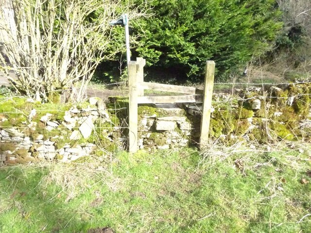
Visitors to Castle Tump Plantation can enjoy a network of well-maintained walking trails that wind through the woodland, offering a tranquil and peaceful escape from the hustle and bustle of everyday life. These paths provide opportunities for leisurely strolls, jogging, or even dog walking.

The plantation also holds historical significance, with remnants of ancient earthworks and archaeological finds dating back to the Roman era. These historical features add an extra layer of interest for those intrigued by the area's past.

Castle Tump Plantation is a cherished natural gem in Gloucestershire, offering a serene and captivating experience for visitors of all ages. Whether seeking solace in nature, exploring historical remnants, or simply enjoying a leisurely walk, this woodland sanctuary is sure to leave a lasting impression.

If you have any feedback on the listing, please let us know in the comments section below.

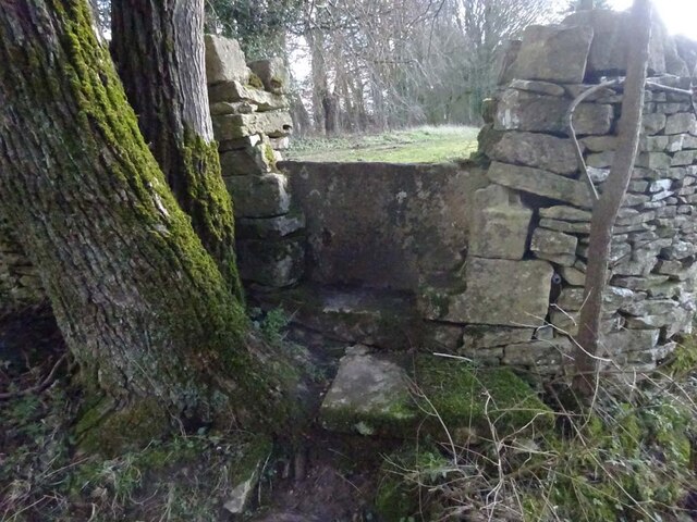
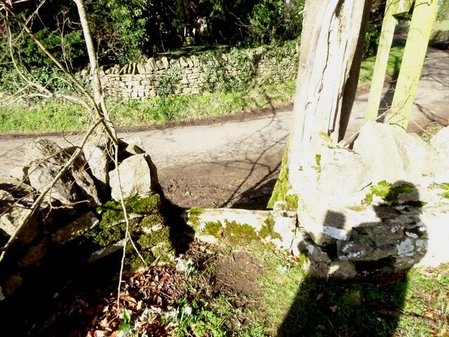
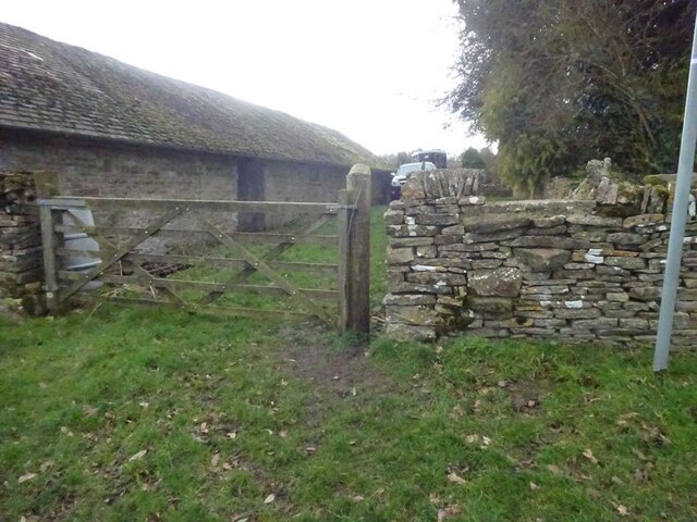
Castle Tump Plantation Images

Images are sourced within 2km of 51.781723/-2.0824043 or Grid Reference SO9409. Thanks to Geograph Open Source API. All images are credited.

Stone Stile, Caudle Green Looking SW towards the village.
Stone Stile, Caudle Green
Looking SW towards the village.
Stone Stile, Caudle Green A step stile on the Northern side of the road approaching the village. On Gloucestershire footpath BBR28. The view from the road side is <a href="https://www.geograph.org.uk/photo/7061298">SO9410 : Stone Stile, Caudle Green</a>.
Stone Stile, Caudle Green
A step stile on the Northern side of the road approaching the village. On Gloucestershire footpath BBR28. The view from the road side is SO9410 : Stone Stile, Caudle Green.
Stone Stile, Caudle Green A step stile on the Northern side of the road approaching the village. On Gloucestershire footpath BBR28. The view from the appreciable drop on the other side is <a href="https://www.geograph.org.uk/photo/7061296">SO9410 : Stone Stile, Caudle Green</a>.
Stone Stile, Caudle Green
A step stile on the Northern side of the road approaching the village. On Gloucestershire footpath BBR28. The view from the appreciable drop on the other side is SO9410 : Stone Stile, Caudle Green.
Stone Stile, Syde On Gloucestershire footpath BSY8 just South of the Manor House in Syde. This view is looking from the road, the view looking North is <a href="https://www.geograph.org.uk/photo/7104847">SO9410 : Stone Stile, Syde</a>.
Stone Stile, Syde
On Gloucestershire footpath BSY8 just South of the Manor House in Syde. This view is looking from the road, the view looking North is SO9410 : Stone Stile, Syde.
Stone Stile, Syde On Gloucestershire footpath BSY8 just South of the Manor House in Syde. This view is looking to the road, the view looking South is <a href="https://www.geograph.org.uk/photo/7104846">SO9410 : Stone Stile, Syde</a>.
Stone Stile, Syde
On Gloucestershire footpath BSY8 just South of the Manor House in Syde. This view is looking to the road, the view looking South is SO9410 : Stone Stile, Syde.
Stone Stile, Caudle Green Looking into a field at the junction of Gloucestershire footpaths MMN23 & BBR38 where the paths transition from woodland to a field sparsely populated with "meadow flowers". The soil in the field is heavily laden with stones. The view towards the woodland is <a href="https://www.geograph.org.uk/photo/7104960">SO9310 : Stone Stile, Caudle Green</a>.
Stone Stile, Caudle Green
Looking into a field at the junction of Gloucestershire footpaths MMN23 & BBR38 where the paths transition from woodland to a field sparsely populated with "meadow flowers". The soil in the field is heavily laden with stones. The view towards the woodland is SO9310 : Stone Stile, Caudle Green.
Stone Stile, Caudle Green Looking from a field at the junction of Gloucestershire footpaths MMN23 & BBR38 where the paths transition from woodland to a field sparsely populated with "meadow flowers". The soil in the field is heavily laden with stones. The view from the woodland is <a href="https://www.geograph.org.uk/photo/7104958">SO9310 : Stone Stile, Caudle Green</a>.
Stone Stile, Caudle Green
Looking from a field at the junction of Gloucestershire footpaths MMN23 & BBR38 where the paths transition from woodland to a field sparsely populated with "meadow flowers". The soil in the field is heavily laden with stones. The view from the woodland is SO9310 : Stone Stile, Caudle Green.
Stone Stile, Caudle Green Due South of the village green at the junction of Gloucestershire footpaths MMN23 & BBR25 in woodland. This point is also on the boundaries of: county constituency, civil parishes of Miserden and Brimsfield, and the county district. This is the view looking NE, the view SW is <a href="https://www.geograph.org.uk/photo/7104970">SO9410 : Stone Stile, Caudle Green</a>.
Stone Stile, Caudle Green
Due South of the village green at the junction of Gloucestershire footpaths MMN23 & BBR25 in woodland. This point is also on the boundaries of: county constituency, civil parishes of Miserden and Brimsfield, and the county district. This is the view looking NE, the view SW is SO9410 : Stone Stile, Caudle Green.
Stone Stile, Caudle Green Due South of the village green at the junction of Gloucestershire footpaths MMN23 & BBR25 in woodland. This point is also on the boundaries of: county constituency, civil parishes of Miserden and Brimsfield, and the county district. This is the view looking SW, the view NE is <a href="https://www.geograph.org.uk/photo/7104969">SO9410 : Stone Stile, Caudle Green</a>.
Stone Stile, Caudle Green
Due South of the village green at the junction of Gloucestershire footpaths MMN23 & BBR25 in woodland. This point is also on the boundaries of: county constituency, civil parishes of Miserden and Brimsfield, and the county district. This is the view looking SW, the view NE is SO9410 : Stone Stile, Caudle Green.
Stone Stile, Caudle Green From a small field into a grazing field at the SE corner of the garden walls of 'Calley House'. This is looking SW away from the village, the view towards the village is <a href="https://www.geograph.org.uk/photo/7104983">SO9410 : Stone Stile, Caudle Green</a>.
Stone Stile, Caudle Green
From a small field into a grazing field at the SE corner of the garden walls of 'Calley House'. This is looking SW away from the village, the view towards the village is SO9410 : Stone Stile, Caudle Green.
Stone Stile, Caudle Green From a small field in to a grazing field at the SE corner of the garden wals of 'Calley House'. This is looking NE towards the village, the view towards the larger field is <a href="https://www.geograph.org.uk/photo/7104981">SO9410 : Stone Stile, Caudle Green</a>.
Stone Stile, Caudle Green
From a small field in to a grazing field at the SE corner of the garden wals of 'Calley House'. This is looking NE towards the village, the view towards the larger field is SO9410 : Stone Stile, Caudle Green.
Stone Stile, Caudle Green A step Stile off the Southern side of the village green on Gloucestershire footpath BBR25. This is looking to the village green, the view from the green is <a href="https://www.geograph.org.uk/photo/7104992">SO9410 : Stone Stile, Caudle Green</a>.
Stone Stile, Caudle Green
A step Stile off the Southern side of the village green on Gloucestershire footpath BBR25. This is looking to the village green, the view from the green is SO9410 : Stone Stile, Caudle Green.
Stone Stile, Caudle Green A step Stile off the Southern side of the village green on Gloucestershire footpath BBR25. This is looking from the village green, the view toward the green is <a href="https://www.geograph.org.uk/photo/7104990">SO9410 : Stone Stile, Caudle Green</a>.
Stone Stile, Caudle Green
A step Stile off the Southern side of the village green on Gloucestershire footpath BBR25. This is looking from the village green, the view toward the green is SO9410 : Stone Stile, Caudle Green.
Stone Stile, Caudle Green A step stile. Looking out of the field on Gloucestershire footpath BBR28 to the road. The view from the road is <a href="https://www.geograph.org.uk/photo/7041359">SO9410 : Stone Stile, Caudle Green</a>.
Stone Stile, Caudle Green
A step stile. Looking out of the field on Gloucestershire footpath BBR28 to the road. The view from the road is SO9410 : Stone Stile, Caudle Green.
Small disused quarry south of Syde
Lane east from Syde Towards the A417.
Lane east from Syde
Towards the A417.
Footpath approaching Syde Footpath and track passing farm building as it approaches Syde.
Footpath approaching Syde
Footpath and track passing farm building as it approaches Syde.
Syde church Syde church is dedicated St Mary the Virgin and dates from the 12th century.  The church is Grade I listed, see: <span class="nowrap"><a title="https://historicengland.org.uk/listing/the-list/list-entry/1305201?section=official-list-entry" rel="nofollow ugc noopener" href="https://historicengland.org.uk/listing/the-list/list-entry/1305201?section=official-list-entry">Link</a><img style="margin-left:2px;" alt="External link" title="External link - shift click to open in new window" src="https://s1.geograph.org.uk/img/external.png" width="10" height="10"/></span>
Syde church
Syde church is dedicated St Mary the Virgin and dates from the 12th century. The church is Grade I listed, see: LinkExternal link
Show me another place!

Castle Tump Plantation is located at Grid Ref: SO9409 (Lat: 51.781723, Lng: -2.0824043)

Administrative County: Gloucestershire

District: Stroud

Police Authority: Gloucestershire

What 3 Words

///threading.richest.broached. Near Painswick, Gloucestershire

Related Wikis

Miserden Castle

Miserden Castle was a castle near the village of Miserden in Gloucestershire, England. The castle is a large motte and bailey Norman castle, built before...

Miserden War Memorial

Miserden War Memorial is a First World War memorial in the village of Miserden, near Stroud, in Gloucestershire, south-western England. The memorial, designed...

Miserden

Miserden is a village and civil parish in Stroud District, Gloucestershire, England, 4 miles north east of Stroud. The parish includes Whiteway Colony...

Syde

Syde, often in the past spelt Side, is a small village and civil parish in Gloucestershire, England. It lies in the Cotswolds, near the source of the River...

Church of St Mary the Virgin, Syde

The Anglican Church of St Mary the Virgin at Syde in the Cotswold District of Gloucestershire, England was built in the early 12th century. It is a grade...

Winstone

Winstone is a village and civil parish in the English county of Gloucestershire. The population taken at the 2011 census was 270.Winstone forms part of...

Church of St Bartholomew, Winstone

The Anglican Church of St Bartholomew at Winstone in the Cotswold District of Gloucestershire, England was built in the 11th century. It is a grade I listed...

Brimpsfield

Brimpsfield is a village in Gloucestershire, England. The village is recorded in Domesday Book as Brimesfelde. Brimpsfield Castle was built in the village...

Nearby Amenities

Located within 500m of 51.781723,-2.0824043
Archaeological Site: tumulus
Historic: archaeological_site
Source: NPE
Lat/Long: 51.7835848/-2.0858492
Barrier: stile
Material: stone
Stile: stepover
Lat/Long: 51.7842418/-2.0767303
Barrier: stile
Material: wood
Step Count: 2
Stile: stepover
Lat/Long: 51.7845766/-2.0851195
Barrier: stile
Lat/Long: 51.7812015/-2.0872787
Ford: yes
Lat/Long: 51.785274/-2.0849046
Power: pole
Lat/Long: 51.7838311/-2.0888056
Power: pole
Lat/Long: 51.7832967/-2.0865453
The data included in this document is from www.openstreetmap.org. The data is made available under ODbL.

Have you been to Castle Tump Plantation?

Leave your review of Castle Tump Plantation below (or comments, questions and feedback).