Six Acre Plantation

Wood, Forest in Wiltshire

England

Six Acre Plantation

Bowood House, Wiltshire The entrance to Bowood in Derry Hill, Calne, Wiltshire.
Bowood House, Wiltshire Credit: Rebecca A Wills

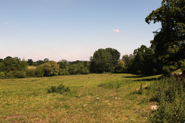
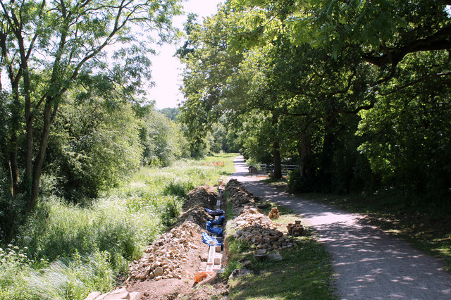
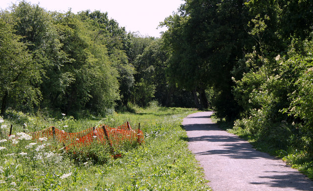
Six Acre Plantation is a charming woodland located in Wiltshire, a county in southwest England. Nestled amidst the picturesque countryside, this woodland exudes natural beauty and tranquility. Spanning an area of approximately six acres, it offers a serene and peaceful environment for visitors to explore and enjoy.

The plantation boasts a diverse range of trees, including oak, beech, and ash, which create a lush and dense forest. The towering trees provide ample shade and shelter, making it an ideal spot for nature lovers and hikers. The woodland floor is covered with a carpet of vibrant wildflowers, adding a splash of color to the surroundings.

Six Acre Plantation is home to a variety of wildlife, making it a haven for nature enthusiasts and birdwatchers. Visitors may spot various bird species, such as woodpeckers, owls, and jays, as well as small mammals like squirrels and rabbits. It is not uncommon to encounter deer roaming peacefully within the woodland.

The plantation offers several walking trails, allowing visitors to explore the area at their own pace. The well-maintained paths wind through the forest, offering glimpses of enchanting vistas and serene clearings. The tranquil atmosphere makes it an excellent location for those seeking a break from the hustle and bustle of city life.

Overall, Six Acre Plantation in Wiltshire is a captivating woodland that offers a natural oasis for individuals seeking solace in the heart of nature. Its diverse flora and fauna, coupled with its peaceful ambiance, make it a must-visit destination for those looking to immerse themselves in the beauty of the English countryside.

If you have any feedback on the listing, please let us know in the comments section below.

Six Acre Plantation Images

Images are sourced within 2km of 51.435887/-2.0869863 or Grid Reference ST9470. Thanks to Geograph Open Source API. All images are credited.

Bowood House, Wiltshire The entrance to Bowood in Derry Hill, Calne, Wiltshire.
Bowood House, Wiltshire
The entrance to Bowood in Derry Hill, Calne, Wiltshire.
Old Milestone by London Road, Bremhill Parish Metal plate attached to stone post by the UC road (was A4), in parish of BREMHILL (NORTH WILTSHIRE District), London Road; opposite The Turnpike, 25m South East of Gate Farmhouse, between old tollhouse and Pewsham Way roundabout, on grass verge 20m from tollhouse, on North side of road. Bath incised iron plate, erected by the Chippenham turnpike trust in the 18th century. An earlier photograph can be found here <a title="https://www.geograph.org.uk/photo/6044769" href="https://www.geograph.org.uk/photo/6044769">Link</a>.

Inscription reads:-
TO
BATH
14 

Grade II listed. List Entry Number: 1022433 <span class="nowrap"><a title="https://historicengland.org.uk/listing/the-list/list-entry/1022433" rel="nofollow ugc noopener" href="https://historicengland.org.uk/listing/the-list/list-entry/1022433">Link</a><img style="margin-left:2px;" alt="External link" title="External link - shift click to open in new window" src="https://s1.geograph.org.uk/img/external.png" width="10" height="10"/></span>

Milestone Society National ID: WI_LB_BACN14.
Old Milestone by London Road, Bremhill Parish
Metal plate attached to stone post by the UC road (was A4), in parish of BREMHILL (NORTH WILTSHIRE District), London Road; opposite The Turnpike, 25m South East of Gate Farmhouse, between old tollhouse and Pewsham Way roundabout, on grass verge 20m from tollhouse, on North side of road. Bath incised iron plate, erected by the Chippenham turnpike trust in the 18th century. An earlier photograph can be found here Link. Inscription reads:- TO BATH 14 Grade II listed. List Entry Number: 1022433 LinkExternal link Milestone Society National ID: WI_LB_BACN14.
Wilts & Berks Canal near Pewsham Re-watered section of the Wilts & Berks canal between Pewsham and Reybridge. Completed with funding through Viridor and others.
Wilts & Berks Canal near Pewsham
Re-watered section of the Wilts & Berks canal between Pewsham and Reybridge. Completed with funding through Viridor and others.
2011 : Entrance to Lackham College of Agriculture <a href="https://www.geograph.org.uk/photo/206400">ST9270 : Lackham House</a> was taken from a similar viewpoint in 2006.
2011 : Entrance to Lackham College of Agriculture
ST9270 : Lackham House was taken from a similar viewpoint in 2006.
2011 : Lockswell Close, Chippenham A new development on the outskirts of Chippenham in the direction of Pewsham.
Some good looking houses here, handy for the A4.
2011 : Lockswell Close, Chippenham
A new development on the outskirts of Chippenham in the direction of Pewsham. Some good looking houses here, handy for the A4.
2011 : Restoration progress at Pewsham Locks Restoration of the Wilts & Berks Canal is being undertaken by the Wilts & Berks Canal Trust for more information see <span class="nowrap"><a title="http://www.wbct.org.uk/" rel="nofollow ugc noopener" href="http://www.wbct.org.uk/">Link</a><img style="margin-left:2px;" alt="External link" title="External link - shift click to open in new window" src="https://s1.geograph.org.uk/img/external.png" width="10" height="10"/></span>
2011 : Restoration progress at Pewsham Locks
Restoration of the Wilts & Berks Canal is being undertaken by the Wilts & Berks Canal Trust for more information see LinkExternal link
2011 : Field north of the entrance to Lackham College The River Avon is on the other side of this field.
2011 : Field north of the entrance to Lackham College
The River Avon is on the other side of this field.
2011 : A4 roundabout at the end of King Henry Drive Calne is away to the left.
Not a pretty sight but it is there.
2011 : A4 roundabout at the end of King Henry Drive
Calne is away to the left. Not a pretty sight but it is there.
2011 : A4 King's Roundabout and Pewsham Way Heading toward Calne.
The roundabout is at the end of King Henry Drive.
2011 : A4 King's Roundabout and Pewsham Way
Heading toward Calne. The roundabout is at the end of King Henry Drive.
2011 : Top Lock, Pewsham Locks Three locks here in process of restoration by <span class="nowrap"><a title="http://www.wbct.org.uk/" rel="nofollow ugc noopener" href="http://www.wbct.org.uk/">Link</a><img style="margin-left:2px;" alt="External link" title="External link - shift click to open in new window" src="https://s1.geograph.org.uk/img/external.png" width="10" height="10"/></span> a closer look at the lock chamber in <a href="https://www.geograph.org.uk/photo/1252459">ST9371 : Upper Lock at Pewsham Locks</a>.
2011 : Top Lock, Pewsham Locks
Three locks here in process of restoration by LinkExternal link a closer look at the lock chamber in ST9371 : Upper Lock at Pewsham Locks.
2011 : The restoration situation below Pewsham Locks Restoration work carried out by the Wilts & Berks Canal Trust.
2011 : The restoration situation below Pewsham Locks
Restoration work carried out by the Wilts & Berks Canal Trust.
2011 : Job to be done, Wilts & Berks canal South of Pewsham locks.
<span class="nowrap"><a title="http://www.wbct.org.uk/" rel="nofollow ugc noopener" href="http://www.wbct.org.uk/">Link</a><img style="margin-left:2px;" alt="External link" title="External link - shift click to open in new window" src="https://s1.geograph.org.uk/img/external.png" width="10" height="10"/></span> are working on it.
2011 : Job to be done, Wilts & Berks canal
South of Pewsham locks. LinkExternal link are working on it.
Lansdown Arms
Lansdown Arms
Abbeyfields School The school is located off Stanley Lane, Pewsham.
Abbeyfields School
The school is located off Stanley Lane, Pewsham.
Stanley Park [1] This recently opened facility is near Pewsham.  Further details are at: <span class="nowrap"><a title="http://www.chippenham.gov.uk/stanley-park.aspx" rel="nofollow ugc noopener" href="http://www.chippenham.gov.uk/stanley-park.aspx">Link</a><img style="margin-left:2px;" alt="External link" title="External link - shift click to open in new window" src="https://s1.geograph.org.uk/img/external.png" width="10" height="10"/></span>
Stanley Park [1]
This recently opened facility is near Pewsham. Further details are at: LinkExternal link
Stanley Park [2] This recently opened facility is near Pewsham.  This is the BMX track. Further details are at: <span class="nowrap"><a title="http://www.chippenham.gov.uk/stanley-park.aspx" rel="nofollow ugc noopener" href="http://www.chippenham.gov.uk/stanley-park.aspx">Link</a><img style="margin-left:2px;" alt="External link" title="External link - shift click to open in new window" src="https://s1.geograph.org.uk/img/external.png" width="10" height="10"/></span>
Stanley Park [2]
This recently opened facility is near Pewsham. This is the BMX track. Further details are at: LinkExternal link
Chippenham Christian Fellowship church, Chippenham The Elim Pentecostal church is located in Wood Lane in the SE of Chippenham.
Chippenham Christian Fellowship church, Chippenham
The Elim Pentecostal church is located in Wood Lane in the SE of Chippenham.
Cricketts Lane houses, Chippenham Viewed from near the Wood Lane junction.
Cricketts Lane houses, Chippenham
Viewed from near the Wood Lane junction.
Show me another place!

Six Acre Plantation is located at Grid Ref: ST9470 (Lat: 51.435887, Lng: -2.0869863)

Unitary Authority: Wiltshire

Police Authority: Wiltshire

What 3 Words

///jukebox.less.square. Near Lacock, Wiltshire

Related Wikis

Pewsham

Pewsham is a small village and former civil parish just south-east of the town of Chippenham on the A4 national route towards Calne in Wiltshire, southwestern...

Cocklemore Brook

The Cocklemore Brook is a short tributary of the Bristol Avon, some 2.5 miles (4.0 km) long. It rises near Studley in Wiltshire, England, and flows in...

Abbeyfield School, Chippenham

Abbeyfield School is a coeducational secondary school and sixth form in Chippenham, Wiltshire, England. == History == The school was built to serve the...

Derry Hill

Derry Hill is a village in the English county of Wiltshire, in the civil parish of Calne Without. It has an elevated position at the northern edge of the...

Nearby Amenities

Located within 500m of 51.435887,-2.0869863
Bench
Squirrel's Rest
Lat/Long: 51.4359849/-2.0939742
Seamark Type: gate
Waterway: lock_gate
Lat/Long: 51.4385206/-2.0920889
Pewsham Top Lock
Seamark Type: gate
Waterway: lock_gate
Lat/Long: 51.4388436/-2.0919087
Pewsham Middle Lock
Seamark Type: gate
Waterway: lock_gate
Lat/Long: 51.4378969/-2.0924427
Pewsham Middle Lock
Seamark Type: gate
Waterway: lock_gate
Lat/Long: 51.4381199/-2.0923271
Pewsham Bottom Lock
Seamark Type: gate
Waterway: lock_gate
Lat/Long: 51.4372248/-2.0928817
Pewsham Bottom Lock
Seamark Type: gate
Waterway: lock_gate
Lat/Long: 51.4374859/-2.092708
Cocklemoor Brook Spill Weir
Waterway: weir
Lat/Long: 51.4370273/-2.0932564
Barrier: stile
Bicycle: no
Foot: yes
Horse: no
Motor Vehicle: no
Stile: stepover
Lat/Long: 51.438562/-2.0919731
The data included in this document is from www.openstreetmap.org. The data is made available under ODbL.

Have you been to Six Acre Plantation?

Leave your review of Six Acre Plantation below (or comments, questions and feedback).