Chettle Chase Coppice

Wood, Forest in Dorset

England

Chettle Chase Coppice

Castleman Hotel, Chettle The Castleman Hotel was originally Chettle Lodge, the dower house for the surrounding estate. Since 1846 the estate has been owned by the Castleman-Bourke family.
Castleman Hotel, Chettle Credit: Steve Whalley

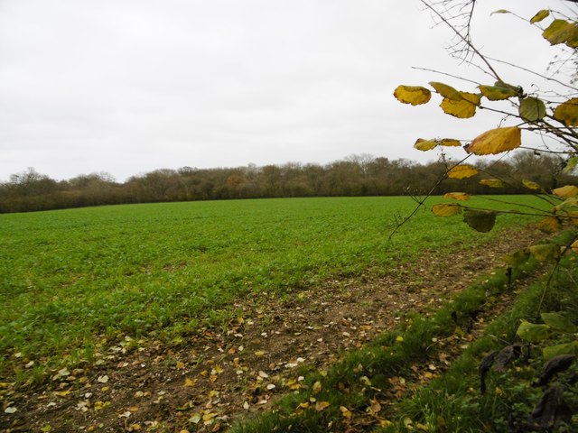
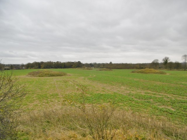
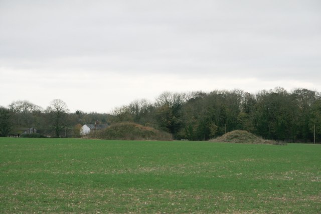
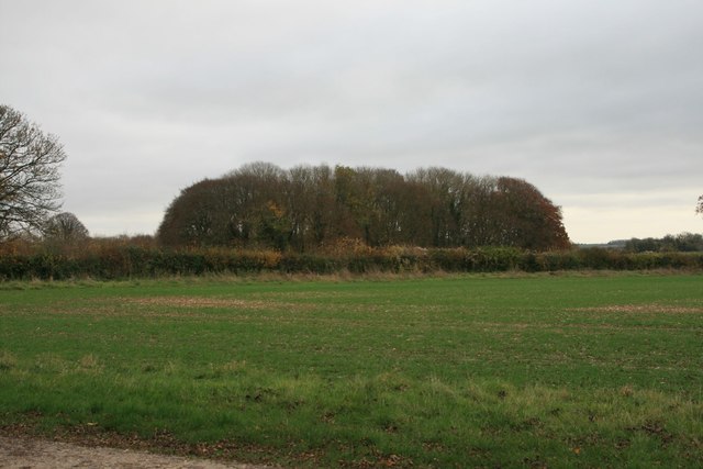
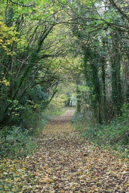
Chettle Chase Coppice is a beautiful woodland area located in the county of Dorset, England. Covering an area of approximately 50 acres, the coppice is a significant part of the Chettle Estate and is known for its diverse flora and fauna.

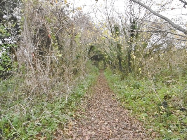
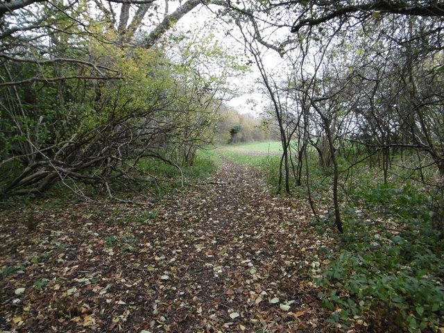
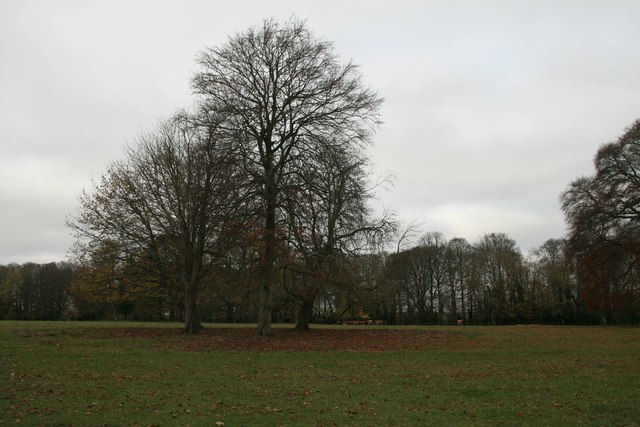
The coppice is primarily composed of deciduous trees, including oak, ash, beech, and birch, which create a stunning canopy overhead. Beneath this canopy, a rich understory of shrubs, ferns, and wildflowers can be found, providing a habitat for a wide range of wildlife.

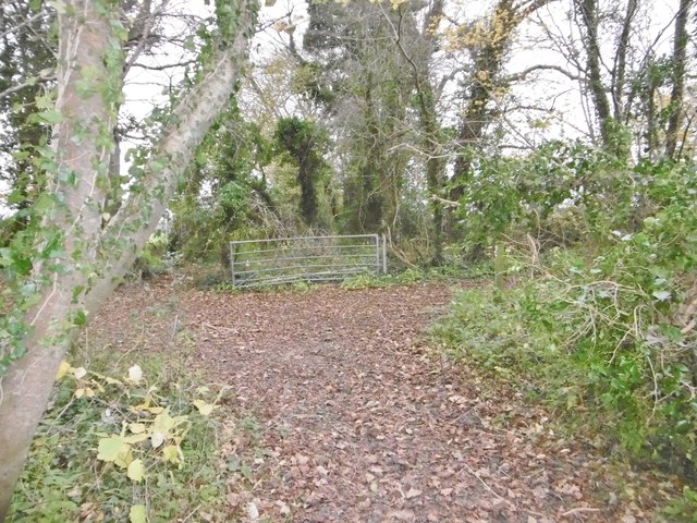
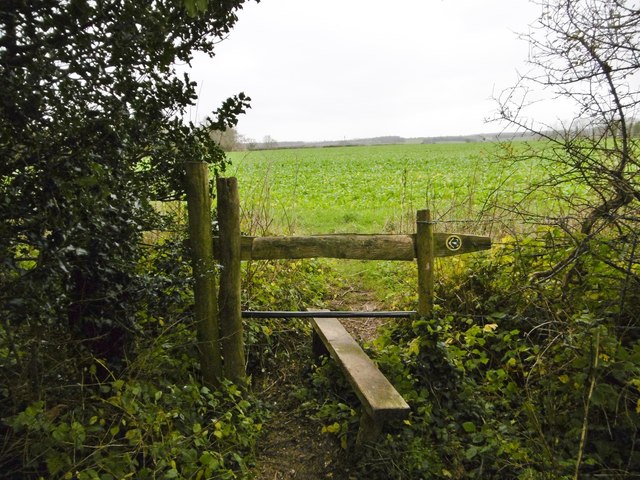
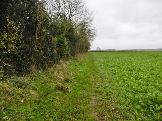
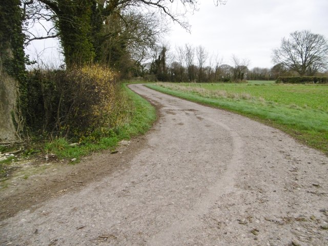
The woodland is crisscrossed by a network of well-maintained footpaths, allowing visitors to explore the area and enjoy its natural beauty. The paths wind through the coppice, leading to picturesque clearings and secluded spots where visitors can sit and appreciate the tranquility of the surroundings.

Chettle Chase Coppice is also home to a variety of wildlife, including deer, foxes, badgers, and a plethora of bird species. Lucky visitors may even catch a glimpse of the elusive red squirrel, which is known to inhabit the area.

The coppice is open to the public throughout the year, with no admission fee. It provides an excellent opportunity for nature lovers, hikers, and photographers to immerse themselves in the peacefulness of the woodlands and observe the native wildlife in its natural habitat.

Overall, Chettle Chase Coppice is a cherished natural treasure in Dorset, offering visitors a chance to escape the hustle and bustle of everyday life and connect with nature in a serene and enchanting setting.

If you have any feedback on the listing, please let us know in the comments section below.

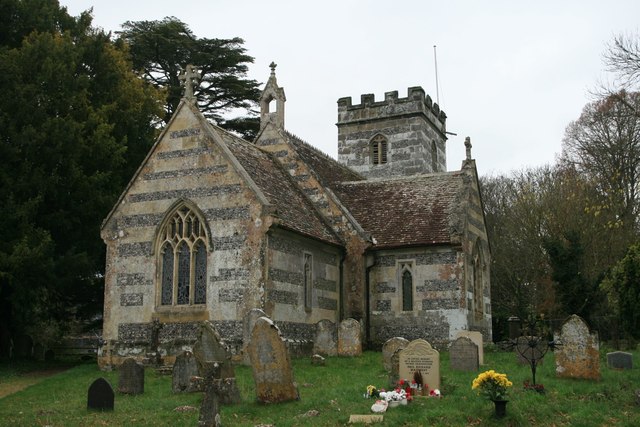
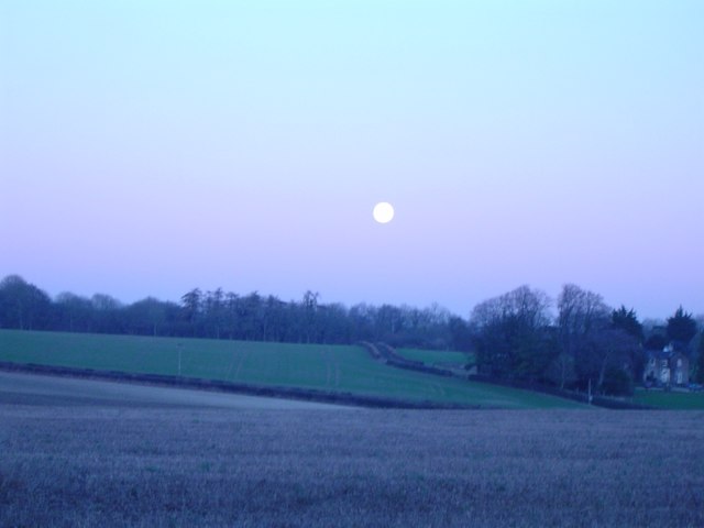
Chettle Chase Coppice Images

Images are sourced within 2km of 50.932049/-2.0881605 or Grid Reference ST9314. Thanks to Geograph Open Source API. All images are credited.

Castleman Hotel, Chettle The Castleman Hotel was originally Chettle Lodge, the dower house for the surrounding estate. Since 1846 the estate has been owned by the Castleman-Bourke family.
Castleman Hotel, Chettle
The Castleman Hotel was originally Chettle Lodge, the dower house for the surrounding estate. Since 1846 the estate has been owned by the Castleman-Bourke family.
Tarrant Hinton, byway junction Coming from Tarrant Gunville; left, to Chettle; right, to Tarrant Hinton.
Tarrant Hinton, byway junction
Coming from Tarrant Gunville; left, to Chettle; right, to Tarrant Hinton.
Tarrant Gunville, bridleway From <a href="https://www.geograph.org.uk/photo/4758077">ST9412 : Tarrant Hinton, byway junction</a> to the village. The bridleway also forms part of the Jubilee Trail, and is on the boundary of Tarrant Gunville and Chettle Parishes.
Tarrant Gunville, bridleway
From ST9412 : Tarrant Hinton, byway junction to the village. The bridleway also forms part of the Jubilee Trail, and is on the boundary of Tarrant Gunville and Chettle Parishes.
Chettle, gate The entrance to Little Wood.
Chettle, gate
The entrance to Little Wood.
Chettle, bridleway Leaving woodland for open farmland, on the way around Eastbury Park. This section forms part of Jubilee Trail. <span class="nowrap"><a title="https://www.ldwa.org.uk/ldp/members/show_path.php?path_name=Jubilee+Trail+(Dorset)" rel="nofollow ugc noopener" href="https://www.ldwa.org.uk/ldp/members/show_path.php?path_name=Jubilee+Trail+(Dorset)">Link</a><img style="margin-left:2px;" alt="External link" title="External link - shift click to open in new window" src="https://s1.geograph.org.uk/img/external.png" width="10" height="10"/></span>
Chettle, bridleway
Leaving woodland for open farmland, on the way around Eastbury Park. This section forms part of Jubilee Trail. LinkExternal link
Chettle, brassicas Looking towards Little Wood.
Chettle, brassicas
Looking towards Little Wood.
Chettle, stile At the beginning of the path along farmland to Tarrant Gunville; on the Jubilee Trail: <span class="nowrap"><a title="https://www.ldwa.org.uk/ldp/members/show_path.php?path_name=Jubilee+Trail+(Dorset)" rel="nofollow ugc noopener" href="https://www.ldwa.org.uk/ldp/members/show_path.php?path_name=Jubilee+Trail+(Dorset)">Link</a><img style="margin-left:2px;" alt="External link" title="External link - shift click to open in new window" src="https://s1.geograph.org.uk/img/external.png" width="10" height="10"/></span>
Chettle, stile
At the beginning of the path along farmland to Tarrant Gunville; on the Jubilee Trail: LinkExternal link
Tarrant Gunville, footpath Around Eastbury Park, towards the village; on the Jubilee Trail: <span class="nowrap"><a title="https://www.ldwa.org.uk/ldp/members/show_path.php?path_name=Jubilee+Trail+(Dorset)" rel="nofollow ugc noopener" href="https://www.ldwa.org.uk/ldp/members/show_path.php?path_name=Jubilee+Trail+(Dorset)">Link</a><img style="margin-left:2px;" alt="External link" title="External link - shift click to open in new window" src="https://s1.geograph.org.uk/img/external.png" width="10" height="10"/></span>
Tarrant Gunville, footpath
Around Eastbury Park, towards the village; on the Jubilee Trail: LinkExternal link
Tarrant Gunville, farm road
Tarrant Gunville, mound At first sight, a tumulus; at second, part of a Bronze Age cemetery; but not shown as such by OS, or listed by Historic England. In fact part of an C17 garden for Eastbury House, and shown on a contemporary plan: <span class="nowrap"><a title="http://www.dorsetlife.co.uk/2007/10/a-lost-mansion-of-dorset/" rel="nofollow ugc noopener" href="http://www.dorsetlife.co.uk/2007/10/a-lost-mansion-of-dorset/">Link</a><img style="margin-left:2px;" alt="External link" title="External link - shift click to open in new window" src="https://s1.geograph.org.uk/img/external.png" width="10" height="10"/></span> See also <a href="https://www.geograph.org.uk/photo/4758238">ST9313 : Tarrant Gunville, Solomon's Quarter</a>.
Tarrant Gunville, mound
At first sight, a tumulus; at second, part of a Bronze Age cemetery; but not shown as such by OS, or listed by Historic England. In fact part of an C17 garden for Eastbury House, and shown on a contemporary plan: LinkExternal link See also ST9313 : Tarrant Gunville, Solomon's Quarter.
Tarrant Gunville, Solomon's Quarter As seen from the top of <a href="https://www.geograph.org.uk/photo/4758237">ST9313 : Tarrant Gunville, mound</a>; seven similar mounds can be made out. Part of elaborate C18 gardens for Eastbury House: <span class="nowrap"><a title="http://www.dorsetlife.co.uk/2007/10/a-lost-mansion-of-dorset/" rel="nofollow ugc noopener" href="http://www.dorsetlife.co.uk/2007/10/a-lost-mansion-of-dorset/">Link</a><img style="margin-left:2px;" alt="External link" title="External link - shift click to open in new window" src="https://s1.geograph.org.uk/img/external.png" width="10" height="10"/></span>
Tarrant Gunville, Solomon's Quarter
As seen from the top of ST9313 : Tarrant Gunville, mound; seven similar mounds can be made out. Part of elaborate C18 gardens for Eastbury House: LinkExternal link
Tarrant Gunville, footpath Along the edge of Eastbury Park (left) to the village; on the Jubilee Trail: <span class="nowrap"><a title="https://www.ldwa.org.uk/ldp/members/show_path.php?path_name=Jubilee+Trail+(Dorset)" rel="nofollow ugc noopener" href="https://www.ldwa.org.uk/ldp/members/show_path.php?path_name=Jubilee+Trail+(Dorset)">Link</a><img style="margin-left:2px;" alt="External link" title="External link - shift click to open in new window" src="https://s1.geograph.org.uk/img/external.png" width="10" height="10"/></span>
Tarrant Gunville, footpath
Along the edge of Eastbury Park (left) to the village; on the Jubilee Trail: LinkExternal link
Tumuli at Solomon's Quarters, Eastbury House An amazing double row of symmetrical tumuli, north of Eastbury House.
Tumuli at Solomon's Quarters, Eastbury House
An amazing double row of symmetrical tumuli, north of Eastbury House.
The Park, Chettle
The Park, Chettle
Zareba Clump, Eastbury House An unusually named clump of trees.
Zareba Clump, Eastbury House
An unusually named clump of trees.
Church of St Mary, Chettle
Byway through Little Wood, Chettle
Bleak midwinter Full moon, short day, midwinter sky
Bleak midwinter
Full moon, short day, midwinter sky
Show me another place!

Chettle Chase Coppice is located at Grid Ref: ST9314 (Lat: 50.932049, Lng: -2.0881605)

Unitary Authority: Dorset

Police Authority: Dorset

What 3 Words

///confident.ledge.router. Near Pimperne, Dorset

Related Wikis

Chettle

Chettle is a small village and civil parish in the county of Dorset in southern England. It lies 6 miles (10 kilometres) northeast of Blandford Forum....
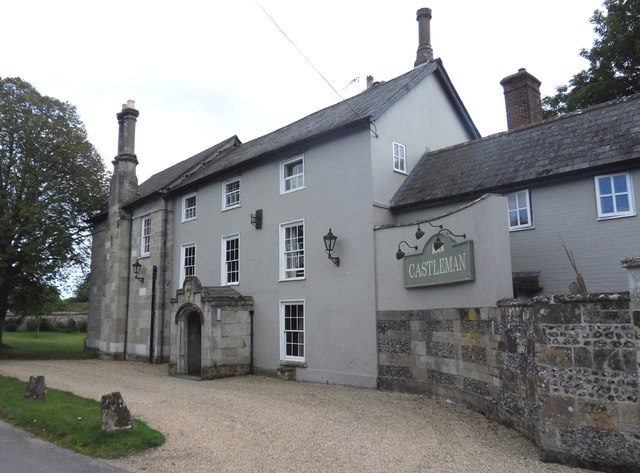
Chettle House

Chettle House is a Grade I listed country manor house with Queen Anne style architecture in Chettle, North Dorset, England, about 6 miles (10 km) northeast...

Farnham, Dorset

Farnham is a village and civil parish in North Dorset, in the south of England, on Cranborne Chase, seven miles (eleven kilometres) northeast of Blandford...

Eastbury Park

Eastbury Park was a country estate near Tarrant Gunville in Dorset, England. It contained a large mansion designed by Sir John Vanbrugh. The mansion has...

Larmer Tree Festival

Larmer Tree Festival was a three-day music, comedy and arts festival held annually from 1990 until 2019 at the Larmer Tree Gardens, near Tollard Royal...

Larmer Tree Gardens

The Larmer Tree Gardens near Tollard Royal in south Wiltshire, England, were created by landowner Augustus Pitt Rivers in 1880 as pleasure grounds for...

Tarrant Gunville

Tarrant Gunville is a village and civil parish in north Dorset, England, situated at the head of the Tarrant Valley on Cranborne Chase five miles (eight...

King John's House, Tollard Royal

King John's House is a former manor house in the south Wiltshire village of Tollard Royal, England. Just south of the church, the building has at its core...

Nearby Amenities

Located within 500m of 50.932049,-2.0881605
Chettle Down
Place: locality
Source: OS_OpenData_StreetView
Lat/Long: 50.9332264/-2.0817804
The data included in this document is from www.openstreetmap.org. The data is made available under ODbL.

Have you been to Chettle Chase Coppice?

Leave your review of Chettle Chase Coppice below (or comments, questions and feedback).