Far Higher Town House Wood

Wood, Forest in Lancashire

England

Far Higher Town House Wood

Ross Ices - old ice cream sign
Ross Ices - old ice cream sign Credit: michael ely

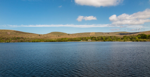
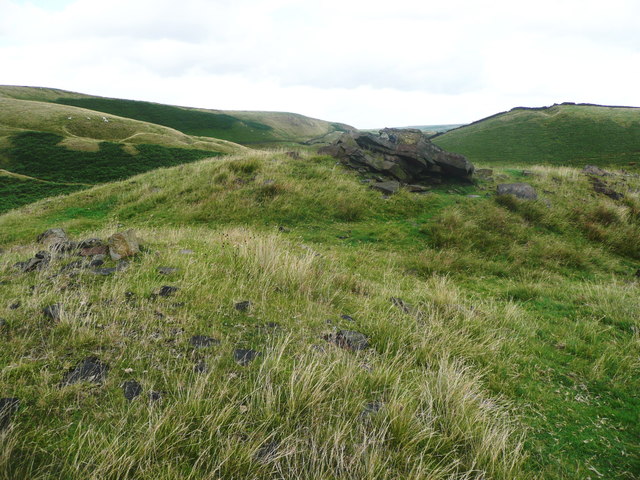
Far Higher Town House Wood is a beautiful woodland area located in the county of Lancashire, England. Situated in the Forest of Bowland, this woodland is known for its lush greenery, diverse wildlife, and serene atmosphere.

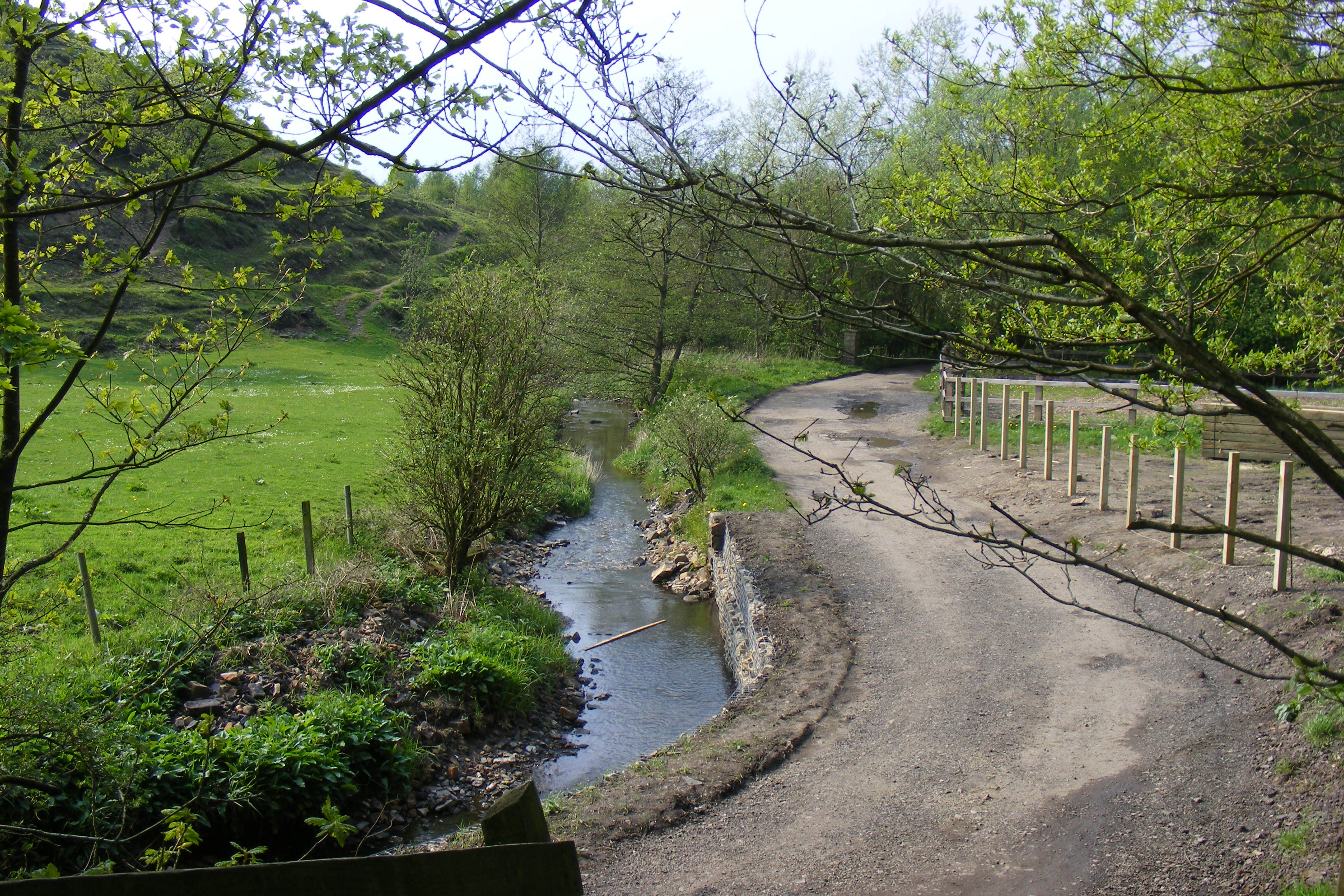
Covering an area of approximately 200 acres, Far Higher Town House Wood is a mix of ancient woodland and newer plantation. The woodland is mainly composed of broadleaf trees such as oak, beech, and birch, providing a stunning canopy of foliage throughout the year. The forest floor is covered in a rich carpet of ferns, bluebells, and wildflowers, adding to the natural beauty of the area.

The wood is home to a wide array of wildlife, including deer, foxes, squirrels, and a variety of bird species. The peaceful surroundings make it an ideal habitat for these creatures, and birdwatchers and nature enthusiasts often visit to observe and appreciate the diverse fauna.

The wood offers various walking trails and paths for visitors to explore and enjoy. These trails meander through the woodland, offering breathtaking views of the surrounding countryside. Visitors can also find picnic areas and benches strategically placed throughout the wood, providing opportunities to relax and immerse themselves in nature.

Far Higher Town House Wood is a popular destination for hikers, photographers, and families looking to spend time in nature. With its tranquil ambiance and stunning scenery, this woodland offers a haven for those seeking solace and a connection with the natural world.

If you have any feedback on the listing, please let us know in the comments section below.

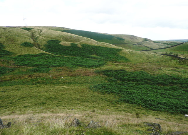
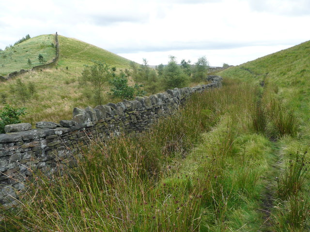
Far Higher Town House Wood Images

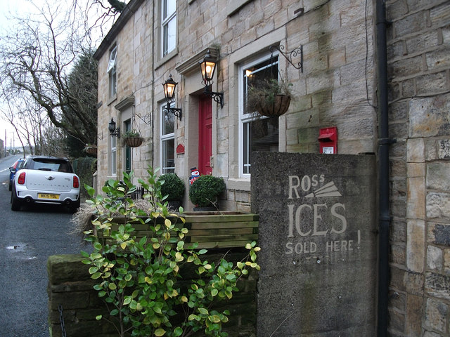
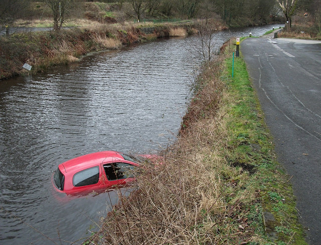
Images are sourced within 2km of 53.65153/-2.1081657 or Grid Reference SD9217. Thanks to Geograph Open Source API. All images are credited.

Ross Ices - old ice cream sign
Car in the Rochdale Canal Just below Sladen Lock. Makes a change from seeing supermarket trolleys.
Car in the Rochdale Canal
Just below Sladen Lock. Makes a change from seeing supermarket trolleys.
Red car in Rochdale Canal Just below Sladen Lock (between Summit and Littleborough) on a very windy day.
Red car in Rochdale Canal
Just below Sladen Lock (between Summit and Littleborough) on a very windy day.
Shore Moor Crook Hill Wind Farm on Shore Moor.
Shore Moor
Crook Hill Wind Farm on Shore Moor.
A58 Church Street, Littleborough
A58 New road, Dearnley
Watergrove History Wall, greater (northern) part The Watergrove History Wall, situated on the east side of Watergrove Reservoir at the southern end of the reservoir, includes several date stones from Watergrove village buildings and surrounding farmsteads that were demolished during the construction of Rochdale Corporation's Watergrove Reservoir in the 1930s.

The image is a composite of 18 photographs produced using Microsoft's ICE (Image Composite Editor) software.

The wall is approximately 170 ft long; this image is the northern 110 ft part.  The wall is divided by adjacent fencing.

The 60 ft lesser (southern) part of the wall is illustrated in the Geograph:

                  <a title="https://www.geograph.org.uk/photo/5163265" href="https://www.geograph.org.uk/photo/5163265">Link</a>
Watergrove History Wall, greater (northern) part
The Watergrove History Wall, situated on the east side of Watergrove Reservoir at the southern end of the reservoir, includes several date stones from Watergrove village buildings and surrounding farmsteads that were demolished during the construction of Rochdale Corporation's Watergrove Reservoir in the 1930s. The image is a composite of 18 photographs produced using Microsoft's ICE (Image Composite Editor) software. The wall is approximately 170 ft long; this image is the northern 110 ft part. The wall is divided by adjacent fencing. The 60 ft lesser (southern) part of the wall is illustrated in the Geograph: Link
Watergrove History Wall, lesser (southern) part The Watergrove History Wall, situated on the east side of Watergrove Reservoir at the southern end of the reservoir, includes several date stones from Watergrove village buildings and surrounding farmsteads that were demolished during the construction of Rochdale Corporation's Watergrove Reservoir in the 1930s.

The image is a composite of 6 photographs produced using Microsoft's ICE (Image Composite Editor) software.

The wall is approximately 170 ft long; this image is the southern 60 ft part.  The wall is divided by adjacent fencing.

The 110 ft greater (northern) part of the wall is illustrated in the Geograph:

       <a title="https://www.geograph.org.uk/photo/5163240" href="https://www.geograph.org.uk/photo/5163240">Link</a>
Watergrove History Wall, lesser (southern) part
The Watergrove History Wall, situated on the east side of Watergrove Reservoir at the southern end of the reservoir, includes several date stones from Watergrove village buildings and surrounding farmsteads that were demolished during the construction of Rochdale Corporation's Watergrove Reservoir in the 1930s. The image is a composite of 6 photographs produced using Microsoft's ICE (Image Composite Editor) software. The wall is approximately 170 ft long; this image is the southern 60 ft part. The wall is divided by adjacent fencing. The 110 ft greater (northern) part of the wall is illustrated in the Geograph: Link
Watergrove Reservoir View looking across Watergrove Reservoir from the dam.
Watergrove Reservoir
View looking across Watergrove Reservoir from the dam.
The junction of Barnes Meadows with Todmorden Road, Calderbrook The road name looks modern, and a look at the 1:2500 map on 1893 shows only a track. The 1910 edition shows the road, without a name, only as far as the newly built school. Calderbrook Terrace also appears on that map.
The junction of Barnes Meadows with Todmorden Road, Calderbrook
The road name looks modern, and a look at the 1:2500 map on 1893 shows only a track. The 1910 edition shows the road, without a name, only as far as the newly built school. Calderbrook Terrace also appears on that map.
Church of England primary School. Calderbrook. Littleborough This first appears on the 1910 edition of the 1:2500 map.
Church of England primary School. Calderbrook. Littleborough
This first appears on the 1910 edition of the 1:2500 map.
Todmorden Road (A6033) Summit, Littleborough
Recreation Ground, Calderbrook
Railway tunnel portal, Summit, Littleborough The 'sugar loaf' hill over the tunnel must surely be a spoil heap.
Railway tunnel portal, Summit, Littleborough
The 'sugar loaf' hill over the tunnel must surely be a spoil heap.
Rochdale Canal,Lock 44 This is Sladen Lock between Littleborough and Summit. Two narrow boats sharing the water as they climb the flight of locks towards the summit pound.
Rochdale Canal,Lock 44
This is Sladen Lock between Littleborough and Summit. Two narrow boats sharing the water as they climb the flight of locks towards the summit pound.
The summit of Cuckoo Hill, Littleborough A nice little hill, without a spot height on the map, but a little over 325m.
The summit of Cuckoo Hill, Littleborough
A nice little hill, without a spot height on the map, but a little over 325m.
View from Cuckoo Hill, Littleborough A path climbs up Allenden Hill, which is 50m higher than Cuckoo Hill, but does not have a proper summit.
View from Cuckoo Hill, Littleborough
A path climbs up Allenden Hill, which is 50m higher than Cuckoo Hill, but does not have a proper summit.
Path along the edge of the moor, Littleborough The area on the left side of the hill is Pasture House Plantation, although there are not many trees at present. It is part of what used to be Calderbrook Moor but was enclosed by 1850.
Path along the edge of the moor, Littleborough
The area on the left side of the hill is Pasture House Plantation, although there are not many trees at present. It is part of what used to be Calderbrook Moor but was enclosed by 1850.
Show me another place!

Far Higher Town House Wood is located at Grid Ref: SD9217 (Lat: 53.65153, Lng: -2.1081657)

Unitary Authority: Rochdale

Police Authority: Greater Manchester

What 3 Words

///chained.sank.spoon. Near Littleborough, Manchester

Related Wikis

Littleborough, Greater Manchester

Littleborough ( LIT-əl-bər-ə) is a town in the Metropolitan Borough of Rochdale, Greater Manchester, England, in the upper Roch Valley by the foothills...

Town House Brook

Town House Brook is a watercourse in Greater Manchester and a tributary of the River Roch. == Tributaries == Long Clough Brook Turn Slack Brook Blue Pot...

Ealees Brook

Ealees Brook is a water course in Greater Manchester named after the Ealees area of Littleborough. It flows northwards from the Ealees Valley to the River...

Littleborough railway station

Littleborough railway station serves the town of Littleborough in the Metropolitan Borough of Rochdale, Greater Manchester, England. It lies on the Calder...

Nearby Amenities

Located within 500m of 53.65153,-2.1081657
Clough
Is In: Littleborough, Rochdale, Greater Manchester, UK
Place: suburb
Source: npe
Lat/Long: 53.6537346/-2.1019377
Bus Stop
Shore Road/Aberley Fold
Bus: yes
Naptan AtcoCode: 1800NE00501
Naptan Bearing: E
Naptan CommonName: Shore Road/Aberley Fold
Naptan Indicator: Factory
Naptan Landmark: FACTORY
Naptan NaptanCode: mandwadt
Naptan PlusbusZoneRef: MNCRPIC
Naptan ShortCommonName: Aberley Fold
Naptan Street: SHORE ROAD
Naptan Verified: no
Network: TfGM
Public Transport: platform
Source: naptan_import
Lat/Long: 53.6499249/-2.1091022
Bus Stop
Shore Road/Kirkstall Avenue
Bus: yes
Naptan AtcoCode: 1800NE02271
Naptan Bearing: SE
Naptan CommonName: Shore Road/Kirkstall Avenue
Naptan Indicator: O/s House 128
Naptan Landmark: HOUSE 84
Naptan NaptanCode: mandwdta
Naptan PlusbusZoneRef: MNCRPIC
Naptan ShortCommonName: Kirkstall Avenue
Naptan Street: SHORE ROAD
Naptan Verified: no
Network: TfGM
Public Transport: platform
Source: naptan_import
Lat/Long: 53.6492565/-2.1067786
Bus Stop
Calderbrook Road/Clough Road
Bus: yes
Naptan AtcoCode: 1800NE24431
Naptan Bearing: S
Naptan CommonName: Calderbrook Road/Clough Road
Naptan Indicator: Opp House 121
Naptan Landmark: HOUSE 119
Naptan NaptanCode: mangamdp
Naptan PlusbusZoneRef: MNCRPIC
Naptan ShortCommonName: Clough Road
Naptan Street: Calderbrook Road
Naptan Verified: no
Network: TfGM
Public Transport: platform
Source: naptan_import
Lat/Long: 53.6516526/-2.1007177
Bus Stop
Shore Road/Furness Avenue
Bus: yes
Naptan AtcoCode: 1800NE24451
Naptan Bearing: E
Naptan CommonName: Shore Road/Furness Avenue
Naptan Indicator: O/s House 44
Naptan Landmark: HOUSE 54
Naptan NaptanCode: mangamga
Naptan PlusbusZoneRef: MNCRPIC
Naptan ShortCommonName: Furness Avenue
Naptan Street: SHORE ROAD
Naptan Verified: no
Network: TfGM
Public Transport: platform
Source: naptan_import
Lat/Long: 53.648279/-2.1042194
Bus Stop
Shore Road/Furness Avenue
Bus: yes
Naptan AtcoCode: 1800NE24461
Naptan Bearing: NW
Naptan CommonName: Shore Road/Furness Avenue
Naptan Indicator: Nr House 22
Naptan Landmark: HOUSE 53
Naptan NaptanCode: mangamgd
Naptan PlusbusZoneRef: MNCRPIC
Naptan ShortCommonName: Furness Avenue
Naptan Street: SHORE ROAD
Naptan Verified: no
Network: TfGM
Public Transport: platform
Source: naptan_import
Lat/Long: 53.648574/-2.106081
Bus Stop
Shore Road/Turf House Close
Bus: yes
Naptan AtcoCode: 1800NE24471
Naptan Bearing: W
Naptan CommonName: Shore Road/Turf House Close
Naptan Indicator: O/s House 11
Naptan Landmark: HOUSE 81
Naptan NaptanCode: mangamgj
Naptan PlusbusZoneRef: MNCRPIC
Naptan ShortCommonName: Turf House Close
Naptan Street: SHORE ROAD
Naptan Verified: no
Network: TfGM
Public Transport: platform
Source: naptan_import
Lat/Long: 53.6497373/-2.1085953
Bus Stop
Shore Road/Ribble Avenue
Bus: yes
Naptan AtcoCode: 1800NE24481
Naptan Bearing: E
Naptan CommonName: Shore Road/Ribble Avenue
Naptan Indicator: War Memorial
Naptan Landmark: HOUSE 1
Naptan NaptanCode: mangamgm
Naptan PlusbusZoneRef: MNCRPIC
Naptan ShortCommonName: Ribble Avenue
Naptan Street: SHORE ROAD
Naptan Verified: no
Network: TfGM
Public Transport: platform
Source: naptan_import
Lat/Long: 53.6494407/-2.1117564
Bus Stop
Shore Road/Ribble Avenue
Bus: yes
Naptan AtcoCode: 1800NE24491
Naptan Bearing: W
Naptan CommonName: Shore Road/Ribble Avenue
Naptan Indicator: O/s House 2
Naptan Landmark: HOUSE 2
Naptan NaptanCode: mangamgp
Naptan PlusbusZoneRef: MNCRPIC
Naptan ShortCommonName: Ribble Avenue
Naptan Street: SHORE ROAD
Naptan Verified: no
Network: TfGM
Public Transport: platform
Source: naptan_import
Lat/Long: 53.6490267/-2.1122546
Bus Stop
Calderbrook Road/Clough Road
Bus: yes
Naptan AtcoCode: 1800NE07341
Naptan Bearing: N
Naptan CommonName: Calderbrook Road/Clough Road
Naptan Indicator: Opp House 121
Naptan Landmark: OPP HOUSE 121
Naptan NaptanCode: mantgtgp
Naptan PlusbusZoneRef: MNCRPIC
Naptan ShortCommonName: Clough Road
Naptan Street: Calderbrook Road
Naptan Verified: no
Network: TfGM
Public Transport: platform
Source: naptan_import
Lat/Long: 53.6516166/-2.1008538
Generator Method: photovoltaic
Generator Output Electricity: yes
Generator Source: solar
Generator Type: solar_photovoltaic_panel
Location: roof
Power: generator
Lat/Long: 53.6482392/-2.1032511
Addr City: Littleborough
Addr Housenumber: 54
Addr Postcode: OL15 8ED
Addr Street: Petts Crescent
Lat/Long: 53.6477652/-2.1049177
Addr City: Littleborough
Addr Housenumber: 52
Addr Postcode: OL15 8ED
Addr Street: Petts Crescent
Lat/Long: 53.6478288/-2.104907
Addr City: Littleborough
Addr Housenumber: 42
Addr Postcode: OL15 8ED
Addr Street: Petts Crescent
Lat/Long: 53.6477604/-2.1041935
Addr City: Littleborough
Addr Housenumber: 44
Addr Postcode: OL15 8ED
Addr Street: Petts Crescent
Lat/Long: 53.6477779/-2.104282
The data included in this document is from www.openstreetmap.org. The data is made available under ODbL.

Have you been to Far Higher Town House Wood?

Leave your review of Far Higher Town House Wood below (or comments, questions and feedback).