Viewley Wood

Wood, Forest in Northumberland

England

Viewley Wood

Glorious gorse above Embley Burn The byway descending west from Embley Fell comes off the heather moorland and immediately enters a scrubby area dominated by gorse, which is in full bloom in mid-May. As the track ahead drops closer to Embley Burn, it becomes more crowded by hawthorn and birch but still with a shrub layer of glorious gorse.
Glorious gorse above Embley Burn Credit: Andy Waddington

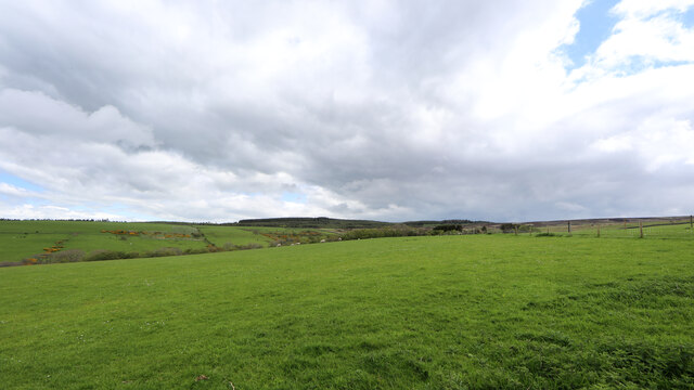
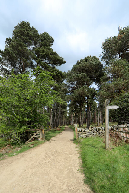
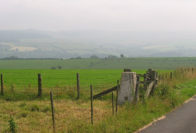
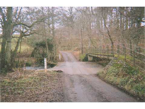
Viewley Wood is a picturesque woodland located in the county of Northumberland, England. Covering an area of approximately 100 hectares, it is a significant natural resource in the region. The wood is situated near the village of Viewley and is easily accessible via well-maintained footpaths.

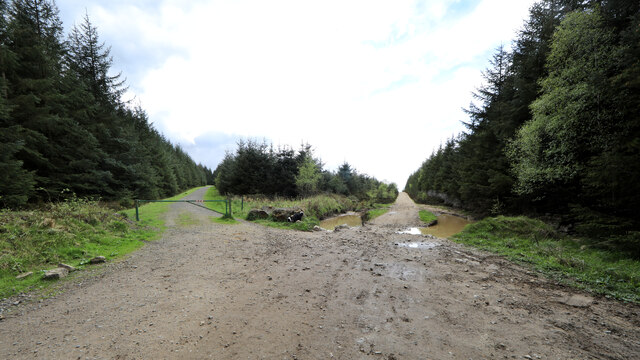
The wood is predominantly composed of a mix of deciduous and coniferous trees, including oak, beech, birch, and pine. This diversity of tree species creates a rich and vibrant ecosystem, attracting a wide range of wildlife. Visitors to Viewley Wood can expect to encounter various bird species, such as woodpeckers, owls, and thrushes, as well as small mammals like rabbits, squirrels, and hedgehogs.

The wood is popular among nature enthusiasts and walkers due to its tranquil atmosphere and scenic beauty. The well-marked trails winding through the woodland offer visitors the opportunity to explore and appreciate the natural surroundings. In spring, the forest floor comes alive with a carpet of bluebells, creating a breathtaking sight.

Viewley Wood also serves as an important site for conservation efforts. The management of the wood focuses on maintaining and enhancing the biodiversity of the area, ensuring its long-term sustainability. Regular tree planting and maintenance activities are carried out to promote the growth of native species and create a balanced ecosystem.

Overall, Viewley Wood is a cherished natural gem in Northumberland, providing a haven for wildlife, a recreational space for visitors, and a site of ecological significance.

If you have any feedback on the listing, please let us know in the comments section below.
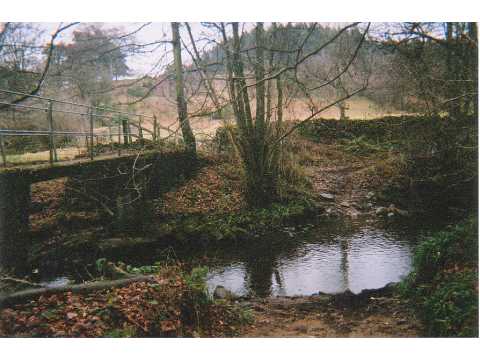
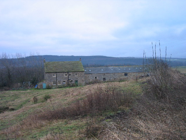
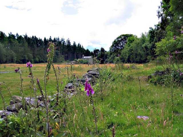
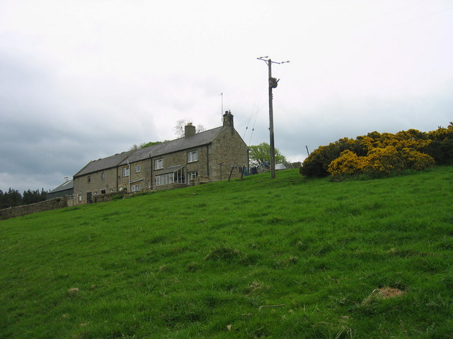
Viewley Wood Images

Images are sourced within 2km of 54.893939/-2.1149225 or Grid Reference NY9255. Thanks to Geograph Open Source API. All images are credited.

Glorious gorse above Embley Burn The byway descending west from Embley Fell comes off the heather moorland and immediately enters a scrubby area dominated by gorse, which is in full bloom in mid-May. As the track ahead drops closer to Embley Burn, it becomes more crowded by hawthorn and birch but still with a shrub layer of glorious gorse.
Glorious gorse above Embley Burn
The byway descending west from Embley Fell comes off the heather moorland and immediately enters a scrubby area dominated by gorse, which is in full bloom in mid-May. As the track ahead drops closer to Embley Burn, it becomes more crowded by hawthorn and birch but still with a shrub layer of glorious gorse.
Byway dropping down Embley Bank The byway descending west from Embley Fell comes off the heather moorland and immediately enters a scrubby area dominated by gorse, which is in full bloom in mid-May. Lower down as the track drops closer to Embley Burn, it becomes more crowded by hawthorn and birch but still with a shrub layer of glorious gorse.
Byway dropping down Embley Bank
The byway descending west from Embley Fell comes off the heather moorland and immediately enters a scrubby area dominated by gorse, which is in full bloom in mid-May. Lower down as the track drops closer to Embley Burn, it becomes more crowded by hawthorn and birch but still with a shrub layer of glorious gorse.
Sheep graze above Embley West of Slaley Forest, moorland drops down to farmland and pasture dominates. The bridleway from Embley just touches the edge of this gridsquare, offering an uninspiring view across the grazing towards the forest.
Sheep graze above Embley
West of Slaley Forest, moorland drops down to farmland and pasture dominates. The bridleway from Embley just touches the edge of this gridsquare, offering an uninspiring view across the grazing towards the forest.
Byway into Slaley Forest Slaley forest and the surrounding moors seem to be home to an unusual density of both bridleways and byways. Southeast of Viewley on the edge of the plantations, is a crossroads of byways, though the one heading to the south behind the photographer is limited to only two-wheeled motor vehicles, and even then, only in the drier summer months. To the north, the planting is now mature, and not the usual densely packed Sitka Spruce, but more widely spaced pines which certainly provide more opportunities for native wildlife as well as being of far greater amenity value for those who prefer open forest.
Byway into Slaley Forest
Slaley forest and the surrounding moors seem to be home to an unusual density of both bridleways and byways. Southeast of Viewley on the edge of the plantations, is a crossroads of byways, though the one heading to the south behind the photographer is limited to only two-wheeled motor vehicles, and even then, only in the drier summer months. To the north, the planting is now mature, and not the usual densely packed Sitka Spruce, but more widely spaced pines which certainly provide more opportunities for native wildlife as well as being of far greater amenity value for those who prefer open forest.
Forest track branches off byway, Slaley Forest The forest track to the left is guarded by a closed barrier to deter those who use the byway from straying where they are not permitted. Whilst signage implies a significant overuse of the byways by motor traffic, some of them shown on the map seem to have been erased entirely on the ground. The ones that still exist seem sufficiently straight that there can be little scope for noisy rally driving, but no doubt provide sport for mindless boy racers who think it fun to go very fast in a straight line. Signs advise calling Northumbria Police if you see bad behaviour taking place, but don't bother to mention where one might find a phone box to do so.
Forest track branches off byway, Slaley Forest
The forest track to the left is guarded by a closed barrier to deter those who use the byway from straying where they are not permitted. Whilst signage implies a significant overuse of the byways by motor traffic, some of them shown on the map seem to have been erased entirely on the ground. The ones that still exist seem sufficiently straight that there can be little scope for noisy rally driving, but no doubt provide sport for mindless boy racers who think it fun to go very fast in a straight line. Signs advise calling Northumbria Police if you see bad behaviour taking place, but don't bother to mention where one might find a phone box to do so.
Edward VII postbox near Turf House It's had some TLC since 2008 - see <a href="https://www.geograph.org.uk/photo/685129">NY9155 : Edward VII postbox near Turf House</a>. The location of this postbox is shown in <a href="https://www.geograph.org.uk/photo/7446643">NY9155 : Daffodils, Edward VII postbox and bus shelter near Turf House</a>.
Edward VII postbox near Turf House
It's had some TLC since 2008 - see NY9155 : Edward VII postbox near Turf House. The location of this postbox is shown in NY9155 : Daffodils, Edward VII postbox and bus shelter near Turf House.
Edward VII postbox near Turf House - royal cipher See <a href="https://www.geograph.org.uk/photo/7446638">NY9155 : Edward VII postbox near Turf House</a>; this postbox has been fitted (in situ) with an enlarged posting aperture.
Edward VII postbox near Turf House - royal cipher
See NY9155 : Edward VII postbox near Turf House; this postbox has been fitted (in situ) with an enlarged posting aperture.
Daffodils, Edward VII postbox and bus shelter near Turf House Shows the location of the <a href="https://www.geograph.org.uk/photo/7446638">NY9155 : Edward VII postbox near Turf House</a>.
Daffodils, Edward VII postbox and bus shelter near Turf House
Shows the location of the NY9155 : Edward VII postbox near Turf House.
East Lightside High level farmland for these parts, the trig is at 246m.
East Lightside
High level farmland for these parts, the trig is at 246m.
Irish bridge, Devil's Water This Irish bridge (culverted ford) takes the road over Devil's Water, near Renny's Barn. Will acquire proper ford status after heavy rainfall.
Irish bridge, Devil's Water
This Irish bridge (culverted ford) takes the road over Devil's Water, near Renny's Barn. Will acquire proper ford status after heavy rainfall.
Ford, Devil's Water, Rawgreen There are two fords in quick succession on this rough lane. This is the deeper one, through Devil's Water.
Ford, Devil's Water, Rawgreen
There are two fords in quick succession on this rough lane. This is the deeper one, through Devil's Water.
Ford, Devil's Water, Embley A shallow concrete ford takes the track through Devil's Water.
Ford, Devil's Water, Embley
A shallow concrete ford takes the track through Devil's Water.
Mire House near Whitley Chapel
White Hall Chapel Methodist Chapel dated 1871 with the usual gable-end porch flanked by round-arched windows.
White Hall Chapel
Methodist Chapel dated 1871 with the usual gable-end porch flanked by round-arched windows.
Stone House near Hackford This house may have been a shieling and only used in the summer months.

The KeysToThe Past website suggest the possibility of the building being an 18th century house.  <span class="nowrap"><a title="http://www.keystothepast.info/durhamcc/K2P.nsf/K2PDetail?readform&PRN=N23631" rel="nofollow ugc noopener" href="http://www.keystothepast.info/durhamcc/K2P.nsf/K2PDetail?readform&PRN=N23631">Link</a><img style="margin-left:2px;" alt="External link" title="External link - shift click to open in new window" src="https://s1.geograph.org.uk/img/external.png" width="10" height="10"/></span>
Stone House near Hackford
This house may have been a shieling and only used in the summer months. The KeysToThe Past website suggest the possibility of the building being an 18th century house. LinkExternal link
Redlead Mill, near Whitley Chapel
Burntshield Haugh Farm This is a good example of an early 18th century farmhouse, though it was altered in the 19th century. It is built of rubble and has a slate roof. In the southern end wall the remains of an old bread oven can still be seen.
Burntshield Haugh Farm
This is a good example of an early 18th century farmhouse, though it was altered in the 19th century. It is built of rubble and has a slate roof. In the southern end wall the remains of an old bread oven can still be seen.
Viewley Farm
Viewley Farm
Show me another place!

Viewley Wood is located at Grid Ref: NY9255 (Lat: 54.893939, Lng: -2.1149225)

Unitary Authority: Northumberland

Police Authority: Northumbria

What 3 Words

///sprayed.constrain.school. Near Slaley, Northumberland

Related Wikis

Whitley Chapel

Whitley Chapel is a village in Northumberland, England about 4 miles (6 km) south of Hexham, and in the parish of Hexhamshire. == Governance == Whitley...

Hexhamshire

Hexhamshire is a civil parish in Northern England. It was incorporated into Northumberland in 1572. == History == Hexhamshire was originally a single parish...

Juniper, Northumberland

Juniper is a hamlet in the English county of Northumberland. It is about 5 miles (8 km) due south of Hexham in the area known as Hexhamshire. There is...

Hexhamshire Low Quarter

Hexhamshire Low Quarter is a former civil parish, now in the parish of Hexhamshire, in Northumberland, England. It was situated to the south of Hexham...

Nearby Amenities

Located within 500m of 54.893939,-2.1149225
Ford: yes
Lat/Long: 54.8926515/-2.115115
Ford: yes
Lat/Long: 54.8956913/-2.1157343
The data included in this document is from www.openstreetmap.org. The data is made available under ODbL.

Have you been to Viewley Wood?

Leave your review of Viewley Wood below (or comments, questions and feedback).