Grange Plantation

Wood, Forest in Dorset

England

Grange Plantation

Path down to Newfoundland copse Overgrown start on the path down to Newfoundland copse
Path down to Newfoundland copse Credit: Shaun Ferguson

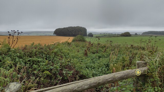
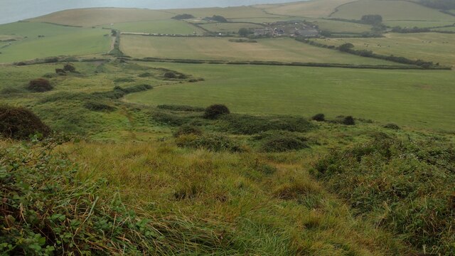
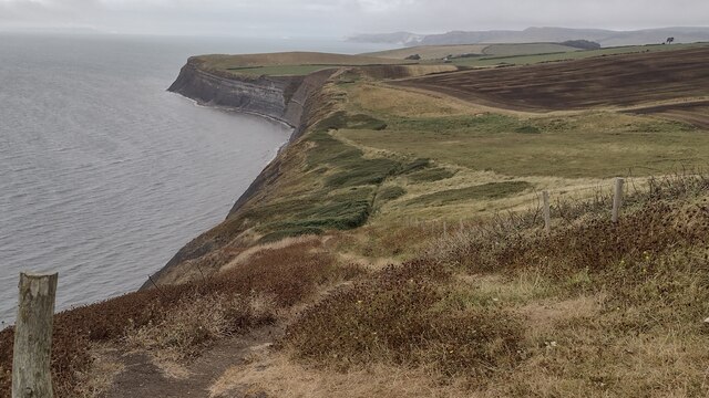
Grange Plantation is a picturesque woodland located in Dorset, England. Covering an area of approximately 100 acres, it is nestled within the stunning landscape of the county, offering visitors a peaceful and serene retreat away from the bustling city life.

The plantation is primarily composed of native tree species, including oak, beech, and ash, which create a dense and lush forest canopy. Walking through the woodland, one can admire the towering trees that provide a habitat for a diverse range of wildlife, such as birds, squirrels, and deer.

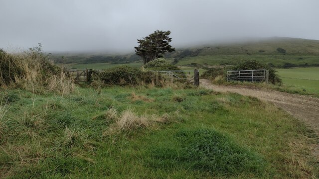
The plantation features well-maintained walking trails that meander through the woodland, allowing visitors to explore its natural beauty at their own pace. These paths are suitable for all levels of walkers, from beginners to more experienced hikers. Along the way, there are designated picnic areas where visitors can take a break and enjoy the tranquil surroundings.

Grange Plantation is a popular destination for nature lovers and outdoor enthusiasts alike. Its proximity to nearby villages and towns makes it easily accessible for day trips or longer stays. The woodland also offers opportunities for educational visits, with guided tours available to learn more about the local flora and fauna.

Furthermore, the plantation is committed to conservation efforts, implementing sustainable practices in managing the woodland. This includes selective tree felling and replanting projects, ensuring the long-term health and vitality of the forest ecosystem.

In conclusion, Grange Plantation in Dorset is a haven of natural beauty, offering visitors the chance to immerse themselves in the serene surroundings of a diverse woodland. Whether it's a leisurely stroll or an educational adventure, this plantation provides a delightful experience for all who visit.

If you have any feedback on the listing, please let us know in the comments section below.

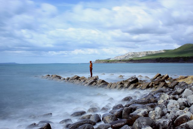
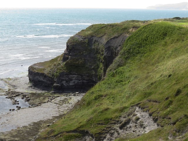
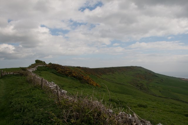
Grange Plantation Images

Images are sourced within 2km of 50.609734/-2.1118771 or Grid Reference SY9278. Thanks to Geograph Open Source API. All images are credited.

Path down to Newfoundland copse Overgrown start on the path down to Newfoundland copse
Path down to Newfoundland copse
Overgrown start on the path down to Newfoundland copse
Path heading towards Kimmeridge Path going along across Smedmore Hill heading towards Kimmeridge
Path heading towards Kimmeridge
Path going along across Smedmore Hill heading towards Kimmeridge
Path coming down from Swyre Head Path coming down from Swyre Head heading down near Swalland Farm
Path coming down from Swyre Head
Path coming down from Swyre Head heading down near Swalland Farm
Path going past the drive to Swalland Farm Path going past the drive to Swalland Farm heading in the distance to a mist covered Swyre Head
Path going past the drive to Swalland Farm
Path going past the drive to Swalland Farm heading in the distance to a mist covered Swyre Head
South West Coast Path South West Coast Path passes the stile and path off to Swyre Head
South West Coast Path
South West Coast Path passes the stile and path off to Swyre Head
South West Coast Path South West Coast Path heading to Rope Lake Head
South West Coast Path
South West Coast Path heading to Rope Lake Head
"Land" by Antony Gormley, Kimmeridge Bay This is one of five one-tone, 6ft high sculptures placed around the UK by the sculptor,  Gormley, to mark the 50th year of the Landmark Trust. This particular photo as taken using several negative density filters, in order to lengthen the exposure to about 25 seconds. The result is a smooth sea that appears misty around the edges. The sculpture was famously toppled by a gale in September 2015 and there are questions as to whether it will be re-erected or not; I hope it is
"Land" by Antony Gormley, Kimmeridge Bay
This is one of five one-tone, 6ft high sculptures placed around the UK by the sculptor, Gormley, to mark the 50th year of the Landmark Trust. This particular photo as taken using several negative density filters, in order to lengthen the exposure to about 25 seconds. The result is a smooth sea that appears misty around the edges. The sculpture was famously toppled by a gale in September 2015 and there are questions as to whether it will be re-erected or not; I hope it is
"Land" by Antony Gormley, Kimmeridge Bay A more extreme use of negative density filters, this time with an exposure of about 1 minute produces a more extreme effect, with the rocks appearing to be made of gun metal and a mistier sea.
"Land" by Antony Gormley, Kimmeridge Bay
A more extreme use of negative density filters, this time with an exposure of about 1 minute produces a more extreme effect, with the rocks appearing to be made of gun metal and a mistier sea.
"Land" by Antony Gormley, Kimmeridge Bay (without the filters) A more conventional picture of the sculpture without the use of the negative density filters used in my previous two pics.
"Land" by Antony Gormley, Kimmeridge Bay (without the filters)
A more conventional picture of the sculpture without the use of the negative density filters used in my previous two pics.
"Land" by Antony Gormley, Kimmeridge Bay (without the filters) A closer view of this wonderful sculpture by Antony Gormley.
"Land" by Antony Gormley, Kimmeridge Bay (without the filters)
A closer view of this wonderful sculpture by Antony Gormley.
View south-east from Cuddle On the south-west coast path near Kimmeridge.
View south-east from Cuddle
On the south-west coast path near Kimmeridge.
View west from Kimmeridge Bay car park
Clavell's Hard, south-west coast path So-called because the short projection of rock is harder than the surrounding rock, which is easily eroded.
Clavell's Hard, south-west coast path
So-called because the short projection of rock is harder than the surrounding rock, which is easily eroded.
Kimmeridge Ledges from the south-west coast path
The Nodding Donkey at Kimmeridge Constantly pumping since 1961, this is the UK's oldest working oil pump. For more information, see <span class="nowrap"><a title="https://en.wikipedia.org/wiki/Kimmeridge_Oil_Field" rel="nofollow ugc noopener" href="https://en.wikipedia.org/wiki/Kimmeridge_Oil_Field">Link</a><img style="margin-left:2px;" alt="External link" title="External link - shift click to open in new window" src="https://s1.geograph.org.uk/img/external.png" width="10" height="10"/></span>.
The Nodding Donkey at Kimmeridge
Constantly pumping since 1961, this is the UK's oldest working oil pump. For more information, see LinkExternal link.
The ridge of Smedmore Hill
Cliffs east of Rope Lake Head
Hardy Way at Swyre Wood Encombe House centre right.
Hardy Way at Swyre Wood
Encombe House centre right.
Show me another place!

Grange Plantation is located at Grid Ref: SY9278 (Lat: 50.609734, Lng: -2.1118771)

Unitary Authority: Dorset

Police Authority: Dorset

What 3 Words

///conceals.optimists.saucepan. Near Corfe Castle, Dorset

Related Wikis

Smedmore House

Smedmore House is a country house near Kimmeridge, Dorset, in England. It was originally built by Sir William Clavell around 1620, partially rebuilt by...

Hasler Hundred

Hasler Hundred or Hasilor Hundred was a hundred in the county of Dorset, England, containing the following parishes: Arne Church Knowle East Holme Kimmeridge...

Kimmeridge

Kimmeridge ( ) is a small village and civil parish on the Isle of Purbeck, a peninsula on the English Channel coast in Dorset, England. It is situated...

Kimmeridge Ledges

Kimmeridge Ledges ( ) is a set of Kimmeridge clay ledges stretching out in to the sea on the Isle of Purbeck, a peninsula on the English Channel coast...

The Etches Collection

The Etches Collection (also known as the Museum of Jurassic Marine Life) is an independent fossil museum located in the village of Kimmeridge, Dorset,...

St Nicholas's Church, Kimmeridge

St Nicholas's Church is a parish church in Kimmeridge, Dorset. It is dedicated to St Nicholas of Myra. The church is in the Archdeaconry of Dorset, in...

Hen Cliff

Hen Cliff is part of the Jurassic Coast near Kimmeridge in the Isle of Purbeck, Dorset, England.The cliff runs from the eastern end of Kimmeridge Bay...

Swyre Head

Swyre Head is the highest point of the Isle of Purbeck in Dorset, on the south coast of England. The hill Swyre Head lies about 2 kilometres (1 mi) southwest...

Nearby Amenities

Located within 500m of 50.609734,-2.1118771
Turning Circle
Lat/Long: 50.6094583/-2.1088938
Material: wood
Power: pole
Source: bing
Lat/Long: 50.6076235/-2.1063864
Material: wood
Power: pole
Source: bing
Lat/Long: 50.608165/-2.1101005
Material: wood
Power: pole
Source: bing
Lat/Long: 50.6083964/-2.111239
Material: wood
Power: pole
Source: bing
Lat/Long: 50.6086906/-2.1124027
Material: wood
Power: pole
Source: bing
Lat/Long: 50.6088445/-2.1133686
Material: wood
Power: pole
Source: bing
Lat/Long: 50.6089311/-2.1065567
Material: wood
Power: pole
Source: bing
Lat/Long: 50.608954/-2.1144237
Material: wood
Power: pole
Source: bing
Lat/Long: 50.6090032/-2.1154807
Material: wood
Power: pole
Source: bing
Lat/Long: 50.6090795/-2.1164543
Material: wood
Power: pole
Source: bing
Lat/Long: 50.6091608/-2.1175948
Material: wood
Power: pole
Source: bing
Lat/Long: 50.6092322/-2.1186343
Material: wood
Power: pole
Source: bing
Lat/Long: 50.6095305/-2.1066323
Material: wood
Power: pole
Source: bing
Lat/Long: 50.6126515/-2.1068781
Material: wood
Power: pole
Source: bing
Lat/Long: 50.6132092/-2.1081451
Smedmore House
Addr Postcode: BH20 5PG
Tourism: attraction
Lat/Long: 50.6093695/-2.1086094
The data included in this document is from www.openstreetmap.org. The data is made available under ODbL.

Have you been to Grange Plantation?

Leave your review of Grange Plantation below (or comments, questions and feedback).