Whitelees Plantation

Wood, Forest in Durham

England

Whitelees Plantation

Rocks on Nookton West Fell The farther stone is surely named as Sheriff's Stone and it sits on the county boundary between Northumberland and County Durham; it's the largest of a number of rocks in the area but not of any significant size.
Rocks on Nookton West Fell Credit: Trevor Littlewood

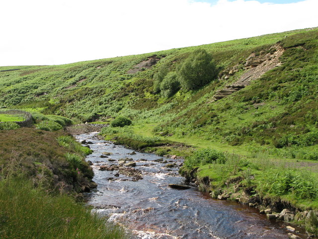
Whitelees Plantation is a picturesque woodland area located in Durham, England. Covering an expansive area of approximately 500 hectares, it is one of the largest and most well-preserved forests in the region. The plantation is part of the larger Whitelees Nature Reserve, which encompasses a diverse range of landscapes, from open grasslands to dense woodlands.

The forest is primarily composed of a mix of native tree species, including oak, ash, and birch, providing a rich habitat for a wide array of wildlife. The dense canopy of trees creates a tranquil and secluded atmosphere, making it a popular destination for nature lovers and hikers seeking solace in nature.

Whitelees Plantation offers a network of well-maintained walking trails, allowing visitors to explore the forest and its surrounding areas at their own pace. These trails cater to various skill levels, making it accessible to both beginners and experienced hikers. Along the way, visitors can discover beautiful viewpoints, hidden streams, and even ancient ruins, adding a touch of mystery and history to the experience.

The plantation also serves as an important conservation area, with ongoing efforts to protect and enhance its biodiversity. Various conservation projects are in place to maintain the integrity of the forest, including the removal of invasive species and the re-introduction of endangered plants and animals.

Overall, Whitelees Plantation is a haven of natural beauty and serenity, offering an escape from the hustle and bustle of everyday life. Whether it's for a leisurely stroll, wildlife spotting, or simply enjoying the tranquility of the surroundings, this forest is a must-visit destination for nature enthusiasts in Durham.

If you have any feedback on the listing, please let us know in the comments section below.

Whitelees Plantation Images

Images are sourced within 2km of 54.817352/-2.1289122 or Grid Reference NY9146. Thanks to Geograph Open Source API. All images are credited.

Rocks on Nookton West Fell The farther stone is surely named as Sheriff's Stone and it sits on the county boundary between Northumberland and County Durham; it's the largest of a number of rocks in the area but not of any significant size.
Rocks on Nookton West Fell
The farther stone is surely named as Sheriff's Stone and it sits on the county boundary between Northumberland and County Durham; it's the largest of a number of rocks in the area but not of any significant size.
Slope descending to Whitelees The near building is the farmhouse at Whitelees. The slope is descending into the valley of the Nookton Burn; Nookton (Farm) is to be seen on the opposite slope.
Slope descending to Whitelees
The near building is the farmhouse at Whitelees. The slope is descending into the valley of the Nookton Burn; Nookton (Farm) is to be seen on the opposite slope.
Fence line towards Cuthbert's Hill Cuthbert's Hill is a tiny feature in the landscape, it's to be seen just breaking the skyline to the left of the red-clad walker.
Bolt's Law is the more distant hill.
Fence line towards Cuthbert's Hill
Cuthbert's Hill is a tiny feature in the landscape, it's to be seen just breaking the skyline to the left of the red-clad walker. Bolt's Law is the more distant hill.
Plantation at Nookton Farm The small coniferous plantation above the farm could act as a wind break, but perhaps not as it lies to the north-west. A defence from winds from the south-east would have given a shield from the prevailing direction.
Plantation at Nookton Farm
The small coniferous plantation above the farm could act as a wind break, but perhaps not as it lies to the north-west. A defence from winds from the south-east would have given a shield from the prevailing direction.
Heather moorland at Nookton Fell On the moorland of Nookton Fell close to a location named on OS maps as Coppy Wreath. The heather is low with areas of dead, white twigs indicating burning as part of the management of the grouse moor. New shoots will arise.
Bolt's Law is the moorland hill in the distance.
Heather moorland at Nookton Fell
On the moorland of Nookton Fell close to a location named on OS maps as Coppy Wreath. The heather is low with areas of dead, white twigs indicating burning as part of the management of the grouse moor. New shoots will arise. Bolt's Law is the moorland hill in the distance.
Pale rocks on moorland beside Norham Burn Norham Burn is obviously at the right side of the image, it drains to the north entering Beldon Burn.
Pale rocks on moorland beside Norham Burn
Norham Burn is obviously at the right side of the image, it drains to the north entering Beldon Burn.
Shallow excavation at Coppy Wreath Coppy Wreath, a minor moorland rise on Nookton Fell, has this shallow quarry which is assumed to have been made to dig fine material for laying on estate roads. The image in fact was recorded from such a road.
Shallow excavation at Coppy Wreath
Coppy Wreath, a minor moorland rise on Nookton Fell, has this shallow quarry which is assumed to have been made to dig fine material for laying on estate roads. The image in fact was recorded from such a road.
Shooting Hut Beside Norham Burn - 2 The shooting hut is beside the Norham Burn and also to an estate road crossing the moorland ridge between the farms at Heatheryburn and Nookton Burn. Still painted green, the shade seems to have changed since images made in 2007 - <a title="https://www.geograph.org.uk/photo/509590" href="https://www.geograph.org.uk/photo/509590">Link</a> - and 2010 - <a title="https://www.geograph.org.uk/photo/1933836" href="https://www.geograph.org.uk/photo/1933836">Link</a>.
Shooting Hut Beside Norham Burn - 2
The shooting hut is beside the Norham Burn and also to an estate road crossing the moorland ridge between the farms at Heatheryburn and Nookton Burn. Still painted green, the shade seems to have changed since images made in 2007 - Link - and 2010 - Link.
Old Boundary Marker Parish Boundary Marker on moorland on Nookton West Fell. A boulder called the Sherriff's Stone on the boundary of Hexhamshire, Northumberland, and Hunstanworth, Durham. See also <a title="https://www.geograph.org.uk/photo/5342401" href="https://www.geograph.org.uk/photo/5342401">Link</a> and <a title="https://www.geograph.org.uk/photo/4247792" href="https://www.geograph.org.uk/photo/4247792">Link</a>.

Milestone Society National ID: NB_HEXHUN01pb
Old Boundary Marker
Parish Boundary Marker on moorland on Nookton West Fell. A boulder called the Sherriff's Stone on the boundary of Hexhamshire, Northumberland, and Hunstanworth, Durham. See also Link and Link. Milestone Society National ID: NB_HEXHUN01pb
Cuthbert's Hill with fence junction Cuthbert's Hill is a minor rise on what is a large area of fairly flat moorland. The kissing gate is to allow the passage of a public footpath.
Cuthbert's Hill with fence junction
Cuthbert's Hill is a minor rise on what is a large area of fairly flat moorland. The kissing gate is to allow the passage of a public footpath.
Flowering heather between wall and road The wall and road are on a broad ridge named as Uzzles Fell. In the direction of travel both road and wall are about to turn down, descending into the valley of the Beldon Burn.
Flowering heather between wall and road
The wall and road are on a broad ridge named as Uzzles Fell. In the direction of travel both road and wall are about to turn down, descending into the valley of the Beldon Burn.
Moorland of catchment area of Nookton Burn It's not immediately obvious from the image but the wide sweep of heather moorland is grooved by a number of streams which converge and merge to form the Nookton Burn, a tributary of the River Derwent.
The short, vertical, white pipe marks the location of a grouse 'grit station'; the position being indicated that way to allow estate workers to locate and supplement the supply. (And not as a guide for the grouse!)
Moorland of catchment area of Nookton Burn
It's not immediately obvious from the image but the wide sweep of heather moorland is grooved by a number of streams which converge and merge to form the Nookton Burn, a tributary of the River Derwent. The short, vertical, white pipe marks the location of a grouse 'grit station'; the position being indicated that way to allow estate workers to locate and supplement the supply. (And not as a guide for the grouse!)
Angular boulders on Uzzles Hill Uzzles Hill is a moorland feature above the Nookton Burn, a tributary of the River Derwent. The hill has no actual hill-like identity, being just a bulge of continually rising ground.
Bolt's Law is the moorland hill on the horizon.
Angular boulders on Uzzles Hill
Uzzles Hill is a moorland feature above the Nookton Burn, a tributary of the River Derwent. The hill has no actual hill-like identity, being just a bulge of continually rising ground. Bolt's Law is the moorland hill on the horizon.
Tractor at road end The large Deere Tractor is parked at the end of an estate road in the valley of the Nookton Burn; the attachment at the rear is a heavy-duty mowing machine. Such equipment is used to cut firebreaks around areas of heather prior to burning or simply to mow areas of heather. Both processes are used to encourage new growth in the plants. Note the doubled rear wheels; they're used to spread the load of the heavy machine over the frequently soft, boggy peatland.
Tractor at road end
The large Deere Tractor is parked at the end of an estate road in the valley of the Nookton Burn; the attachment at the rear is a heavy-duty mowing machine. Such equipment is used to cut firebreaks around areas of heather prior to burning or simply to mow areas of heather. Both processes are used to encourage new growth in the plants. Note the doubled rear wheels; they're used to spread the load of the heavy machine over the frequently soft, boggy peatland.
Currick on rough grassy ground The well-made cairn stands in the corner of an enclosure which is virtually moorland; the image was made from an estate road above.
The valley of the Nookton Burn lies beyond the declining slope. Bolt's Law is the moorland hill on the horizon.
Currick on rough grassy ground
The well-made cairn stands in the corner of an enclosure which is virtually moorland; the image was made from an estate road above. The valley of the Nookton Burn lies beyond the declining slope. Bolt's Law is the moorland hill on the horizon.
Moorland between Great and Little Espy Sikes Great Espy Sike and Little Espy Sike are two feeding streams of the Nookton Burn. The valley slopes are mainly of heather moorland which is managed for grouse shooting. OS, 1:25 000 mapping suggests a road or track of some kind crossing the slope somewhere in the vicinity of the walker; no such feature was noticed.
Moorland between Great and Little Espy Sikes
Great Espy Sike and Little Espy Sike are two feeding streams of the Nookton Burn. The valley slopes are mainly of heather moorland which is managed for grouse shooting. OS, 1:25 000 mapping suggests a road or track of some kind crossing the slope somewhere in the vicinity of the walker; no such feature was noticed.
Disused circular sheepfold The fold is basically intact but in a rickety state.
The location is at the head of the valley of the Nookton Burn where a number of feeding streams meet within a small area. The geometric patterns mown into the heather slopes are part of the management regime for grouse shooting.
Disused circular sheepfold
The fold is basically intact but in a rickety state. The location is at the head of the valley of the Nookton Burn where a number of feeding streams meet within a small area. The geometric patterns mown into the heather slopes are part of the management regime for grouse shooting.
Plantation on slope of valley The valley is that of the Nookton Burn. The trees are astride the stream, Westerly Sike. Once they were virtually continuous with others running down into the valley bottom, across it, then up on the far side, but there's been extensive clear-felling which has removed most of them.
Bolt's Law is the hill at the centre of the horizon.
Plantation on slope of valley
The valley is that of the Nookton Burn. The trees are astride the stream, Westerly Sike. Once they were virtually continuous with others running down into the valley bottom, across it, then up on the far side, but there's been extensive clear-felling which has removed most of them. Bolt's Law is the hill at the centre of the horizon.
Show me another place!

Whitelees Plantation is located at Grid Ref: NY9146 (Lat: 54.817352, Lng: -2.1289122)

Unitary Authority: County Durham

Police Authority: Durham

What 3 Words

///then.bearings.stung. Near Stanhope, Co. Durham

Related Wikis

Ramshaw, Consett

Ramshaw is a small village in County Durham, in England. It is situated to the south of Hunstanworth, a few miles west of Consett. Lead mining was an important...

Beldon Burn

Beldon Burn is a headwater stream of the River Derwent in Northumberland and County Durham, England.It rises at Quickcleugh Moss as the Quickcleugh Burn...

Townfield

Townfield is a village in County Durham, in England. It is situated just to the south of Hunstanworth and part of that parish, about 10 miles (16 km) west...

Lintzgarth

Lintzgarth is a village in the civil parish of Stanhope, in County Durham, England. It is situated to the west of Rookhope. The Lintzgarth smeltmill was...

Hunstanworth

Hunstanworth is a village in County Durham, England. It is situated approximately 10 miles to the west of Consett, south-west of the village of Blanchland...

Hexhamshire Moors

Hexhamshire Moors is a Site of Special Scientific Interest covering an extensive area of moorland in the Wear Valley district of north-west County Durham...

Baybridge, Northumberland

Baybridge is a small village in Northumberland, England, just to the west of Blanchland and on the border with County Durham. It is situated to the west...

Blanchland

Blanchland is a village in Northumberland, England, on the County Durham boundary. The population of the civil parish at the 2011 census was 135.Set beside...

Have you been to Whitelees Plantation?

Leave your review of Whitelees Plantation below (or comments, questions and feedback).