Gerald's Plantation

Wood, Forest in Dorset

England

Gerald's Plantation

Pasture beside the railway Looking towards Stoborough Heath, viewed from a Swanage to Wareham train service.
Pasture beside the railway Credit: John Lucas

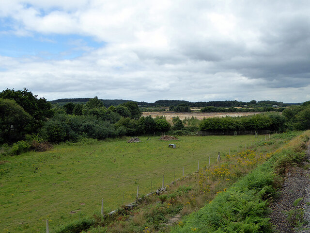
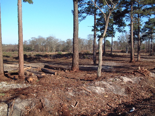
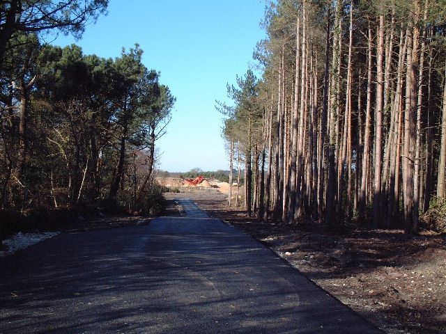
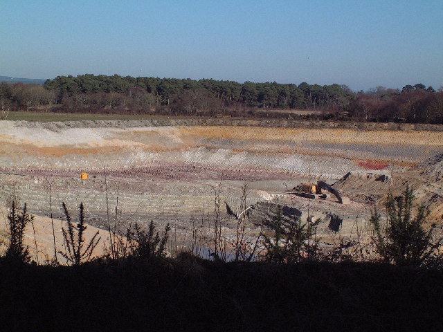
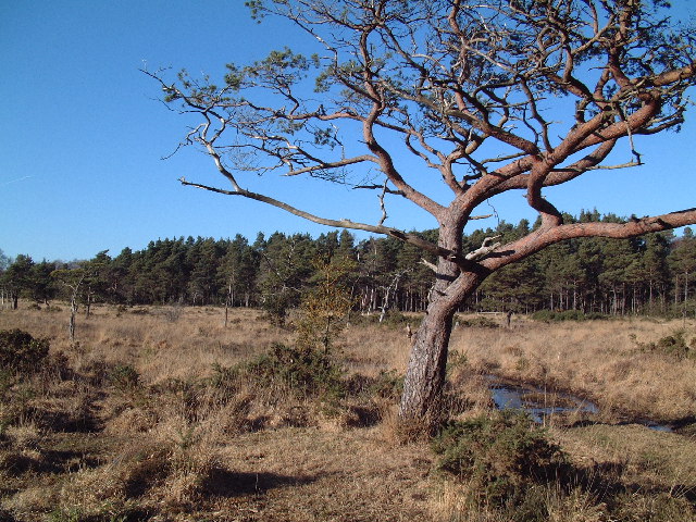
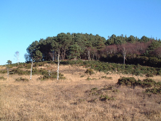
Gerald's Plantation is a sprawling woodland located in the picturesque county of Dorset, England. This enchanting forest covers an extensive area, stretching over several hundred acres. It is renowned for its natural beauty and diverse ecosystem, attracting nature enthusiasts, hikers, and photographers alike.

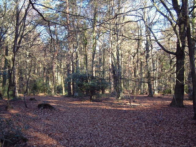
The plantation is characterized by its dense canopy of towering trees, predominantly consisting of oak, beech, and ash. These majestic giants provide a tranquil and serene ambiance, creating a haven for various species of flora and fauna. Delicate wildflowers carpet the forest floor in spring, while ferns and mosses flourish in the shaded areas.

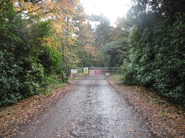
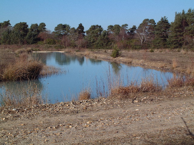
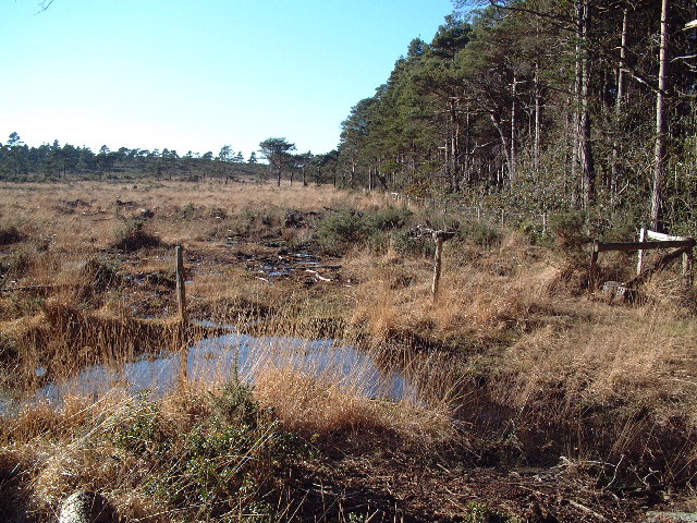
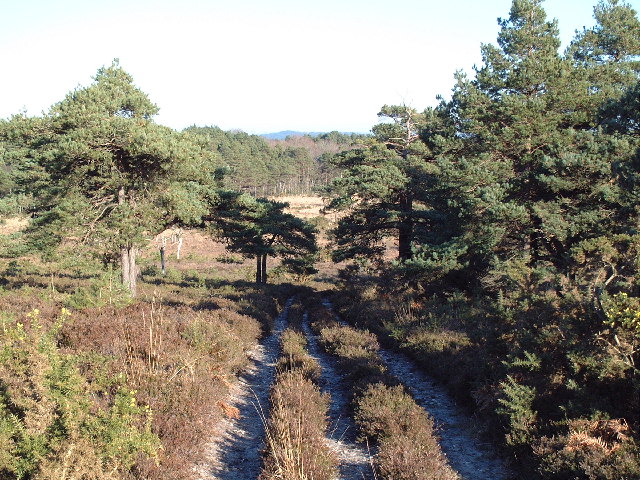
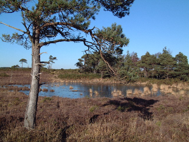
The forest boasts a network of well-maintained trails, allowing visitors to explore its hidden treasures. These trails meander through the woodland, passing babbling brooks, secluded ponds, and ancient stone ruins. Gerald's Plantation is also home to a rich array of wildlife, including deer, foxes, badgers, and a myriad of bird species. Nature enthusiasts can delight in observing these creatures in their natural habitat.

The plantation offers a range of recreational activities, such as hiking, birdwatching, and picnicking. It also serves as an educational resource, with guided nature walks and workshops organized throughout the year. Gerald's Plantation is a popular destination for families, providing a safe and enjoyable space for children to connect with nature.

Overall, Gerald's Plantation is a haven of tranquility and natural splendor. Its lush vegetation, diverse wildlife, and well-maintained trails make it an ideal destination for those seeking solace in the embrace of nature.

If you have any feedback on the listing, please let us know in the comments section below.

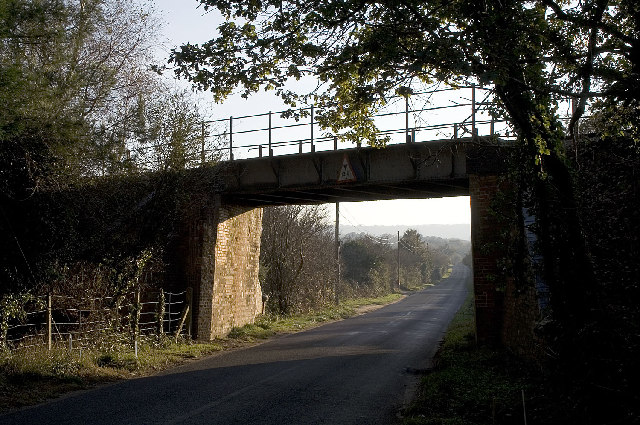
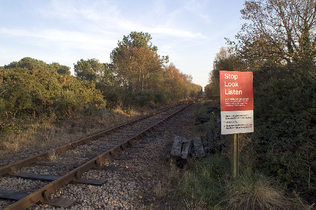
Gerald's Plantation Images

Images are sourced within 2km of 50.658286/-2.1203819 or Grid Reference SY9184. Thanks to Geograph Open Source API. All images are credited.

Pasture beside the railway Looking towards Stoborough Heath, viewed from a Swanage to Wareham train service.
Pasture beside the railway
Looking towards Stoborough Heath, viewed from a Swanage to Wareham train service.
East Holme, gate At the boundary of the MoD military training area. Apart from MoD warning signs, there are notices about forestry operations.
East Holme, gate
At the boundary of the MoD military training area. Apart from MoD warning signs, there are notices about forestry operations.
Lookout Holiday Park, Stoborough, Wareham, Dorset One of the many caravan parks catering for the multitude of summer visitors to the Isle of Purbeck.
Lookout Holiday Park, Stoborough, Wareham, Dorset
One of the many caravan parks catering for the multitude of summer visitors to the Isle of Purbeck.
Springfield Country Hotel and Leisure Club, Wareham, Dorset <span class="nowrap"><a title="http://www.springfield-country-hotel.co.uk/" rel="nofollow ugc noopener" href="http://www.springfield-country-hotel.co.uk/">Link</a><img style="margin-left:2px;" alt="External link" title="External link - shift click to open in new window" src="https://s1.geograph.org.uk/img/external.png" width="10" height="10"/></span>
Springfield Country Hotel and Leisure Club, Wareham, Dorset
Railway Bridge, Creech Bottom, Dorset The bridge carries the section of the line used by trains carrying Liquefied Petroleum Gas from the BP terminal at Furzebrook. On average eleven trains a week arrive at Furzebrook where they are loaded with butane and propane destined for BP's distribution terminal at Avonmouth. On 3rd January 2002 the remaining track was re-laid at Norden to connect with this section, re-establishing the rail link between Swanage and the main line that was closed in 1972.
<span class="nowrap"><a title="http://www.swanagerailway.co.uk/history.htm" rel="nofollow ugc noopener" href="http://www.swanagerailway.co.uk/history.htm">Link</a><img style="margin-left:2px;" alt="External link" title="External link - shift click to open in new window" src="https://s1.geograph.org.uk/img/external.png" width="10" height="10"/></span>
Railway Bridge, Creech Bottom, Dorset
The bridge carries the section of the line used by trains carrying Liquefied Petroleum Gas from the BP terminal at Furzebrook. On average eleven trains a week arrive at Furzebrook where they are loaded with butane and propane destined for BP's distribution terminal at Avonmouth. On 3rd January 2002 the remaining track was re-laid at Norden to connect with this section, re-establishing the rail link between Swanage and the main line that was closed in 1972. LinkExternal link
Railway Crossing, Creech Bottom, Dorset The Purbeck Way crosses the railway line at this point. This section of the line is used by trains carrying Liquefied Petroleum Gas from the BP terminal at Furzebrook. On average eleven trains a week arrive at Furzebrook where they are loaded with butane and propane destined for BP's distribution terminal at Avonmouth. On 3rd January 2002 the remaining track was re-laid at Norden to connect with this section, re-establishing the rail link between Swanage and the main line that was closed in 1972.
<span class="nowrap"><a title="http://www.swanagerailway.co.uk/history.htm" rel="nofollow ugc noopener" href="http://www.swanagerailway.co.uk/history.htm">Link</a><img style="margin-left:2px;" alt="External link" title="External link - shift click to open in new window" src="https://s1.geograph.org.uk/img/external.png" width="10" height="10"/></span>
Railway Crossing, Creech Bottom, Dorset
The Purbeck Way crosses the railway line at this point. This section of the line is used by trains carrying Liquefied Petroleum Gas from the BP terminal at Furzebrook. On average eleven trains a week arrive at Furzebrook where they are loaded with butane and propane destined for BP's distribution terminal at Avonmouth. On 3rd January 2002 the remaining track was re-laid at Norden to connect with this section, re-establishing the rail link between Swanage and the main line that was closed in 1972. LinkExternal link
Holme Lane Plantation The undergrowth here has been cleared recently, probably of rhododendrons judging from nearby areas that have not been cleared.
Holme Lane Plantation
The undergrowth here has been cleared recently, probably of rhododendrons judging from nearby areas that have not been cleared.
Disused Clay Workings The former clay workings here are flooded.
Disused Clay Workings
The former clay workings here are flooded.
Quarry Access Road Looking north west from the point where the road is crossed by a permissive path. The surface, if not the road itself, is very new.
Quarry Access Road
Looking north west from the point where the road is crossed by a permissive path. The surface, if not the road itself, is very new.
Clay Pit near Dorey's Farm Clay has been extracted in this area for hundreds of years. Extensive Roman era kilns have recently been uncovered near Swineham Point and Josiah Wedgwood apparently sourced his clay from this area as well. Clay extraction continues now with modern methods. Note the colours of the exposed strata and the patterns made by the scoops.
Clay Pit near Dorey's Farm
Clay has been extracted in this area for hundreds of years. Extensive Roman era kilns have recently been uncovered near Swineham Point and Josiah Wedgwood apparently sourced his clay from this area as well. Clay extraction continues now with modern methods. Note the colours of the exposed strata and the patterns made by the scoops.
Bridewell Plantation A clearing viewed looking north east from the permissive path running through the wood.
Bridewell Plantation
A clearing viewed looking north east from the permissive path running through the wood.
Grange Heath This picture shows the north east corner of this national nature reserve comprising lowland heathland managed by the RSPB. Note the stile at the extreme right which comprises two upright logs. The wood is the southern edge of Bridewell Plantation.
Grange Heath
This picture shows the north east corner of this national nature reserve comprising lowland heathland managed by the RSPB. Note the stile at the extreme right which comprises two upright logs. The wood is the southern edge of Bridewell Plantation.
Grange Heath Even the permissive bridleway, seen to the right of the tree, is very wet in this part of the NNR despite a winter with less than average rainfall.
Grange Heath
Even the permissive bridleway, seen to the right of the tree, is very wet in this part of the NNR despite a winter with less than average rainfall.
Grange Heath Looking north east from the top of a slight rise on this track.
Grange Heath
Looking north east from the top of a slight rise on this track.
Grange Heath This heathland pond had a thin covering of ice despite the early afternoon air temperature being 11 degrees celsius.
Grange Heath
This heathland pond had a thin covering of ice despite the early afternoon air temperature being 11 degrees celsius.
Drinking Barrow This rather strangely named feature is a prominent feature of the south west corner of the nature reserve.
Drinking Barrow
This rather strangely named feature is a prominent feature of the south west corner of the nature reserve.
Grange Heath This photograph was taken in the extreme south west corner of the national nature reserve. The fence in the foreground marks the boundary with the Army training range.
Grange Heath
This photograph was taken in the extreme south west corner of the national nature reserve. The fence in the foreground marks the boundary with the Army training range.
Ponies grazing on Stoborough Heath One of the last remaining bits of Dorset heathland still remaining.
Ponies grazing on Stoborough Heath
One of the last remaining bits of Dorset heathland still remaining.
Show me another place!

Gerald's Plantation is located at Grid Ref: SY9184 (Lat: 50.658286, Lng: -2.1203819)

Unitary Authority: Dorset

Police Authority: Dorset

What 3 Words

///preparing.spaceship.coping. Near Wareham, Dorset

Related Wikis

Furzebrook, Dorset

Furzebrook is a small village on the Isle of Purbeck, in the county of Dorset in the south of England. It is about 2 miles (3.2 km) south of Wareham and...

Stoborough Green

Stoborough Green is a village in the English county of Dorset. It is situated to the south of the village of Stoborough and about 2 kilometres south of...
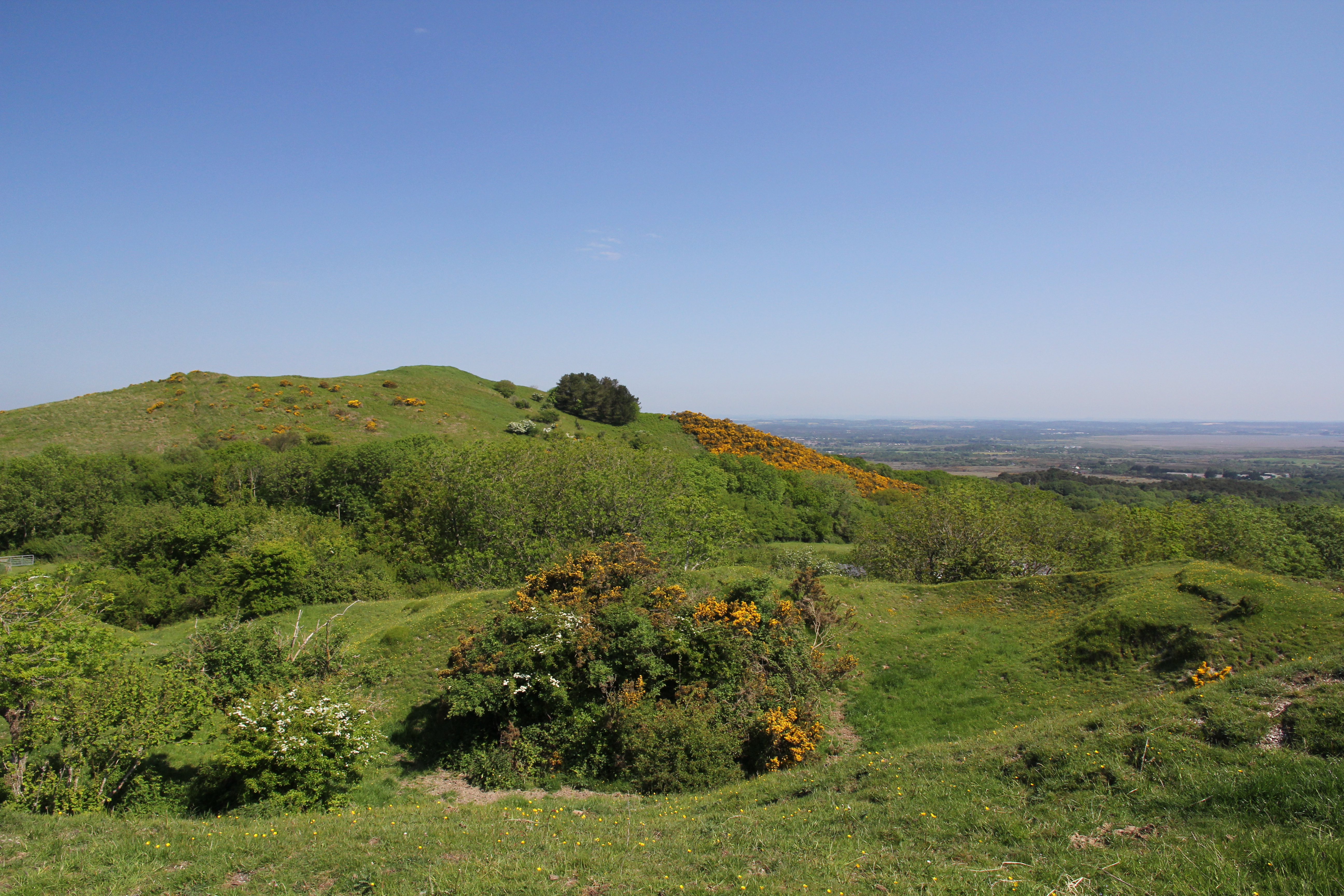
Creech Barrow Hill

Creech Barrow Hill is a steep, conical hill, 193 metres (633 ft) (one source 637 feet) high, near the coast of Dorset, England, and the highest point of...

Creech Grange

Creech Grange is a country house in Steeple, south of Wareham in Dorset at the foot of the Purbeck Hills. Historic England designate it as a Grade I listed...

Related Videos

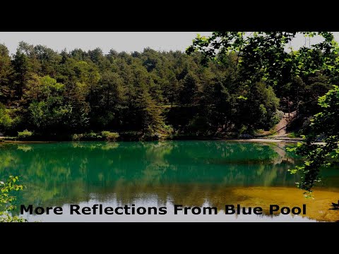
On My Travel's - The Blue Pool

On My Travel's Video Collection,We Visit The Blue Pool In Dorset.

Blue Pool Dorset Part #2 ~June Holiday 2018 Day #5

BluepoolDorset #Dorset #caravanningUKcommunity #placestovisitindorset #holidaysindorset So we continue our trip to Blue Pool ...

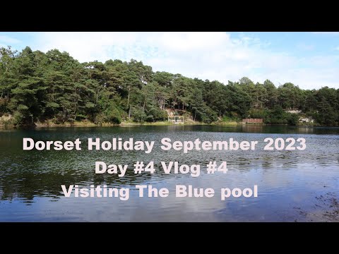
Visiting "The Blue Pool" - Dorset Holiday Sept 2023 Day #4 Vlog #4

thebluepool #bluepool #caravanholiday #caravaning #dorset #holidayvideo #holidayvlog #placestovisit #placestovisitindorset In ...

Nearby Amenities

Located within 500m of 50.658286,-2.1203819
Post Box
Collection Times: Mo-Sa 09:00
Operator: Royal Mail
Operator Wikidata: Q638098
Post Box Type: lamp
Ref: BH20 94
Ref GB Uprn: 10015431136
Royal Cypher: EIIR
Royal Cypher Wikidata: Q33102113
Lat/Long: 50.6613276/-2.1157643
Material: wood
Power: pole
Source: bing
Lat/Long: 50.6541549/-2.1211316
Material: wood
Power: pole
Source: bing
Transformer: distribution
Voltage Primary: 11000
Voltage Secondary: 400
Voltage Tertiary: 230
Lat/Long: 50.6549464/-2.1210802
Material: wood
Power: pole
Source: bing
Lat/Long: 50.6555922/-2.1206093
Material: wood
Power: pole
Source: bing
Lat/Long: 50.6564428/-2.1199729
Material: wood
Power: pole
Source: bing
Lat/Long: 50.6568694/-2.1196522
Material: wood
Power: pole
Source: bing
Lat/Long: 50.6576878/-2.1190897
Material: wood
Power: pole
Source: bing
Lat/Long: 50.6583575/-2.1185978
Material: wood
Power: pole
Source: bing
Lat/Long: 50.6589193/-2.1181765
Material: wood
Power: pole
Source: bing
Lat/Long: 50.6591373/-2.1173633
Material: wood
Power: pole
Source: bing
Lat/Long: 50.6593877/-2.118988
Material: wood
Power: pole
Source: survey
Switch: recloser
Lat/Long: 50.6593488/-2.1165021
Material: wood
Note: Vertically stacked
Power: pole
Source: bing
Lat/Long: 50.6598803/-2.1143339
Material: wood
Power: pole
Source: bing
Lat/Long: 50.6598811/-2.1197705
Material: wood
Power: pole
Source: bing
Lat/Long: 50.6603613/-2.1205654
Material: wood
Power: pole
Source: bing
Lat/Long: 50.660737/-2.1229285
Material: wood
Power: pole
Source: bing
Lat/Long: 50.6608494/-2.1213188
Material: wood
Power: pole
Source: bing
Lat/Long: 50.6612715/-2.1219703
Ford: yes
Lat/Long: 50.6546966/-2.1210229
RSPB Grange Heath
Fixme: Find extents
Lat/Long: 50.6554942/-2.1219385
Ford: yes
Lat/Long: 50.6559669/-2.1219615
Power: pole
Source: bing
Lat/Long: 50.6595487/-2.1156903
The data included in this document is from www.openstreetmap.org. The data is made available under ODbL.

Have you been to Gerald's Plantation?

Leave your review of Gerald's Plantation below (or comments, questions and feedback).