Hazel Wood
Wood, Forest in Worcestershire Wychavon
England
Hazel Wood
Hazel Wood, located in Worcestershire, is a serene and picturesque forest that covers an area of approximately 50 acres. Nestled amidst the rolling hills of the county, this woodland is a haven for nature enthusiasts and those seeking a peaceful escape from the hustle and bustle of city life.
The forest gets its name from the abundant presence of hazel trees that dominate the landscape. These trees, with their distinctive heart-shaped leaves and delicate yellow catkins, create a stunning display throughout the year. In spring, the woodland floor comes alive with a vibrant carpet of bluebells, daffodils, and wild garlic, adding to the enchanting atmosphere.
Hazel Wood offers a variety of walking trails, allowing visitors to explore its natural wonders at their own pace. As you wander through the forest, you may encounter a diverse range of wildlife, including deer, foxes, and a plethora of bird species. The forest's tranquil setting also makes it an ideal spot for birdwatching and photography enthusiasts.
The forest is well-maintained, with clearly marked paths and picnic areas for visitors to relax and enjoy the surroundings. It is a popular destination for families, hikers, and nature lovers alike, who can immerse themselves in the beauty of the woodlands and take in the fresh, crisp air.
Hazel Wood is easily accessible, located just a short drive from nearby towns and villages. Whether you are seeking a leisurely stroll, a peaceful picnic, or simply a moment of tranquility in nature, this idyllic woodland provides the perfect escape.
If you have any feedback on the listing, please let us know in the comments section below.
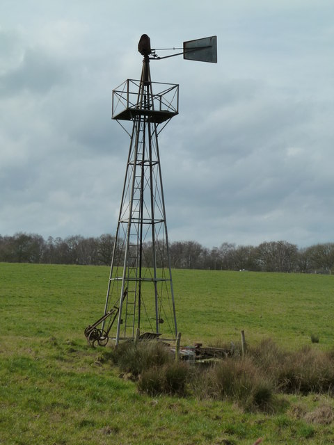
Hazel Wood Images
Images are sourced within 2km of 52.249848/-2.1247542 or Grid Reference SO9161. Thanks to Geograph Open Source API. All images are credited.


Hazel Wood is located at Grid Ref: SO9161 (Lat: 52.249848, Lng: -2.1247542)
Administrative County: Worcestershire
District: Wychavon
Police Authority: West Mercia
What 3 Words
///loops.examiner.bleaching. Near Droitwich, Worcestershire
Nearby Locations
Related Wikis

Hadzor
Hadzor is a small village near Droitwich, Worcestershire, England. There are around fourteen houses and a Roman Catholic church in the village, although...

Dunhampstead
Dunhampstead is a small village in the English county of Worcestershire. It is located about 6 miles to the north-east of Worcester and around half a...
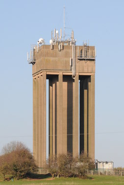
Droitwich Water Tower
The Droitwich Water Tower, also known as Yew Tree Hill Water Tower, is a structure on Yew Tree Hill in Droitwich, England, owned and operated by Severn...

Oddingley
Oddingley is a village and civil parish in the English county of Worcestershire, approximately 9 km (5.6 mi) north-east of the county town of Worcester...
Droitwich Road railway station
Droitwich Road railway station served the town of Droitwich Spa, Worcestershire, England, from 1840 to 1855 on the Birmingham and Gloucester Railway....

Droitwich Spa Lido
The Droitwich Spa Lido is a lido in Droitwich Spa, Worcestershire, England. It is one of the few remaining inland, open-air salt-water swimming pools...

Church of the Sacred Heart and St Catherine of Alexandria
The Church of the Sacred Heart and St Catherine of Alexandria is a Catholic church situated in Droitwich Spa, Worcestershire, England, noted for its remarkable...
Dunhampstead railway station
Dunhampstead railway station served the village of Dunhampstead, Worcestershire, England, from 1841 to 1855 on the Birmingham and Gloucester Railway....
Nearby Amenities
Located within 500m of 52.249848,-2.1247542Have you been to Hazel Wood?
Leave your review of Hazel Wood below (or comments, questions and feedback).