Woodcote Coppice

Wood, Forest in Worcestershire Bromsgrove

England

Woodcote Coppice

One Oak These premises beside the Kidderminster Road near Dodford house the interesting combination of an Indian Restaurant and an ornamental gate manufacturers.
One Oak Credit: David Stowell

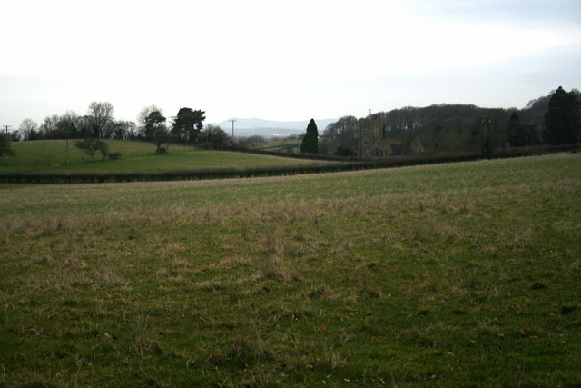
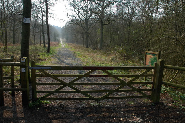
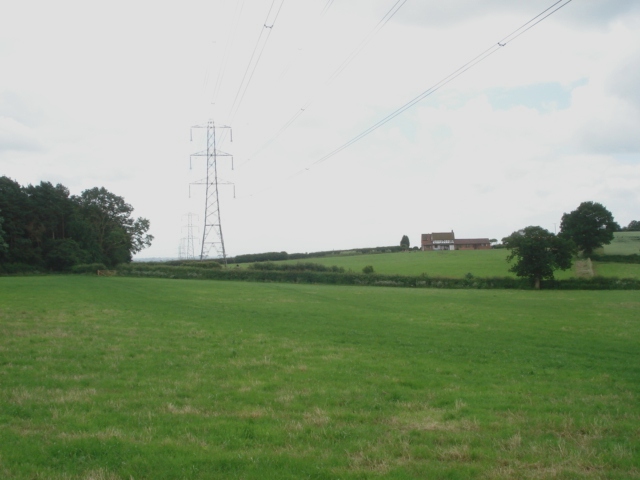
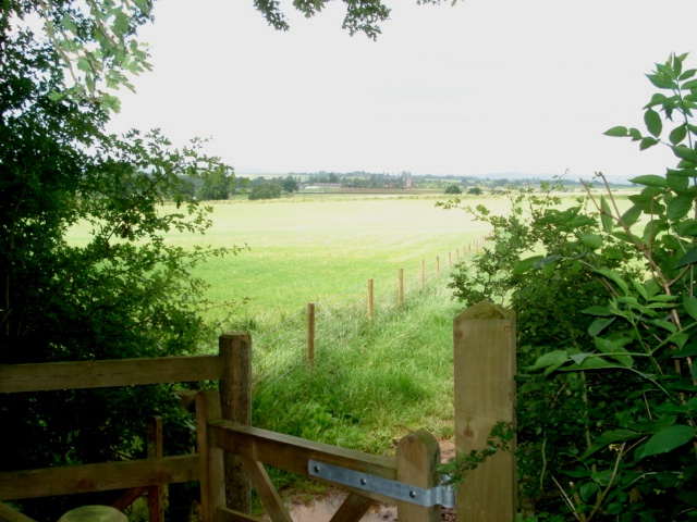
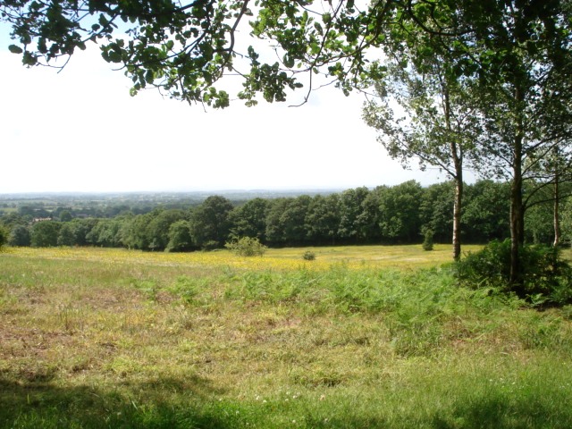
Woodcote Coppice is a picturesque woodland located in Worcestershire, England. Spanning over a vast area, it is renowned for its dense forest cover and stunning natural beauty. The coppice is situated on the outskirts of the village of Woodcote, nestled within the rolling hills and serene countryside of Worcestershire.

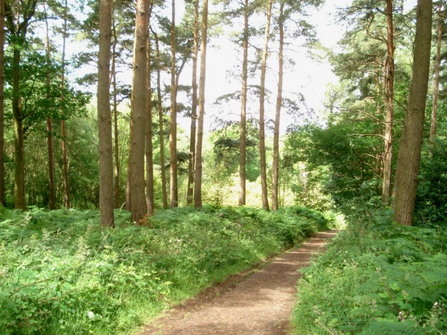
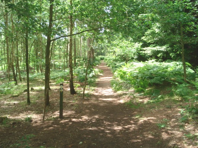
The woodland is characterized by its diverse range of tree species, including oak, ash, birch, and beech. These towering trees create a dense canopy that filters sunlight, casting mesmerizing patterns on the forest floor. Woodcote Coppice is also home to a rich variety of flora and fauna, making it a haven for nature enthusiasts and wildlife enthusiasts alike. The forest floor is adorned with vibrant wildflowers and moss-covered rocks, adding to its enchanting appeal.

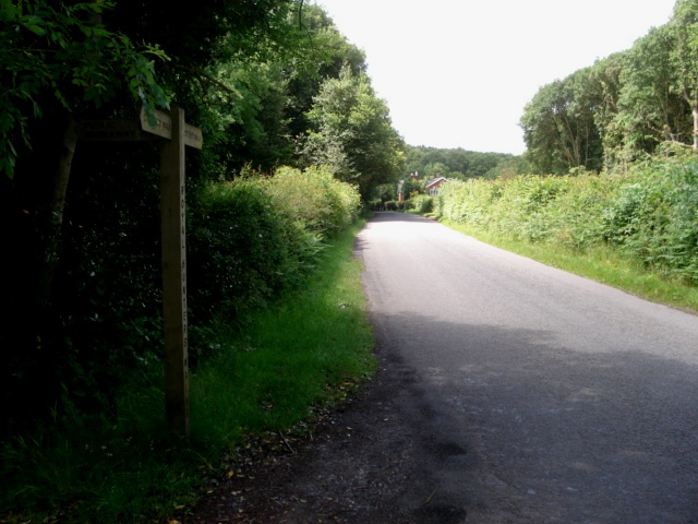
The woodland offers several well-maintained trails that wind their way through the forest, providing visitors with the opportunity to explore its hidden treasures. These trails are suitable for both leisurely strolls and more challenging hikes, catering to all levels of fitness and experience. Along the way, walkers may stumble upon natural springs and small streams, adding to the tranquility and serenity of the area.

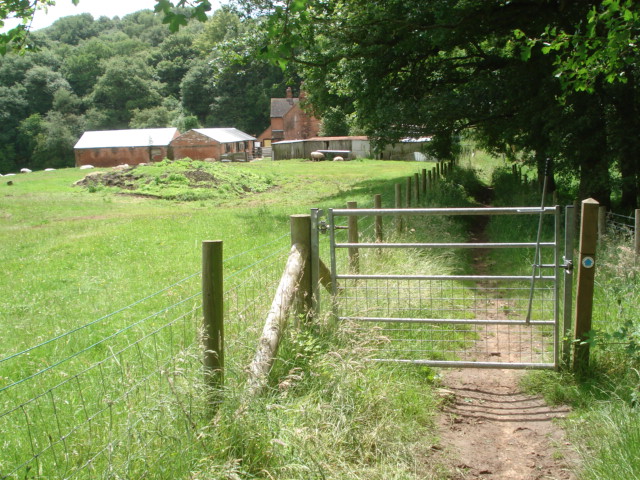
Woodcote Coppice is a popular destination for outdoor activities such as birdwatching, photography, and picnicking. The peaceful atmosphere and stunning surroundings make it an ideal spot for relaxation and rejuvenation. Whether one is seeking solitude or an adventure in nature, Woodcote Coppice offers an immersive experience that showcases the beauty of Worcestershire's woodlands.

If you have any feedback on the listing, please let us know in the comments section below.

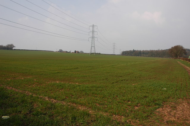
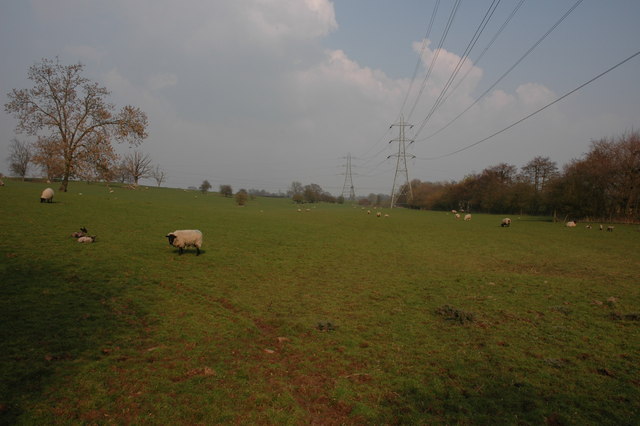
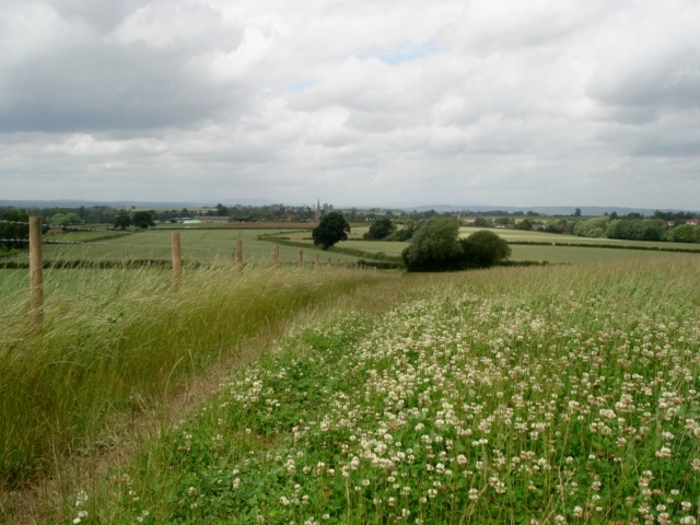
Woodcote Coppice Images

Images are sourced within 2km of 52.346392/-2.1259512 or Grid Reference SO9172. Thanks to Geograph Open Source API. All images are credited.

One Oak These premises beside the Kidderminster Road near Dodford house the interesting combination of an Indian Restaurant and an ornamental gate manufacturers.
One Oak
These premises beside the Kidderminster Road near Dodford house the interesting combination of an Indian Restaurant and an ornamental gate manufacturers.
Woodcote Farm Situated beside the Kidderminster Road, this old farm now does B&B and has holiday cottages.  The farmhouse actually sits along the northern edge of the square.
Woodcote Farm
Situated beside the Kidderminster Road, this old farm now does B&B and has holiday cottages. The farmhouse actually sits along the northern edge of the square.
Cross Roads for Dodford The sign at the junction with the Kidderminster Road on the eastern edge of the square is occasionally the target for witless vandalism!
Cross Roads for Dodford
The sign at the junction with the Kidderminster Road on the eastern edge of the square is occasionally the target for witless vandalism!
Holy Trinity and St. Mary Church, Dodford Built in 1908 with "Arts and Crafts" style features and stonework embellished by the Bromsgrove Guild.
Holy Trinity and St. Mary Church, Dodford
Built in 1908 with "Arts and Crafts" style features and stonework embellished by the Bromsgrove Guild.
Chaddesley Wood Chaddesley Wood is a National Nature Reserve.
Chaddesley Wood
Chaddesley Wood is a National Nature Reserve.
Farm buildings near Woodcote Green
Pylons and farmland near Woodcote Green
Field to the south of The Durrance
Clover field near Chaddesley Wood The path from the wood leads to Chaddesley Corbett village in the distance. The church spire is just visible.
Clover field near Chaddesley Wood
The path from the wood leads to Chaddesley Corbett village in the distance. The church spire is just visible.
Chaddesley Wood Farm With Chaddesley Wood to the left.
Chaddesley Wood Farm
With Chaddesley Wood to the left.
View from the edge of Chaddesley Wood
Chaddesley Wood This wood is managed by Natural England (ex English Nature) and it is a designated National Nature Reserve. It was once part of the Royal Hunting Forest of Feckenham and there are many interesting walks.
<span class="nowrap"><a title="http://worcestershire.whub.org.uk/cms/environment-and-planning/countryside/waymarked-walks/off-site-circular-trails/royal-hunters-walks.aspx" rel="nofollow ugc noopener" href="http://worcestershire.whub.org.uk/cms/environment-and-planning/countryside/waymarked-walks/off-site-circular-trails/royal-hunters-walks.aspx">Link</a><img style="margin-left:2px;" alt="External link" title="External link - shift click to open in new window" src="https://s1.geograph.org.uk/img/external.png" width="10" height="10"/></span>
Chaddesley Wood
This wood is managed by Natural England (ex English Nature) and it is a designated National Nature Reserve. It was once part of the Royal Hunting Forest of Feckenham and there are many interesting walks. LinkExternal link
Path junction in Chaddesley Wood
The edge of Chaddesley Wood View to the south west across grassland.
The edge of Chaddesley Wood
View to the south west across grassland.
View from Santery Hill Wood
Woodcote Lane at Nutnells Wood On the left is a Worcester County Council sign for a part of the Foresters Walk, designed by the council. These woods are the remnants of the 190 square mile Great Hunting Forest of Feckenham.
Woodcote Lane at Nutnells Wood
On the left is a Worcester County Council sign for a part of the Foresters Walk, designed by the council. These woods are the remnants of the 190 square mile Great Hunting Forest of Feckenham.
View towards Highwood Cottage A real old-fashioned farmhouse in a clearing in the woods.
View towards Highwood Cottage
A real old-fashioned farmhouse in a clearing in the woods.
Front garden of Highwood Cottage Sitting in a clearing in the wood and a long way from the nearest neighbour, this farm seems to have one field of sheep and a real tumble-down feel.
Front garden of Highwood Cottage
Sitting in a clearing in the wood and a long way from the nearest neighbour, this farm seems to have one field of sheep and a real tumble-down feel.
Show me another place!

Woodcote Coppice is located at Grid Ref: SO9172 (Lat: 52.346392, Lng: -2.1259512)

Administrative County: Worcestershire

District: Bromsgrove

Police Authority: West Mercia

What 3 Words

///spires.copycat.depths. Near Bromsgrove, Worcestershire

Related Wikis

Chaddesley Woods National Nature Reserve

Chaddesley Woods National Nature Reserve is situated near the village of Chaddesley Corbett, in Worcestershire, England. It is a reserve of the Worcestershire...

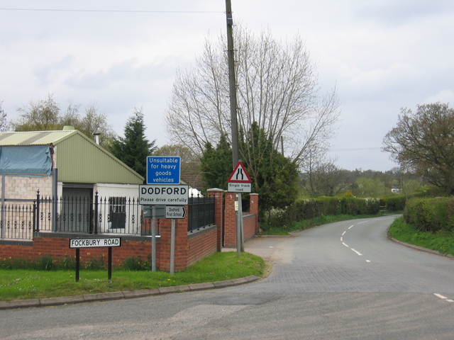
Dodford, Worcestershire

Dodford is a village in the Bromsgrove district of Worcestershire, England, approximately 3 miles (4.8 km) west of Bromsgrove, officially founded on 2...

Rosedene

Rosedene is a cottage built as part of the Great Dodford Chartist settlement. It is the best preserved example of a Chartist cottage built by the National...

Dodford Priory

Dodford Priory in the parish of Bromsgrove in Worcestershire in the current village of Dodford, was a small Augustinian monastery. == History == It was...

Nearby Amenities

Located within 500m of 52.346392,-2.1259512
Post Box
Post Box Type: wall
Ref: B61 294
Lat/Long: 52.3458865/-2.1233936
Material: wood
Power: pole
Lat/Long: 52.3454419/-2.1223301
Material: wood
Power: pole
Source: bing
Lat/Long: 52.3453092/-2.1275684
Material: wood
Power: pole
Source: bing
Lat/Long: 52.3453387/-2.126407
Material: wood
Power: pole
Source: bing
Lat/Long: 52.3453617/-2.1254978
Material: wood
Power: pole
Source: bing
Lat/Long: 52.3453928/-2.1246502
Material: wood
Power: pole
Source: bing
Lat/Long: 52.3454223/-2.1236953
Material: wood
Power: pole
Source: bing
Lat/Long: 52.3454452/-2.1217319
Material: wood
Power: pole
Ref: 774846
Source: wpd_opendata
Transformer: distribution
Lat/Long: 52.3454731/-2.1209943
Material: wood
Power: pole
Source: bing
Lat/Long: 52.3455075/-2.1196988
Material: wood
Power: pole
Source: bing
Lat/Long: 52.345514/-2.1190953
The data included in this document is from www.openstreetmap.org. The data is made available under ODbL.

Have you been to Woodcote Coppice?

Leave your review of Woodcote Coppice below (or comments, questions and feedback).