Ivelet Wood

Wood, Forest in Yorkshire Richmondshire

England

Ivelet Wood

Swinner Gill Ford This ford at Swinner Gill is found on the bridleway between Muker and Keld. A video of the ford can be viewed at:
<span class="nowrap"><a title="https://youtu.be/pRj-GMUVvRE" rel="nofollow ugc noopener" href="https://youtu.be/pRj-GMUVvRE">Link</a><img style="margin-left:2px;" alt="External link" title="External link - shift click to open in new window" src="https://s1.geograph.org.uk/img/external.png" width="10" height="10"/></span>
Swinner Gill Ford Credit: John Walton

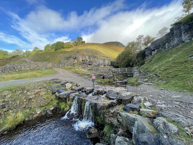
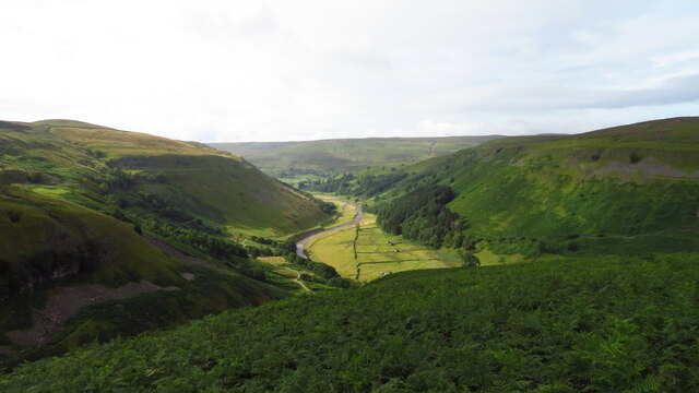
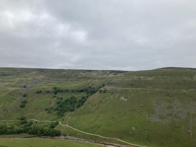
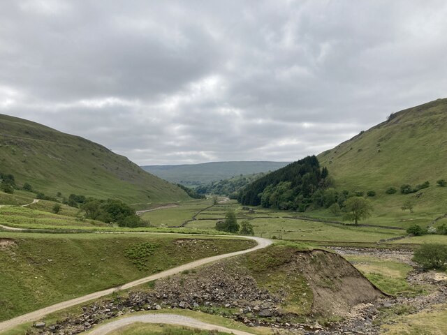
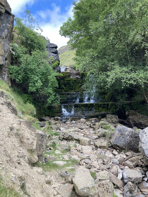
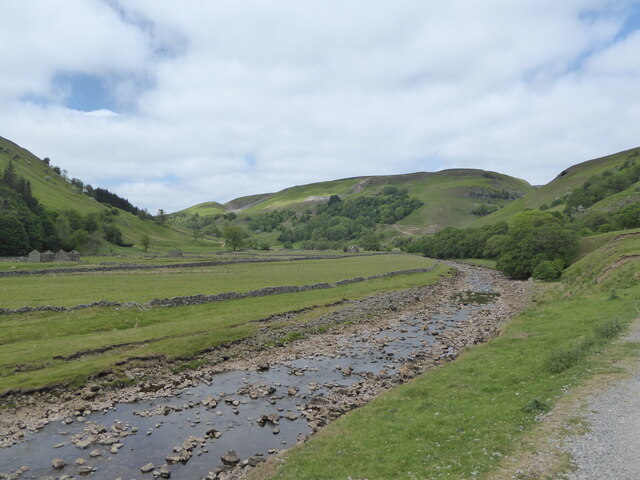
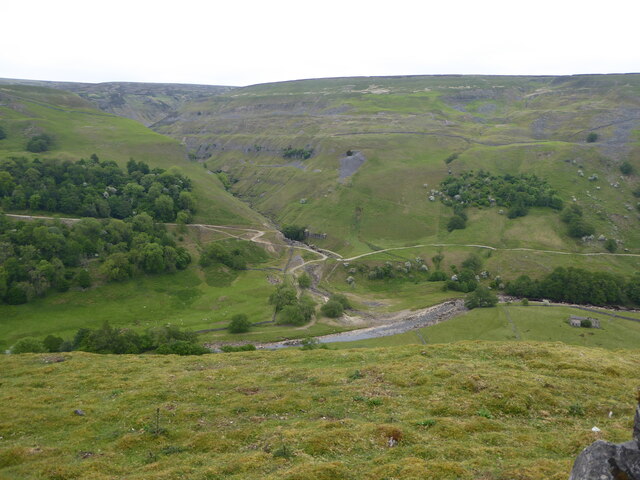
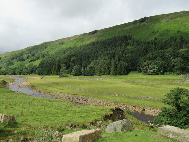
Ivelet Wood is a picturesque woodland located in the county of Yorkshire, England. Situated in the heart of the Yorkshire Dales National Park, this enchanting forest covers an area of approximately 300 hectares. The wood is named after the nearby river, Ivelet, which meanders through the landscape, adding to the area's natural beauty.

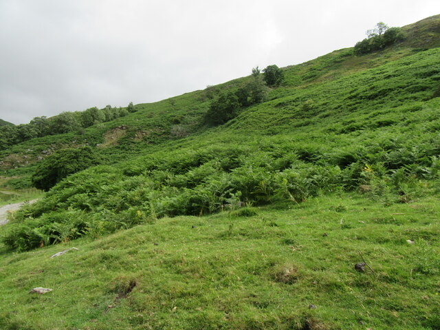
The woodland is renowned for its diverse range of flora and fauna, making it a haven for nature lovers and wildlife enthusiasts. It is home to a variety of tree species, including oak, birch, and beech, which dominate the dense canopy overhead. The forest floor is adorned with a vibrant carpet of bluebells and wild garlic during the spring months, creating a stunning display of natural colors.

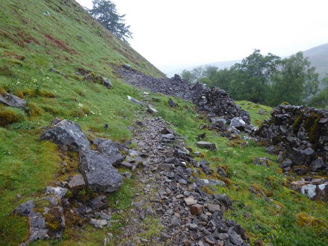
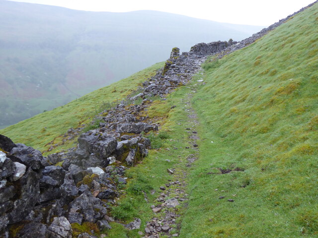
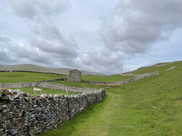
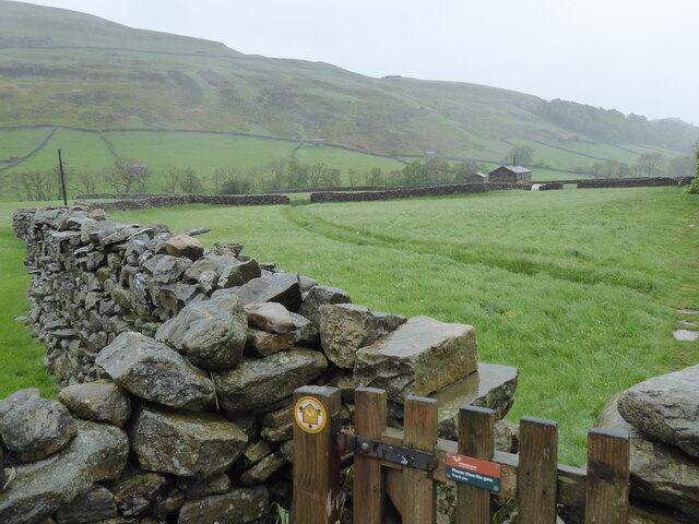
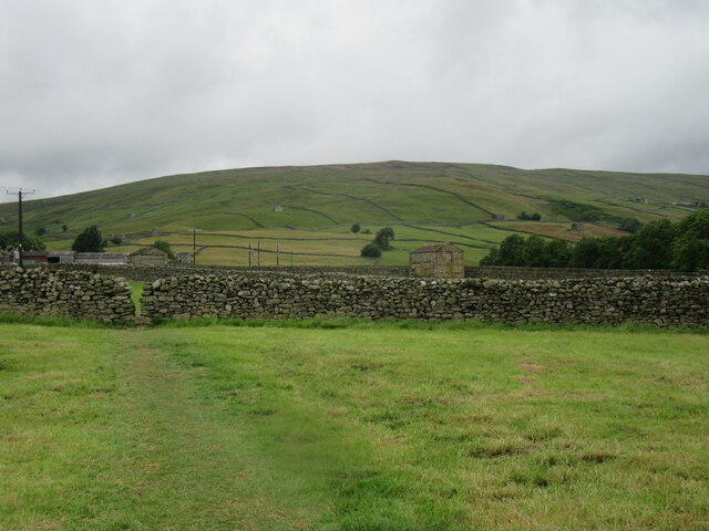
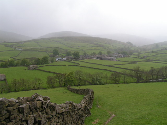
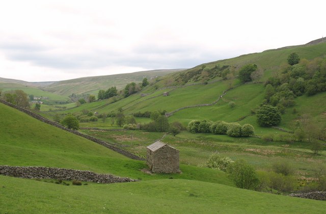
Walking trails wind their way through the wood, allowing visitors to explore its hidden corners and appreciate its tranquility. The paths weave alongside babbling brooks and ancient stone walls, offering glimpses of the surrounding countryside and panoramic views of the rolling hills that stretch out beyond the woodland's borders.

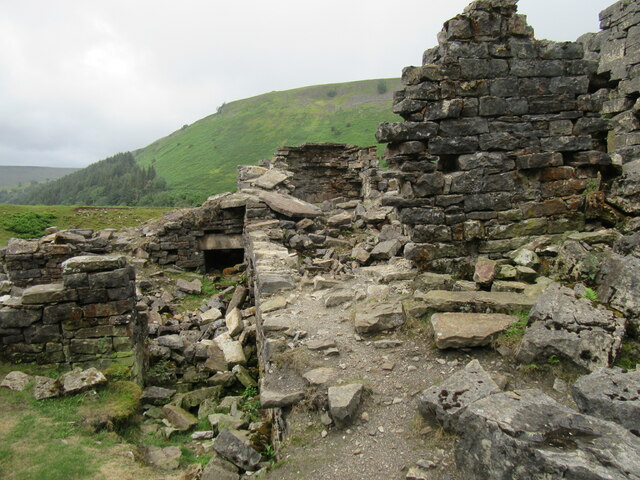
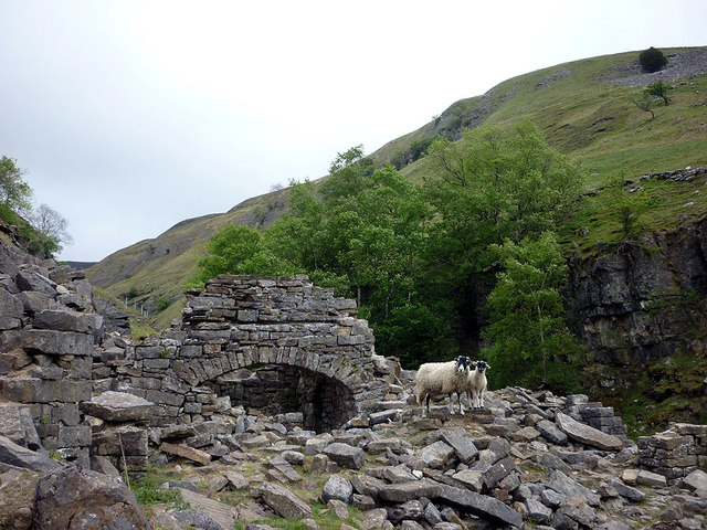
In addition to its natural beauty, Ivelet Wood has a rich cultural history. The remains of old lead mines can still be seen within the forest, serving as a reminder of the area's industrial past. The wood has also been a source of inspiration for artists and writers throughout the years, with its ethereal atmosphere and scenic vistas capturing the imagination of many.

Overall, Ivelet Wood is a captivating destination that offers a peaceful retreat from the hustle and bustle of modern life. Its lush greenery, abundant wildlife, and historical significance make it a cherished spot for both locals and tourists alike.

If you have any feedback on the listing, please let us know in the comments section below.

Ivelet Wood Images

Images are sourced within 2km of 54.383012/-2.1375835 or Grid Reference SD9198. Thanks to Geograph Open Source API. All images are credited.

Swinner Gill Ford This ford at Swinner Gill is found on the bridleway between Muker and Keld. A video of the ford can be viewed at:
<span class="nowrap"><a title="https://youtu.be/pRj-GMUVvRE" rel="nofollow ugc noopener" href="https://youtu.be/pRj-GMUVvRE">Link</a><img style="margin-left:2px;" alt="External link" title="External link - shift click to open in new window" src="https://s1.geograph.org.uk/img/external.png" width="10" height="10"/></span>
Swinner Gill Ford
This ford at Swinner Gill is found on the bridleway between Muker and Keld. A video of the ford can be viewed at: LinkExternal link
The Pennine Way near Rukin Wood
The R Swale valley looking S from E of Crackpot Hall
West Arn Gill from North Gan Scar
Looking down Swaledale from Swinner Gill
Waterfall in Swinner Gill
Looking up Swaledale
Looking across Swaledale towards Swinner Gill
Near West Arn Gill Looking SW.
Near West Arn Gill
Looking SW.
Near Swinner Gill In Swaledale.
Near Swinner Gill
In Swaledale.
Ruined mining building in Swinner Gill By the waterfall in Swinner Gill.
Ruined mining building in Swinner Gill
By the waterfall in Swinner Gill.
Swinner Gill waterfall One of the many waterfalls in this area.
Swinner Gill waterfall
One of the many waterfalls in this area.
Long Close Cross Roads From the Duckingdub bridge in Muker, the bridleway to Muker Common would be pretty challenging for equestrians until the lower end of Long Close Cross Roads, a walled lane, is reached. From there it gets much more amenable, ascending to meet at right angles another lane contouring round the hillside from which this view is taken. Across the dale, the hill opposite is Kisdon, an isolated lump surrounded on the north and east by the current course of the River Swale and on the west and south by its former course, before the Keld gorge cut down. Just visible on the right of the photo are the highest buildings of the village of Muker.
Long Close Cross Roads
From the Duckingdub bridge in Muker, the bridleway to Muker Common would be pretty challenging for equestrians until the lower end of Long Close Cross Roads, a walled lane, is reached. From there it gets much more amenable, ascending to meet at right angles another lane contouring round the hillside from which this view is taken. Across the dale, the hill opposite is Kisdon, an isolated lump surrounded on the north and east by the current course of the River Swale and on the west and south by its former course, before the Keld gorge cut down. Just visible on the right of the photo are the highest buildings of the village of Muker.
On the Pennine Way between Thwaite and Kisdon Lovely section of the National Trail, above the Swaledale valley
On the Pennine Way between Thwaite and Kisdon
Lovely section of the National Trail, above the Swaledale valley
The Pennine Way near Thwaite
Near Thwaite Looking west towards Thwaite.
Near Thwaite
Looking west towards Thwaite.
Smelt mill ruins, foot of Swinner Gill The mill was built in 1771, re-built in 1840 and closed in 1883. The lamb was born in 2011 but the ewe's birthday is not known.
Smelt mill ruins, foot of Swinner Gill
The mill was built in 1771, re-built in 1840 and closed in 1883. The lamb was born in 2011 but the ewe's birthday is not known.
Show me another place!

Ivelet Wood is located at Grid Ref: SD9198 (Lat: 54.383012, Lng: -2.1375835)

Division: North Riding

Administrative County: North Yorkshire

District: Richmondshire

Police Authority: North Yorkshire

What 3 Words

///jets.universally.woodstove. Near Bowes, Co. Durham

Related Wikis

Arn Gill (North Yorkshire)

Arn Gill is a ravine or gully containing a beck of the same name, near the village of Muker in Swaledale, North Yorkshire, England. The ravine and beck...

Muker

Muker is a village and civil parish at the western end of Swaledale in North Yorkshire, England, within the Yorkshire Dales. The parish includes the hamlets...

Kisdon

Kisdon, also called Kisdon Hill, is a fell situated in upper Swaledale in the Yorkshire Dales National Park in North Yorkshire, England. == Geography... ==

Thwaite, North Yorkshire

Thwaite is a small village in the Yorkshire Dales, North Yorkshire, England. It is in Swaledale and is part the district of Richmondshire and the civil...

Angram Bottoms

Angram Bottoms (grid reference SD891999) is a 9.8 hectares (24 acres) biological Site of Special Scientific Interest (SSSI) near to the village of Angram...

Ivelet

Ivelet is a hamlet in the Yorkshire Dales, North Yorkshire, England about a mile west of Gunnerside in Swaledale. Ivelet Bridge crosses the River Swale...
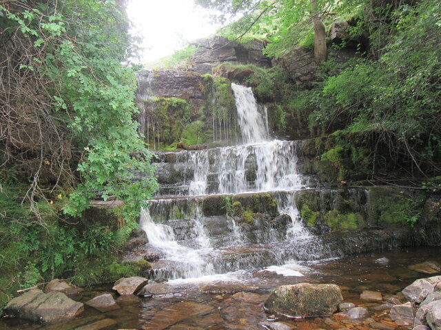
Kisdon Force

Kisdon Force is a series of waterfalls on the River Swale in Swaledale, England. The falls are situated within the Yorkshire Dales National Park in the...

Angram, Richmondshire

Angram is a hamlet in the Yorkshire Dales in the Richmondshire district of North Yorkshire, England. It is situated near to Keld to the north and Thwaite...

Nearby Amenities

Located within 500m of 54.383012,-2.1375835
Barrier: stile
Foot: yes
Lat/Long: 54.3821891/-2.1408034
Barrier: stile
Foot: yes
Lat/Long: 54.3788534/-2.1359153
Barrier: stile
Foot: yes
Lat/Long: 54.3800757/-2.137234
Barrier: stile
Foot: yes
Lat/Long: 54.3812853/-2.1381186
Access: yes
Barrier: cattle_grid
Lat/Long: 54.3805717/-2.1364695
Barrier: stile
Foot: yes
Lat/Long: 54.3802741/-2.139674
Barrier: stile
Foot: yes
Lat/Long: 54.3812367/-2.140139
Barrier: stile
Foot: yes
Lat/Long: 54.37893/-2.1390802
Barrier: stile
Foot: yes
Lat/Long: 54.3829687/-2.1403303
Information: guidepost
Tourism: information
Lat/Long: 54.3831782/-2.1408108
Power: pole
Lat/Long: 54.379136/-2.1356309
Ramps Holme
Place: isolated_dwelling
Lat/Long: 54.379962/-2.1352008
Barrier: entrance
Lat/Long: 54.3833898/-2.141534
The data included in this document is from www.openstreetmap.org. The data is made available under ODbL.

Have you been to Ivelet Wood?

Leave your review of Ivelet Wood below (or comments, questions and feedback).