Croft Outerly

Settlement in Fife

Scotland

Croft Outerly

Western Avenue underpass artworks
Western Avenue underpass artworks Credit: James Henry

Croft Outerly is a charming village located in the region of Fife, Scotland. Situated in the northeastern part of the county, it lies approximately 10 miles north of the town of St. Andrews. With a population of around 500 residents, Croft Outerly offers a peaceful and close-knit community atmosphere.

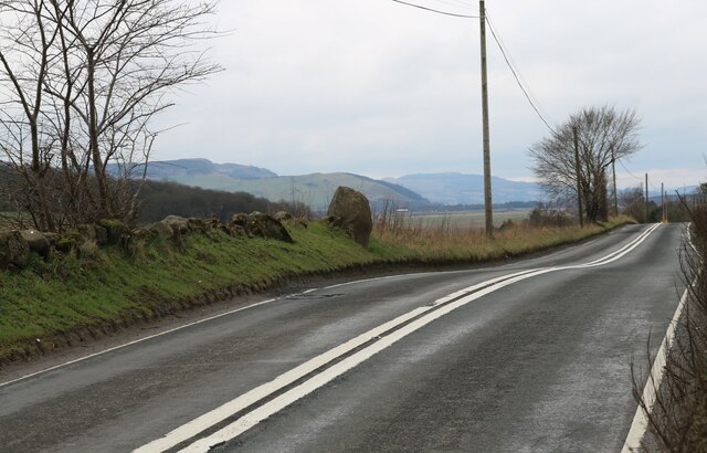
The village is known for its picturesque setting, surrounded by rolling hills and lush greenery. It is bordered by farmland, giving it a rural and idyllic feel. The nearby coastline, only a short drive away, offers stunning views of the North Sea.

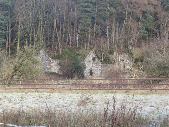
Croft Outerly has a rich history, dating back many centuries. The village is home to several historic buildings, including a 12th-century church, which adds to its old-world charm. The village center features a few local shops, a post office, and a cozy pub, providing basic amenities for its residents.

The area surrounding Croft Outerly offers ample opportunities for outdoor activities. Residents and visitors alike can explore the numerous walking trails and enjoy the peaceful countryside. The village also has a well-maintained community park, where locals can gather for recreational activities and events.

Transportation in Croft Outerly is primarily dependent on private vehicles, although there is a limited bus service connecting the village to neighboring towns. The nearest train station is located in nearby Leuchars, providing convenient access to major cities in Scotland.

Overall, Croft Outerly is a small but picturesque village, perfect for those seeking a tranquil and rural retreat in the beautiful region of Fife.

If you have any feedback on the listing, please let us know in the comments section below.

Croft Outerly Images

Images are sourced within 2km of 56.203277/-3.213011 or Grid Reference NO2401. Thanks to Geograph Open Source API. All images are credited.

Western Avenue underpass artworks
Western Avenue underpass artworks The north portal, with the A92 Western Avenue above.
Western Avenue underpass artworks
The north portal, with the A92 Western Avenue above.
Greenside scene, Leslie
Housing development being built
Standing Stone On the south side of the A911 Leslie to Auchmuirbridge road lies this standing stone. According to Canmore it may be the last survivor of four which used to stand close to this position <span class="nowrap"><a title="https://canmore.org.uk/site/30013/strathendry" rel="nofollow ugc noopener" href="https://canmore.org.uk/site/30013/strathendry">Link</a><img style="margin-left:2px;" alt="External link" title="External link - shift click to open in new window" src="https://s1.geograph.org.uk/img/external.png" width="10" height="10"/></span>
Standing Stone
On the south side of the A911 Leslie to Auchmuirbridge road lies this standing stone. According to Canmore it may be the last survivor of four which used to stand close to this position LinkExternal link
Horse paddocks
Horse paddocks
Bird box This bird box was attached to a road sign on the A911 outside of Leslie. There was no sign of activity.
Bird box
This bird box was attached to a road sign on the A911 outside of Leslie. There was no sign of activity.
East Goatmilk This former farm is now a ruin nestled beneath the Goatmilk Hills near Fife airport.
East Goatmilk
This former farm is now a ruin nestled beneath the Goatmilk Hills near Fife airport.
Panorama Gleneagles Avenue Glenrothes with west Lomond Hill in the distance
Panorama
Gleneagles Avenue Glenrothes with west Lomond Hill in the distance
Heavy Plant Crossing, Glenrothes.
Leslie, Fife
Leslie, Fife
Christ's Kirk on the Green, Leslie
Golf Club and starter's box
Show me another place!

Croft Outerly is located at Grid Ref: NO2401 (Lat: 56.203277, Lng: -3.213011)

Unitary Authority: Fife

Police Authority: Fife

What 3 Words

///shams.educates.dished. Near Leslie, Fife

Related Wikis

Leslie, Fife

Leslie (Scottish Gaelic: Fiodh Chill) is a large village and parish on the northern tip of the River Leven Valley, to the west of Glenrothes in Fife. According...

Leslie railway station

Leslie railway station served the village of Leslie, Fife, Scotland, from 1861 to 1932 on the Leslie Railway. == History == The station was opened on 1...

Glenwood High School, Glenrothes

Glenwood High School is a comprehensive, co-educational and non-denominational school serving the western part of the town of Glenrothes, Fife, Scotland...

Leslie House

Leslie House in Leslie, Fife — where several of the buildings are listed — is the largest and earliest Restoration house in Fife, Scotland, and was the...

Nearby Amenities

Located within 500m of 56.203277,-3.213011
Crossing
Crossing: traffic_signals
Lat/Long: 56.2024291/-3.2190235
Leslie
Is In: Fife, Scotland, UK
Name Ru: Лесли
Name Sco: Lesslie
Place: village
Population: 1000
Wikidata: Q3830902
Wikipedia: en:Leslie, Fife
Lat/Long: 56.2013764/-3.215211
Passing Place
Lat/Long: 56.2049147/-3.207736
Turning Circle
Lat/Long: 56.2031973/-3.2191989
Turning Circle
Lat/Long: 56.2046684/-3.2175031
Parking
Lat/Long: 56.2035125/-3.2163644
Turning Circle
Lat/Long: 56.2037112/-3.2182075
Parking
Lat/Long: 56.2037524/-3.207781
Barrier: bollard
Bollard: fixed
Lat/Long: 56.202448/-3.2100194
Post Office
Source: OS OpenData StreetView
Lat/Long: 56.201842/-3.2113913
Crossing
Crossing: unmarked
Crossing Island: no
Tactile Paving: no
Lat/Long: 56.2046461/-3.2076717
Bench
Backrest: yes
Check Date: 2021-06-21
Lat/Long: 56.2039489/-3.2088051
Recycling
Location: overground
Recycling Clothes: yes
Recycling Glass: no
Recycling Glass Bottles: yes
Recycling Type: container
Lat/Long: 56.2036861/-3.2126065
Fountain
Lat/Long: 56.2032027/-3.212649
Tattoo Krazy
Phone: +44 1592 621002
Shop: tattoo
Website: http://www.tattookrazy.com/
Lat/Long: 56.2005673/-3.2162214
Best One
Brand Wikidata: Q4896532
Contact Website: https://stores.best-one.co.uk/manns-best-one-250d92a52c4d
Shop: convenience
Lat/Long: 56.2003429/-3.2160039
KeyStore
Shop: convenience
Lat/Long: 56.2006064/-3.2156703
Pub
Station Hotel
Lat/Long: 56.2007227/-3.2153225
Andrea Watt
Shop: hairdresser
Lat/Long: 56.2005541/-3.2152764
Env-i
Shop: beauty
Lat/Long: 56.2006113/-3.2150905
Post Box
Collection Times: Mo-Fr 16:45, Sa 11:45
Operator: Royal Mail
Operator Wikidata: Q638098
Post Box Type: pillar
Ref: KY6 74
Royal Cypher: scottish_crown
Source: survey
Lat/Long: 56.2008231/-3.2149391
Aladdin's Cave
Shop: sports
Lat/Long: 56.2009505/-3.2147016
Bus Stop
GlenWood Road
Bench: no
Lit: no
Shelter: no
Tactile Paving: no
Lat/Long: 56.2009576/-3.2142946
CW Green
Shop: butcher
Lat/Long: 56.201086/-3.2143404
Trusted Lettings
Office: estate_agent
Source: Survey
Lat/Long: 56.2012426/-3.2139365
Fast Food
K&K Fish Bar
Cuisine: fish_and_chips
Source: Survey
Lat/Long: 56.2012954/-3.2137899
Bus Stop
Blair place
Bench: no
Bin: no
Lit: no
Naptan AtcoCode: 6500K0995
Naptan NaptanCode: 34329424
Shelter: no
Tactile Paving: yes
Lat/Long: 56.2012662/-3.2136867
Istanbul Hair
Shop: hairdresser
Source: Survey
Lat/Long: 56.201426/-3.2134419
Fosterton Equine and Pet
Shop: pet
Source: Survey
Lat/Long: 56.2014949/-3.2132003
Glen Bakers
Shop: bakery
Source: Survey
Lat/Long: 56.2016258/-3.2128524
Leslie Christian Charity
Shop: charity
Source: Survey
Lat/Long: 56.2014773/-3.2127238
Junk Box
Second Hand: yes
Shop: second_hand
Source: Survey
Lat/Long: 56.2017094/-3.2126408
Pub
The Auld Hoose
Source: Survey
Lat/Long: 56.2018359/-3.2123126
Bus Stop
Norman Place
Bench: no
Bin: no
Bus: yes
Lit: yes
Public Transport: platform
Shelter: no
Tactile Paving: yes
Lat/Long: 56.2016929/-3.2122473
Dentist
Bupa Dental Care
Addr Country: GB
Brand: Bupa
Brand Wikidata: Q931628
Brand Wikipedia: en:Bupa
Healthcare: dentist
Lat/Long: 56.2017138/-3.2120615
Mario
Shop: hairdresser
Source: survey
Lat/Long: 56.2017644/-3.2119429
Fringe Effects
Shop: hairdresser
Source: survey
Lat/Long: 56.2018249/-3.2117531
Bayne's
Shop: bakery
Source: survey
Lat/Long: 56.2020481/-3.2117412
Fast Food
Tony's
Cuisine: italian
Source: survey
Lat/Long: 56.2021636/-3.2114249
Artisan Antics
Shop: art
Source: survey
Lat/Long: 56.2023253/-3.21098
Bus Stop
Murray Place
Bench: yes
Bin: yes
Bus: yes
Lit: yes
Naptan AtcoCode: 6500K0678
Naptan NaptanCode: 34329462
Public Transport: platform
Shelter: yes
Tactile Paving: no
Lat/Long: 56.202399/-3.2106202
Callum Robertson Funeral Directors
Shop: funeral_directors
Source: survey
Lat/Long: 56.2021449/-3.2108357
Trojan Printers
Addr City: Glenrothes
Addr Housenumber: 250-252
Addr Postcode: KY6 3AE
Addr Street: High Street
Contact Facebook: https://facebook.com/trojanpress
Email: trojanpressprint@gmail.com
Opening Hours: Mo-Fr 09:00-17:30
Phone: +44 1592 744302
Shop: copyshop
Source: survey
Website: https://www.trojanpressprint.co.uk/
Lat/Long: 56.202553/-3.209764
Budgie's Warehouse
Shop: hardware
Source: survey
Lat/Long: 56.2028708/-3.2095149
Fast Food
Peking House
Cuisine: chinese
Source: survey
Lat/Long: 56.202873/-3.2092895
Car Wash
Sponge Car Wash
Source: survey
Lat/Long: 56.2029357/-3.209159
Leslie Mini Market
Shop: convenience
Source: survey
Lat/Long: 56.2029236/-3.2089376
Restaurant
Mee Kee
Cuisine: chinese
Opening Hours: Mo,We-Sa 16:00-22:30; Tu off
Source: survey
Lat/Long: 56.2029797/-3.2083227
Bus Stop
High Street
Bench: no
Bin: no
Bus: yes
Lit: yes
Naptan AtcoCode: 6500K0677
Naptan NaptanCode: 34329484
Public Transport: platform
Shelter: no
Tactile Paving: no
Lat/Long: 56.2028752/-3.2082357
ID Barbers
Shop: hairdresser
Source: survey
Lat/Long: 56.2028873/-3.2077493
Fast Food
Nazar Turkish
Source: survey
Lat/Long: 56.203049/-3.2076525
Pub
Burns Tavern
Source: survey
Lat/Long: 56.2029203/-3.2074626
Restaurant
Reya Tandoori
Cuisine: indian
Opening Hours: Mo-Th 12:00-14:00,17:00-22:30; Fr,Sa 12:00-15:00,17:00-23:00; Su 16:00-22:30
Source: survey
Lat/Long: 56.2030787/-3.2075081
Bus Stop
High Street
Bench: no
Bin: no
Bus: yes
Lit: yes
Naptan AtcoCode: 6500K0676
Naptan NaptanCode: 34329487
Public Transport: platform
Shelter: no
Tactile Paving: no
Lat/Long: 56.2031237/-3.2071305
Pub
85 High Street
Source: survey
Lat/Long: 56.2031897/-3.2068932
D Mitchell & Son Undertakers
Shop: funeral_directors
Source: survey
Lat/Long: 56.2031007/-3.2064919
Veterinary
Lomond Hills Veterinary Clinic
Source: survey
Lat/Long: 56.2032491/-3.2058592
Nicki Penman
Shop: hairdresser
Source: survey
Lat/Long: 56.2022435/-3.2112163
Har Barber
Shop: hairdresser
Source: survey
Lat/Long: 56.2022121/-3.2112926
Mighty Cycles
Shop: bicycle
Source: survey
Website: https://www.mightycycles.co.uk/
Lat/Long: 56.2020081/-3.2112747
Make Me Glam
Shop: beauty
Source: survey
Lat/Long: 56.201588/-3.212979
Doctors
Infinity Tan
Healthcare: doctor
Source: survey
Lat/Long: 56.2015594/-3.213068
Something Different
Shop: hairdresser
Source: survey
Lat/Long: 56.2002362/-3.2163382
Post Box
Collection Times: Mo-Fr 09:00; Sa 07:00
Operator: Royal Mail
Ref: KY6 71
Royal Cypher: scottish_crown
Source: survey
Lat/Long: 56.203059/-3.2154867
Post Box
Brand: Royal Mail
Brand Wikidata: Q638098
Collection Times: Mo-Fr 09:00; Sa 07:00
Mapillary: 923725804890255
Operator: Royal Mail
Operator Wikidata: Q638098
Post Box Mounting: building
Post Box Type: wall
Ref: KY6 72
Royal Cypher: scottish_crown
Source: survey
Survey Date: 2021-09-17
Lat/Long: 56.2032019/-3.2061469
Bus Stop
Hamish Gordon Bus Depot
Bench: no
Bin: no
Lit: no
Shelter: no
Tactile Paving: no
Lat/Long: 56.202152/-3.2202726
Barrier: cycle_barrier
Cycle Barrier: double
Cycle Barrier Installation: fixed
Lat/Long: 56.2011135/-3.2169066
Crossing
Crossing: unmarked
Crossing Island: no
Kerb: lowered
Tactile Paving: no
Lat/Long: 56.2010247/-3.2167358
Crossing
Crossing: zebra
Crossing Island: no
Kerb: flush
Tactile Paving: yes
Lat/Long: 56.2006998/-3.2164269
Cafe
The Twa Hens
Addr City: Leslie
Addr Housenumber: 273
Addr Postcode: KY6 3AX
Addr Street: High Street
Contact Facebook: https://www.facebook.com/thetwahens
Lat/Long: 56.20076/-3.2152228
Parking
Parking: lane
Lat/Long: 56.20064/-3.2177061
Dentist
Leslie Meadows Dental Care
Contact Facebook: https://www.facebook.com/lesliemeadowsdental
Email: lesliemeadowsdental@gmail.com
Healthcare: dentist
Opening Hours: Mo-Th 08:30-17:00; Fr 08:30-16:30
Phone: +44 1592 620304
Website: http://www.lesliemeadowsdentalcare.co.uk/
Lat/Long: 56.2004842/-3.2185814
Doctors
Leslie Medical Centre
Healthcare: doctor
Lat/Long: 56.2005707/-3.218238
Pharmacy
Lloyds Pharmacy
Brand: Lloyds Pharmacy
Brand Wikidata: Q6662870
Brand Wikipedia: en:LloydsPharmacy
Dispensing: yes
Healthcare: pharmacy
Lat/Long: 56.2006781/-3.2179376
Crossing
Crossing: zebra
Crossing Island: no
Tactile Paving: yes
Lat/Long: 56.2019675/-3.2116235
Turning Loop
Lat/Long: 56.2042888/-3.2137666
Crossing
Button Operated: yes
Crossing: traffic_signals
Crossing Island: no
Tactile Paving: yes
Traffic Signals Sound: yes
Lat/Long: 56.2006329/-3.2152876
Information: board
Tourism: information
Lat/Long: 56.2030572/-3.2123953
Parking
Lat/Long: 56.2027493/-3.2055201
Parking
Parking: street_side
Lat/Long: 56.2030715/-3.2058081
Bench
Backrest: yes
Lat/Long: 56.2029366/-3.2138582
Bench
Backrest: yes
Lat/Long: 56.2026615/-3.2142577
Parking
Parking: street_side
Lat/Long: 56.200688/-3.2186473
Bus Stop
Allan Street
Bench: no
Bin: no
Bus: yes
Lit: yes
Public Transport: platform
Shelter: no
Tactile Paving: no
Lat/Long: 56.2009451/-3.2167678
Turning Circle
Lat/Long: 56.2017751/-3.2201244
Power: pole
Lat/Long: 56.2052377/-3.2199574
Power: pole
Lat/Long: 56.2053412/-3.2186722
Power: pole
Lat/Long: 56.2053159/-3.2186246
Power: pole
Lat/Long: 56.2050837/-3.2179928
Material: wood
Power: pole
Lat/Long: 56.2060245/-3.2068296
Addr Housenumber: 11
Addr Street: Prinlaws Road
Entrance: yes
Lat/Long: 56.1997866/-3.217831
Addr Housenumber: 49
Addr Street: Douglas Road
Lat/Long: 56.2005974/-3.2162229
Addr Housenumber: 5
Addr Street: Prinlaws Road
Entrance: yes
Lat/Long: 56.1999238/-3.217448
Addr Housenumber: 1
Addr Street: Prinlaws Road
Entrance: yes
Lat/Long: 56.200022/-3.217153
Addr Housenumber: 3
Addr Street: Prinlaws Road
Entrance: yes
Lat/Long: 56.1999736/-3.2172873
Addr Housenumber: 9
Addr Street: Prinlaws Road
Entrance: yes
Lat/Long: 56.199845/-3.2176579
Addr Housenumber: 7
Addr Street: Prinlaws Road
Entrance: yes
Lat/Long: 56.1998834/-3.2175557
Addr Housenumber: 13
Addr Street: Prinlaws Road
Entrance: yes
Lat/Long: 56.1997381/-3.2179627
Addr Housenumber: 49
Addr Street: Provosts Land
Entrance: yes
Lat/Long: 56.200222/-3.2183541
Addr Housenumber: 44
Addr Street: Provosts Land
Entrance: yes
Lat/Long: 56.200337/-3.217954
Addr Housenumber: 50
Addr Street: Provosts Land
Entrance: yes
Lat/Long: 56.2002036/-3.218404
Addr Housenumber: 19
Addr Street: Provosts Land
Entrance: yes
Lat/Long: 56.2008825/-3.2174566
Addr Housenumber: 18
Addr Street: Provosts Land
Entrance: yes
Lat/Long: 56.2008631/-3.2173676
Addr Housenumber: 27
Addr Street: Provosts Land
Entrance: yes
Lat/Long: 56.2005653/-3.2175863
Addr Housenumber: 11
Addr Street: Provosts Land
Entrance: yes
Lat/Long: 56.2009609/-3.2170017
Addr Housenumber: 48
Addr Street: Provosts Land
Entrance: yes
Lat/Long: 56.2002444/-3.2182933
Addr Housenumber: 47
Addr Street: Provosts Land
Entrance: yes
Lat/Long: 56.2002711/-3.2182211
Addr Housenumber: 22
Addr Street: Provosts Land
Entrance: yes
Lat/Long: 56.2008149/-3.2175864
Addr Housenumber: 46
Addr Street: Provosts Land
Entrance: yes
Lat/Long: 56.2003072/-3.2181525
Addr Housenumber: 16,17
Addr Street: Provosts Land
Entrance: yes
Lat/Long: 56.2008819/-3.2173144
Addr Housenumber: 35
Addr Street: Allan Street
Entrance: yes
Lat/Long: 56.2018629/-3.2160298
Addr Housenumber: 2
Addr Street: Allan Street
Entrance: yes
Lat/Long: 56.2014494/-3.2165324
Addr Housenumber: 4
Addr Street: Allan Street
Entrance: yes
Lat/Long: 56.2014877/-3.2164278
Addr Housenumber: 10
Addr Street: Allan Street
Entrance: yes
Lat/Long: 56.2016274/-3.216047
Leslie Golf Club
Club: sport
Lat/Long: 56.205084/-3.2137545
Addr Housenumber: 12
Addr Street: Allan Street
Entrance: yes
Lat/Long: 56.2017065/-3.2158313
Addr Housenumber: 8
Addr Street: Allan Street
Entrance: yes
Lat/Long: 56.2015735/-3.2161938
Addr Housenumber: 203
Addr Street: High Street
Entrance: yes
Lat/Long: 56.2018958/-3.2120847
Addr Housenumber: 37
Addr Street: Douglas Road
Entrance: yes
Lat/Long: 56.2016293/-3.2172797
Addr Housenumber: 269
Addr Street: High Street
Entrance: yes
Lat/Long: 56.2008009/-3.2150673
Addr Housenumber: 2
Addr Street: Ramsay Gardens
Lat/Long: 56.2024655/-3.2201072
Defibrillator
Emergency: defibrillator
Indoor: no
Lat/Long: 56.2025294/-3.2109087
The data included in this document is from www.openstreetmap.org. The data is made available under ODbL.

Have you been to Croft Outerly?

Leave your review of Croft Outerly below (or comments, questions and feedback).