Leslie

Settlement in Fife

Scotland

Leslie

Airfield Glenrothes airfield.
Airfield Credit: David Johnston

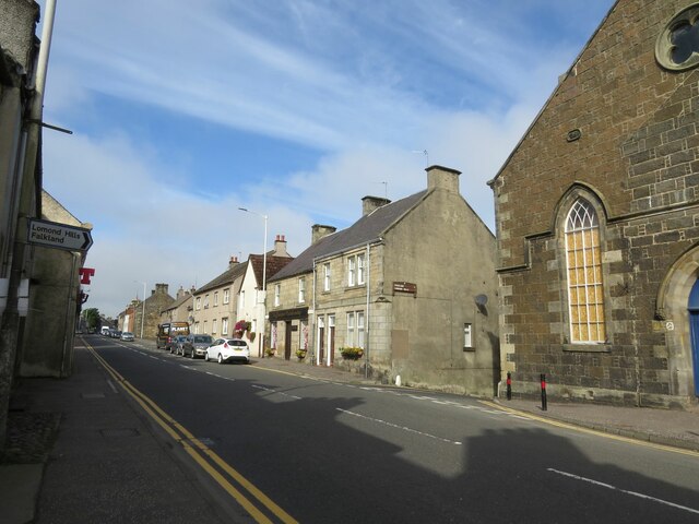
Leslie is a small town located in the Kingdom of Fife, Scotland. Situated approximately 8 miles southeast of the city of Glenrothes, Leslie lies on the banks of the River Leven. With a population of around 4,000 residents, the town offers a close-knit community atmosphere.

Historically, Leslie was primarily an industrial town, with coal mining and weaving being the major industries in the area. However, in recent decades, the town has seen a shift towards a more residential and commuter-oriented lifestyle. Many residents now work in nearby towns and cities, such as Glenrothes, Kirkcaldy, and even Edinburgh, which is just over 30 miles away.

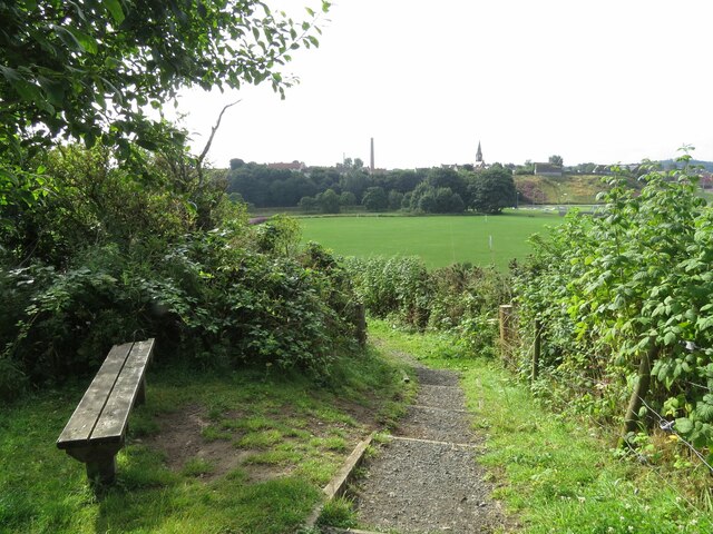
Leslie boasts a variety of amenities for its residents. There are several shops, including grocery stores, convenience stores, and small local businesses, providing for everyday needs. The town also has a primary school and a community center that hosts various events and activities throughout the year. Additionally, Leslie is home to several parks and green spaces, offering recreational opportunities for residents to enjoy outdoor activities.

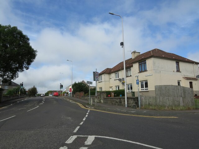
Transportation in Leslie is facilitated by regular bus services, connecting the town with surrounding areas. The nearest train station is located in nearby Markinch, approximately 2 miles away, providing further connectivity to larger cities and towns.

Overall, Leslie, Fife, is a charming town with a rich industrial history and a strong sense of community. Its convenient location and range of amenities make it an appealing place to live for those seeking a peaceful and close-knit community atmosphere.

If you have any feedback on the listing, please let us know in the comments section below.

Leslie Images

Images are sourced within 2km of 56.201553/-3.21294 or Grid Reference NO2401. Thanks to Geograph Open Source API. All images are credited.

Airfield Glenrothes airfield.
Airfield
Glenrothes airfield.
Goatmilk Hills Small rocky outcrops west of Glenrothes, just north of Fife Airport.
Goatmilk Hills
Small rocky outcrops west of Glenrothes, just north of Fife Airport.
Goatmilk A farm and stubble, overlooking Fife Airport.
Goatmilk
A farm and stubble, overlooking Fife Airport.
Gateposts to Leslie Cemetery There is a damaged Ordnance Survey benchmark on the left hand post. See <a href="https://www.geograph.org.uk/photo/6976495">NO2401 : Damaged benchmark at Leslie Cemetery</a>.
Gateposts to Leslie Cemetery
There is a damaged Ordnance Survey benchmark on the left hand post. See NO2401 : Damaged benchmark at Leslie Cemetery.
Benchmark on #3 Maryfield Crescent, Leslie Ordnance Survey benchmark described on database at <span class="nowrap"><a title="https://www.bench-marks.org.uk/bm152766" rel="nofollow ugc noopener" href="https://www.bench-marks.org.uk/bm152766">Link</a><img style="margin-left:2px;" alt="External link" title="External link - shift click to open in new window" src="https://s1.geograph.org.uk/img/external.png" width="10" height="10"/></span>. See also <a href="https://www.geograph.org.uk/photo/6976155">NO2401 : #3 Maryfield Crescent, Leslie</a>.
Benchmark on #3 Maryfield Crescent, Leslie
Ordnance Survey benchmark described on database at LinkExternal link. See also NO2401 : #3 Maryfield Crescent, Leslie.
Bench with a view Situated near Leslie Golf Course with the rugby field in the background.
Bench with a view
Situated near Leslie Golf Course with the rugby field in the background.
Benchmark on wall, Walkerton Drive, Leslie Ordnance Survey benchmark, described on database at <span class="nowrap"><a title="https://www.bench-marks.org.uk/bm152819" rel="nofollow ugc noopener" href="https://www.bench-marks.org.uk/bm152819">Link</a><img style="margin-left:2px;" alt="External link" title="External link - shift click to open in new window" src="https://s1.geograph.org.uk/img/external.png" width="10" height="10"/></span>. See also <a href="https://www.geograph.org.uk/photo/6976514">NO2401 : Walkerton Drive, Leslie</a>.
Benchmark on wall, Walkerton Drive, Leslie
Ordnance Survey benchmark, described on database at LinkExternal link. See also NO2401 : Walkerton Drive, Leslie.
Benchmark on Leslie Town Hall Ordnance Survey benchmark, described on database at <span class="nowrap"><a title="https://www.bench-marks.org.uk/bm152765" rel="nofollow ugc noopener" href="https://www.bench-marks.org.uk/bm152765">Link</a><img style="margin-left:2px;" alt="External link" title="External link - shift click to open in new window" src="https://s1.geograph.org.uk/img/external.png" width="10" height="10"/></span>. See also <a href="https://www.geograph.org.uk/photo/6976188">NO2501 : Leslie Town Hall and Main Street</a>.
Benchmark on Leslie Town Hall
Ordnance Survey benchmark, described on database at LinkExternal link. See also NO2501 : Leslie Town Hall and Main Street.
#3 Maryfield Crescent, Leslie There is an Ordnance Survey benchmark on the house on the right. See <a href="https://www.geograph.org.uk/photo/6975089">NO2401 : Benchmark on #3 Maryfield Crescent, Leslie</a>.
#3 Maryfield Crescent, Leslie
There is an Ordnance Survey benchmark on the house on the right. See NO2401 : Benchmark on #3 Maryfield Crescent, Leslie.
Fields near North Lodge
Leslie Town Hall and Main Street There is an Ordnance Survey benchmark on the town hall. See <a href="https://www.geograph.org.uk/photo/6976129">NO2501 : Benchmark on Leslie Town Hall</a>.
Leslie Town Hall and Main Street
There is an Ordnance Survey benchmark on the town hall. See NO2501 : Benchmark on Leslie Town Hall.
Track near Roaring Hill, Leslie
Fife Pilgrim Way at Den Plantation West of Leslie.
Fife Pilgrim Way at Den Plantation
West of Leslie.
Damaged benchmark at Leslie Cemetery Damaged Ordnance Survey benchmark on gatepost at Leslie Cemetery. The benchmark is described on the database at <span class="nowrap"><a title="https://www.bench-marks.org.uk/bm152767" rel="nofollow ugc noopener" href="https://www.bench-marks.org.uk/bm152767">Link</a><img style="margin-left:2px;" alt="External link" title="External link - shift click to open in new window" src="https://s1.geograph.org.uk/img/external.png" width="10" height="10"/></span>. See also <a href="https://www.geograph.org.uk/photo/6934975">NO2401 : Gateposts to Leslie Cemetery</a>.
Damaged benchmark at Leslie Cemetery
Damaged Ordnance Survey benchmark on gatepost at Leslie Cemetery. The benchmark is described on the database at LinkExternal link. See also NO2401 : Gateposts to Leslie Cemetery.
Entrance to Leslie Cemetery
Leslie Goff Club House
Benchmark on #18 Viewbank, Leslie Ordnance Survey benchmark, described on database at <span class="nowrap"><a title="https://www.bench-marks.org.uk/bm152820" rel="nofollow ugc noopener" href="https://www.bench-marks.org.uk/bm152820">Link</a><img style="margin-left:2px;" alt="External link" title="External link - shift click to open in new window" src="https://s1.geograph.org.uk/img/external.png" width="10" height="10"/></span>. See also <a href="https://www.geograph.org.uk/photo/6976513">NO2401 : Viewbank, Leslie</a>.
Benchmark on #18 Viewbank, Leslie
Ordnance Survey benchmark, described on database at LinkExternal link. See also NO2401 : Viewbank, Leslie.
Benchmark, North Lodge, Strathenry Ordnance Survey benchmark, described on database at <span class="nowrap"><a title="https://www.bench-marks.org.uk/bm152817" rel="nofollow ugc noopener" href="https://www.bench-marks.org.uk/bm152817">Link</a><img style="margin-left:2px;" alt="External link" title="External link - shift click to open in new window" src="https://s1.geograph.org.uk/img/external.png" width="10" height="10"/></span>. See also <a href="https://www.geograph.org.uk/photo/6976508">NO2201 : North Lodge, Strathenry</a>.
Benchmark, North Lodge, Strathenry
Ordnance Survey benchmark, described on database at LinkExternal link. See also NO2201 : North Lodge, Strathenry.
Show me another place!

Leslie is located at Grid Ref: NO2401 (Lat: 56.201553, Lng: -3.21294)

Unitary Authority: Fife

Police Authority: Fife

What 3 Words

///spreading.suspended.muddle. Near Leslie, Fife

Related Wikis

Leslie, Fife

Leslie (Scottish Gaelic: Fiodh Chill) is a large village and parish on the northern tip of the River Leven Valley, to the west of Glenrothes in Fife. According...

Leslie railway station

Leslie railway station served the village of Leslie, Fife, Scotland, from 1861 to 1932 on the Leslie Railway. == History == The station was opened on 1...

Glenwood High School, Glenrothes

Glenwood High School is a comprehensive, co-educational and non-denominational school serving the western part of the town of Glenrothes, Fife, Scotland...

Leslie House

Leslie House in Leslie, Fife — where several of the buildings are listed — is the largest and earliest Restoration house in Fife, Scotland, and was the...

Glenrothes High School

Glenrothes High School is a six-year non-denominational secondary school of approximately 860 pupils located in Glenrothes, Fife, Scotland. The school...

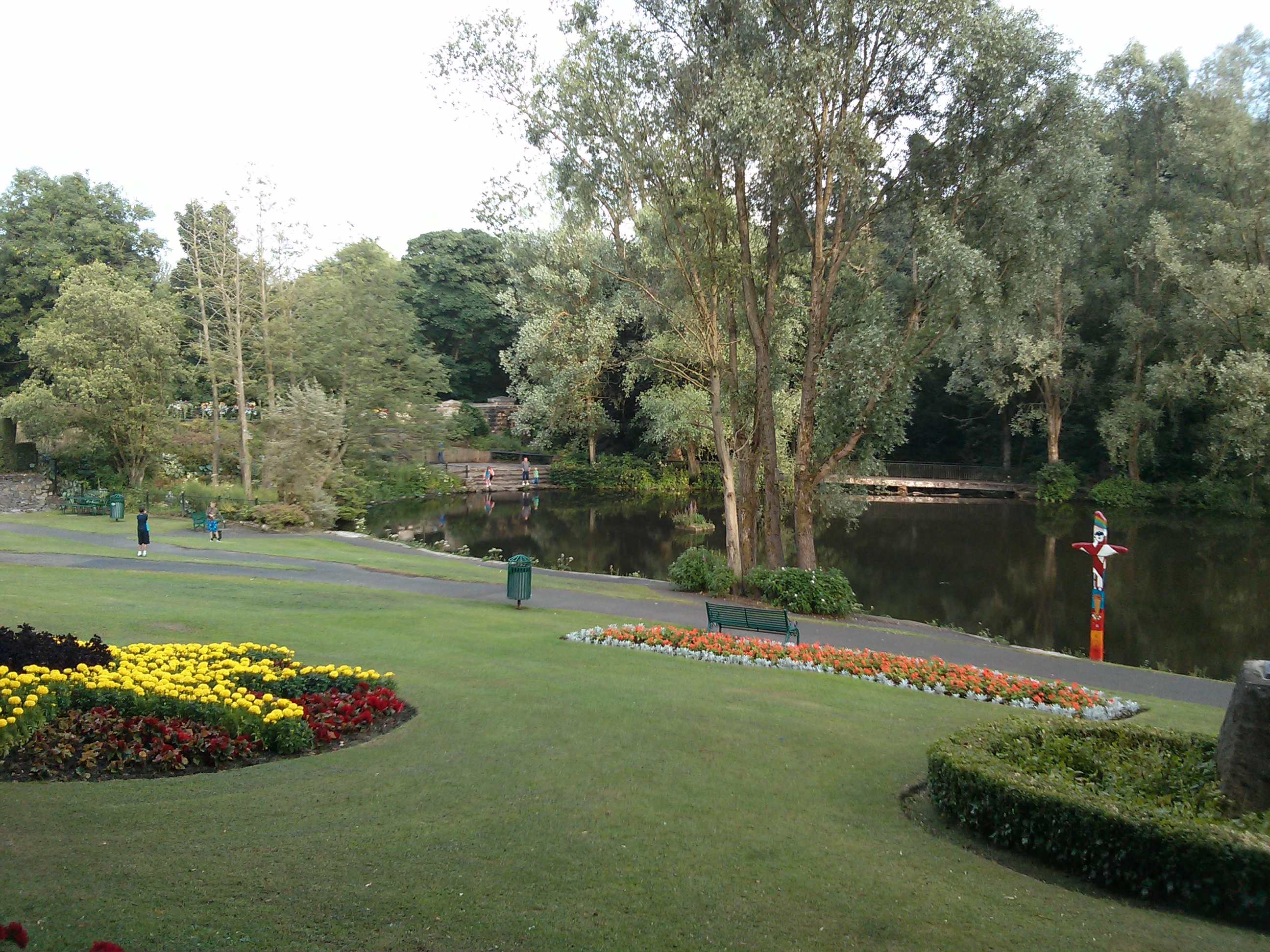
Riverside Park, Glenrothes

Riverside Park is a town park situated in the town of Glenrothes, Fife. The park has pleasant woodland walks, floral gardens, a pond and recently an Arboretum...

Glenrothes Hospital

Glenrothes Hospital is a health facility in Lodge Rise, Glenrothes, Scotland. It is managed by NHS Fife. == History == The facility was built in the early...
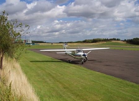
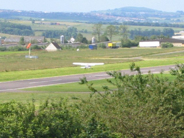
Fife Airport

Fife Airport (ICAO: EGPJ) (Scottish Gaelic: Port-adhair Fìobha) is an unlicensed aerodrome located 2 nautical miles (3.7 km; 2.3 mi) west of Glenrothes...

Nearby Amenities

Located within 500m of 56.201553,-3.21294
Crossing
Crossing: traffic_signals
Lat/Long: 56.2024291/-3.2190235
Leslie
Is In: Fife, Scotland, UK
Name Ru: Лесли
Name Sco: Lesslie
Place: village
Population: 1000
Wikidata: Q3830902
Wikipedia: en:Leslie, Fife
Lat/Long: 56.2013764/-3.215211
Passing Place
Lat/Long: 56.2049147/-3.207736
Turning Circle
Lat/Long: 56.2031973/-3.2191989
Turning Circle
Lat/Long: 56.2046684/-3.2175031
Parking
Lat/Long: 56.2035125/-3.2163644
Turning Circle
Lat/Long: 56.2037112/-3.2182075
Parking
Lat/Long: 56.2037524/-3.207781
Barrier: bollard
Bollard: fixed
Lat/Long: 56.202448/-3.2100194
Post Office
Source: OS OpenData StreetView
Lat/Long: 56.201842/-3.2113913
Crossing
Crossing: unmarked
Crossing Island: no
Tactile Paving: no
Lat/Long: 56.2046461/-3.2076717
Bench
Backrest: yes
Check Date: 2021-06-21
Lat/Long: 56.2039489/-3.2088051
Recycling
Location: overground
Recycling Clothes: yes
Recycling Glass: no
Recycling Glass Bottles: yes
Recycling Type: container
Lat/Long: 56.2036861/-3.2126065
Fountain
Lat/Long: 56.2032027/-3.212649
Tattoo Krazy
Phone: +44 1592 621002
Shop: tattoo
Website: http://www.tattookrazy.com/
Lat/Long: 56.2005673/-3.2162214
Best One
Brand Wikidata: Q4896532
Contact Website: https://stores.best-one.co.uk/manns-best-one-250d92a52c4d
Shop: convenience
Lat/Long: 56.2003429/-3.2160039
KeyStore
Shop: convenience
Lat/Long: 56.2006064/-3.2156703
Pub
Station Hotel
Lat/Long: 56.2007227/-3.2153225
Andrea Watt
Shop: hairdresser
Lat/Long: 56.2005541/-3.2152764
Env-i
Shop: beauty
Lat/Long: 56.2006113/-3.2150905
Post Box
Collection Times: Mo-Fr 16:45, Sa 11:45
Operator: Royal Mail
Operator Wikidata: Q638098
Post Box Type: pillar
Ref: KY6 74
Royal Cypher: scottish_crown
Source: survey
Lat/Long: 56.2008231/-3.2149391
Aladdin's Cave
Shop: sports
Lat/Long: 56.2009505/-3.2147016
Bus Stop
GlenWood Road
Bench: no
Lit: no
Shelter: no
Tactile Paving: no
Lat/Long: 56.2009576/-3.2142946
CW Green
Shop: butcher
Lat/Long: 56.201086/-3.2143404
Trusted Lettings
Office: estate_agent
Source: Survey
Lat/Long: 56.2012426/-3.2139365
Fast Food
K&K Fish Bar
Cuisine: fish_and_chips
Source: Survey
Lat/Long: 56.2012954/-3.2137899
Bus Stop
Blair place
Bench: no
Bin: no
Lit: no
Naptan AtcoCode: 6500K0995
Naptan NaptanCode: 34329424
Shelter: no
Tactile Paving: yes
Lat/Long: 56.2012662/-3.2136867
Istanbul Hair
Shop: hairdresser
Source: Survey
Lat/Long: 56.201426/-3.2134419
Fosterton Equine and Pet
Shop: pet
Source: Survey
Lat/Long: 56.2014949/-3.2132003
Glen Bakers
Shop: bakery
Source: Survey
Lat/Long: 56.2016258/-3.2128524
Leslie Christian Charity
Shop: charity
Source: Survey
Lat/Long: 56.2014773/-3.2127238
Junk Box
Second Hand: yes
Shop: second_hand
Source: Survey
Lat/Long: 56.2017094/-3.2126408
Pub
The Auld Hoose
Source: Survey
Lat/Long: 56.2018359/-3.2123126
Bus Stop
Norman Place
Bench: no
Bin: no
Bus: yes
Lit: yes
Public Transport: platform
Shelter: no
Tactile Paving: yes
Lat/Long: 56.2016929/-3.2122473
Dentist
Bupa Dental Care
Addr Country: GB
Brand: Bupa
Brand Wikidata: Q931628
Brand Wikipedia: en:Bupa
Healthcare: dentist
Lat/Long: 56.2017138/-3.2120615
Mario
Shop: hairdresser
Source: survey
Lat/Long: 56.2017644/-3.2119429
Fringe Effects
Shop: hairdresser
Source: survey
Lat/Long: 56.2018249/-3.2117531
Bayne's
Shop: bakery
Source: survey
Lat/Long: 56.2020481/-3.2117412
Fast Food
Tony's
Cuisine: italian
Source: survey
Lat/Long: 56.2021636/-3.2114249
Artisan Antics
Shop: art
Source: survey
Lat/Long: 56.2023253/-3.21098
Bus Stop
Murray Place
Bench: yes
Bin: yes
Bus: yes
Lit: yes
Naptan AtcoCode: 6500K0678
Naptan NaptanCode: 34329462
Public Transport: platform
Shelter: yes
Tactile Paving: no
Lat/Long: 56.202399/-3.2106202
Callum Robertson Funeral Directors
Shop: funeral_directors
Source: survey
Lat/Long: 56.2021449/-3.2108357
Trojan Printers
Addr City: Glenrothes
Addr Housenumber: 250-252
Addr Postcode: KY6 3AE
Addr Street: High Street
Contact Facebook: https://facebook.com/trojanpress
Email: trojanpressprint@gmail.com
Opening Hours: Mo-Fr 09:00-17:30
Phone: +44 1592 744302
Shop: copyshop
Source: survey
Website: https://www.trojanpressprint.co.uk/
Lat/Long: 56.202553/-3.209764
Budgie's Warehouse
Shop: hardware
Source: survey
Lat/Long: 56.2028708/-3.2095149
Fast Food
Peking House
Cuisine: chinese
Source: survey
Lat/Long: 56.202873/-3.2092895
Car Wash
Sponge Car Wash
Source: survey
Lat/Long: 56.2029357/-3.209159
Leslie Mini Market
Shop: convenience
Source: survey
Lat/Long: 56.2029236/-3.2089376
Restaurant
Mee Kee
Cuisine: chinese
Opening Hours: Mo,We-Sa 16:00-22:30; Tu off
Source: survey
Lat/Long: 56.2029797/-3.2083227
Bus Stop
High Street
Bench: no
Bin: no
Bus: yes
Lit: yes
Naptan AtcoCode: 6500K0677
Naptan NaptanCode: 34329484
Public Transport: platform
Shelter: no
Tactile Paving: no
Lat/Long: 56.2028752/-3.2082357
ID Barbers
Shop: hairdresser
Source: survey
Lat/Long: 56.2028873/-3.2077493
Fast Food
Nazar Turkish
Source: survey
Lat/Long: 56.203049/-3.2076525
Pub
Burns Tavern
Source: survey
Lat/Long: 56.2029203/-3.2074626
Restaurant
Reya Tandoori
Cuisine: indian
Opening Hours: Mo-Th 12:00-14:00,17:00-22:30; Fr,Sa 12:00-15:00,17:00-23:00; Su 16:00-22:30
Source: survey
Lat/Long: 56.2030787/-3.2075081
Bus Stop
High Street
Bench: no
Bin: no
Bus: yes
Lit: yes
Naptan AtcoCode: 6500K0676
Naptan NaptanCode: 34329487
Public Transport: platform
Shelter: no
Tactile Paving: no
Lat/Long: 56.2031237/-3.2071305
Pub
85 High Street
Source: survey
Lat/Long: 56.2031897/-3.2068932
D Mitchell & Son Undertakers
Shop: funeral_directors
Source: survey
Lat/Long: 56.2031007/-3.2064919
Veterinary
Lomond Hills Veterinary Clinic
Source: survey
Lat/Long: 56.2032491/-3.2058592
Nicki Penman
Shop: hairdresser
Source: survey
Lat/Long: 56.2022435/-3.2112163
Har Barber
Shop: hairdresser
Source: survey
Lat/Long: 56.2022121/-3.2112926
Mighty Cycles
Shop: bicycle
Source: survey
Website: https://www.mightycycles.co.uk/
Lat/Long: 56.2020081/-3.2112747
Make Me Glam
Shop: beauty
Source: survey
Lat/Long: 56.201588/-3.212979
Doctors
Infinity Tan
Healthcare: doctor
Source: survey
Lat/Long: 56.2015594/-3.213068
Something Different
Shop: hairdresser
Source: survey
Lat/Long: 56.2002362/-3.2163382
Post Box
Collection Times: Mo-Fr 09:00; Sa 07:00
Operator: Royal Mail
Ref: KY6 71
Royal Cypher: scottish_crown
Source: survey
Lat/Long: 56.203059/-3.2154867
Post Box
Collection Times: Mo-Fr 17:00; Sa 11:45
Operator: Royal Mail
Ref: KY6 95
Source: survey
Lat/Long: 56.1996716/-3.2200351
Post Box
Brand: Royal Mail
Brand Wikidata: Q638098
Collection Times: Mo-Fr 09:00; Sa 07:00
Mapillary: 923725804890255
Operator: Royal Mail
Operator Wikidata: Q638098
Post Box Mounting: building
Post Box Type: wall
Ref: KY6 72
Royal Cypher: scottish_crown
Source: survey
Survey Date: 2021-09-17
Lat/Long: 56.2032019/-3.2061469
Bus Stop
Hamish Gordon Bus Depot
Bench: no
Bin: no
Lit: no
Shelter: no
Tactile Paving: no
Lat/Long: 56.202152/-3.2202726
Barrier: cycle_barrier
Cycle Barrier: double
Cycle Barrier Installation: fixed
Lat/Long: 56.2011135/-3.2169066
Crossing
Crossing: unmarked
Crossing Island: no
Kerb: lowered
Tactile Paving: no
Lat/Long: 56.2010247/-3.2167358
Crossing
Crossing: zebra
Crossing Island: no
Kerb: flush
Tactile Paving: yes
Lat/Long: 56.2006998/-3.2164269
Cafe
The Twa Hens
Addr City: Leslie
Addr Housenumber: 273
Addr Postcode: KY6 3AX
Addr Street: High Street
Contact Facebook: https://www.facebook.com/thetwahens
Lat/Long: 56.20076/-3.2152228
Parking
Lat/Long: 56.2000125/-3.2191591
Parking
Parking: lane
Lat/Long: 56.20064/-3.2177061
Dentist
Leslie Meadows Dental Care
Contact Facebook: https://www.facebook.com/lesliemeadowsdental
Email: lesliemeadowsdental@gmail.com
Healthcare: dentist
Opening Hours: Mo-Th 08:30-17:00; Fr 08:30-16:30
Phone: +44 1592 620304
Website: http://www.lesliemeadowsdentalcare.co.uk/
Lat/Long: 56.2004842/-3.2185814
Doctors
Leslie Medical Centre
Healthcare: doctor
Lat/Long: 56.2005707/-3.218238
Check Date: 2020-03-05
Disused Amenity: pharmacy
Old Name: Lloyds Pharmacy
Lat/Long: 56.2006781/-3.2179376
Crossing
Crossing: zebra
Crossing Island: no
Tactile Paving: yes
Lat/Long: 56.2019675/-3.2116235
Turning Loop
Lat/Long: 56.2042888/-3.2137666
Crossing
Button Operated: yes
Crossing: traffic_signals
Crossing Island: no
Tactile Paving: yes
Traffic Signals Sound: yes
Lat/Long: 56.2006329/-3.2152876
Information: board
Tourism: information
Lat/Long: 56.2030572/-3.2123953
Parking
Lat/Long: 56.2027493/-3.2055201
Parking
Parking: street_side
Lat/Long: 56.2030715/-3.2058081
Bench
Backrest: yes
Lat/Long: 56.2029366/-3.2138582
Bench
Backrest: yes
Lat/Long: 56.2026615/-3.2142577
Parking
Parking: street_side
Lat/Long: 56.200688/-3.2186473
Bus Stop
Allan Street
Bench: no
Bin: no
Bus: yes
Lit: yes
Public Transport: platform
Shelter: no
Tactile Paving: no
Lat/Long: 56.2009451/-3.2167678
Turning Circle
Lat/Long: 56.2017751/-3.2201244
Barrier: bollard
Bollard: fixed
Lat/Long: 56.2001235/-3.2188162
Addr Housenumber: 11
Addr Street: Prinlaws Road
Entrance: yes
Lat/Long: 56.1997866/-3.217831
Addr Housenumber: 50
Addr Street: Prinlaws Road
Entrance: yes
Lat/Long: 56.1990764/-3.2195841
Addr Housenumber: 49
Addr Street: Douglas Road
Lat/Long: 56.2005974/-3.2162229
Addr Housenumber: 5
Addr Street: Prinlaws Road
Entrance: yes
Lat/Long: 56.1999238/-3.217448
Addr Housenumber: 15
Addr Street: Prinlaws Road
Entrance: yes
Lat/Long: 56.1996763/-3.218123
Pub
The Prinlaws
Lat/Long: 56.1992774/-3.2186945
Addr Housenumber: 1
Addr Street: Prinlaws Road
Entrance: yes
Lat/Long: 56.200022/-3.217153
Addr Housenumber: 17
Addr Street: Prinlaws Road
Entrance: yes
Lat/Long: 56.1996206/-3.2182614
Addr Housenumber: 3
Addr Street: Prinlaws Road
Entrance: yes
Lat/Long: 56.1999736/-3.2172873
Addr Housenumber: 9
Addr Street: Prinlaws Road
Entrance: yes
Lat/Long: 56.199845/-3.2176579
Addr Housenumber: 7
Addr Street: Prinlaws Road
Entrance: yes
Lat/Long: 56.1998834/-3.2175557
Addr Housenumber: 13
Addr Street: Prinlaws Road
Entrance: yes
Lat/Long: 56.1997381/-3.2179627
Addr Housenumber: 48
Addr Street: Prinlaws Road
Entrance: yes
Lat/Long: 56.1990978/-3.2195191
Addr Housenumber: 52
Addr Street: Prinlaws Road
Entrance: yes
Lat/Long: 56.1990521/-3.2196578
Addr Housenumber: 49
Addr Street: Provosts Land
Entrance: yes
Lat/Long: 56.200222/-3.2183541
Addr Housenumber: 44
Addr Street: Provosts Land
Entrance: yes
Lat/Long: 56.200337/-3.217954
Addr Housenumber: 50
Addr Street: Provosts Land
Entrance: yes
Lat/Long: 56.2002036/-3.218404
Addr Housenumber: 19
Addr Street: Provosts Land
Entrance: yes
Lat/Long: 56.2008825/-3.2174566
Addr Housenumber: 18
Addr Street: Provosts Land
Entrance: yes
Lat/Long: 56.2008631/-3.2173676
Addr Housenumber: 27
Addr Street: Provosts Land
Entrance: yes
Lat/Long: 56.2005653/-3.2175863
Addr Housenumber: 11
Addr Street: Provosts Land
Entrance: yes
Lat/Long: 56.2009609/-3.2170017
Addr Housenumber: 48
Addr Street: Provosts Land
Entrance: yes
Lat/Long: 56.2002444/-3.2182933
Addr Housenumber: 47
Addr Street: Provosts Land
Entrance: yes
Lat/Long: 56.2002711/-3.2182211
Addr Housenumber: 22
Addr Street: Provosts Land
Entrance: yes
Lat/Long: 56.2008149/-3.2175864
Addr Housenumber: 46
Addr Street: Provosts Land
Entrance: yes
Lat/Long: 56.2003072/-3.2181525
Addr Housenumber: 16,17
Addr Street: Provosts Land
Entrance: yes
Lat/Long: 56.2008819/-3.2173144
Addr Housenumber: 35
Addr Street: Allan Street
Entrance: yes
Lat/Long: 56.2018629/-3.2160298
Addr Housenumber: 2
Addr Street: Allan Street
Entrance: yes
Lat/Long: 56.2014494/-3.2165324
Addr Housenumber: 4
Addr Street: Allan Street
Entrance: yes
Lat/Long: 56.2014877/-3.2164278
Addr Housenumber: 10
Addr Street: Allan Street
Entrance: yes
Lat/Long: 56.2016274/-3.216047
Leslie Golf Club
Club: sport
Lat/Long: 56.205084/-3.2137545
Addr Housenumber: 12
Addr Street: Allan Street
Entrance: yes
Lat/Long: 56.2017065/-3.2158313
Addr Housenumber: 8
Addr Street: Allan Street
Entrance: yes
Lat/Long: 56.2015735/-3.2161938
Addr Housenumber: 203
Addr Street: High Street
Entrance: yes
Lat/Long: 56.2018958/-3.2120847
Addr Housenumber: 37
Addr Street: Douglas Road
Entrance: yes
Lat/Long: 56.2016293/-3.2172797
Addr Housenumber: 269
Addr Street: High Street
Entrance: yes
Lat/Long: 56.2008009/-3.2150673
Addr Housenumber: 2
Addr Street: Ramsay Gardens
Lat/Long: 56.2024655/-3.2201072
Defibrillator
Emergency: defibrillator
Indoor: no
Lat/Long: 56.2025294/-3.2109087
The data included in this document is from www.openstreetmap.org. The data is made available under ODbL.

Have you been to Leslie?

Leave your review of Leslie below (or comments, questions and feedback).