Whites Wood

Wood, Forest in Staffordshire South Staffordshire

England

Whites Wood

Looking Up Battlefield Hill To The Red Lion. Wombourne.
Looking Up Battlefield Hill To The Red Lion. Wombourne. Credit: Mick Malpass

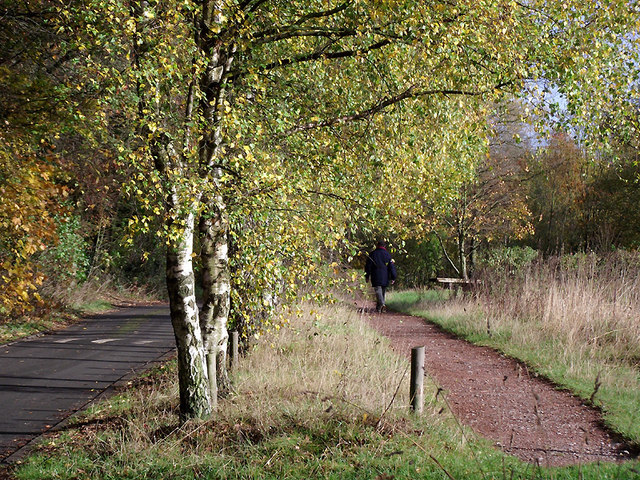
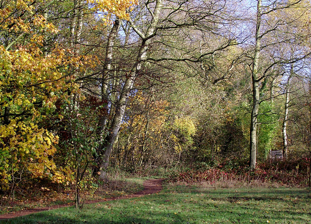
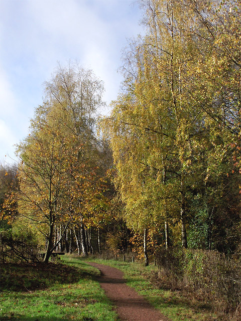
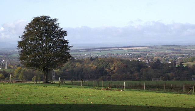
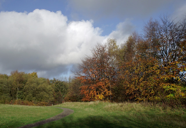
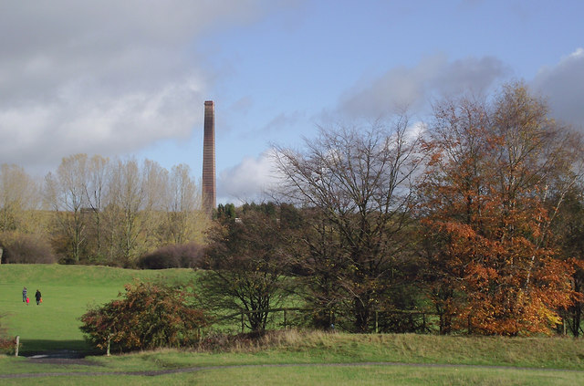
Whites Wood is a picturesque forest located in the county of Staffordshire, England. Covering an area of approximately 200 hectares, this woodland is a haven for nature lovers and outdoor enthusiasts alike.

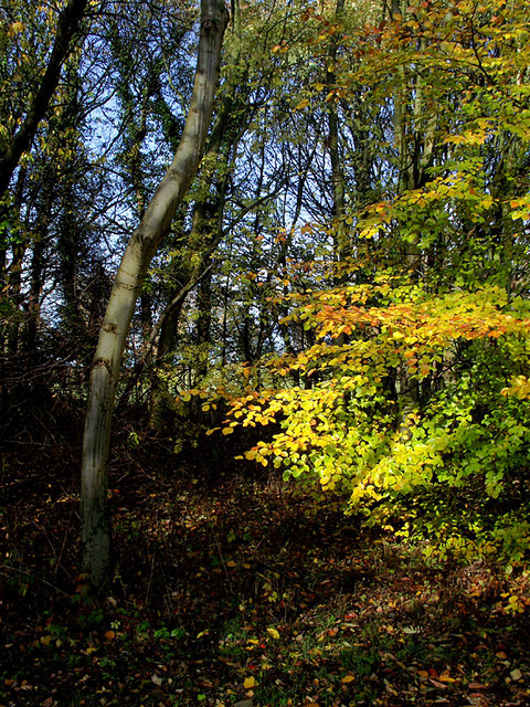
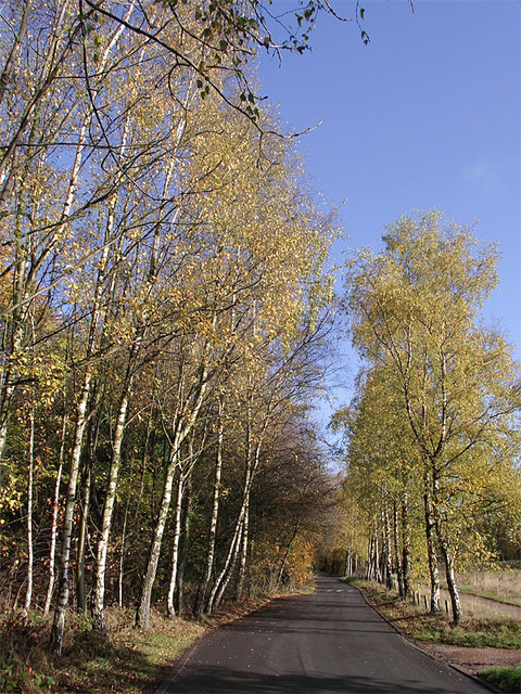
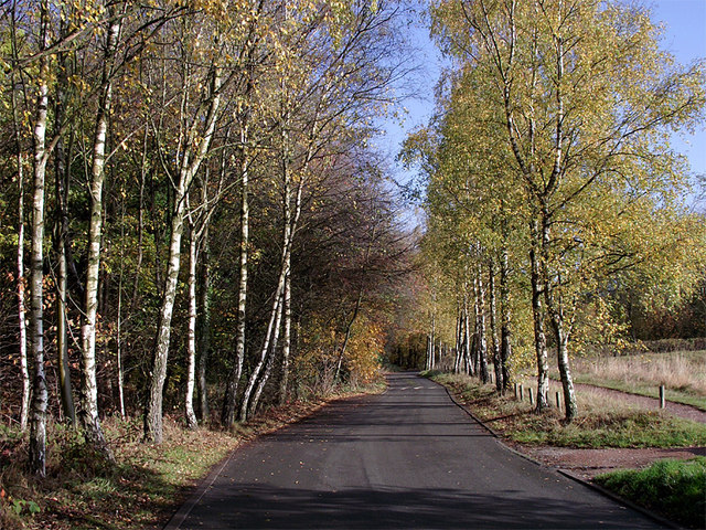
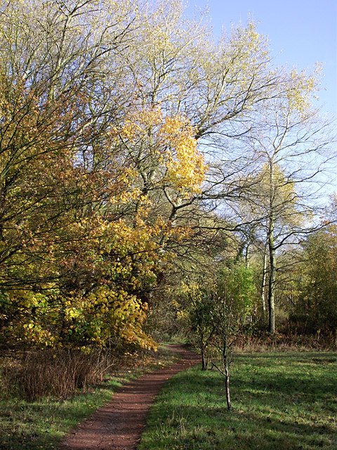
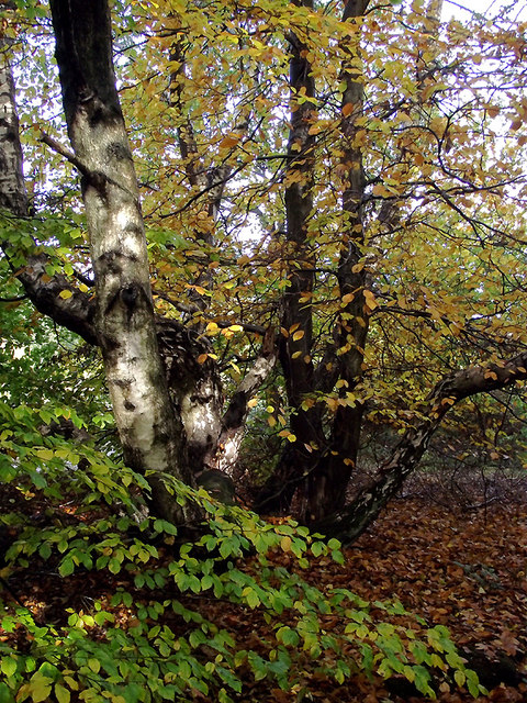
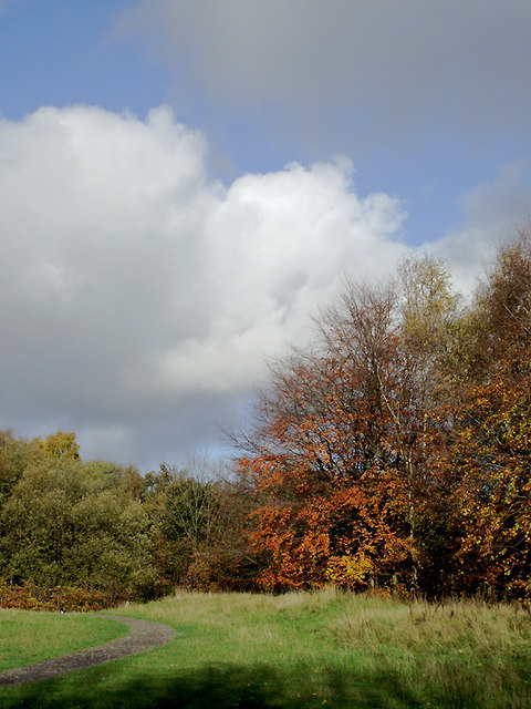
The forest is characterized by its dense canopy of deciduous trees, including oak, birch, and beech, which provide a stunning display of colors throughout the seasons. The woodland floor is covered with a vibrant carpet of wildflowers during springtime, creating a picturesque scene that attracts many visitors.

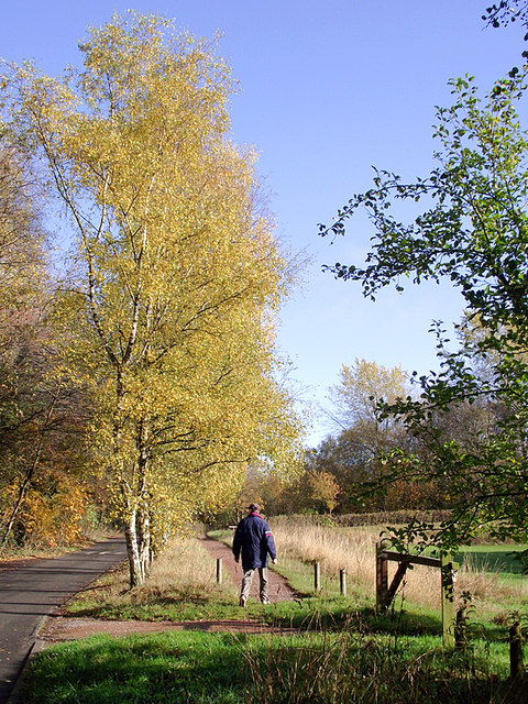
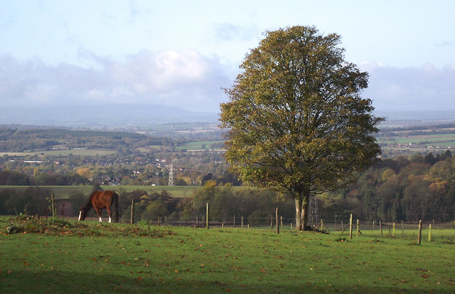
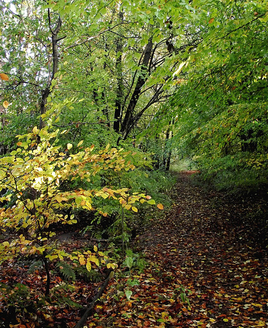
Whites Wood offers a variety of walking trails and paths, allowing visitors to explore the forest at their own pace. The trails range in difficulty, catering to both casual walkers and more experienced hikers. Along the way, visitors can spot a rich diversity of wildlife, including deer, foxes, and a wide array of bird species.

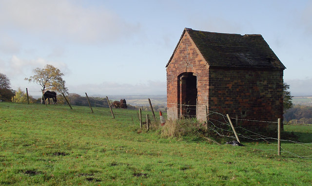
For those interested in history, Whites Wood has a fascinating past. It is believed to have been a hunting ground during medieval times and remnants of ancient earthworks can still be seen today. The forest also played a role in the timber industry, with evidence of old saw pits and charcoal platforms scattered throughout the area.

Whites Wood is a popular destination for families and nature enthusiasts, offering a tranquil escape from the hustle and bustle of everyday life. With its breathtaking scenery, diverse flora and fauna, and rich history, it is no wonder that Whites Wood is considered one of Staffordshire's hidden gems.

If you have any feedback on the listing, please let us know in the comments section below.
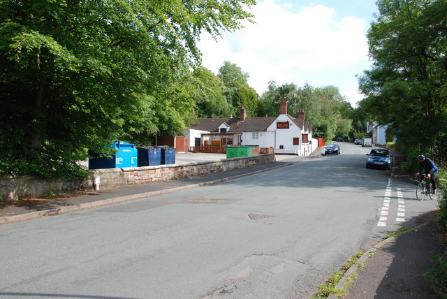
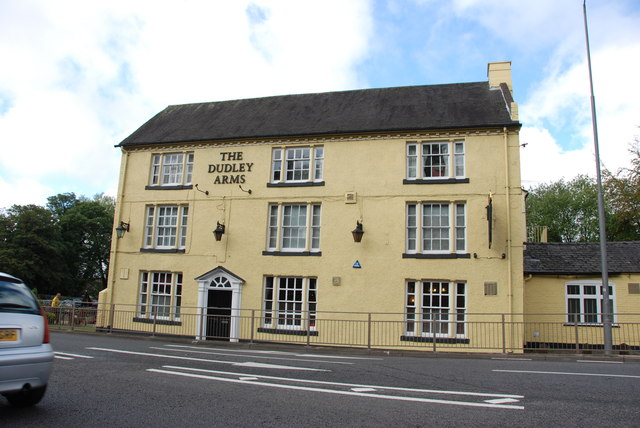
Whites Wood Images

Images are sourced within 2km of 52.528273/-2.1534613 or Grid Reference SO8992. Thanks to Geograph Open Source API. All images are credited.

Looking Up Battlefield Hill To The Red Lion. Wombourne.
The Dudley Arms, Himley
Woodland in Baggeridge Country Park, near Sedgley These woods are by the road north of the visitor centre near Gospel End. 
Baggeridge Country Park is an attractive area of countryside near Dudley and Wolverhampton. It was formerly the Baggeridge Colliery. Together with part of the original Himley Estate of the Earls of Dudley, the whole site has been transformed into 150 acres of attractive country park, including woodland, lakes, and open grassed areas.
Woodland in Baggeridge Country Park, near Sedgley
These woods are by the road north of the visitor centre near Gospel End. Baggeridge Country Park is an attractive area of countryside near Dudley and Wolverhampton. It was formerly the Baggeridge Colliery. Together with part of the original Himley Estate of the Earls of Dudley, the whole site has been transformed into 150 acres of attractive country park, including woodland, lakes, and open grassed areas.
 Baggeridge Country Park, near Sedgley The road links the car parks to Woodhouse Lane (A463) near Gospel End. The Upper Meadow is on the right.

Baggeridge Country Park is an attractive area of countryside near Dudley and Wolverhampton. It was formerly the Baggeridge Colliery. Together with part of the original Himley Estate of the Earls of Dudley, the whole site has been transformed into 150 acres of attractive country park, including woodland, lakes, and open grassed areas. <span class="nowrap"><a title="http://www.sstaffs.gov.uk/default.aspx?page=12695" rel="nofollow ugc noopener" href="http://www.sstaffs.gov.uk/default.aspx?page=12695">Link</a><img style="margin-left:2px;" alt="External link" title="External link - shift click to open in new window" src="https://s1.geograph.org.uk/img/external.png" width="10" height="10"/></span>
Baggeridge Country Park, near Sedgley
The road links the car parks to Woodhouse Lane (A463) near Gospel End. The Upper Meadow is on the right. Baggeridge Country Park is an attractive area of countryside near Dudley and Wolverhampton. It was formerly the Baggeridge Colliery. Together with part of the original Himley Estate of the Earls of Dudley, the whole site has been transformed into 150 acres of attractive country park, including woodland, lakes, and open grassed areas. LinkExternal link
 Baggeridge Country Park, near Sedgley The road links the car parks to Woodhouse Lane (A463) near Gospel End. The Upper Meadow is off to the right.
Baggeridge Country Park, near Sedgley
The road links the car parks to Woodhouse Lane (A463) near Gospel End. The Upper Meadow is off to the right.
The Road to Gospel End near Sedgley The private road is in Baggeridge Country Park and links the car parks to Woodhouse Lane (A463) near Gospel End.
The Road to Gospel End near Sedgley
The private road is in Baggeridge Country Park and links the car parks to Woodhouse Lane (A463) near Gospel End.
The Road to Gospel End near Sedgley The private road is in Baggeridge Country Park and links the car parks to Woodhouse Lane (A463) near Gospel End.
The Road to Gospel End near Sedgley
The private road is in Baggeridge Country Park and links the car parks to Woodhouse Lane (A463) near Gospel End.
Pathway in Baggeridge Country Park near Sedgley This is at the north end of Upper Meadow, looking towards Gospel End.
Pathway in Baggeridge Country Park near Sedgley
This is at the north end of Upper Meadow, looking towards Gospel End.
Pathway in Baggeridge Country Park near Sedgley This is at the north end of Upper Meadow, looking towards Gospel End.
Pathway in Baggeridge Country Park near Sedgley
This is at the north end of Upper Meadow, looking towards Gospel End.
Pathway in Baggeridge Country Park near Sedgley This is at the north end of Upper Meadow, looking away from Gospel End. The driveway from the A453 Wodehouse Road passes through the birch trees on the right.
Pathway in Baggeridge Country Park near Sedgley
This is at the north end of Upper Meadow, looking away from Gospel End. The driveway from the A453 Wodehouse Road passes through the birch trees on the right.
Farmland and woodland near Gospel End, Staffordshire Looking towards Wombourne past deciduous woodland at The Foxhills. Beyond the nearby fields is the wide valley occupied by the Smestow Brook.
Farmland and woodland near Gospel End, Staffordshire
Looking towards Wombourne past deciduous woodland at The Foxhills. Beyond the nearby fields is the wide valley occupied by the Smestow Brook.
Pasture and woodland near Gospel End, Staffordshire Looking towards Wombourne past deciduous woodland at The Foxhills. Beyond the nearby fields is the wide valley occupied by the Smestow Brook.
Pasture and woodland near Gospel End, Staffordshire
Looking towards Wombourne past deciduous woodland at The Foxhills. Beyond the nearby fields is the wide valley occupied by the Smestow Brook.
Farm outhouse in pasture near Gospel End, Staffordshire Beyond the nearby fields is the wide valley occupied by the Smestow Brook.
Farm outhouse in pasture near Gospel End, Staffordshire
Beyond the nearby fields is the wide valley occupied by the Smestow Brook.
Woodland in Baggeridge Country Park near Sedgley This is by a partly overgrown track north-east of Heather Cottage.
Woodland in Baggeridge Country Park near Sedgley
This is by a partly overgrown track north-east of Heather Cottage.
Woodland track in Baggeridge Country Path The track north-east from Heather Cottage is not all as well defined as this.
Woodland track in Baggeridge Country Path
The track north-east from Heather Cottage is not all as well defined as this.
Woodland in Baggeridge Country Park near Sedgley This is by the Events Field south of the tea rooms.
Woodland in Baggeridge Country Park near Sedgley
This is by the Events Field south of the tea rooms.
Woodland in Baggeridge Country Park near Sedgley This is by the Events Field south of the tea rooms.
Woodland in Baggeridge Country Park near Sedgley
This is by the Events Field south of the tea rooms.
Baggeridge Country Park near Sedgley Looking across the Events Field towards the chimney of the Baggeridge Brickworks.
Baggeridge Country Park near Sedgley
Looking across the Events Field towards the chimney of the Baggeridge Brickworks.
Show me another place!

Whites Wood is located at Grid Ref: SO8992 (Lat: 52.528273, Lng: -2.1534613)

Administrative County: Staffordshire

District: South Staffordshire

Police Authority: Staffordshire

What 3 Words

///unrealistic.hood.loans. Near Wombourn, Staffordshire
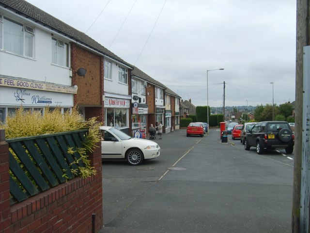
Related Wikis

Baggeridge Country Park

Baggeridge Country Park is located within the South Staffordshire district of Staffordshire, England. Its entrance is on the A463 just west of Gospel End...

Straits Estate

Straits Estate is a housing estate located near Sedgley, West Midlands, England, to the north-west of Gornal Ward, and was built for homeowners during...

Baggeridge Colliery

Baggeridge Colliery was a colliery located in Sedgley, West Midlands England. == Colliery History == The Baggeridge Colliery was an enterprise of the Earls...

Gospel End

Gospel End is a village in the South Staffordshire district of Staffordshire, England. Population details taken at the 2011 census can be found under...
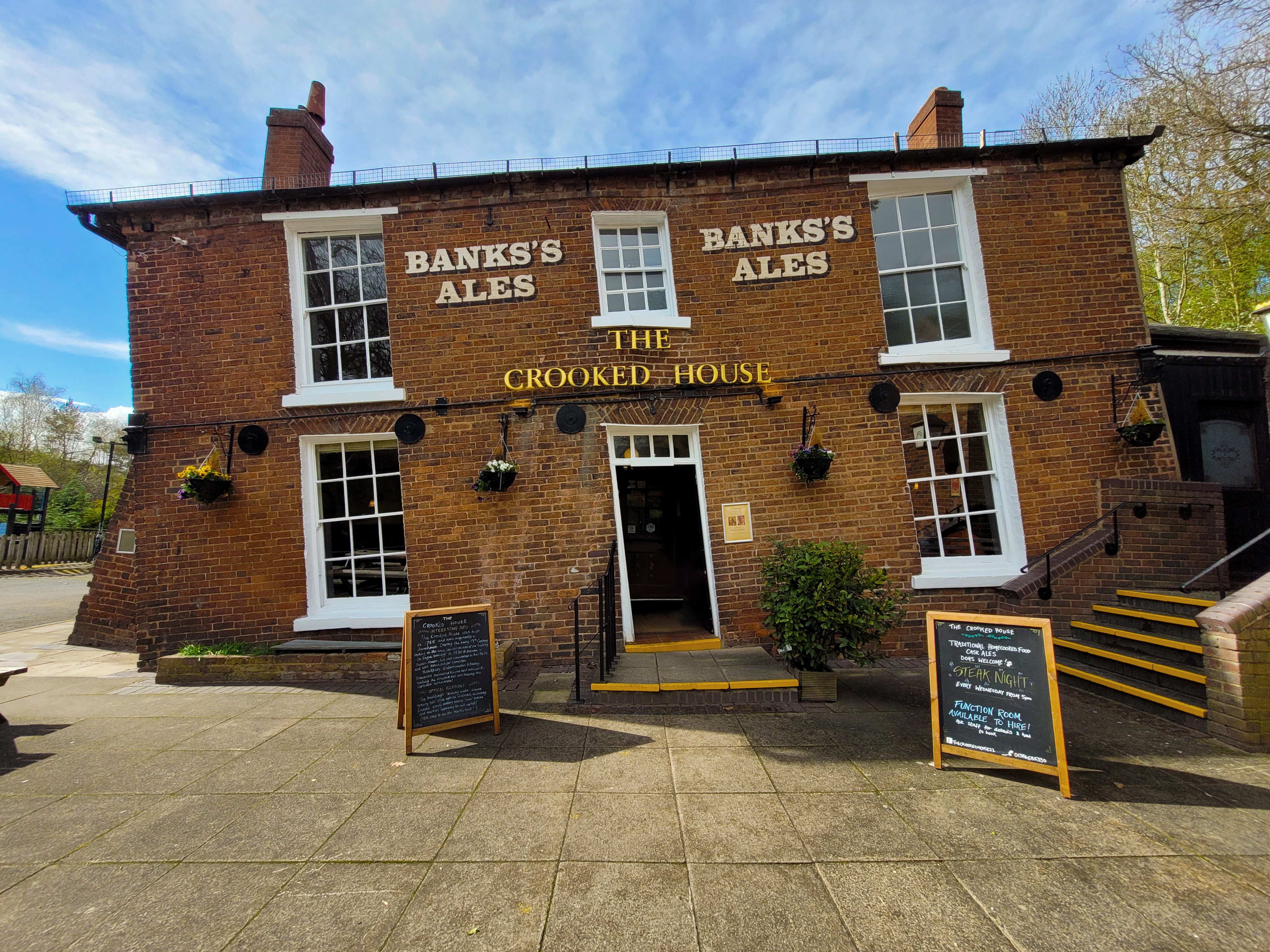
The Crooked House

The Crooked House was a pub in South Staffordshire, England. Its name and distinctive appearance were the result of 19th-century mining subsidence which...

Ellowes Hall Sports College

Ellowes Hall Sports College (formerly Ellowes Hall School) is a comprehensive secondary school and sixth form situated on Stickley Lane in Lower Gornal...

Ellowes Hall

Ellowes Hall was a stately home located in Sedgley, Staffordshire (now West Midlands). It was built in 1821 in parkland near Lower Gornal village as the...

The Wodehouse

The Wodehouse is a Grade II* listed English country house near Wombourne, Staffordshire, notable as the family seat of the Georgian landscape designer...

Nearby Amenities

Located within 500m of 52.528273,-2.1534613
Bus Stop
Sandyfields Rd / Longfellow Rd
NaPTANAreaCode: 43000853502
Bus: yes
Naptan AtcoCode: 43000853502
Naptan Bearing: SW
Naptan BusStopType: MKD
Naptan CommonName: Longfellow Rd
Naptan Indicator: adj
Naptan NaptanCode: nwmjwjwa
Naptan PlusbusZoneRef: BHAMNWS
Naptan Status: ACT
Naptan StopType: BCT
Naptan Street: SANDYFIELDS RD
Naptan Towards: Gornal Wood
Naptan Verified: no
Public Transport: platform
Route Ref: 27
Shelter: yes
Shelter Ref: 405320
Source: WMCA
Lat/Long: 52.5284116/-2.146213
Bus Stop
The Straits / High Arcal Rd
Bus: yes
Naptan AtcoCode: 43000853601
Naptan Bearing: NW
Naptan BusStopType: MKD
Naptan CommonName: High Arcal Rd
Naptan Indicator: adj
Naptan NaptanCode: nwmjwjwd
Naptan PlusbusZoneRef: BHAMNWS
Naptan Status: ACT
Naptan StopType: BCT
Naptan Street: THE STRAITS
Naptan Towards: Sedgley
Naptan Verified: no
Public Transport: platform
Route Ref: 27
Source: WMCA
Lat/Long: 52.5253161/-2.1485906
Barrier: stile
Foot: yes
Lat/Long: 52.5310078/-2.1480117
Whites Wood
Place: locality
Source: signpost
Lat/Long: 52.5283246/-2.153241
Smoking: yes
Tourism: picnic_site
Lat/Long: 52.5302241/-2.1553708
Power: tower
Lat/Long: 52.5285327/-2.1580195
Power: tower
Source: bing
Lat/Long: 52.5267651/-2.1558534
Power: tower
Source: bing
Lat/Long: 52.5264671/-2.1561535
Power: tower
Source: bing
Lat/Long: 52.5254546/-2.1532518
Power: tower
Source: bing
Lat/Long: 52.5252496/-2.1536678
Power: tower
Source: bing
Lat/Long: 52.5288557/-2.1579016
Bench
Lat/Long: 52.5285073/-2.1563753
Sparrow Copse
Tourism: picnic_site
Lat/Long: 52.5304547/-2.1538166
Barrier: stile
Lat/Long: 52.5284881/-2.1563971
Barrier: bollard
Lat/Long: 52.5268543/-2.1500077
Barrier: bollard
Lat/Long: 52.5264321/-2.1512893
Barrier: kissing_gate
Lat/Long: 52.5265731/-2.1509663
Barrier: cycle_barrier
Lat/Long: 52.5264387/-2.1513634
Tourism: picnic_site
Lat/Long: 52.5275207/-2.1572975
Bench
Bob's Bench
Lat/Long: 52.5311006/-2.1535987
Bench
Lat/Long: 52.5269429/-2.152695
Tourism: picnic_site
Lat/Long: 52.5309031/-2.154111
The data included in this document is from www.openstreetmap.org. The data is made available under ODbL.

Have you been to Whites Wood?

Leave your review of Whites Wood below (or comments, questions and feedback).