Island Pool

Lake, Pool, Pond, Freshwater Marsh in Staffordshire South Staffordshire

England

Island Pool

Wombourne Institute The 1863 Institute in Church Road stands next to St Benedict Church overlooking the Staffordshire Village Green.
Wombourne Institute Credit: Gordon Griffiths

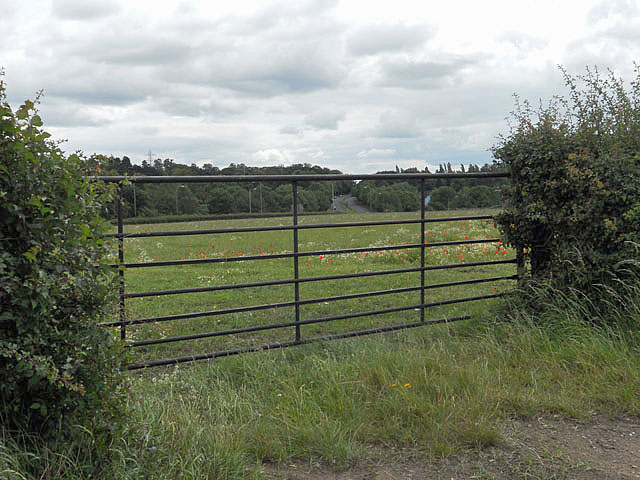
Island Pool is a serene and picturesque freshwater marsh located in Staffordshire, England. It is nestled amidst the stunning Cannock Chase Area of Outstanding Natural Beauty, offering visitors a tranquil escape from the bustling city life. The pool is a popular destination for nature enthusiasts and birdwatchers due to its diverse ecosystem and abundant wildlife.

Covering an area of approximately 10 acres, Island Pool is primarily fed by natural springs, ensuring a constant flow of crystal-clear water. The pool is surrounded by lush vegetation, including reed beds, water lilies, and various species of aquatic plants, creating a vibrant and colorful landscape. This thriving ecosystem provides a habitat for numerous species of birds, amphibians, and insects.

Birdwatchers flock to Island Pool to catch a glimpse of the diverse avian population, which includes species such as great crested grebes, tufted ducks, and little grebes. The reed beds attract reed warblers and sedge warblers, while the surrounding woodlands are home to woodpeckers and owls. The pool also serves as a stopover for migratory birds, making it an ideal spot for birdwatching throughout the year.

In addition to its natural beauty, Island Pool offers various recreational activities. Anglers can enjoy fishing for species such as carp, roach, and tench in the well-stocked waters. The pool is also a popular spot for leisurely walks and picnics, with several footpaths and seating areas available for visitors.

Overall, Island Pool in Staffordshire is a haven of tranquility and natural beauty, offering a diverse range of flora and fauna for visitors to explore and appreciate.

If you have any feedback on the listing, please let us know in the comments section below.
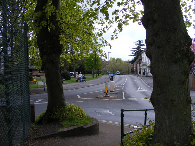
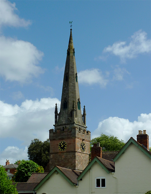
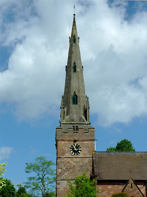
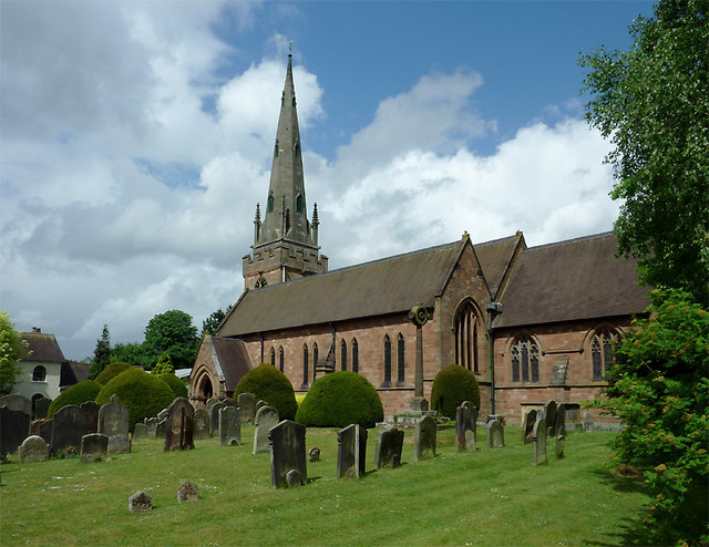
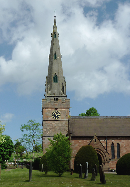
Island Pool Images

Images are sourced within 2km of 52.526287/-2.1600872 or Grid Reference SO8992. Thanks to Geograph Open Source API. All images are credited.

Wombourne Institute The 1863 Institute in Church Road stands next to St Benedict Church overlooking the Staffordshire Village Green.
Wombourne Institute
The 1863 Institute in Church Road stands next to St Benedict Church overlooking the Staffordshire Village Green.
Wombourne Church The St Benedict Biscop Church stands in Church Road overlooking the Village Green.
Wombourne Church
The St Benedict Biscop Church stands in Church Road overlooking the Village Green.
Green on the Green Wombourne Bowls Club stands on the Staffordshire Village Green, with St Benedict's Church in the background.
Green on the Green
Wombourne Bowls Club stands on the Staffordshire Village Green, with St Benedict's Church in the background.
Wombourne Path The view up Maypole Street alongside the Staffordshire Village Green.
Wombourne Path
The view up Maypole Street alongside the Staffordshire Village Green.
Wombourne View The view of Gravel Hill from the corner of the Staffordshire Village Green.
Wombourne View
The view of Gravel Hill from the corner of the Staffordshire Village Green.
The spire of St Benedict Biscop Church at Wombourne, Staffordshire In 1840 nearly all the then existing medieval church was demolished. The 14th century tower with its recessed stone spire was retained. The 1840 rebuild was itself taken down, and the present fine structure replaced it in 1867 - again retaining the original 14th century tower and spire.
The spire of St Benedict Biscop Church at Wombourne, Staffordshire
In 1840 nearly all the then existing medieval church was demolished. The 14th century tower with its recessed stone spire was retained. The 1840 rebuild was itself taken down, and the present fine structure replaced it in 1867 - again retaining the original 14th century tower and spire.
St Benedict Biscop Church in Wombourne, Staffordshire In 1840 nearly all the then existing medieval church was demolished. The 14th century tower with its recessed stone spire was retained. The 1840 rebuild was itself taken down, and the present fine structure replaced it in 1867 - again retaining the original 14th century tower and spire.
St Benedict Biscop Church in Wombourne, Staffordshire
In 1840 nearly all the then existing medieval church was demolished. The 14th century tower with its recessed stone spire was retained. The 1840 rebuild was itself taken down, and the present fine structure replaced it in 1867 - again retaining the original 14th century tower and spire.
St Benedict Biscop Church in Wombourne, Staffordshire In 1840 nearly all the then existing medieval church was demolished. The 14th century tower with its recessed stone spire was retained. The 1840 rebuild was itself taken down, and the present fine structure replaced it in 1867 - again retaining the original 14th century tower and spire.

<span class="nowrap"><a title="http://www.stbenedictbiscop.org.uk/" rel="nofollow ugc noopener" href="http://www.stbenedictbiscop.org.uk/">Link</a><img style="margin-left:2px;" alt="External link" title="External link - shift click to open in new window" src="https://s1.geograph.org.uk/img/external.png" width="10" height="10"/></span>
St Benedict Biscop Church in Wombourne, Staffordshire
In 1840 nearly all the then existing medieval church was demolished. The 14th century tower with its recessed stone spire was retained. The 1840 rebuild was itself taken down, and the present fine structure replaced it in 1867 - again retaining the original 14th century tower and spire. LinkExternal link
St Benedict's Church clock in Wombourne, Staffordshire The tower was originally built in the 14th century and has structural strengthening ironware showing here, as well as a gargoyle.

In 1840 nearly all the then existing medieval church was demolished. The tower with its recessed stone spire was retained. The 1840 rebuild was itself taken down, and the present fine structure replaced it in 1867 - again retaining the 14th century tower and spire.
St Benedict's Church clock in Wombourne, Staffordshire
The tower was originally built in the 14th century and has structural strengthening ironware showing here, as well as a gargoyle. In 1840 nearly all the then existing medieval church was demolished. The tower with its recessed stone spire was retained. The 1840 rebuild was itself taken down, and the present fine structure replaced it in 1867 - again retaining the 14th century tower and spire.
War memorial in St Benedict's churchyard in Wombourne, Staffordshire The inscription reads:

TO
THE GLORY OF GOD
AND IN MEMORY OF
THE MEN OF WOMBOURN
WHO GAVE THEIR LIVES
FOR THEIR COUNTRY
IN THE GREAT WAR
1914-1919
1939-1945
War memorial in St Benedict's churchyard in Wombourne, Staffordshire
The inscription reads: TO THE GLORY OF GOD AND IN MEMORY OF THE MEN OF WOMBOURN WHO GAVE THEIR LIVES FOR THEIR COUNTRY IN THE GREAT WAR 1914-1919 1939-1945
Sytch Lane Cemetery Entrance The view of the entrance to the Wombourne Cemetery which opened in December 2009.
Sytch Lane Cemetery Entrance
The view of the entrance to the Wombourne Cemetery which opened in December 2009.
Wombourne Cemetery The view of Sytch Lane Cemetery which opened in December 2009.
Wombourne Cemetery
The view of Sytch Lane Cemetery which opened in December 2009.
Wombourne Cemetery View The view of Sytch Lane Cemetery which opened in December 2009.
Wombourne Cemetery View
The view of Sytch Lane Cemetery which opened in December 2009.
Looking Up Battlefield Hill To The Red Lion. Wombourne.
Gated field adjacent the A449
Churns Hill Lane, Himley
The Dudley Arms, Himley
Show me another place!

Island Pool is located at Grid Ref: SO8992 (Lat: 52.526287, Lng: -2.1600872)

Administrative County: Staffordshire

District: South Staffordshire

Police Authority: Staffordshire

What 3 Words

///habit.doll.trades. Near Wombourn, Staffordshire
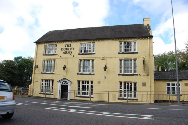
Related Wikis

Baggeridge Country Park

Baggeridge Country Park is located within the South Staffordshire district of Staffordshire, England. Its entrance is on the A463 just west of Gospel End...

Straits Estate

Straits Estate is a housing estate located near Sedgley, West Midlands, England, to the north-west of Gornal Ward, and was built for homeowners during...

Baggeridge Colliery

Baggeridge Colliery was a colliery located in Sedgley, West Midlands England. == Colliery History == The Baggeridge Colliery was an enterprise of the Earls...
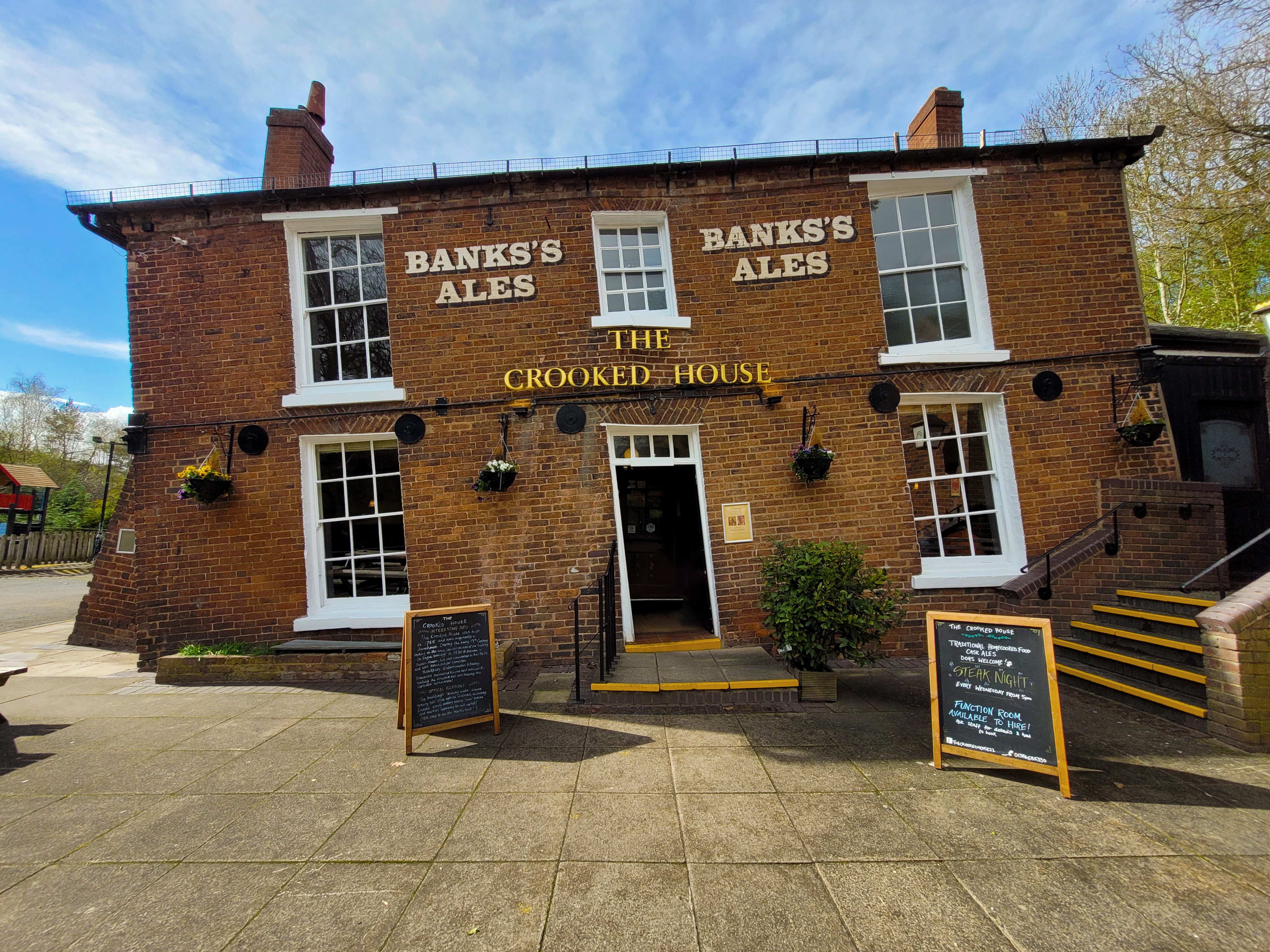
The Crooked House

The Crooked House was a pub in South Staffordshire, England. Its name and distinctive appearance were the result of 19th-century mining subsidence which...

The Wodehouse

The Wodehouse is a Grade II* listed English country house near Wombourne, Staffordshire, notable as the family seat of the Georgian landscape designer...

Gospel End

Gospel End is a village in the South Staffordshire district of Staffordshire, England. Population details taken at the 2011 census can be found under...

Holbeche House

Holbeche House (also, in some texts, Holbeach or Holbeache) is a mansion located approximately 1 mile (1.6 km) north of Kingswinford, now in the Metropolitan...

Wombourne

Wombourne is a village and civil parish located in the district of South Staffordshire, in the county of Staffordshire, England. It is 4 miles (6 km) south...
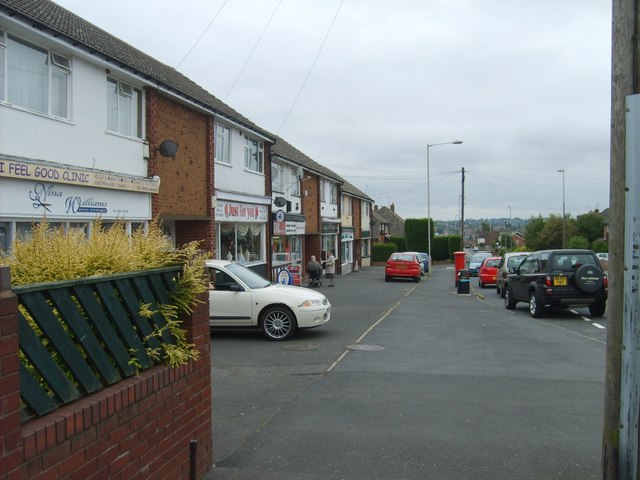
Nearby Amenities

Located within 500m of 52.526287,-2.1600872
Power: tower
Lat/Long: 52.5285327/-2.1580195
Power: tower
Source: bing
Lat/Long: 52.5267651/-2.1558534
Power: tower
Source: bing
Lat/Long: 52.5264671/-2.1561535
Power: tower
Source: bing
Lat/Long: 52.5254546/-2.1532518
Power: tower
Source: bing
Lat/Long: 52.5252496/-2.1536678
Power: tower
Source: bing
Lat/Long: 52.5298217/-2.1618335
Power: tower
Source: bing
Lat/Long: 52.5296422/-2.1622248
Power: tower
Source: bing
Lat/Long: 52.5288557/-2.1579016
Bench
Lat/Long: 52.5285073/-2.1563753
Barrier: stile
Lat/Long: 52.5284881/-2.1563971
Tourism: picnic_site
Lat/Long: 52.5275207/-2.1572975
Ford: yes
Lat/Long: 52.5229051/-2.1637863
Cave Size: small
Lat/Long: 52.5229614/-2.1645018
Life Ring
Emergency: life_ring
Lat/Long: 52.5231348/-2.1634939
The data included in this document is from www.openstreetmap.org. The data is made available under ODbL.

Have you been to Island Pool?

Leave your review of Island Pool below (or comments, questions and feedback).