The Brake

Wood, Forest in Wiltshire

England

The Brake

Stile onto footpath This stile provides access from the road onto the footpath.  Judging by the relatively vigorous crop growth on the footpath this is not frequently used.
Stile onto footpath Credit: Doug Lee

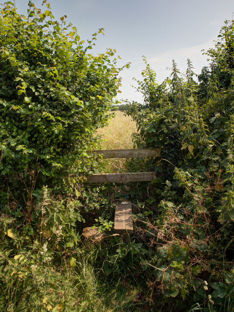
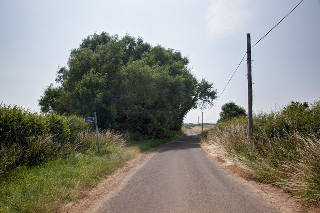
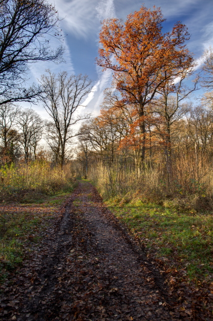
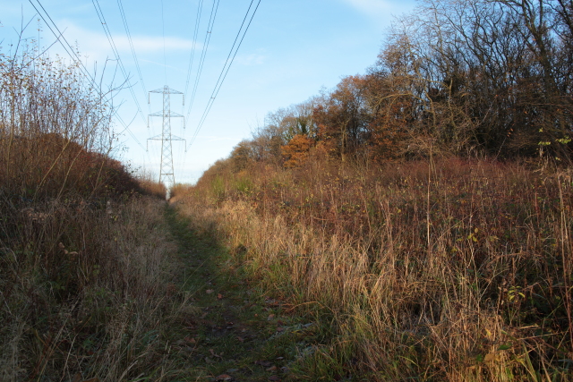
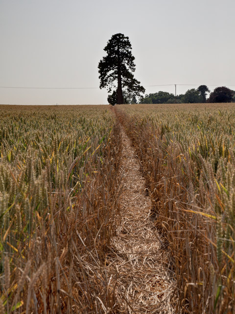
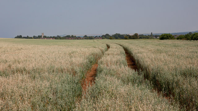
The Brake is a dense woodland located in the county of Wiltshire, England. Spanning over a vast area, this forest is a haven for nature enthusiasts and outdoor adventurers alike. The Brake is renowned for its rich biodiversity, with a diverse range of flora and fauna thriving within its boundaries.

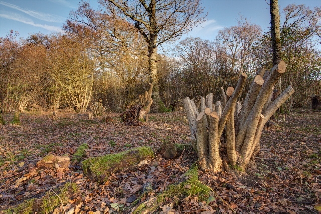
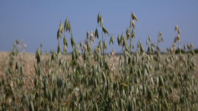
This woodland is predominantly composed of deciduous trees, including oak, beech, and birch. The tall, majestic trees create a canopy that filters sunlight, casting enchanting shadows on the forest floor. The undergrowth is a tapestry of ferns, wildflowers, and mosses, providing a vibrant and colorful backdrop to the woodland.

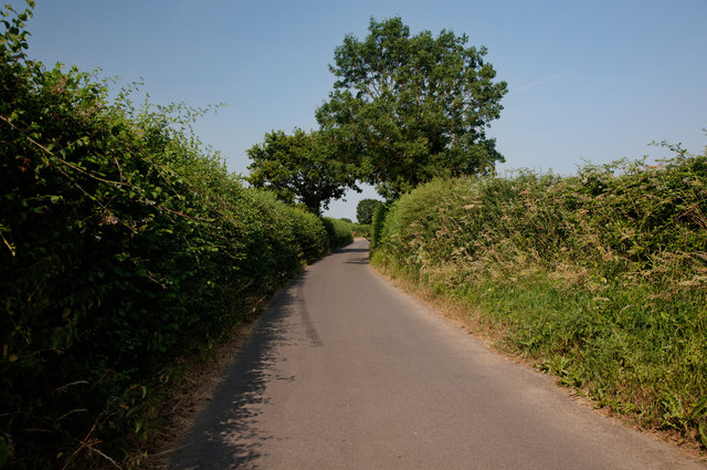
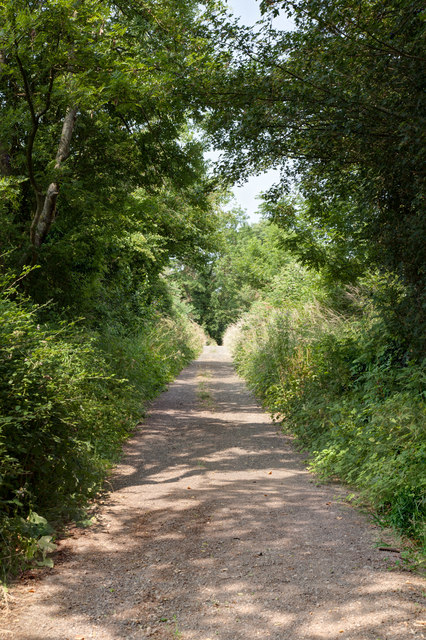
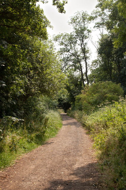
Traversing through The Brake, visitors can expect to discover a network of well-maintained trails. These paths wind their way through the forest, leading to hidden groves, bubbling streams, and peaceful clearings. The trails offer opportunities for walking, hiking, and cycling, allowing visitors to immerse themselves in the tranquility of nature.

The Brake is also home to a diverse range of wildlife. Birdwatchers can spot a variety of species, including woodpeckers, owls, and songbirds. The forest floor is inhabited by small mammals like squirrels, rabbits, and hedgehogs, while deer can be occasionally glimpsed in the distance.

With its untouched beauty and serene atmosphere, The Brake is not only a retreat for nature lovers but also an important ecological site. It serves as a vital habitat for many species and plays a crucial role in maintaining the local ecosystem.

If you have any feedback on the listing, please let us know in the comments section below.

The Brake Images

Images are sourced within 2km of 51.305178/-2.1671998 or Grid Reference ST8856. Thanks to Geograph Open Source API. All images are credited.

Stile onto footpath This stile provides access from the road onto the footpath.  Judging by the relatively vigorous crop growth on the footpath this is not frequently used.
Stile onto footpath
This stile provides access from the road onto the footpath. Judging by the relatively vigorous crop growth on the footpath this is not frequently used.
Sandpits Lane The footpath sign points towards the stile and footpath shown in <a href="https://www.geograph.org.uk/photo/3565438">ST9056 : Stile onto footpath</a>
Sandpits Lane
The footpath sign points towards the stile and footpath shown in ST9056 : Stile onto footpath
Clanger Wood, Wiltshire Farmland adjacent to the western perimeter of Clanger Wood.
Clanger Wood, Wiltshire
Farmland adjacent to the western perimeter of Clanger Wood.
Gates and field near Brook Farm
St John The Evangelist, West Ashton Church at West Ashton
St John The Evangelist, West Ashton
Church at West Ashton
Path in Green Lane Wood Green Lane Wood is owned and managed by the Wiltshire Wildlife Trust.  This is the main track into the wood from the car park on the A350.
Path in Green Lane Wood
Green Lane Wood is owned and managed by the Wiltshire Wildlife Trust. This is the main track into the wood from the car park on the A350.
Recently Coppiced Trees in Green Lane Wood Green Lane Wood is owned and managed by the Wiltshire Wildlife Trust.  Coppicing is carried out each winter by volunteers.
Recently Coppiced Trees in Green Lane Wood
Green Lane Wood is owned and managed by the Wiltshire Wildlife Trust. Coppicing is carried out each winter by volunteers.
Electricity Pylon in Green Lane Wood A footpath runs underneath the line of the pylons which pass through the centre of the wood.
Electricity Pylon in Green Lane Wood
A footpath runs underneath the line of the pylons which pass through the centre of the wood.
Clearing for Pylons Through Green Lane Wood There is a clearing through the centre of Green Lane Wood for a line of electricity pylons.  A footpath runs underneath the pylons through the centre of this clearing.
Clearing for Pylons Through Green Lane Wood
There is a clearing through the centre of Green Lane Wood for a line of electricity pylons. A footpath runs underneath the pylons through the centre of this clearing.
Road junction at Crossways Farm
A350 approaching Yarnbrook
Wind Pump at East Town Farm Seven years on from <a href="https://www.geograph.org.uk/photo/716683">ST8955 : 2008 : Wind Pump at East Town Farm</a> and the wind pump is still maintained.

In the distance through the gap in the trees you can see the church of St. Mary in Steeple Ashton
Wind Pump at East Town Farm
Seven years on from ST8955 : 2008 : Wind Pump at East Town Farm and the wind pump is still maintained. In the distance through the gap in the trees you can see the church of St. Mary in Steeple Ashton
Footpath through the wheat
West Ditch Lane
West Ditch Lane
North along Mudmead Lane Mudmead Lane is a restricted byway
North along Mudmead Lane
Mudmead Lane is a restricted byway
South along Mudmead Lane Mudmead Lane is a restricted byway
South along Mudmead Lane
Mudmead Lane is a restricted byway
View towards Steeple Ashton The field is planted with a crop of oats
View towards Steeple Ashton
The field is planted with a crop of oats
Field of oats This is a view of the oats shown in <a href="https://www.geograph.org.uk/photo/3565478">ST8957 : View towards Steeple Ashton</a>
Field of oats
This is a view of the oats shown in ST8957 : View towards Steeple Ashton
Show me another place!

The Brake is located at Grid Ref: ST8856 (Lat: 51.305178, Lng: -2.1671998)

Unitary Authority: Wiltshire

Police Authority: Wiltshire

What 3 Words

///items.outcasts.enabling. Near North Bradley, Wiltshire

Related Wikis

Rood Ashton House

Rood Ashton House was a country house in Wiltshire, England, standing in parkland 0.5 miles (0.80 km) northeast of the village of West Ashton, near Trowbridge...

West Ashton

West Ashton is a village and civil parish in Wiltshire, England. It is about 2 miles (3.2 km) southeast of Trowbridge, near the A350 between Melksham and...

Yarnbrook

Yarnbrook is a large hamlet in Wiltshire, England, between the towns of Westbury and Trowbridge. Most of the settlement lies in the civil parish of North...

Picket and Clanger Wood

Picket and Clanger Wood (grid reference ST875543) is a 66.4 hectare biological Site of Special Scientific Interest in Wiltshire, England, and lies off...

Steeple Ashton

Steeple Ashton is a village and civil parish in Wiltshire, England, 3 miles (4.8 km) east of Trowbridge. In the north of the parish are the hamlets of...

Ashton Common

Ashton Common is a hamlet in Wiltshire, England, to the east of Trowbridge. The hamlet lies on Common Hill, a little south of the A350 road, within the...

Whorwellsdown Hundred

Whorwellsdown was a hundred of the English county of Wiltshire, lying in the west of the county to the south of the towns of Bradford on Avon and Melksham...

Heywood, Wiltshire

Heywood is a civil parish and small village in the county of Wiltshire in southwestern England. The village is approximately 1.5 miles (2.4 km) north of...

Nearby Amenities

Located within 500m of 51.305178,-2.1671998
The data included in this document is from www.openstreetmap.org. The data is made available under ODbL.

Have you been to The Brake?

Leave your review of The Brake below (or comments, questions and feedback).