Mountpleasant Covert

Wood, Forest in Staffordshire South Staffordshire

England

Mountpleasant Covert

Bonded Warehouse, Stourbridge This building is a restored bonded warehouse in Canal St, Stourbridge
Bonded Warehouse, Stourbridge Credit: Rob Newman

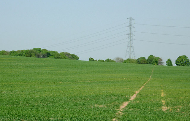
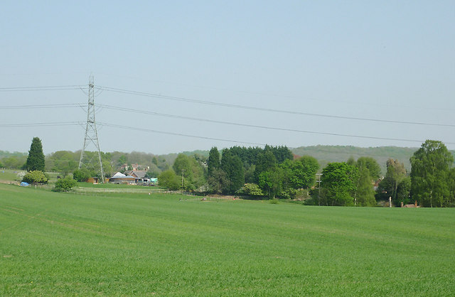
Mountpleasant Covert is a woodland area located in the county of Staffordshire in the West Midlands region of England. Covering an approximate area of 50 acres, it is situated in close proximity to the village of Mountpleasant and is a designated Site of Special Scientific Interest (SSSI).

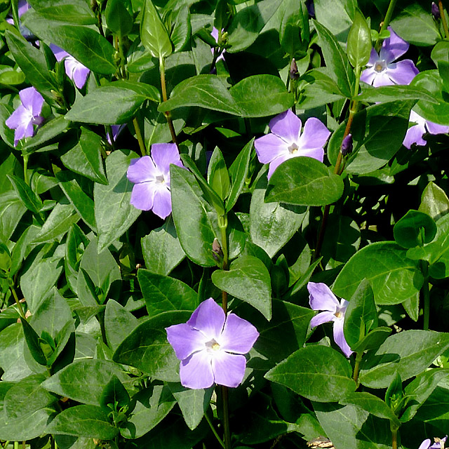
The covert is predominantly composed of mixed deciduous trees, including oak, beech, and birch, creating a diverse and vibrant woodland ecosystem. The dense canopy of the trees provides a habitat for a wide variety of wildlife, including birds, mammals, and insects. The woodland floor is adorned with an array of wildflowers and ferns, adding to its natural beauty.

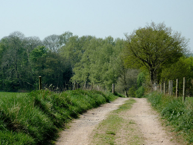
The covert is crisscrossed by a network of footpaths, allowing visitors to explore its enchanting surroundings. These paths wind through the trees, providing opportunities for nature walks, bird watching, and peaceful picnics. The tranquil atmosphere of Mountpleasant Covert makes it a popular destination for both locals and tourists seeking respite from the hustle and bustle of everyday life.

Managed by the Staffordshire Wildlife Trust, the woodland is carefully conserved to preserve its natural habitat and biodiversity. The Trust organizes regular educational events and guided walks to raise awareness about the importance of conservation and to allow visitors to learn more about the flora and fauna of the area.

Overall, Mountpleasant Covert in Staffordshire is a picturesque woodland that offers a haven of tranquility and a chance to connect with nature. Its diverse ecosystem and well-maintained paths make it an ideal destination for nature lovers and those seeking a peaceful retreat.

If you have any feedback on the listing, please let us know in the comments section below.

Mountpleasant Covert Images

Images are sourced within 2km of 52.472653/-2.1726117 or Grid Reference SO8886. Thanks to Geograph Open Source API. All images are credited.

Bonded Warehouse, Stourbridge This building is a restored bonded warehouse in Canal St, Stourbridge
Bonded Warehouse, Stourbridge
This building is a restored bonded warehouse in Canal St, Stourbridge
Derelict Building, Stourbridge This dilapilated building is to be found in Canal Street, Stourbridge
Derelict Building, Stourbridge
This dilapilated building is to be found in Canal Street, Stourbridge
Stourbridge Canal Basin Viewed from beside the bonded warehouse in Canal Street this is the terminal basin of the Stourbridge Canal
Stourbridge Canal Basin
Viewed from beside the bonded warehouse in Canal Street this is the terminal basin of the Stourbridge Canal
Cave at Prestwood near Stourton, Staffordshire This cave in the Triassic sandstone is on land belonging to Prestwood Cave Nursery. The nursery grows a limited range of hardy shrubs and other plants. Quality is high, and the prices are very reasonable. The hard winter of 2010-2011 killed many plants in nurseries all over the West Midlands, but enough remains here to continue trading.
Cave at Prestwood near Stourton, Staffordshire
This cave in the Triassic sandstone is on land belonging to Prestwood Cave Nursery. The nursery grows a limited range of hardy shrubs and other plants. Quality is high, and the prices are very reasonable. The hard winter of 2010-2011 killed many plants in nurseries all over the West Midlands, but enough remains here to continue trading.
Prestwood Cave Nursery near Stourton, Staffordshire The nursery grows a limited range of hardy shrubs and other plants. Quality is high, and the prices are very reasonable. The hard winter of 2010-2011 killed many plants in nurseries all over the West Midlands, but enough remains here to continue trading.
Prestwood Cave Nursery near Stourton, Staffordshire
The nursery grows a limited range of hardy shrubs and other plants. Quality is high, and the prices are very reasonable. The hard winter of 2010-2011 killed many plants in nurseries all over the West Midlands, but enough remains here to continue trading.
Bridleway near Stourton, Staffordshire The bridleway links Wolverhampton Road (A449) at Prestwood with Greensforge Lane and Gothersley Farm.
Bridleway near Stourton, Staffordshire
The bridleway links Wolverhampton Road (A449) at Prestwood with Greensforge Lane and Gothersley Farm.
Bridleway near Stourton, Staffordshire The bridleway links Wolverhampton Road (A449) at Prestwood with Greensforge Lane and Gothersley Farm.
Bridleway near Stourton, Staffordshire
The bridleway links Wolverhampton Road (A449) at Prestwood with Greensforge Lane and Gothersley Farm.
Bridleway near Stourton, Staffordshire The bridleway links Wolverhampton Road (A449) at Prestwood with Greensforge Lane and Gothersley Farm.
Bridleway near Stourton, Staffordshire
The bridleway links Wolverhampton Road (A449) at Prestwood with Greensforge Lane and Gothersley Farm.
Public footpath and stile near Prestwood, Staffordshire The path across this crop field seems little used. The bridleway from the Coach House which is mapped as being behind the camera does not exist at all now.
Public footpath and stile near Prestwood, Staffordshire
The path across this crop field seems little used. The bridleway from the Coach House which is mapped as being behind the camera does not exist at all now.
Farmland near Prestwood, Staffordshire Seen from the bridleway near Prestwood Cave Nursery.
Farmland near Prestwood, Staffordshire
Seen from the bridleway near Prestwood Cave Nursery.
Farmland near Prestwood, Staffordshire Looking across the fields from the bridleway between Prestwood and Greensforge Lane.
Farmland near Prestwood, Staffordshire
Looking across the fields from the bridleway between Prestwood and Greensforge Lane.
Crop field near Prestwood, Staffordshire What appear to be tractor wheel tracks actually follow almost exactly the course of a public footpath across the field to Foley Lane.
Crop field near Prestwood, Staffordshire
What appear to be tractor wheel tracks actually follow almost exactly the course of a public footpath across the field to Foley Lane.
Arable Land near Prestwood, Staffordshire Looking across the fields from the bridleway between Prestwood and Greensforge Lane. The tall dark green conifers in the centre of the image are by the A449 near Yew Tree Farm.
Arable Land near Prestwood, Staffordshire
Looking across the fields from the bridleway between Prestwood and Greensforge Lane. The tall dark green conifers in the centre of the image are by the A449 near Yew Tree Farm.
Bridleway north of Stourton, Staffordshire The bridleway links Wolverhampton Road (A449) at Prestwood with Greensforge Lane and Gothersley Farm. The woodland ahead is on the slope down to the Smestow River. To the right of the bridleway there is Gothersley Rough, and to the left, Colbourn's Rough.
Bridleway north of Stourton, Staffordshire
The bridleway links Wolverhampton Road (A449) at Prestwood with Greensforge Lane and Gothersley Farm. The woodland ahead is on the slope down to the Smestow River. To the right of the bridleway there is Gothersley Rough, and to the left, Colbourn's Rough.
Bridleway north of Stourton, Staffordshire The bridleway links Gothersley Farm and Greensforge Lane with the Wolverhampton Road (A449) at Prestwood. On the skyline are Lousy Wood and Crabtree Rough.
Bridleway north of Stourton, Staffordshire
The bridleway links Gothersley Farm and Greensforge Lane with the Wolverhampton Road (A449) at Prestwood. On the skyline are Lousy Wood and Crabtree Rough.
Periwinkle flowers near Prestwood Cave, Staffordshire These attractive periwinkle (Vinca major) flowers were growing at the edge of the bridleway below a conifer hedge, so it is probably an escape from the garden. 

<a href="https://www.geograph.org.uk/photo/2379158">SO8686 : Periwinkle flowers near Prestwood Cave, Staffordshire</a>
Periwinkle flowers near Prestwood Cave, Staffordshire
These attractive periwinkle (Vinca major) flowers were growing at the edge of the bridleway below a conifer hedge, so it is probably an escape from the garden. SO8686 : Periwinkle flowers near Prestwood Cave, Staffordshire
Periwinkle flowers near Prestwood Cave, Staffordshire These pretty periwinkle (Vinca major) flowers were growing at the edge of the bridleway below a conifer hedge, so it is probably an escape from the garden. 

<a href="https://www.geograph.org.uk/photo/2379146">SO8686 : Periwinkle flowers near Prestwood Cave, Staffordshire</a>
Periwinkle flowers near Prestwood Cave, Staffordshire
These pretty periwinkle (Vinca major) flowers were growing at the edge of the bridleway below a conifer hedge, so it is probably an escape from the garden. SO8686 : Periwinkle flowers near Prestwood Cave, Staffordshire
Show me another place!

Mountpleasant Covert is located at Grid Ref: SO8886 (Lat: 52.472653, Lng: -2.1726117)

Administrative County: Staffordshire

District: South Staffordshire

Police Authority: Staffordshire

What 3 Words

///shells.revisits.paraded. Near Stourbridge, West Midlands

Related Wikis

Stourbridge Canal

The Stourbridge Canal is a canal in the West Midlands of England. It links the Staffordshire and Worcestershire Canal (at Stourton Junction, affording...

Red House Cone

The Red House Cone is a glass cone located in Wordsley in the West Midlands, adjacent to the Stourbridge Canal bridge on the A491 High Street. It is a...

The Lace Guild

The Lace Guild is a registered charity, accredited museum and educational organisation based in the UK for lacemakers and those interested in lacemaking...

Wollaston, West Midlands

Wollaston is a village on the outskirts of Stourbridge in the English West Midlands. It is located in the south of the Dudley Metropolitan Borough, one...

Amblecote

Amblecote is an affluent urban village in the Metropolitan Borough of Dudley in the West Midlands, England. It lies immediately north of the historic town...
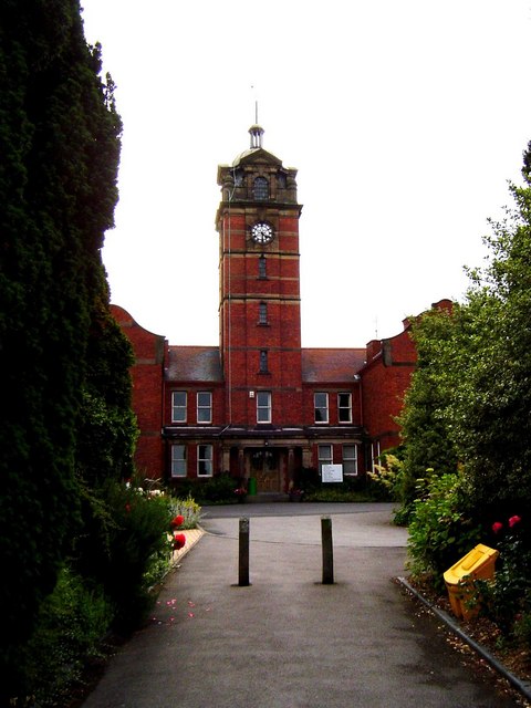
Wordsley Hospital

Wordsley Hospital was an NHS hospital located in Wordsley, near Stourbridge, West Midlands, England. == History == The facility was built as part of the...

Ridgewood High School, Wollaston

Ridgewood High School is a coeducational secondary school, a part of the Stour Vale Academy Trust situated in Wollaston (near Stourbridge), in the West...

The Wordsley School

The Wordsley School is a coeducational community secondary school, located in Wordsley (near Stourbridge) in the West Midlands of England. == History... ==

Nearby Amenities

Located within 500m of 52.472653,-2.1726117
Bus Stop
Balmoral Rd / Westminster Rd
Bus: yes
Naptan AtcoCode: 43000841502
Naptan Bearing: SE
Naptan BusStopType: MKD
Naptan CommonName: Westminster Rd
Naptan Indicator: adj
Naptan NaptanCode: nwmjwamp
Naptan PlusbusZoneRef: BHAMNWS
Naptan Status: ACT
Naptan StopType: BCT
Naptan Street: BALMORAL RD
Naptan Towards: Wordsley
Naptan Verified: no
Public Transport: platform
Route Ref: 226;267
Source: WMCA
Lat/Long: 52.4769329/-2.1735311
Bus Stop
Balmoral Rd / Braemar Avenue
Bus: yes
Naptan AtcoCode: 43000841601
Naptan Bearing: NW
Naptan BusStopType: MKD
Naptan CommonName: Braemar Avenue
Naptan Indicator: adj
Naptan NaptanCode: nwmjwamt
Naptan PlusbusZoneRef: BHAMNWS
Naptan Status: ACT
Naptan StopType: BCT
Naptan Street: BALMORAL RD
Naptan Towards: Kingswinford
Naptan Verified: no
Public Transport: platform
Route Ref: 226;267
Source: WMCA
Lat/Long: 52.474984/-2.1721248
Bus Stop
Balmoral Rd / Braemar Avenue
Bus: yes
Naptan AtcoCode: 43000841602
Naptan Bearing: SE
Naptan BusStopType: MKD
Naptan CommonName: Braemar Avenue
Naptan Indicator: opp
Naptan NaptanCode: nwmjwamw
Naptan PlusbusZoneRef: BHAMNWS
Naptan Status: ACT
Naptan StopType: BCT
Naptan Street: BALMORAL RD
Naptan Towards: Wordsley
Naptan Verified: no
Public Transport: platform
Route Ref: 226;267
Source: WMCA
Lat/Long: 52.47458/-2.1717551
Bus Stop
Bells Lane / Sandringham Place
NaPTANAreaCode: 43000841801
Bus: yes
Naptan AtcoCode: 43000841801
Naptan Bearing: SW
Naptan BusStopType: MKD
Naptan CommonName: Sandringham Place
Naptan Indicator: opp
Naptan Landmark: The Ashwood
Naptan NaptanCode: nwmjwapd
Naptan PlusbusZoneRef: BHAMNWS
Naptan Status: ACT
Naptan StopType: BCT
Naptan Street: BELLS LANE
Naptan Towards: Kingswinford
Naptan Verified: no
Public Transport: platform
Route Ref: 226;267
Shelter: yes
Shelter Ref: 406612
Source: WMCA
Lat/Long: 52.4743405/-2.1685923
Bus Stop
Bells Lane / Sandringham Place
NaPTANAreaCode: 43000841802
Bus: yes
Naptan AtcoCode: 43000841802
Naptan Bearing: NE
Naptan BusStopType: MKD
Naptan CommonName: Sandringham Place
Naptan Indicator: adj
Naptan Landmark: The Ashwood
Naptan NaptanCode: nwmjwapg
Naptan PlusbusZoneRef: BHAMNWS
Naptan Status: ACT
Naptan StopType: BCT
Naptan Street: BELLS LANE
Naptan Towards: Wordsley
Naptan Verified: no
Public Transport: platform
Route Ref: 226;267
Shelter: yes
Shelter Ref: 406610
Source: WMCA
Lat/Long: 52.4750795/-2.1682383
Bus Stop
Balmoral Rd / Kensington Gardens
Bus: yes
Naptan AtcoCode: 43008483001
Naptan Bearing: SE
Naptan BusStopType: MKD
Naptan CommonName: Kensington Gardens
Naptan Indicator: opp
Naptan NaptanCode: nwmpmpgm
Naptan PlusbusZoneRef: BHAMNWS
Naptan Status: ACT
Naptan StopType: BCT
Naptan Street: BALMORAL RD
Naptan Towards: Wordsley
Naptan Verified: no
Public Transport: platform
Route Ref: 226;267
Source: WMCA
Lat/Long: 52.4731443/-2.1698798
Bus Stop
Balmoral Rd / Kensington Gardens
Bus: yes
Naptan AtcoCode: 43008483002
Naptan Bearing: NW
Naptan BusStopType: MKD
Naptan CommonName: Kensington Gardens
Naptan Indicator: adj
Naptan NaptanCode: nwmtwgap
Naptan PlusbusZoneRef: BHAMNWS
Naptan Status: ACT
Naptan StopType: BCT
Naptan Street: BALMORAL RD
Naptan Towards: Kingswinford
Naptan Verified: no
Public Transport: platform
Route Ref: 226;267
Source: WMCA
Lat/Long: 52.4730762/-2.1700497
Source: visual survey; bing
Waterway: weir
Lat/Long: 52.4712967/-2.1781049
Barrier: cycle_barrier
Source: survey
Lat/Long: 52.4712633/-2.1677389
Barrier: stile
Lat/Long: 52.4699213/-2.1770027
Generator Method: photovoltaic
Generator Output Electricity: yes
Generator Source: solar
Generator Type: solar_photovoltaic_panel
Location: roof
Power: generator
Lat/Long: 52.4753049/-2.1672329
Generator Method: photovoltaic
Generator Output Electricity: yes
Generator Source: solar
Generator Type: solar_photovoltaic_panel
Location: roof
Power: generator
Lat/Long: 52.4759534/-2.1695933
Generator Method: photovoltaic
Generator Output Electricity: yes
Generator Source: solar
Generator Type: solar_photovoltaic_panel
Location: roof
Power: generator
Lat/Long: 52.4743197/-2.1662512
Generator Method: photovoltaic
Generator Output Electricity: yes
Generator Source: solar
Generator Type: solar_photovoltaic_panel
Location: roof
Power: generator
Lat/Long: 52.4729114/-2.1698159
Generator Method: photovoltaic
Generator Output Electricity: yes
Generator Source: solar
Generator Type: solar_photovoltaic_panel
Location: roof
Power: generator
Lat/Long: 52.4731156/-2.1723761
Generator Method: photovoltaic
Generator Output Electricity: yes
Generator Source: solar
Generator Type: solar_photovoltaic_panel
Location: roof
Power: generator
Lat/Long: 52.4739725/-2.1730319
Generator Method: photovoltaic
Generator Output Electricity: yes
Generator Source: solar
Generator Type: solar_photovoltaic_panel
Location: roof
Power: generator
Lat/Long: 52.474604/-2.174035
Generator Method: photovoltaic
Generator Output Electricity: yes
Generator Source: solar
Generator Type: solar_photovoltaic_panel
Location: roof
Power: generator
Lat/Long: 52.4765146/-2.1694404
The data included in this document is from www.openstreetmap.org. The data is made available under ODbL.

Have you been to Mountpleasant Covert?

Leave your review of Mountpleasant Covert below (or comments, questions and feedback).