Friar's Gorse

Wood, Forest in Staffordshire South Staffordshire

England

Friar's Gorse

Ridge Road looking toward Dudley and the Black Country
Ridge Road looking toward Dudley and the Black Country Credit: charlie

Friar's Gorse is a woodland located in Staffordshire, England. It is situated in the southern part of the county, near the town of Stafford. Covering an area of approximately 200 hectares, Friar's Gorse is a diverse and picturesque forest that attracts nature enthusiasts and hikers alike.

The woodland is characterized by its rolling hills, dense vegetation, and a variety of tree species. Oak, beech, and birch trees dominate the landscape, providing a rich habitat for numerous wildlife species. The forest floor is adorned with a vibrant carpet of wildflowers and ferns, adding to its natural beauty.

Several walking trails wind their way through the forest, offering visitors the opportunity to explore and immerse themselves in the tranquil surroundings. These paths are well-maintained and suitable for all levels of hikers, making Friar's Gorse an ideal destination for families and outdoor enthusiasts.

The woodland is also home to a diverse array of wildlife. Birdwatchers can spot a range of species, including woodpeckers, owls, and various songbirds. Mammals such as deer, foxes, and squirrels can be observed in their natural habitat, adding to the enchanting atmosphere of the forest.

Friar's Gorse is a popular destination for nature lovers looking to escape the hustle and bustle of urban life. Its peaceful ambiance, stunning scenery, and abundant wildlife make it a must-visit location for those seeking a tranquil woodland experience in Staffordshire.

If you have any feedback on the listing, please let us know in the comments section below.

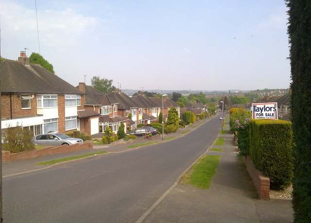
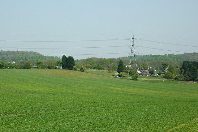
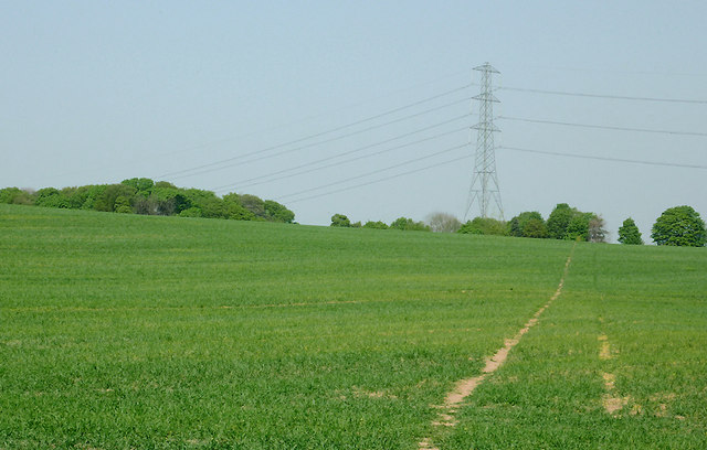
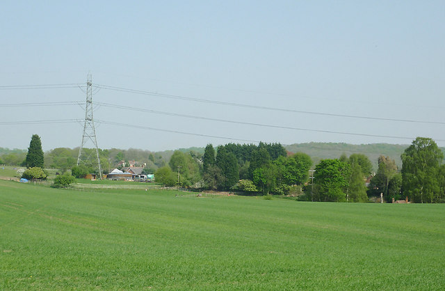
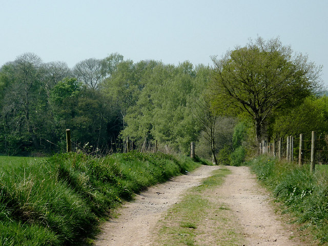
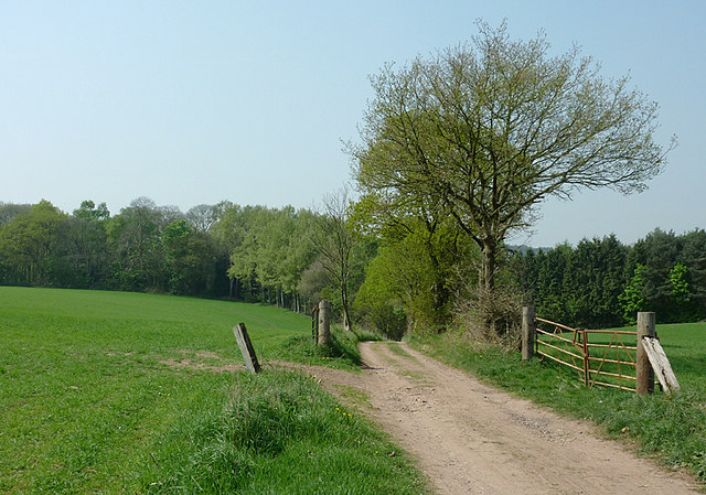
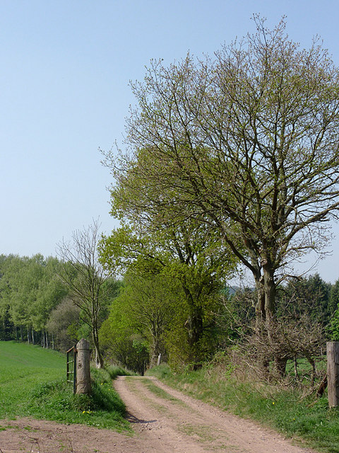
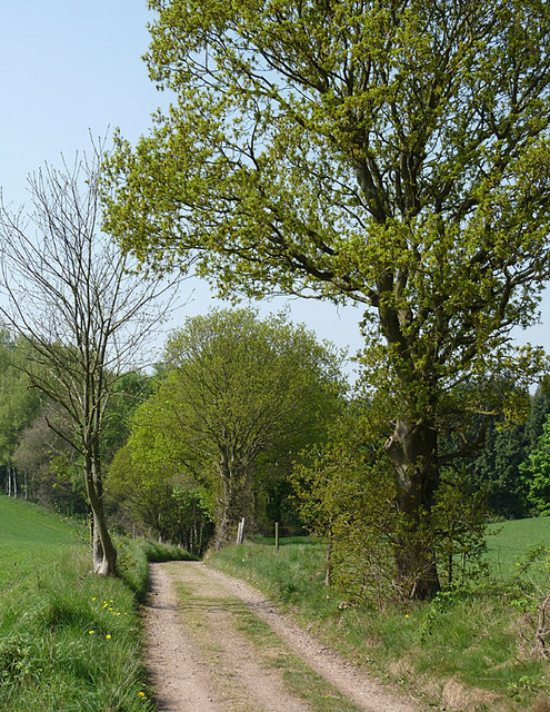
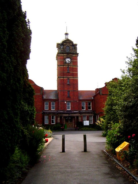
Friar's Gorse Images

Images are sourced within 2km of 52.476961/-2.1775167 or Grid Reference SO8886. Thanks to Geograph Open Source API. All images are credited.

Ridge Road looking toward Dudley and the Black Country
Cave at Prestwood near Stourton, Staffordshire This cave in the Triassic sandstone is on land belonging to Prestwood Cave Nursery. The nursery grows a limited range of hardy shrubs and other plants. Quality is high, and the prices are very reasonable. The hard winter of 2010-2011 killed many plants in nurseries all over the West Midlands, but enough remains here to continue trading.
Cave at Prestwood near Stourton, Staffordshire
This cave in the Triassic sandstone is on land belonging to Prestwood Cave Nursery. The nursery grows a limited range of hardy shrubs and other plants. Quality is high, and the prices are very reasonable. The hard winter of 2010-2011 killed many plants in nurseries all over the West Midlands, but enough remains here to continue trading.
Prestwood Cave Nursery near Stourton, Staffordshire The nursery grows a limited range of hardy shrubs and other plants. Quality is high, and the prices are very reasonable. The hard winter of 2010-2011 killed many plants in nurseries all over the West Midlands, but enough remains here to continue trading.
Prestwood Cave Nursery near Stourton, Staffordshire
The nursery grows a limited range of hardy shrubs and other plants. Quality is high, and the prices are very reasonable. The hard winter of 2010-2011 killed many plants in nurseries all over the West Midlands, but enough remains here to continue trading.
Bridleway near Stourton, Staffordshire The bridleway links Wolverhampton Road (A449) at Prestwood with Greensforge Lane and Gothersley Farm.
Bridleway near Stourton, Staffordshire
The bridleway links Wolverhampton Road (A449) at Prestwood with Greensforge Lane and Gothersley Farm.
Bridleway near Stourton, Staffordshire The bridleway links Wolverhampton Road (A449) at Prestwood with Greensforge Lane and Gothersley Farm.
Bridleway near Stourton, Staffordshire
The bridleway links Wolverhampton Road (A449) at Prestwood with Greensforge Lane and Gothersley Farm.
Bridleway near Stourton, Staffordshire The bridleway links Wolverhampton Road (A449) at Prestwood with Greensforge Lane and Gothersley Farm.
Bridleway near Stourton, Staffordshire
The bridleway links Wolverhampton Road (A449) at Prestwood with Greensforge Lane and Gothersley Farm.
Staffordshire and Worcestershire Canal near Prestwood, Staffordshire Seen from the bridleway crossing Prestwood Bridge (No 34). The canal was opened in 1772, engineered by James Brindley. It joins the River Severn at Stourport to the Trent and Mersey Canal at Great Haywood Junction in Staffordshire. There are 43 locks (45 if you don't fancy the deep wide locks at Stourport) and the canal is 46 miles in length.
Staffordshire and Worcestershire Canal near Prestwood, Staffordshire
Seen from the bridleway crossing Prestwood Bridge (No 34). The canal was opened in 1772, engineered by James Brindley. It joins the River Severn at Stourport to the Trent and Mersey Canal at Great Haywood Junction in Staffordshire. There are 43 locks (45 if you don't fancy the deep wide locks at Stourport) and the canal is 46 miles in length.
Public footpath and stile near Prestwood, Staffordshire The path across this crop field seems little used. The bridleway from the Coach House which is mapped as being behind the camera does not exist at all now.
Public footpath and stile near Prestwood, Staffordshire
The path across this crop field seems little used. The bridleway from the Coach House which is mapped as being behind the camera does not exist at all now.
Farmland near Prestwood, Staffordshire Seen from the bridleway near Prestwood Cave Nursery.
Farmland near Prestwood, Staffordshire
Seen from the bridleway near Prestwood Cave Nursery.
Farmland near Prestwood, Staffordshire Looking across the fields from the bridleway between Prestwood and Greensforge Lane.
Farmland near Prestwood, Staffordshire
Looking across the fields from the bridleway between Prestwood and Greensforge Lane.
Crop field near Prestwood, Staffordshire What appear to be tractor wheel tracks actually follow almost exactly the course of a public footpath across the field to Foley Lane.
Crop field near Prestwood, Staffordshire
What appear to be tractor wheel tracks actually follow almost exactly the course of a public footpath across the field to Foley Lane.
Arable Land near Prestwood, Staffordshire Looking across the fields from the bridleway between Prestwood and Greensforge Lane. The tall dark green conifers in the centre of the image are by the A449 near Yew Tree Farm.
Arable Land near Prestwood, Staffordshire
Looking across the fields from the bridleway between Prestwood and Greensforge Lane. The tall dark green conifers in the centre of the image are by the A449 near Yew Tree Farm.
Bridleway north of Stourton, Staffordshire The bridleway links Wolverhampton Road (A449) at Prestwood with Greensforge Lane and Gothersley Farm. The woodland ahead is on the slope down to the Smestow River. To the right of the bridleway there is Gothersley Rough, and to the left, Colbourn's Rough.
Bridleway north of Stourton, Staffordshire
The bridleway links Wolverhampton Road (A449) at Prestwood with Greensforge Lane and Gothersley Farm. The woodland ahead is on the slope down to the Smestow River. To the right of the bridleway there is Gothersley Rough, and to the left, Colbourn's Rough.
Bridleway north of Stourton, Staffordshire The bridleway links Gothersley Farm and Greensforge Lane with the Wolverhampton Road (A449) at Prestwood. On the skyline are Lousy Wood and Crabtree Rough.
Bridleway north of Stourton, Staffordshire
The bridleway links Gothersley Farm and Greensforge Lane with the Wolverhampton Road (A449) at Prestwood. On the skyline are Lousy Wood and Crabtree Rough.
Bridleway north of Stourton, Staffordshire The bridleway links Wolverhampton Road (A449) at Prestwood with Greensforge Lane and Gothersley Farm, then on to The Million plantation and Enville. The woodland ahead is on the slope down to the Smestow River, east of the canal. To the right of the bridleway there is Gothersley Rough, and to the left, Colbourn's Rough.
Bridleway north of Stourton, Staffordshire
The bridleway links Wolverhampton Road (A449) at Prestwood with Greensforge Lane and Gothersley Farm, then on to The Million plantation and Enville. The woodland ahead is on the slope down to the Smestow River, east of the canal. To the right of the bridleway there is Gothersley Rough, and to the left, Colbourn's Rough.
Bridleway north of Stourton, Staffordshire The bridleway links Wolverhampton Road (A449) at Prestwood with Greensforge Lane and Gothersley Farm. The woodland ahead is on the slope down to the Smestow River. To the right of the bridleway there is Gothersley Rough, and to the left, Colbourn's Rough.
Bridleway north of Stourton, Staffordshire
The bridleway links Wolverhampton Road (A449) at Prestwood with Greensforge Lane and Gothersley Farm. The woodland ahead is on the slope down to the Smestow River. To the right of the bridleway there is Gothersley Rough, and to the left, Colbourn's Rough.
Bridleway north of Stourton, Staffordshire The bridleway links Wolverhampton Road (A449) at Prestwood with Greensforge Lane, Gothersley Farm and The Million. The woodland ahead is on the slope down to the canal and the Smestow River. To the right of the bridleway there is Gothersley Rough, and to the left, Colbourn's Rough.
Bridleway north of Stourton, Staffordshire
The bridleway links Wolverhampton Road (A449) at Prestwood with Greensforge Lane, Gothersley Farm and The Million. The woodland ahead is on the slope down to the canal and the Smestow River. To the right of the bridleway there is Gothersley Rough, and to the left, Colbourn's Rough.
Show me another place!

Friar's Gorse is located at Grid Ref: SO8886 (Lat: 52.476961, Lng: -2.1775167)

Administrative County: Staffordshire

District: South Staffordshire

Police Authority: Staffordshire

What 3 Words

///friends.obtain.slope. Near Kingswinford, West Midlands

Related Wikis

Related Videos

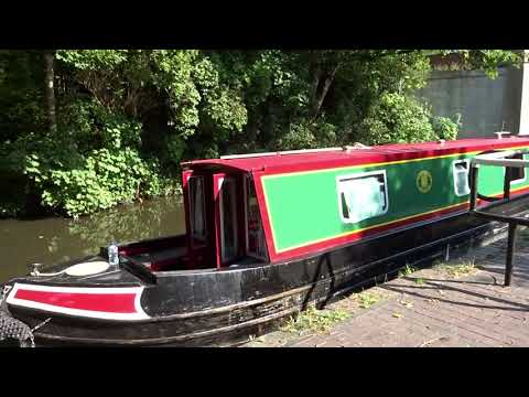
UK Summer Vacation ( Staycation ) on a Narrow Boat..Pt3. Frm 12 Sep til 19 Sep 2020

DayThree of are Narrow Boat Adventure on HMS Ginger. Starting From Merry Hill today passing through lovely areas and ...

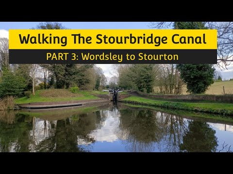
Walking The Stourbridge Canal (Part 3)

The final part of my walk along the Stourbridge Canal, the last bit of my Dudley and Stourbridge Canal series. Starting at Wordsley ...

Kingswinford Concert Band "A Holiday Swingalong" at Kingswinford Community Centre

About Kingswinford Concert Band is a sociable and friendly group of musicians who enjoy getting together to make music.

Nearby Amenities

Located within 500m of 52.476961,-2.1775167
Bus Stop
Balmoral Rd / Hamilton Drive
Bus: yes
Naptan AtcoCode: 43000841401
Naptan Bearing: N
Naptan BusStopType: MKD
Naptan CommonName: Hamilton Drive
Naptan Indicator: opp
Naptan NaptanCode: nwmjwamd
Naptan PlusbusZoneRef: BHAMNWS
Naptan Status: ACT
Naptan StopType: BCT
Naptan Street: BALMORAL RD
Naptan Towards: Kingswinford
Naptan Verified: no
Public Transport: platform
Route Ref: 226;267
Source: WMCA
Lat/Long: 52.4795899/-2.176295
Bus Stop
Balmoral Rd / Hamilton Drive
Bus: yes
Naptan AtcoCode: 43000841402
Naptan Bearing: S
Naptan BusStopType: MKD
Naptan CommonName: Hamilton Drive
Naptan Indicator: adj
Naptan NaptanCode: nwmjwamg
Naptan PlusbusZoneRef: BHAMNWS
Naptan Status: ACT
Naptan StopType: BCT
Naptan Street: BALMORAL RD
Naptan Towards: Wordsley
Naptan Verified: no
Public Transport: platform
Route Ref: 226;267
Source: WMCA
Lat/Long: 52.4796799/-2.1762218
Bus Stop
Balmoral Rd / Westminster Rd
Bus: yes
Naptan AtcoCode: 43000841501
Naptan Bearing: NW
Naptan BusStopType: MKD
Naptan CommonName: Westminster Rd
Naptan Indicator: opp
Naptan NaptanCode: nwmjwamj
Naptan PlusbusZoneRef: BHAMNWS
Naptan Status: ACT
Naptan StopType: BCT
Naptan Street: BALMORAL RD
Naptan Towards: Kingswinford
Naptan Verified: no
Public Transport: platform
Route Ref: 226;267
Source: WMCA
Lat/Long: 52.4772557/-2.1740624
Bus Stop
Balmoral Rd / Westminster Rd
Bus: yes
Naptan AtcoCode: 43000841502
Naptan Bearing: SE
Naptan BusStopType: MKD
Naptan CommonName: Westminster Rd
Naptan Indicator: adj
Naptan NaptanCode: nwmjwamp
Naptan PlusbusZoneRef: BHAMNWS
Naptan Status: ACT
Naptan StopType: BCT
Naptan Street: BALMORAL RD
Naptan Towards: Wordsley
Naptan Verified: no
Public Transport: platform
Route Ref: 226;267
Source: WMCA
Lat/Long: 52.4769329/-2.1735311
Bus Stop
Balmoral Rd / Braemar Avenue
Bus: yes
Naptan AtcoCode: 43000841601
Naptan Bearing: NW
Naptan BusStopType: MKD
Naptan CommonName: Braemar Avenue
Naptan Indicator: adj
Naptan NaptanCode: nwmjwamt
Naptan PlusbusZoneRef: BHAMNWS
Naptan Status: ACT
Naptan StopType: BCT
Naptan Street: BALMORAL RD
Naptan Towards: Kingswinford
Naptan Verified: no
Public Transport: platform
Route Ref: 226;267
Source: WMCA
Lat/Long: 52.474984/-2.1721248
Bus Stop
Balmoral Rd / Braemar Avenue
Bus: yes
Naptan AtcoCode: 43000841602
Naptan Bearing: SE
Naptan BusStopType: MKD
Naptan CommonName: Braemar Avenue
Naptan Indicator: opp
Naptan NaptanCode: nwmjwamw
Naptan PlusbusZoneRef: BHAMNWS
Naptan Status: ACT
Naptan StopType: BCT
Naptan Street: BALMORAL RD
Naptan Towards: Wordsley
Naptan Verified: no
Public Transport: platform
Route Ref: 226;267
Source: WMCA
Lat/Long: 52.47458/-2.1717551
Turning Circle
Source: bing
Lat/Long: 52.4783817/-2.1714429
Generator Method: photovoltaic
Generator Output Electricity: yes
Generator Source: solar
Generator Type: solar_photovoltaic_panel
Location: roof
Power: generator
Lat/Long: 52.4805652/-2.1744561
Generator Method: photovoltaic
Generator Output Electricity: yes
Generator Source: solar
Generator Type: solar_photovoltaic_panel
Location: roof
Power: generator
Lat/Long: 52.4792632/-2.1713582
Generator Method: photovoltaic
Generator Output Electricity: yes
Generator Source: solar
Generator Type: solar_photovoltaic_panel
Location: roof
Power: generator
Lat/Long: 52.4739725/-2.1730319
Generator Method: photovoltaic
Generator Output Electricity: yes
Generator Source: solar
Generator Type: solar_photovoltaic_panel
Location: roof
Power: generator
Lat/Long: 52.474604/-2.174035
Generator Method: photovoltaic
Generator Output Electricity: yes
Generator Source: solar
Generator Type: solar_photovoltaic_panel
Location: roof
Power: generator
Lat/Long: 52.4773617/-2.1744803
Generator Method: photovoltaic
Generator Output Electricity: yes
Generator Source: solar
Generator Type: solar_photovoltaic_panel
Location: roof
Power: generator
Lat/Long: 52.4771951/-2.1734543
Generator Method: photovoltaic
Generator Output Electricity: yes
Generator Source: solar
Generator Type: solar_photovoltaic_panel
Location: roof
Power: generator
Lat/Long: 52.4771787/-2.173516
The data included in this document is from www.openstreetmap.org. The data is made available under ODbL.

Have you been to Friar's Gorse?

Leave your review of Friar's Gorse below (or comments, questions and feedback).