Burybank Wood

Wood, Forest in Staffordshire Stafford

England

Burybank Wood

Entrance to Downs Banks, and war memorial The granite stone on the left is inscribed:
THESE DOWNS WERE PURCHASED BY JOHN JOULE AND SONS LTD
ENDOWED BY PUBLIC SUBSCRIPTION
AND PRESENTED
TO THE NATIONAL TRUST
ON THE 22ND DAY OF JULY 1950
AS A THANK OFFERING FOR VICTORY
IN THE WAR OF 1939-1945
AND AS A MEMORIAL
TO THOSE WHO FELL IN THE WAR
Entrance to Downs Banks, and war memorial Credit: Tim Heaton

Burybank Wood is a picturesque forest located in the county of Staffordshire, England. Situated near the village of Burybank, this wood is renowned for its natural beauty and diverse wildlife. Covering an area of approximately 100 acres, Burybank Wood is a popular destination for nature enthusiasts and outdoor enthusiasts alike.

The wood is characterized by its dense canopy of oak, beech, and birch trees, which provide a sheltered and enchanting atmosphere. Walking through the wood, visitors can enjoy the peaceful ambiance, surrounded by the sounds of birds chirping and leaves rustling in the gentle breeze. The forest floor is carpeted with a rich variety of flora, including bluebells, wild garlic, and wood sorrel, adding vibrant colors to the landscape during the spring and summer months.

Burybank Wood is home to a wide range of wildlife, including deer, foxes, badgers, and numerous species of birds. Nature lovers can spot buzzards soaring above the treetops, while lucky observers may catch a glimpse of elusive creatures such as red squirrels or tawny owls. The wood is also home to a diverse insect population, with butterflies, beetles, and dragonflies fluttering among the foliage.

For those seeking outdoor activities, Burybank Wood offers several walking trails, allowing visitors to explore the forest at their own pace. These paths wind through the wood, providing opportunities to admire the natural surroundings and discover hidden gems along the way. The wood is also equipped with picnic areas, making it an ideal spot for a family day out.

Overall, Burybank Wood is a magical and serene location, offering a tranquil escape from the hustle and bustle of everyday life. Its natural beauty, diverse wildlife, and recreational opportunities make it a must-visit destination for nature enthusiasts and those seeking a peaceful retreat in the heart of Staffordshire.

If you have any feedback on the listing, please let us know in the comments section below.

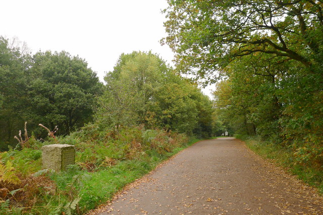
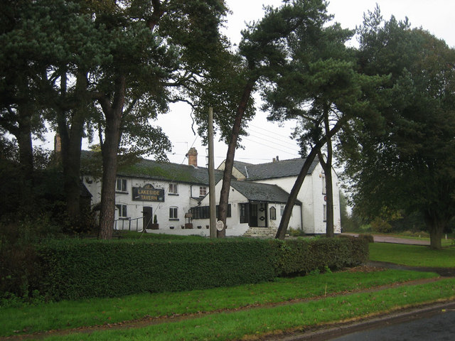
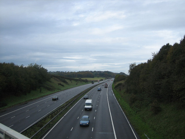
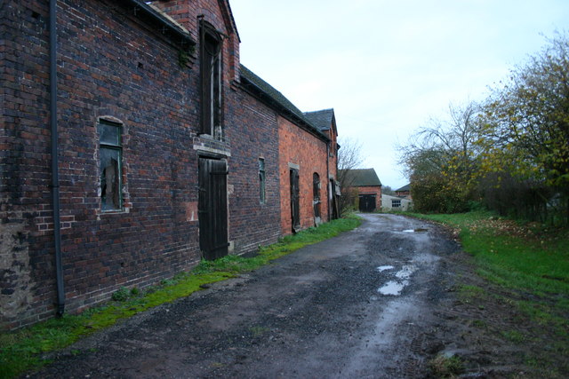
Burybank Wood Images

Images are sourced within 2km of 52.920791/-2.1755215 or Grid Reference SJ8835. Thanks to Geograph Open Source API. All images are credited.

Entrance to Downs Banks, and war memorial The granite stone on the left is inscribed:
THESE DOWNS WERE PURCHASED BY JOHN JOULE AND SONS LTD
ENDOWED BY PUBLIC SUBSCRIPTION
AND PRESENTED
TO THE NATIONAL TRUST
ON THE 22ND DAY OF JULY 1950
AS A THANK OFFERING FOR VICTORY
IN THE WAR OF 1939-1945
AND AS A MEMORIAL
TO THOSE WHO FELL IN THE WAR
Entrance to Downs Banks, and war memorial
The granite stone on the left is inscribed: THESE DOWNS WERE PURCHASED BY JOHN JOULE AND SONS LTD ENDOWED BY PUBLIC SUBSCRIPTION AND PRESENTED TO THE NATIONAL TRUST ON THE 22ND DAY OF JULY 1950 AS A THANK OFFERING FOR VICTORY IN THE WAR OF 1939-1945 AND AS A MEMORIAL TO THOSE WHO FELL IN THE WAR
Lane near Common Plot Viewed from the south west corner of the grid square as the lane approaches Old Road.
Lane near Common Plot
Viewed from the south west corner of the grid square as the lane approaches Old Road.
Footpath near Outlanes
Darlaston Inn Situated in the centre of a roundabout just outside of stone.
Darlaston Inn
Situated in the centre of a roundabout just outside of stone.
The Trent & Mersey Canal above Meaford locks
Turnover Bridge on Trent & Mersey Canal Taken near to the site of the former power station at Meaford, north of Stone
Turnover Bridge on Trent & Mersey Canal
Taken near to the site of the former power station at Meaford, north of Stone
Lakeside Tavern Lakeside Tavern on the road between Meaford and Barlaston adjacent to Barlaston Golf Course
Lakeside Tavern
Lakeside Tavern on the road between Meaford and Barlaston adjacent to Barlaston Golf Course
M6 Motorway Looking north along the M6 from the bridge on the A51, Stone to Nantwich road
M6 Motorway
Looking north along the M6 from the bridge on the A51, Stone to Nantwich road
Derelict Farm Buildings This is Blakelow Farm. These farm buildings appear to be derelict although I heard work in progress at the location.
Derelict Farm Buildings
This is Blakelow Farm. These farm buildings appear to be derelict although I heard work in progress at the location.
Muddy Farm Track This muddy track is on Darlaston Park near to Stone.
Muddy Farm Track
This muddy track is on Darlaston Park near to Stone.
A51 towards Stone This is the A51 looking towards the Darlaston Roundabout where the road joins the A34 north of Stone.
A51 towards Stone
This is the A51 looking towards the Darlaston Roundabout where the road joins the A34 north of Stone.
Saxon Lowe This is a view of Saxon Lowe on Tittensor Chase, from a public footpath.  Unfortunately this is on private land so a closer, circumnavigation of the hill is unable to be made... yet.
Saxon Lowe
This is a view of Saxon Lowe on Tittensor Chase, from a public footpath. Unfortunately this is on private land so a closer, circumnavigation of the hill is unable to be made... yet.
Darlaston Park Darlaston Park near Stone, with Home Farm on the right and a new building 'going up' on the left.
Darlaston Park
Darlaston Park near Stone, with Home Farm on the right and a new building 'going up' on the left.
Darlaston Park near Stone Looking back towards Yarnfield Lane on Darlaston Park.
Darlaston Park near Stone
Looking back towards Yarnfield Lane on Darlaston Park.
No Access, Private Property This track on Darlaston Park leads alongside woodland to Meaford near to Stone but unfortunately it cannot be used by Jo Public!
No Access, Private Property
This track on Darlaston Park leads alongside woodland to Meaford near to Stone but unfortunately it cannot be used by Jo Public!
Woodland and Field This field next to private woodland on the Darlaston Park.
Woodland and Field
This field next to private woodland on the Darlaston Park.
A51 to Chester This view is at the top of Bury Bank, Darlaston near Stone, on the A51 looking towards Chester.
A51 to Chester
This view is at the top of Bury Bank, Darlaston near Stone, on the A51 looking towards Chester.
Track to Tittensor This track runs from Bury Bank on the A51 near to Stone and goes to Tittensor.
Track to Tittensor
This track runs from Bury Bank on the A51 near to Stone and goes to Tittensor.
Show me another place!

Burybank Wood is located at Grid Ref: SJ8835 (Lat: 52.920791, Lng: -2.1755215)

Administrative County: Staffordshire

District: Stafford

Police Authority: Staffordshire

What 3 Words

///dined.love.agenda. Near Stone, Staffordshire

Related Wikis

Bury Bank

Bury Bank is an Iron Age hillfort in Staffordshire, England, about 1.5 miles (2.4 km) north-west of Stone and near the village of Meaford. It is a scheduled...

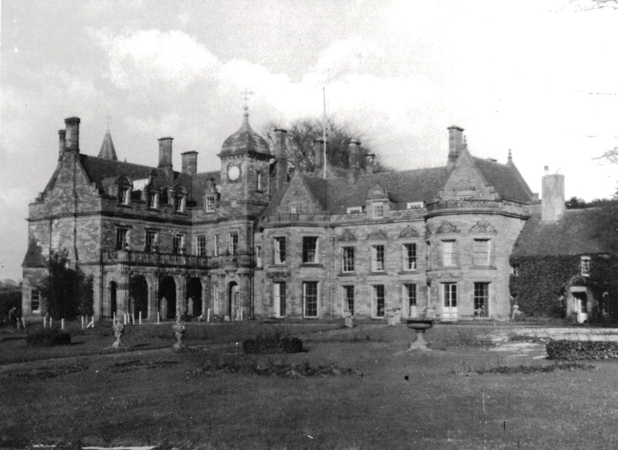
Meaford Hall, Staffordshire

Meaford Hall in Staffordshire, England is a 17th-century country house at Meaford, near Stone, Staffordshire. The River Trent runs through the estate's...

Meaford Power Station

Meaford Power Station was a coal-fired power station situated on the River Trent at Meaford near Stone in Staffordshire. == History == === Meaford A... ===

Dorlestone Hall

Dorlestone Hall was a manor house at Darlaston, a locality also known as Dorlestone, near Stone, Staffordshire, England, on the Trent. The Hall was built...

Stone railway station

Stone railway station serves the market town of Stone, Staffordshire, England. The station is located on a junction of the Colwich to Manchester spur of...

Downs Banks

Downs Bank, also known as Barlaston Downs, is an area of open countryside, located two miles (3 km) north of the town of Stone in Staffordshire, and four...

Stone Rural District

Stone Rural District was a rural district in Staffordshire, England. It was created in 1894 and abolished by virtue of the Local Government Act 1972 in...

Barlaston railway station

Barlaston railway station served the village of Barlaston in Staffordshire, England. This station was opened on 17 April 1848 and is on the first line...

Nearby Amenities

Located within 500m of 52.920791,-2.1755215
Bus Stop
Bury Bank
Bus: yes
Naptan AtcoCode: 3800C739801
Naptan Bearing: N
Naptan CommonName: Bury Bank
Naptan Indicator: Adj
Naptan Landmark: Bury Bank
Naptan Street: Bankside
Naptan Verified: no
Public Transport: platform
Source: naptan_import
Lat/Long: 52.9186795/-2.1726147
Bus Stop
Bury Bank
Bus: yes
Naptan AtcoCode: 3800C739802
Naptan Bearing: S
Naptan CommonName: Bury Bank
Naptan Indicator: Opp
Naptan Landmark: Bury Bank
Naptan Street: Bankside
Naptan Verified: no
Public Transport: platform
Source: naptan_import
Lat/Long: 52.9189502/-2.1719019
Speed Camera
Lat/Long: 52.9247699/-2.1743651
Power: tower
Source: Bing
Lat/Long: 52.9230991/-2.1765721
Power: tower
Source: Bing
Lat/Long: 52.9224786/-2.181983
Power: tower
Source: Bing
Lat/Long: 52.9233681/-2.1741968
Power: pole
Lat/Long: 52.9238413/-2.1716289
Power: pole
Lat/Long: 52.9246627/-2.1736945
Barrier: stile
Lat/Long: 52.9200849/-2.1798347
Bury Bank
Natural: peak
Lat/Long: 52.9202464/-2.1767238
Barrier: stile
Lat/Long: 52.9205946/-2.1805883
Post Box
Collection Times: Mo-Fr 16:00; Sa 07:30
Post Box Type: wall
Ref: ST15 227
Source: survey
Lat/Long: 52.9171948/-2.1731497
Power: pole
Lat/Long: 52.9222161/-2.1725033
Power: pole
Lat/Long: 52.9238314/-2.1732891
Power: pole
Lat/Long: 52.9195221/-2.1820026
Addr Housename: Firs Cottage
Lat/Long: 52.9246429/-2.1748511
Addr Housename: Meardale Cottage
Lat/Long: 52.9241255/-2.1745936
Power: pole
Lat/Long: 52.9230046/-2.1728885
Power: pole
Lat/Long: 52.9246475/-2.1737602
Direction: 180
Man Made: surveillance
Surveillance: public
Surveillance Type: ALPR
Surveillance Zone: traffic
Lat/Long: 52.9185646/-2.1724678
Camera Direction: 120
Camera Mount: street_lamp
Camera Type: fixed
Man Made: surveillance
Surveillance: public
Surveillance Type: camera
Surveillance Zone: traffic
Lat/Long: 52.9176088/-2.1742384
Darlaston
Place: hamlet
Lat/Long: 52.9171682/-2.1736741
Barrier: block
Lat/Long: 52.9176917/-2.1727338
Barrier: block
Lat/Long: 52.917895/-2.1726683
The data included in this document is from www.openstreetmap.org. The data is made available under ODbL.

Have you been to Burybank Wood?

Leave your review of Burybank Wood below (or comments, questions and feedback).