Peat Moor

Wood, Forest in Dorset

England

Peat Moor

Old Boundary Marker on Lower Hyde Heath Boundary Marker on Lower Hyde Heath, southwest of Stroud Bridge. On the boundary of Bere Regis and Wareham St Martin parishes.

Milestone Society National ID: DO_BERWSM01bm
Old Boundary Marker on Lower Hyde Heath Credit: W Halliday

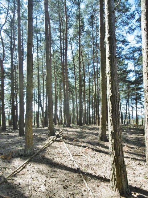
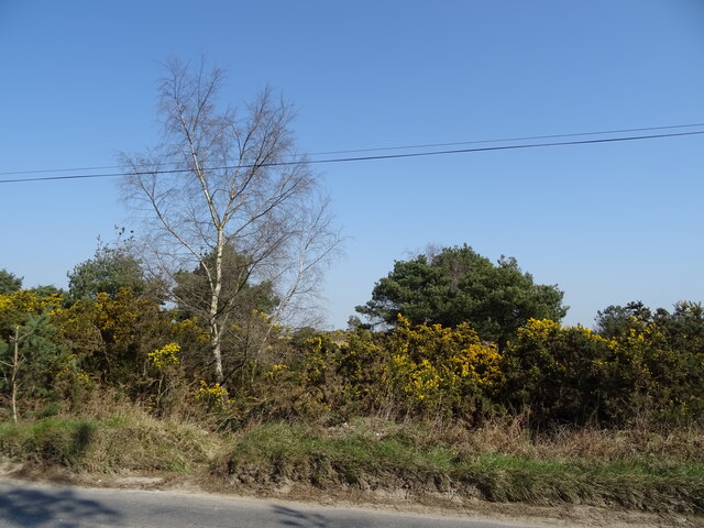
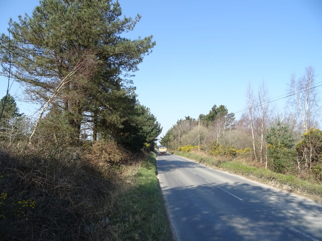
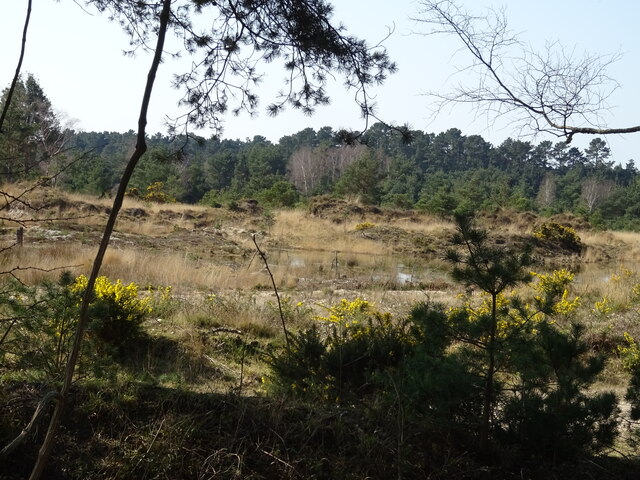
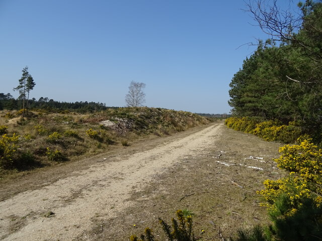
Peat Moor is a picturesque woodland area located in Dorset, England. Situated near the village of Peatmoor, the forest covers an expansive area of approximately 500 acres. It is a popular destination for nature enthusiasts and outdoor enthusiasts alike.

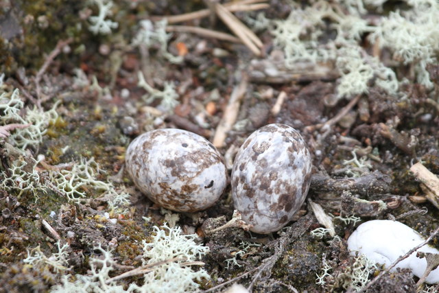
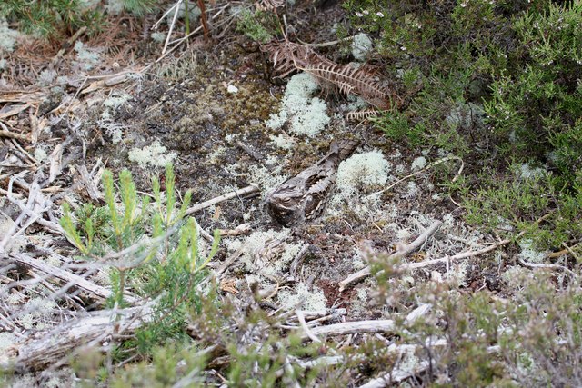
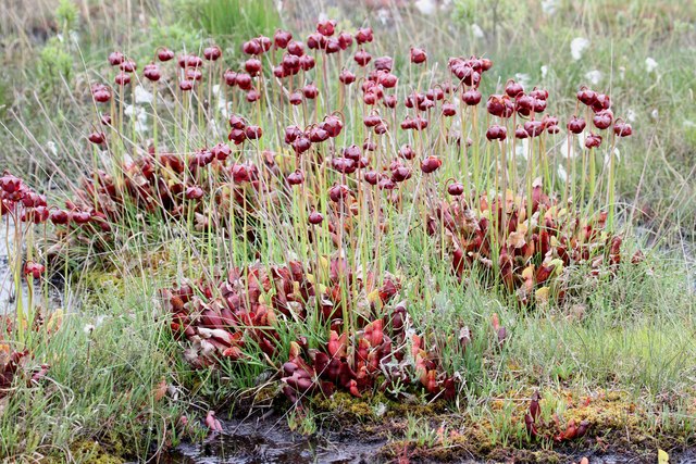
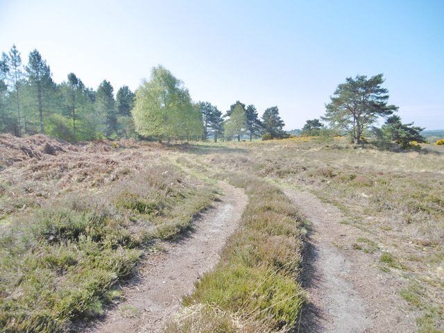
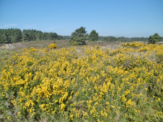
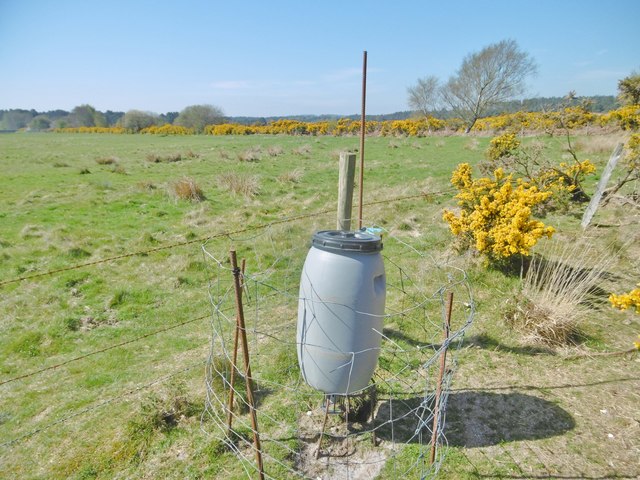
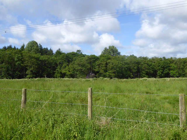
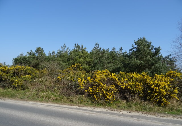
The forest boasts a diverse range of habitats, including wetlands, heathland, and woodland, making it a haven for wildlife. Visitors to Peat Moor can expect to encounter a variety of flora and fauna, including deer, foxes, badgers, and a rich variety of bird species. Rare species such as the Dartford warbler and sand lizard have also been spotted in the area.

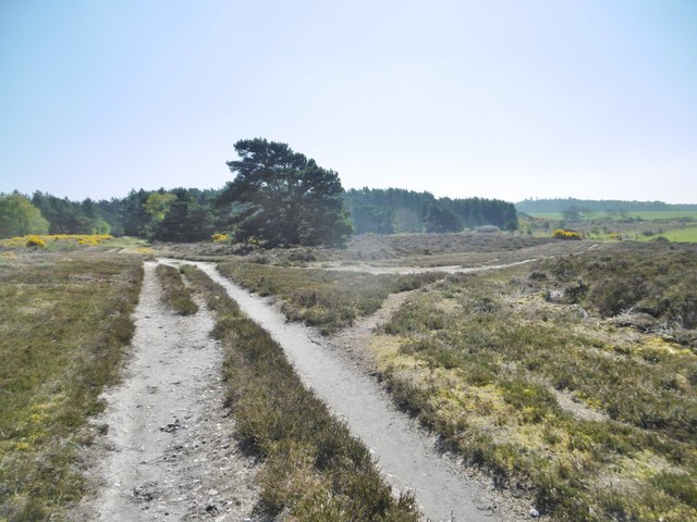
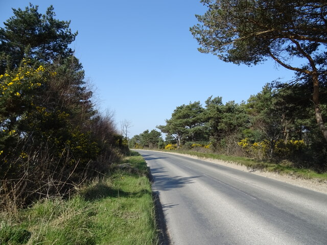
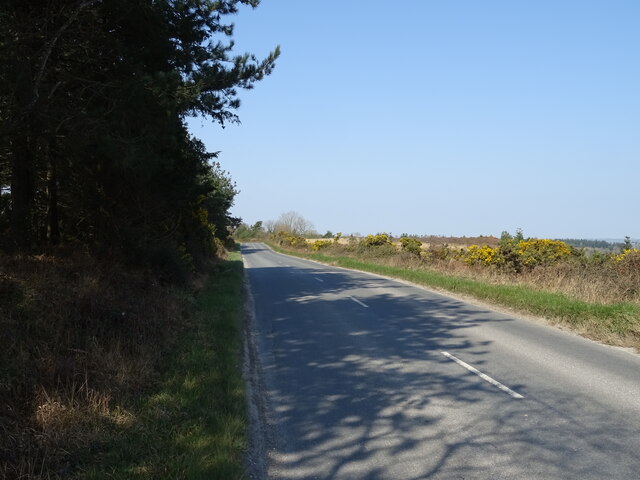
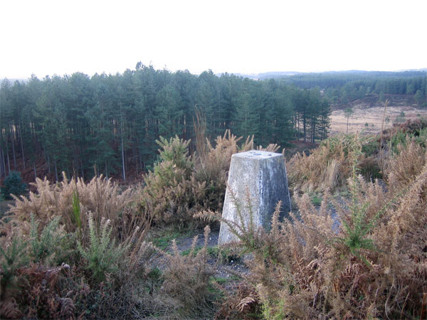
The forest is crisscrossed with a network of well-maintained walking trails, allowing visitors to explore the natural beauty of Peat Moor at their own pace. These trails offer stunning views of the surrounding countryside, with rolling hills and meandering streams adding to the charm of the area.

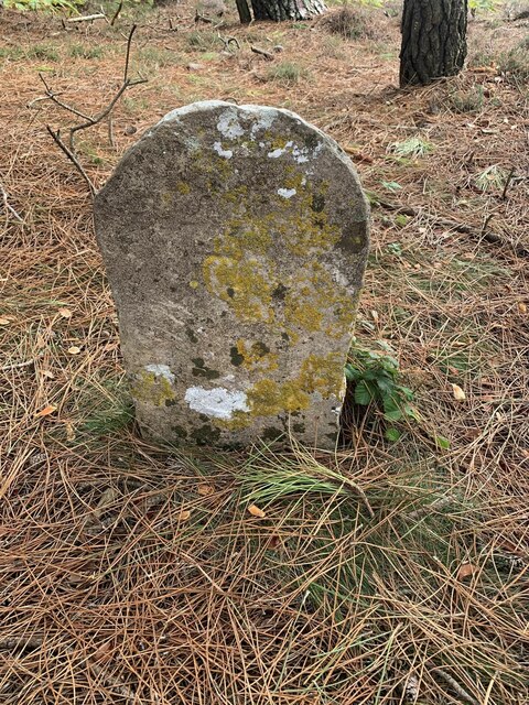
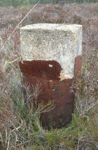
Peat Moor also holds historical significance, as it was once used for peat extraction during the 19th century. Peat was an important fuel source during this time, and the remnants of the peat extraction can still be seen today. These historical features add an interesting layer to the natural beauty of the forest.

Overall, Peat Moor in Dorset is a captivating woodland area that offers a diverse range of habitats and a wealth of wildlife. Its picturesque landscapes and historical significance make it a must-visit destination for nature lovers and history enthusiasts alike.

If you have any feedback on the listing, please let us know in the comments section below.

Peat Moor Images

Images are sourced within 2km of 50.70848/-2.1796096 or Grid Reference SY8789. Thanks to Geograph Open Source API. All images are credited.

Old Boundary Marker on Lower Hyde Heath Boundary Marker on Lower Hyde Heath, southwest of Stroud Bridge. On the boundary of Bere Regis and Wareham St Martin parishes.

Milestone Society National ID: DO_BERWSM01bm
Old Boundary Marker on Lower Hyde Heath
Boundary Marker on Lower Hyde Heath, southwest of Stroud Bridge. On the boundary of Bere Regis and Wareham St Martin parishes. Milestone Society National ID: DO_BERWSM01bm
Nightjar eggs, Philliols Heath Whilst trying to get a better vantage point to photograph a buzzard, I was surprised by a nightjar erupting from the heather just in front of me. To my astonishment, there in the place where the bird had been, were two very well camouflaged eggs. I didn't want to disturb the bird any more than I had already done so but I just had to get a shot of the bird itself...
Nightjar eggs, Philliols Heath
Whilst trying to get a better vantage point to photograph a buzzard, I was surprised by a nightjar erupting from the heather just in front of me. To my astonishment, there in the place where the bird had been, were two very well camouflaged eggs. I didn't want to disturb the bird any more than I had already done so but I just had to get a shot of the bird itself...
Nightjar, Philliols Heath Having disturbed the bird on its eggs the previous day I returned the following day to try to get a pic of the bird itself. This time I stayed about 10 feet away. The bird was virtually invisible due to its camouflaged plumage; although it appears to be dozing with just a tiny slit of eye visible, this is simply a further attempt by the bird to become invisible; it is actually wide awake but hiding its very dark and very visible eyes.
Nightjar, Philliols Heath
Having disturbed the bird on its eggs the previous day I returned the following day to try to get a pic of the bird itself. This time I stayed about 10 feet away. The bird was virtually invisible due to its camouflaged plumage; although it appears to be dozing with just a tiny slit of eye visible, this is simply a further attempt by the bird to become invisible; it is actually wide awake but hiding its very dark and very visible eyes.
Pitcher plants, Philliols Heath My understanding is that these plants are sarracenia purpurea, the purple pitcher plant, an insectivorous plant native of North America. This pic shows three large groups but a wider angle would reveal closer to 50 of them. I know that many believe that as an alien species they should be removed and destroyed but whatever your belief, you can't deny their beauty and the fact that they're fascinating.
Pitcher plants, Philliols Heath
My understanding is that these plants are sarracenia purpurea, the purple pitcher plant, an insectivorous plant native of North America. This pic shows three large groups but a wider angle would reveal closer to 50 of them. I know that many believe that as an alien species they should be removed and destroyed but whatever your belief, you can't deny their beauty and the fact that they're fascinating.
Lower Hyde Heath, track On the Trigon Estate, access land.
Lower Hyde Heath, track
On the Trigon Estate, access land.
Lower Hyde Heath, gorse On access land, on the Trigon Estate. Bushes were probably cut last year, providing plants of a similar size.
Lower Hyde Heath, gorse
On access land, on the Trigon Estate. Bushes were probably cut last year, providing plants of a similar size.
Lower Hyde Heath, track junction On access land, on the Trigon Estate.
Lower Hyde Heath, track junction
On access land, on the Trigon Estate.
Lower Hyde Heath, plantation On access land, on the Trigon Estate.
Lower Hyde Heath, plantation
On access land, on the Trigon Estate.
Lower Hyde Common, bird feeder At the boundary of heathland and coarse grazing, on the Trigon Estate.
Lower Hyde Common, bird feeder
At the boundary of heathland and coarse grazing, on the Trigon Estate.
Woodland, River Piddle valley Looking across one of the strands of the Piddle, hidden by lush vegetation, but marked by the line of a white umbellifer.
Woodland, River Piddle valley
Looking across one of the strands of the Piddle, hidden by lush vegetation, but marked by the line of a white umbellifer.
Old Boundary Marker on Bloxworth Heath, Bloxworth parish Parish Boundary Marker in parish of Bloxworth (Purbeck District), Bloxworth Heath, 30m Southwest of forestry road overlooking wet grassland, on patch of dry heathland.

Surveyed

Milestone Society National ID: DO_BLXEST01pb
Old Boundary Marker on Bloxworth Heath, Bloxworth parish
Parish Boundary Marker in parish of Bloxworth (Purbeck District), Bloxworth Heath, 30m Southwest of forestry road overlooking wet grassland, on patch of dry heathland. Surveyed Milestone Society National ID: DO_BLXEST01pb
Bend in Puddletown Road
Woodland beside Puddletown Road
Puddletown Road
Puddletown Road
Gravel Pit, Stokeford Heath
Track, Stokeford Heath
Puddletown Road
Puddletown Road
Woodland beside Puddletown Road
Show me another place!

Peat Moor is located at Grid Ref: SY8789 (Lat: 50.70848, Lng: -2.1796096)

Unitary Authority: Dorset

Police Authority: Dorset

What 3 Words

///rivals.endlessly.diets. Near Bovington Camp, Dorset

Related Wikis

Wareham Forest

Wareham Forest is an area of countryside in Dorset, England, consisting of open heathland, including Decoy Heath and Gore Heath, and plantations of conifers...

Trigon Hill

Trigon Hill is a hill on the edge of a clay pit near Cold Harbour, Dorset, on the Dorset Heaths. It rises about 3 kilometres northwest of the centre of...

Monkey World

The Monkey World Ape Rescue Centre is a 65-acre (26.3 ha) ape and monkey sanctuary and rescue centre near Wool, Dorset, England. == History == Set up in...

Bere Stream

Bere Stream (grid reference SY860926) is an 11.2 hectare biological Site of Special Scientific Interest in Dorset, notified in 1977. == Sources == English...

Woolsbarrow Hillfort

Woolsbarrow Hillfort is a hillfort on Bloxworth Heath in the district of Purbeck in the county of Dorset, England. It dates to the period from the Late...

East Stoke, Dorset

East Stoke is a village in the English county of Dorset. It lies three miles west of the small town of Wareham and two miles east of Wool. In 2013 the...

Worgret Heath

Worgret Heath SSSI, Dorset (grid reference SY895871) is an 8.4 hectare biological Site of Special Scientific Interest in Dorset, notified in 1987.The site...

Woolbridge Manor House

Woolbridge Manor is a 17th-century manor house just outside the village of Wool, in Dorset, England. English Heritage have designated it a Grade II* listed...

Nearby Amenities

Located within 500m of 50.70848,-2.1796096
Power: tower
Source: bing
Lat/Long: 50.7050528/-2.1752894
Power: tower
Source: bing
Lat/Long: 50.7048688/-2.1800311
Material: wood
Power: pole
Source: bing
Lat/Long: 50.7043977/-2.1776698
The data included in this document is from www.openstreetmap.org. The data is made available under ODbL.

Have you been to Peat Moor?

Leave your review of Peat Moor below (or comments, questions and feedback).