Barratt's Coppice

Wood, Forest in Staffordshire South Staffordshire

England

Barratt's Coppice

Cave at Prestwood near Stourton, Staffordshire This cave in the Triassic sandstone is on land belonging to Prestwood Cave Nursery. The nursery grows a limited range of hardy shrubs and other plants. Quality is high, and the prices are very reasonable. The hard winter of 2010-2011 killed many plants in nurseries all over the West Midlands, but enough remains here to continue trading.
Cave at Prestwood near Stourton, Staffordshire Credit: Roger Kidd

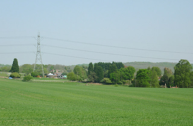
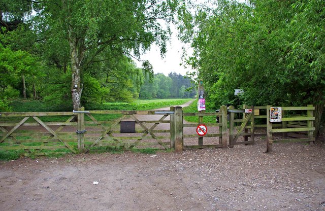
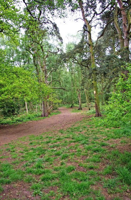
Barratt's Coppice is a picturesque woodland located in Staffordshire, England. Spanning over an area of approximately 100 acres, it is nestled in the countryside and offers a serene and tranquil environment. The coppice is a popular destination for nature lovers, hikers, and those seeking a peaceful escape from the bustling city life.

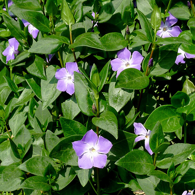
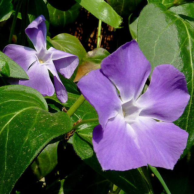
The woodland is home to a diverse range of flora and fauna, making it an ideal spot for nature enthusiasts. Visitors can expect to see a variety of tree species including oak, birch, and beech, which create a beautiful canopy and provide shade during the summer months. The forest floor is adorned with carpets of bluebells and wildflowers, adding to the charm of the woodland.

The wildlife in Barratt's Coppice is abundant and varied. Birdwatchers can spot a variety of species, such as woodpeckers, nuthatches, and warblers, while small mammals like squirrels and rabbits can be seen darting through the undergrowth. Additionally, there is a possibility of catching a glimpse of elusive creatures like badgers and foxes.

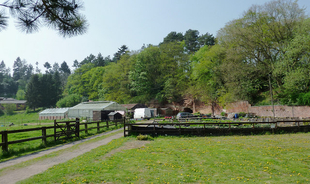
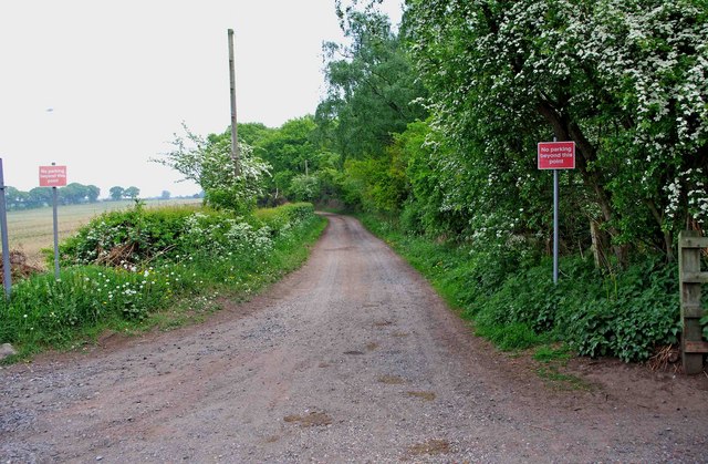
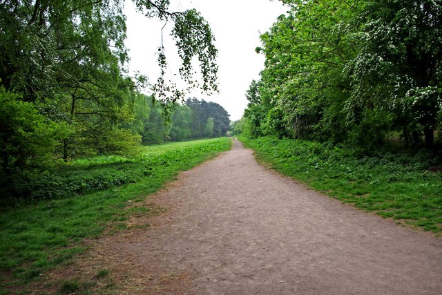
The woodland offers a network of well-maintained trails, allowing visitors to explore its natural beauty on foot. The paths wind their way through the forest, leading to secluded clearings and hidden glades, perfect for picnics and relaxation. There are also designated areas for camping and barbecues, making it an ideal location for outdoor activities.

Barratt's Coppice provides a peaceful retreat for those seeking a break from the daily grind. Its natural beauty, diverse wildlife, and well-maintained trails make it a must-visit destination for nature lovers and outdoor enthusiasts in Staffordshire.

If you have any feedback on the listing, please let us know in the comments section below.

Barratt's Coppice Images

Images are sourced within 2km of 52.458581/-2.1918064 or Grid Reference SO8784. Thanks to Geograph Open Source API. All images are credited.

Cave at Prestwood near Stourton, Staffordshire This cave in the Triassic sandstone is on land belonging to Prestwood Cave Nursery. The nursery grows a limited range of hardy shrubs and other plants. Quality is high, and the prices are very reasonable. The hard winter of 2010-2011 killed many plants in nurseries all over the West Midlands, but enough remains here to continue trading.
Cave at Prestwood near Stourton, Staffordshire
This cave in the Triassic sandstone is on land belonging to Prestwood Cave Nursery. The nursery grows a limited range of hardy shrubs and other plants. Quality is high, and the prices are very reasonable. The hard winter of 2010-2011 killed many plants in nurseries all over the West Midlands, but enough remains here to continue trading.
Prestwood Cave Nursery near Stourton, Staffordshire The nursery grows a limited range of hardy shrubs and other plants. Quality is high, and the prices are very reasonable. The hard winter of 2010-2011 killed many plants in nurseries all over the West Midlands, but enough remains here to continue trading.
Prestwood Cave Nursery near Stourton, Staffordshire
The nursery grows a limited range of hardy shrubs and other plants. Quality is high, and the prices are very reasonable. The hard winter of 2010-2011 killed many plants in nurseries all over the West Midlands, but enough remains here to continue trading.
Bridleway near Stourton, Staffordshire The bridleway links Wolverhampton Road (A449) at Prestwood with Greensforge Lane and Gothersley Farm.
Bridleway near Stourton, Staffordshire
The bridleway links Wolverhampton Road (A449) at Prestwood with Greensforge Lane and Gothersley Farm.
Bridleway near Stourton, Staffordshire The bridleway links Wolverhampton Road (A449) at Prestwood with Greensforge Lane and Gothersley Farm.
Bridleway near Stourton, Staffordshire
The bridleway links Wolverhampton Road (A449) at Prestwood with Greensforge Lane and Gothersley Farm.
Bridleway near Stourton, Staffordshire The bridleway links Wolverhampton Road (A449) at Prestwood with Greensforge Lane and Gothersley Farm.
Bridleway near Stourton, Staffordshire
The bridleway links Wolverhampton Road (A449) at Prestwood with Greensforge Lane and Gothersley Farm.
Public footpath and stile near Prestwood, Staffordshire The path across this crop field seems little used. The bridleway from the Coach House which is mapped as being behind the camera does not exist at all now.
Public footpath and stile near Prestwood, Staffordshire
The path across this crop field seems little used. The bridleway from the Coach House which is mapped as being behind the camera does not exist at all now.
Farmland near Prestwood, Staffordshire Seen from the bridleway near Prestwood Cave Nursery.
Farmland near Prestwood, Staffordshire
Seen from the bridleway near Prestwood Cave Nursery.
Arable Land near Prestwood, Staffordshire Looking across the fields from the bridleway between Prestwood and Greensforge Lane. The tall dark green conifers in the centre of the image are by the A449 near Yew Tree Farm.
Arable Land near Prestwood, Staffordshire
Looking across the fields from the bridleway between Prestwood and Greensforge Lane. The tall dark green conifers in the centre of the image are by the A449 near Yew Tree Farm.
Bridleway north of Stourton, Staffordshire The bridleway links Gothersley Farm and Greensforge Lane with the Wolverhampton Road (A449) at Prestwood. On the skyline are Lousy Wood and Crabtree Rough.
Bridleway north of Stourton, Staffordshire
The bridleway links Gothersley Farm and Greensforge Lane with the Wolverhampton Road (A449) at Prestwood. On the skyline are Lousy Wood and Crabtree Rough.
Periwinkle flowers near Prestwood Cave, Staffordshire These attractive periwinkle (Vinca major) flowers were growing at the edge of the bridleway below a conifer hedge, so it is probably an escape from the garden. 

<a href="https://www.geograph.org.uk/photo/2379158">SO8686 : Periwinkle flowers near Prestwood Cave, Staffordshire</a>
Periwinkle flowers near Prestwood Cave, Staffordshire
These attractive periwinkle (Vinca major) flowers were growing at the edge of the bridleway below a conifer hedge, so it is probably an escape from the garden. SO8686 : Periwinkle flowers near Prestwood Cave, Staffordshire
Periwinkle flowers near Prestwood Cave, Staffordshire These pretty periwinkle (Vinca major) flowers were growing at the edge of the bridleway below a conifer hedge, so it is probably an escape from the garden. 

<a href="https://www.geograph.org.uk/photo/2379146">SO8686 : Periwinkle flowers near Prestwood Cave, Staffordshire</a>
Periwinkle flowers near Prestwood Cave, Staffordshire
These pretty periwinkle (Vinca major) flowers were growing at the edge of the bridleway below a conifer hedge, so it is probably an escape from the garden. SO8686 : Periwinkle flowers near Prestwood Cave, Staffordshire
Prestwood Cave Nursery near Stourton, Staffordshire The cave and the Triassic sandstone rock face are clearly visible.

The nursery grows a limited range of hardy shrubs and other plants. Quality is high, and the prices are very reasonable. The hard winter of 2010-2011 killed many plants in nurseries all over the West Midlands, but enough remain here to continue propagation and trading.
Prestwood Cave Nursery near Stourton, Staffordshire
The cave and the Triassic sandstone rock face are clearly visible. The nursery grows a limited range of hardy shrubs and other plants. Quality is high, and the prices are very reasonable. The hard winter of 2010-2011 killed many plants in nurseries all over the West Midlands, but enough remain here to continue propagation and trading.
Entrance to Bunkers Hill Wood from Whittington Hall Lane near Whittington Bunkers Hill Wood is owned and managed by the Woodland Trust, a registered charity. Like all their sites, it is open to the public, and although there are only two public footpaths within the wood, there are a large number of other paths which are permissive footpaths. This view shows one of the entrances, adjacent to which is a small area for car parking.
Entrance to Bunkers Hill Wood from Whittington Hall Lane near Whittington
Bunkers Hill Wood is owned and managed by the Woodland Trust, a registered charity. Like all their sites, it is open to the public, and although there are only two public footpaths within the wood, there are a large number of other paths which are permissive footpaths. This view shows one of the entrances, adjacent to which is a small area for car parking.
Sandy Lane near Whittington This lane runs between Whittington Hall Lane and the edge of the town of Stourbridge. There is a public footpath running along its whole length. For part of the way, it runs adjacent to Bunkers Hill Wood.
Sandy Lane near Whittington
This lane runs between Whittington Hall Lane and the edge of the town of Stourbridge. There is a public footpath running along its whole length. For part of the way, it runs adjacent to Bunkers Hill Wood.
Whittington Hall Lane near Whittington On the left of the lane is a gravelled area, which can be used by visitors to the nearby Bunkers Hill Woods, when the small car park by the wood's entrance is full.
Whittington Hall Lane near Whittington
On the left of the lane is a gravelled area, which can be used by visitors to the nearby Bunkers Hill Woods, when the small car park by the wood's entrance is full.
Public footpath in Bunkers Hill Wood near Whittington This public footpath, which starts here at the entrance to the wood from Whittington Hall Lane, is one of the two public footpaths to be found in the woods. There are many other paths there however, which the public can use, but they are permissive footpaths. These date from when the wood was used for shooting purposes. This was before its acquisition by the Woodland Trust.
Public footpath in Bunkers Hill Wood near Whittington
This public footpath, which starts here at the entrance to the wood from Whittington Hall Lane, is one of the two public footpaths to be found in the woods. There are many other paths there however, which the public can use, but they are permissive footpaths. These date from when the wood was used for shooting purposes. This was before its acquisition by the Woodland Trust.
Bunkers Hill Wood near Whittington Hall Lane Bunkers Hill Wood is about half a mile west of Stourbridge. According to its owners, the Woodland Trust, it contains a mixture of predominantly secondary plantation trees with mature and veteran broadleaves and conifers, including Sweet Chestnut, Oak, Scots Pine and Corsican Pine. These are contrasted by younger stands of broadleaves and conifers and areas of naturally regenerated Birch.

The site, which was formerly part of Iverley Heath, was originally planted around 1860, with subsequent replanting as recently as 20 to 25 years ago.
Bunkers Hill Wood near Whittington Hall Lane
Bunkers Hill Wood is about half a mile west of Stourbridge. According to its owners, the Woodland Trust, it contains a mixture of predominantly secondary plantation trees with mature and veteran broadleaves and conifers, including Sweet Chestnut, Oak, Scots Pine and Corsican Pine. These are contrasted by younger stands of broadleaves and conifers and areas of naturally regenerated Birch. The site, which was formerly part of Iverley Heath, was originally planted around 1860, with subsequent replanting as recently as 20 to 25 years ago.
Show me another place!

Barratt's Coppice is located at Grid Ref: SO8784 (Lat: 52.458581, Lng: -2.1918064)

Administrative County: Staffordshire

District: South Staffordshire

Police Authority: Staffordshire

What 3 Words

///steadier.rejoined.before. Near Kinvere, Staffordshire

Related Wikis

Stourton, Staffordshire

Stourton is a hamlet in Staffordshire, England a few miles to the northwest of Stourbridge. There is a fair amount of dispute over the pronunciation, being...

Ridgewood High School, Wollaston

Ridgewood High School is a coeducational secondary school, a part of the Stour Vale Academy Trust situated in Wollaston (near Stourbridge), in the West...

Smestow Brook

The Smestow Brook, sometimes called the River Smestow, is a small river that plays an important part in the drainage of Wolverhampton, South Staffordshire...

Prestwood (Kinver)

Prestwood is a hamlet now in the parish of Kinver, but in the Kingswinford until the creation of Brierley Hill Urban District in the 1930s. == History... ==

Wollaston, West Midlands

Wollaston is a village on the outskirts of Stourbridge in the English West Midlands. It is located in the south of the Dudley Metropolitan Borough, one...

Amblecote

Amblecote is an affluent urban village in the Metropolitan Borough of Dudley in the West Midlands, England. It lies immediately north of the historic town...

Dunsley, Staffordshire

Dunsley is a hamlet in Kinver, Staffordshire, England. The settled part of the hamlet is the part of the village of Kinver, lying east of the River Stour...

Norton, Stourbridge

Norton is a suburb and council ward in the town of Stourbridge, West Midlands. It has a population of 11,943 in an area of 569 hectares. The population...

Related Videos

UK Summer Vacation ( Staycation ) on a Narrow Boat..Pt3. Frm 12 Sep til 19 Sep 2020

DayThree of are Narrow Boat Adventure on HMS Ginger. Starting From Merry Hill today passing through lovely areas and ...

Walking Mum down the aisle! (Dunsley Hall, Kinver Wedding)

Our final wedding of 2021 was the wedding of Vicky and Paul at St Leonard's Church in Frankley, an unusal wedding in a way, ...

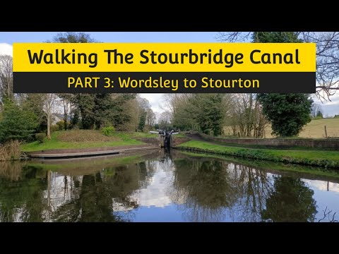
Walking The Stourbridge Canal (Part 3)

The final part of my walk along the Stourbridge Canal, the last bit of my Dudley and Stourbridge Canal series. Starting at Wordsley ...

Nearby Amenities

Located within 500m of 52.458581,-2.1918064
Bus Stop
Clyndon House
Bus: yes
Naptan AtcoCode: 3800C637701
Naptan Bearing: E
Naptan CommonName: Clyndon House
Naptan Indicator: Adj
Naptan Landmark: Clyndon House
Naptan Street: Bridgnorth Road
Naptan Verified: no
Public Transport: platform
Shelter: no
Source: naptan_import
Lat/Long: 52.4628501/-2.1935228
Bus Stop
Clyndon House
Bus: yes
Naptan AtcoCode: 3800C637702
Naptan Bearing: W
Naptan CommonName: Clyndon House
Naptan Indicator: Opp
Naptan Landmark: Clyndon House
Naptan Street: Bridgnorth Road
Naptan Verified: no
Public Transport: platform
Shelter: no
Source: naptan_import
Lat/Long: 52.4627422/-2.193537
Power: tower
Source: bing
Lat/Long: 52.4607845/-2.1863642
Power: tower
Source: bing
Lat/Long: 52.4587145/-2.1867694
Power: tower
Lat/Long: 52.4555681/-2.1876592
Communication Mobile Phone: yes
Man Made: mast
Tower Type: communication
Lat/Long: 52.4554252/-2.188962
The data included in this document is from www.openstreetmap.org. The data is made available under ODbL.

Have you been to Barratt's Coppice?

Leave your review of Barratt's Coppice below (or comments, questions and feedback).