Grovemead Wood

Wood, Forest in Gloucestershire Stroud

England

Grovemead Wood

St. Peter's Grange, Prinknash This old Benedictine monastery is now used as a retreat house associated with Prinknash Abbey.
St. Peter's Grange, Prinknash Credit: Penny Mayes

Grovemead Wood is a picturesque forest located in Gloucestershire, England. Spanning an area of approximately 200 acres, it is a captivating natural destination that attracts visitors from both near and far. The wood is situated near the village of Northleach, and its idyllic setting makes it a popular spot for nature lovers and outdoor enthusiasts.

The wood is primarily composed of broadleaf trees, such as oak, beech, and ash, which add to its charm and provide a diverse habitat for numerous wildlife species. It is believed that Grovemead Wood has been in existence for centuries, with some of its oldest trees estimated to be over 300 years old. The forest floor is adorned with a rich carpet of bluebells during the spring season, creating a stunning display of colors.

Visitors to Grovemead Wood can explore its network of well-maintained walking trails, allowing them to immerse themselves in the peaceful and serene atmosphere. The wood offers a variety of experiences, from leisurely strolls to more challenging hikes, catering to all levels of fitness and interest. Along the way, visitors may encounter an array of wildlife, including deer, foxes, badgers, and a wide variety of bird species.

The wood is also home to a diverse range of plant life, with numerous wildflowers and ferns adding to its natural beauty. Additionally, there are several picnic areas and benches strategically placed throughout the wood, providing visitors with the perfect opportunity to relax and admire the surrounding scenery.

In conclusion, Grovemead Wood is a captivating forest in Gloucestershire, offering a harmonious blend of natural beauty and tranquility. With its ancient trees, diverse wildlife, and well-maintained trails, it is a must-visit destination for anyone seeking a peaceful escape into nature.

If you have any feedback on the listing, please let us know in the comments section below.

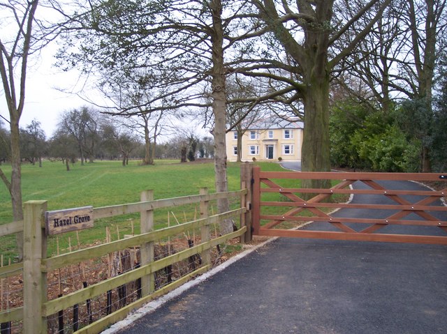
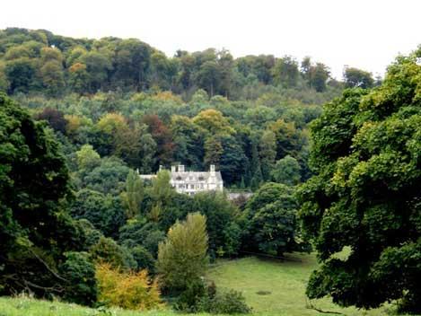
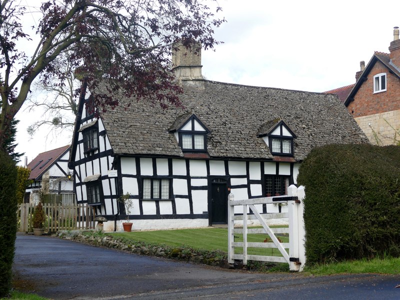
Grovemead Wood Images

Images are sourced within 2km of 51.822005/-2.189102 or Grid Reference SO8713. Thanks to Geograph Open Source API. All images are credited.

St. Peter's Grange, Prinknash This old Benedictine monastery is now used as a retreat house associated with Prinknash Abbey.
St. Peter's Grange, Prinknash
This old Benedictine monastery is now used as a retreat house associated with Prinknash Abbey.
Buckholt Woods Buckholt Woods Nature reserve near Cranham.
Buckholt Woods
Buckholt Woods Nature reserve near Cranham.
The Cotswold Way in Upton Wood The Cotswold Way passes through a wooded area near Witcombe, here it passes through Upton Wood. The Cotswold Way is approximately 100 miles long, running from Chipping Campden in the north to Bath in the south and is now an official long distance path with the acorn on its signposts.
The Cotswold Way in Upton Wood
The Cotswold Way passes through a wooded area near Witcombe, here it passes through Upton Wood. The Cotswold Way is approximately 100 miles long, running from Chipping Campden in the north to Bath in the south and is now an official long distance path with the acorn on its signposts.
Primary  School Upton St Leonards
Primary School Upton St Leonards
Bowden Hall Hotel Upton St Leonards Once a country house
Bowden Hall Hotel Upton St Leonards
Once a country house
The Village Institute Upton St Leonards
Parish Church Upton St Leonards
Moorend near Upton St. Leonards Hamlet around Moorend Farm at the bottom of the dip. Looking NNE.
Moorend near Upton St. Leonards
Hamlet around Moorend Farm at the bottom of the dip. Looking NNE.
Buckholt Wood An ancient wood. Buckholt is derived from the saxon word for Beechwood. Looking north along The Cotswold Way long distance footpath.
Buckholt Wood
An ancient wood. Buckholt is derived from the saxon word for Beechwood. Looking north along The Cotswold Way long distance footpath.
Old Road from Manor Farm to Bondend Looking north along the lane.
Old Road from Manor Farm to Bondend
Looking north along the lane.
Spoonbed Hill Looking south up the hill over unfenced probably common land.
Spoonbed Hill
Looking south up the hill over unfenced probably common land.
Hazel Grove Looking west south west up the drive.
Hazel Grove
Looking west south west up the drive.
Lightning tree In the grounds of Prinknash Abbey. This oak seems none the worse for it.
Lightning tree
In the grounds of Prinknash Abbey. This oak seems none the worse for it.
White helleborine on Kimsbury Cephalanthera damasonium growing on one of the steep banks on the southeast side of the hillfort on Painswick Hill.
White helleborine on Kimsbury
Cephalanthera damasonium growing on one of the steep banks on the southeast side of the hillfort on Painswick Hill.
Southern side of Kimsbury The golf course incorporates the iron age hillfort on Kimsbury (Painswick Hill). This view from the upper rampart looks across a bank and ditch through trees to a green on the course. Beyond, the ridge rises to Catsbrain Tump.
Southern side of Kimsbury
The golf course incorporates the iron age hillfort on Kimsbury (Painswick Hill). This view from the upper rampart looks across a bank and ditch through trees to a green on the course. Beyond, the ridge rises to Catsbrain Tump.
The front elevation of Bowden Hall hotel Late winter sun shines on the windows of this extraordinary elevation.
The front elevation of Bowden Hall hotel
Late winter sun shines on the windows of this extraordinary elevation.
The front entrance to the Bowden Hall Hotel Upton St Leonard's <span class="nowrap"><a title="http://www.ramadajarvis.co.uk/hotel/overview.asp?hotel_id=39" rel="nofollow ugc noopener" href="http://www.ramadajarvis.co.uk/hotel/overview.asp?hotel_id=39">Link</a><img style="margin-left:2px;" alt="External link" title="External link - shift click to open in new window" src="https://s1.geograph.org.uk/img/external.png" width="10" height="10"/></span>

Ramada Jarvis hotels.
The front entrance to the Bowden Hall Hotel Upton St Leonard's
LinkExternal link Ramada Jarvis hotels.
The front elevation of Bowden Hall hotel #2 <span class="nowrap"><a title="http://www.ramadajarvis.co.uk/hotel/overview.asp?hotel_id=39" rel="nofollow ugc noopener" href="http://www.ramadajarvis.co.uk/hotel/overview.asp?hotel_id=39">Link</a><img style="margin-left:2px;" alt="External link" title="External link - shift click to open in new window" src="https://s1.geograph.org.uk/img/external.png" width="10" height="10"/></span>
The front elevation of Bowden Hall hotel #2
Show me another place!

Grovemead Wood is located at Grid Ref: SO8713 (Lat: 51.822005, Lng: -2.189102)

Administrative County: Gloucestershire

District: Stroud

Police Authority: Gloucestershire

What 3 Words

///focal.jumped.player. Near Painswick, Gloucestershire

Related Wikis

Prinknash Abbey

Prinknash Abbey (pronounced locally variously as "Prinidge/Prinnish") (IPA: ) is a Roman Catholic monastery in the Vale of Gloucester in the Diocese of...

Bondend

Bondend is a lane within the village of Upton St Leonards in Gloucestershire, England. == External links == Media related to Bondend at Wikimedia Commons

Upton St Leonards

Upton St Leonards is a village in the English county of Gloucestershire. Forming part of the district of Stroud, it is a mile or so north of the A46 road...

Kimsbury hill fort

Kimsbury hill fort, also known as Castle Godwyn, Kimsbury Camp, Painswick Beacon or Painswick hill fort is an Iron Age hill fort on Painswick Beacon near...

Gloucestershire

Gloucestershire ( GLOST-ər-shər, -⁠sheer; abbreviated Glos.) is a ceremonial county in South West England. It is bordered by Herefordshire to the north...

Range Farm Fields

Range Farm Fields (grid reference SO850130) is a 12.8-hectare (32-acre) biological Site of Special Scientific Interest in Gloucestershire, near to Gloucester...

Matson, Gloucester

Matson is a suburb of Gloucester, in the county of Gloucestershire, England. In 1931 the parish had a population of 40. == History == Unlike neighbouring...

Cooper's Hill Cheese-Rolling and Wake

The Cooper's Hill Cheese-Rolling and Wake is an annual event held on the Spring Bank Holiday at Cooper's Hill, near Gloucester in England. Participants...

Nearby Amenities

Located within 500m of 51.822005,-2.189102
Watery Lane
Power: substation
Ref: 4562
Voltage: 11000
Lat/Long: 51.825759/-2.1925123
Manor Farm
Landuse: farmyard
Lat/Long: 51.8255146/-2.1888343
Barrier: stile
Lat/Long: 51.8216672/-2.1826074
Barrier: stile
Lat/Long: 51.8252922/-2.1845933
Barrier: stile
Lat/Long: 51.8250957/-2.186723
Ford: yes
Lat/Long: 51.8247196/-2.1849991
Barrier: stile
Lat/Long: 51.8255435/-2.1847494
Barrier: stile
Foot: yes
Lat/Long: 51.8252881/-2.1889385
Barrier: stile
Foot: yes
Lat/Long: 51.8230507/-2.18716
Barrier: stile
Foot: yes
Lat/Long: 51.8229367/-2.1868352
Barrier: stile
Stile: stepover
Lat/Long: 51.8259869/-2.1919284
Watery Lane
Power: transformer
Transformer: distribution
Voltage Primary: 11000
Lat/Long: 51.82576/-2.1924913
Cross House
Power: transformer
Transformer: distribution
Voltage Primary: 11000
Lat/Long: 51.8247662/-2.1876499
Power: pole
Lat/Long: 51.8249485/-2.1839444
Power: pole
Lat/Long: 51.8242887/-2.1833704
Portway Cottages
Power: pole
Transformer: distribution
Voltage Primary: 11000
Lat/Long: 51.8210103/-2.1838546
Power: pole
Lat/Long: 51.8219561/-2.183416
Power: pole
Lat/Long: 51.8228265/-2.1830124
Power: pole
Lat/Long: 51.8236944/-2.1825778
The data included in this document is from www.openstreetmap.org. The data is made available under ODbL.

Have you been to Grovemead Wood?

Leave your review of Grovemead Wood below (or comments, questions and feedback).