The Clump

Wood, Forest in Staffordshire South Staffordshire

England

The Clump

Bonded Warehouse, Stourbridge This building is a restored bonded warehouse in Canal St, Stourbridge
Bonded Warehouse, Stourbridge Credit: Rob Newman

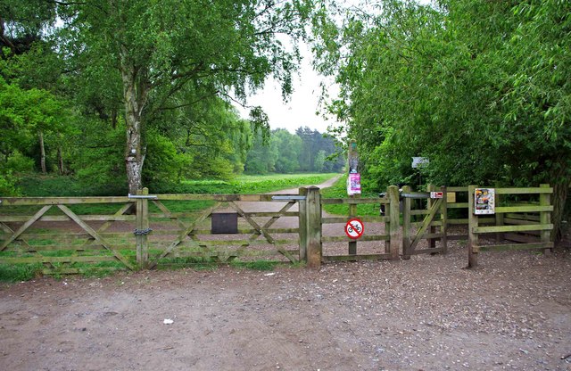
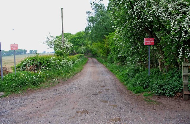
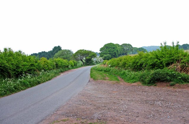
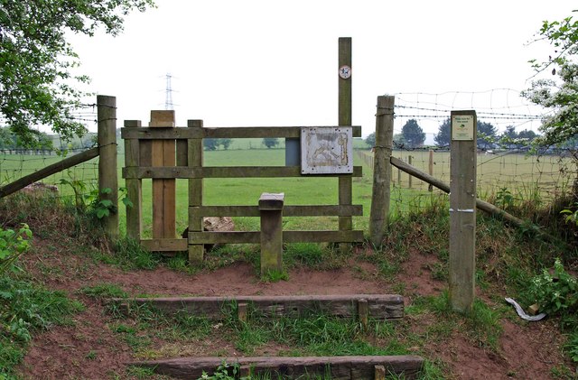
The Clump is a beautiful woodland area located in Staffordshire, England. It is situated in the southern part of the county, near the town of Leek. Covering an area of approximately 100 acres, The Clump is a well-preserved forest that offers a tranquil and peaceful environment for visitors to enjoy.

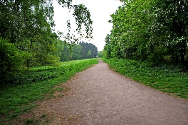
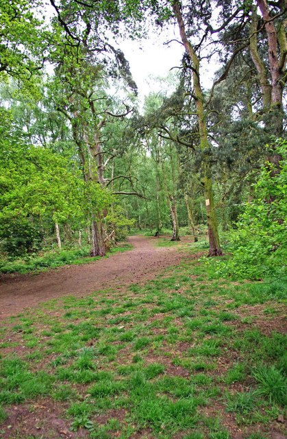
The woodland is primarily composed of native British trees, including oak, beech, and birch. The dense canopy provides ample shade, making it an ideal destination for nature lovers and hikers seeking respite from the summer heat. The forest floor is carpeted with a variety of wildflowers and ferns, creating a vibrant and picturesque scene.

The Clump is home to a diverse array of wildlife, including deer, squirrels, and numerous bird species. Nature enthusiasts will have the opportunity to observe these creatures in their natural habitat. The forest also boasts a small lake, which attracts waterfowl and adds to the area's charm.

Visitors to The Clump can take advantage of the well-maintained walking trails that wind through the forest, offering stunning views of the surrounding landscape. There are also picnic areas and benches scattered throughout the woodland, allowing visitors to relax and take in the peaceful atmosphere.

The Clump is a popular destination for both locals and tourists alike, offering a serene and idyllic escape from the hustle and bustle of everyday life. Its natural beauty and abundant wildlife make it a must-visit location for those seeking a true woodland experience in Staffordshire.

If you have any feedback on the listing, please let us know in the comments section below.

The Clump Images

Images are sourced within 2km of 52.456514/-2.180201 or Grid Reference SO8784. Thanks to Geograph Open Source API. All images are credited.

Bonded Warehouse, Stourbridge This building is a restored bonded warehouse in Canal St, Stourbridge
Bonded Warehouse, Stourbridge
This building is a restored bonded warehouse in Canal St, Stourbridge
Derelict Building, Stourbridge This dilapilated building is to be found in Canal Street, Stourbridge
Derelict Building, Stourbridge
This dilapilated building is to be found in Canal Street, Stourbridge
Stourbridge Canal Basin Viewed from beside the bonded warehouse in Canal Street this is the terminal basin of the Stourbridge Canal
Stourbridge Canal Basin
Viewed from beside the bonded warehouse in Canal Street this is the terminal basin of the Stourbridge Canal
Entrance to Bunkers Hill Wood from Whittington Hall Lane near Whittington Bunkers Hill Wood is owned and managed by the Woodland Trust, a registered charity. Like all their sites, it is open to the public, and although there are only two public footpaths within the wood, there are a large number of other paths which are permissive footpaths. This view shows one of the entrances, adjacent to which is a small area for car parking.
Entrance to Bunkers Hill Wood from Whittington Hall Lane near Whittington
Bunkers Hill Wood is owned and managed by the Woodland Trust, a registered charity. Like all their sites, it is open to the public, and although there are only two public footpaths within the wood, there are a large number of other paths which are permissive footpaths. This view shows one of the entrances, adjacent to which is a small area for car parking.
Sandy Lane near Whittington This lane runs between Whittington Hall Lane and the edge of the town of Stourbridge. There is a public footpath running along its whole length. For part of the way, it runs adjacent to Bunkers Hill Wood.
Sandy Lane near Whittington
This lane runs between Whittington Hall Lane and the edge of the town of Stourbridge. There is a public footpath running along its whole length. For part of the way, it runs adjacent to Bunkers Hill Wood.
Whittington Hall Lane near Whittington On the left of the lane is a gravelled area, which can be used by visitors to the nearby Bunkers Hill Woods, when the small car park by the wood's entrance is full.
Whittington Hall Lane near Whittington
On the left of the lane is a gravelled area, which can be used by visitors to the nearby Bunkers Hill Woods, when the small car park by the wood's entrance is full.
Public footpath in Bunkers Hill Wood near Whittington This public footpath, which starts here at the entrance to the wood from Whittington Hall Lane, is one of the two public footpaths to be found in the woods. There are many other paths there however, which the public can use, but they are permissive footpaths. These date from when the wood was used for shooting purposes. This was before its acquisition by the Woodland Trust.
Public footpath in Bunkers Hill Wood near Whittington
This public footpath, which starts here at the entrance to the wood from Whittington Hall Lane, is one of the two public footpaths to be found in the woods. There are many other paths there however, which the public can use, but they are permissive footpaths. These date from when the wood was used for shooting purposes. This was before its acquisition by the Woodland Trust.
Bunkers Hill Wood near Whittington Hall Lane Bunkers Hill Wood is about half a mile west of Stourbridge. According to its owners, the Woodland Trust, it contains a mixture of predominantly secondary plantation trees with mature and veteran broadleaves and conifers, including Sweet Chestnut, Oak, Scots Pine and Corsican Pine. These are contrasted by younger stands of broadleaves and conifers and areas of naturally regenerated Birch.

The site, which was formerly part of Iverley Heath, was originally planted around 1860, with subsequent replanting as recently as 20 to 25 years ago.
Bunkers Hill Wood near Whittington Hall Lane
Bunkers Hill Wood is about half a mile west of Stourbridge. According to its owners, the Woodland Trust, it contains a mixture of predominantly secondary plantation trees with mature and veteran broadleaves and conifers, including Sweet Chestnut, Oak, Scots Pine and Corsican Pine. These are contrasted by younger stands of broadleaves and conifers and areas of naturally regenerated Birch. The site, which was formerly part of Iverley Heath, was originally planted around 1860, with subsequent replanting as recently as 20 to 25 years ago.
A litter bin and two dog waste bins at Bunkers Hill Wood, near Whittington Bunkers Hill Wood is only about half a mile from the edge of the town of Stourbridge, It is therefore a very popular spot with people from there for walking with, or without, dogs. These bins are conveniently situated near the entrance from Whittington Hall Lane. Normally the wood would have a lot of visitors, but on the day of the wedding of Prince William and Kate Middleton, it was very quiet.
A litter bin and two dog waste bins at Bunkers Hill Wood, near Whittington
Bunkers Hill Wood is only about half a mile from the edge of the town of Stourbridge, It is therefore a very popular spot with people from there for walking with, or without, dogs. These bins are conveniently situated near the entrance from Whittington Hall Lane. Normally the wood would have a lot of visitors, but on the day of the wedding of Prince William and Kate Middleton, it was very quiet.
Stile at start of footpath from Bunkers Hill Wood to Whittington Hall Lane The footpath starts at the stile, and go west across fields to Whittington Hall Lane.
Stile at start of footpath from Bunkers Hill Wood to Whittington Hall Lane
The footpath starts at the stile, and go west across fields to Whittington Hall Lane.
The Cottage Inn, Stourbridge
Royal Exchange, Stourbridge
The Queens Head, Stourbridge
Somerset House, Stourbridge
Footbridge over entrance to the 'New Foundry' wharf Cast by John Bradley & Co at Coalbrookdale in 1873.
Footbridge over entrance to the 'New Foundry' wharf
Cast by John Bradley & Co at Coalbrookdale in 1873.
Footpath & cycleway to Bradley Road, Wollaston, Stourbridge Although a cycleway, cyclists are supposed to dismount for the section ahead, but many don't bother. The path comes out in the industrial semi-dereliction of Bradley Road.
Footpath & cycleway to Bradley Road, Wollaston, Stourbridge
Although a cycleway, cyclists are supposed to dismount for the section ahead, but many don't bother. The path comes out in the industrial semi-dereliction of Bradley Road.
Footpath & cycleway to High Street, Wollaston, Stourbridge This is part of a cycleway that goes to Kingswinford. This section runs alongside a playing field.

<a href="https://www.geograph.org.uk/photo/985742">SO8984 : Playing field behind High Street, Wollaston</a>.
Footpath & cycleway to High Street, Wollaston, Stourbridge
This is part of a cycleway that goes to Kingswinford. This section runs alongside a playing field. SO8984 : Playing field behind High Street, Wollaston.
Footpath & cycleway to High Street, Wollaston, Stourbridge Part of a cycleway that eventually arrives at Kingswinford.
Footpath & cycleway to High Street, Wollaston, Stourbridge
Part of a cycleway that eventually arrives at Kingswinford.
Show me another place!

The Clump is located at Grid Ref: SO8784 (Lat: 52.456514, Lng: -2.180201)

Administrative County: Staffordshire

District: South Staffordshire

Police Authority: Staffordshire

What 3 Words

///removal.concluded.depending. Near Stourbridge, West Midlands

Related Wikis

Ridgewood High School, Wollaston

Ridgewood High School is a coeducational secondary school, a part of the Stour Vale Academy Trust situated in Wollaston (near Stourbridge), in the West...

Wollaston, West Midlands

Wollaston is a village on the outskirts of Stourbridge in the English West Midlands. It is located in the south of the Dudley Metropolitan Borough, one...

Norton, Stourbridge

Norton is a suburb and council ward in the town of Stourbridge, West Midlands. It has a population of 11,943 in an area of 569 hectares. The population...
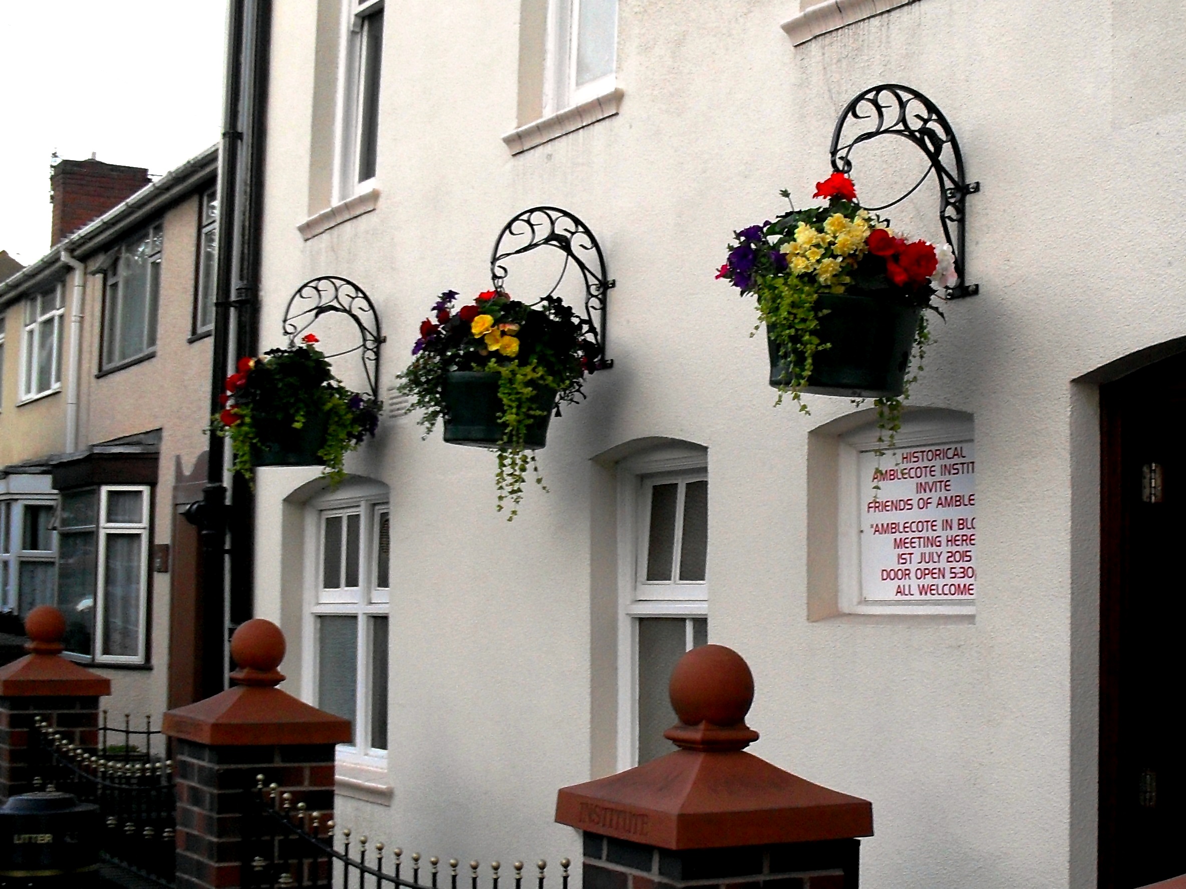
Amblecote

Amblecote is an affluent urban village in the Metropolitan Borough of Dudley in the West Midlands, England. It lies immediately north of the historic town...

Stourton, Staffordshire

Stourton is a hamlet in Staffordshire, England a few miles to the northwest of Stourbridge. There is a fair amount of dispute over the pronunciation, being...
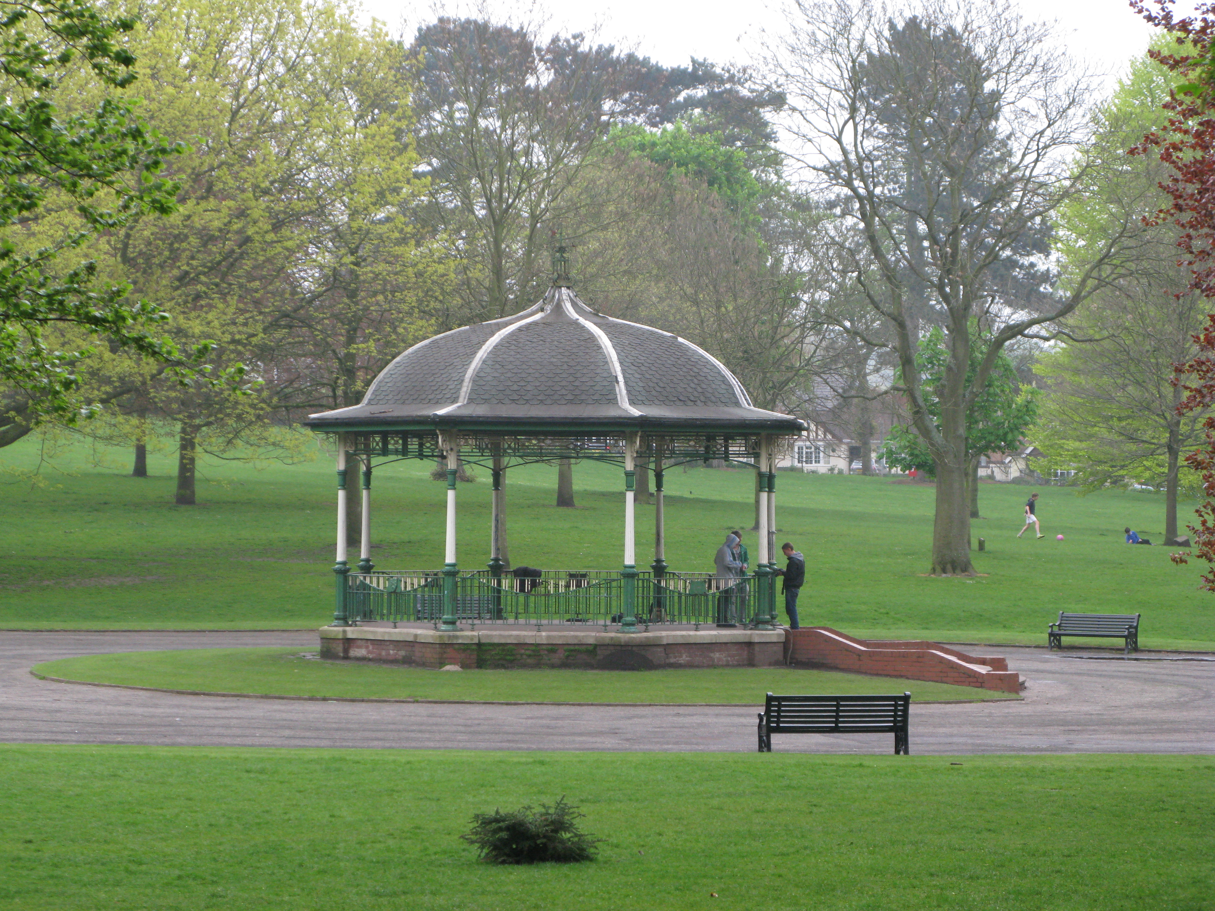
Mary Stevens Park

Mary Stevens Park is a public park located in Norton, Stourbridge, West Midlands, UK. Opened to the public in 1931, it attracts 1.3 million visitors per...

Battle of Stourbridge Heath

The Battle of Stourbridge Heath (26 March 1644) was a skirmish that took place during the First English Civil War, in which a Parliamentarian contingent...

Smestow Brook

The Smestow Brook, sometimes called the River Smestow, is a small river that plays an important part in the drainage of Wolverhampton, South Staffordshire...

Nearby Amenities

Located within 500m of 52.456514,-2.180201
Generator Method: photovoltaic
Generator Output Electricity: yes
Generator Source: solar
Generator Type: solar_photovoltaic_panel
Location: roof
Power: generator
Lat/Long: 52.4585771/-2.1736917
Marker: pedestal
Operator: Esso
Utility: oil
Lat/Long: 52.4528872/-2.1822889
Marker: pedestal
Operator: Esso
Utility: oil
Lat/Long: 52.4530362/-2.18234
Barrier: kissing_gate
Lat/Long: 52.4559075/-2.1788079
Barrier: kissing_gate
Lat/Long: 52.4552154/-2.1792363
Barrier: stile
Bicycle: no
Foot: yes
Horse: no
Motor Vehicle: no
Stile: stepover
Lat/Long: 52.4599423/-2.176719
The data included in this document is from www.openstreetmap.org. The data is made available under ODbL.

Have you been to The Clump?

Leave your review of The Clump below (or comments, questions and feedback).