Redebridge Plantation

Wood, Forest in Northumberland

England

Redebridge Plantation

Conheath
Conheath Credit: Peter McDermott

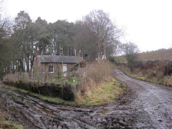
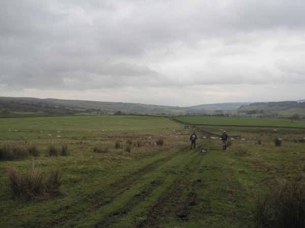
Redebridge Plantation is a picturesque woodland area located in Northumberland, England. Covering an area of approximately 200 acres, this enchanting forest offers visitors a tranquil and peaceful retreat from the hustle and bustle of everyday life.

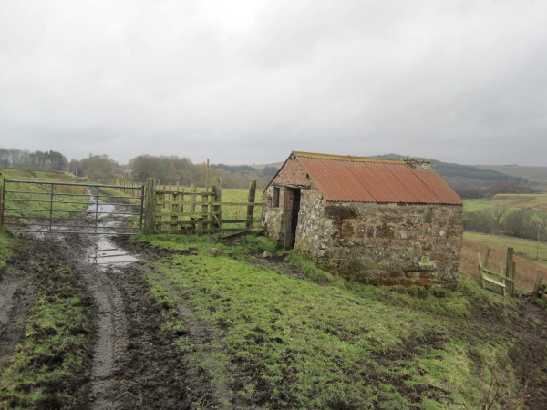
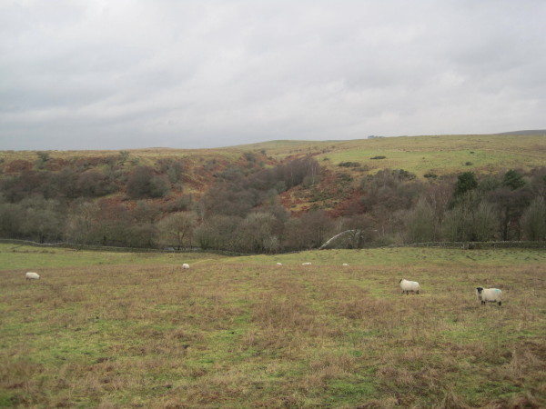
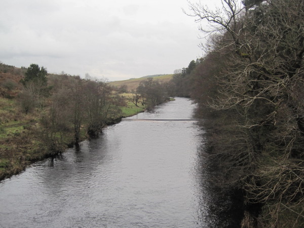
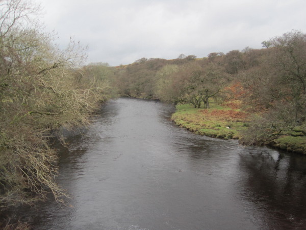
The woodland is dominated by a variety of native tree species, including oak, beech, and birch, which create a rich and diverse habitat for numerous wildlife species. The forest floor is adorned with a carpet of wildflowers, adding bursts of color throughout the seasons.

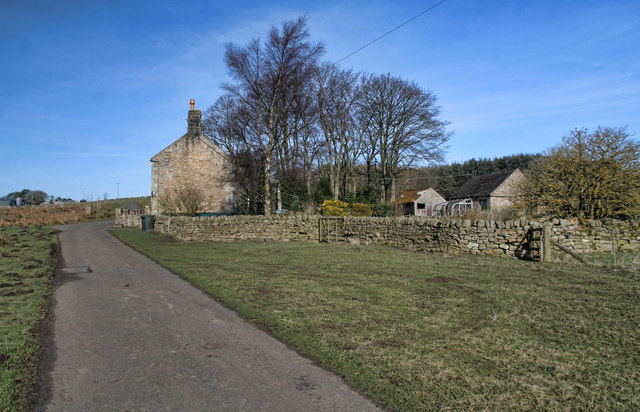
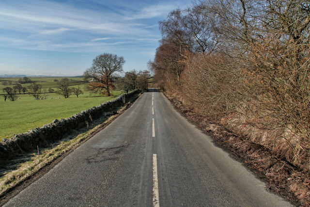
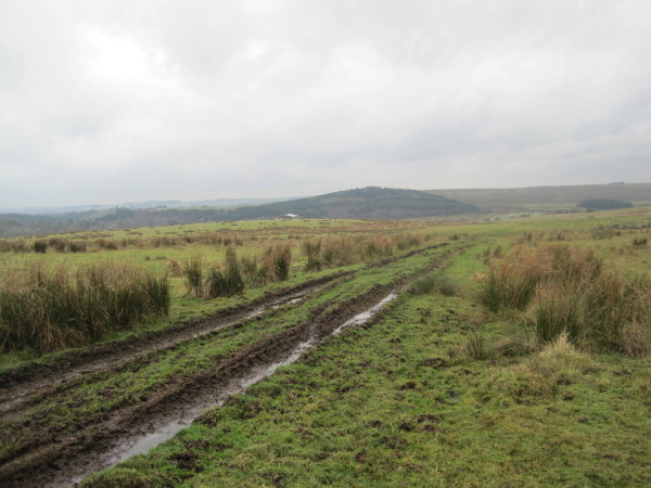
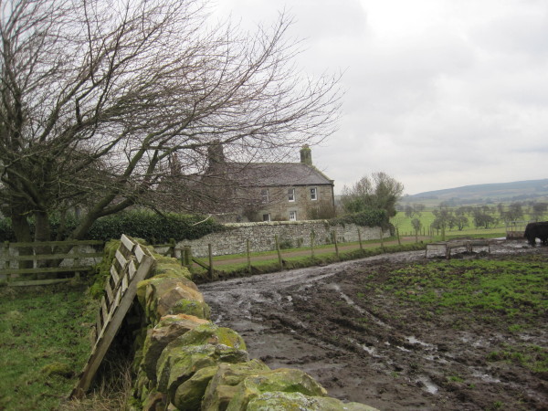
Redebridge Plantation is crisscrossed by a network of well-maintained footpaths and trails, making it an ideal destination for walkers, hikers, and nature enthusiasts. These pathways offer visitors the opportunity to explore the woodland at their own pace, immersing themselves in the natural beauty and serenity of the surroundings.

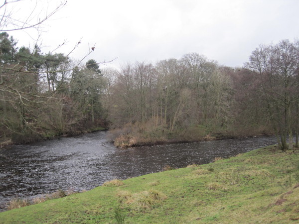
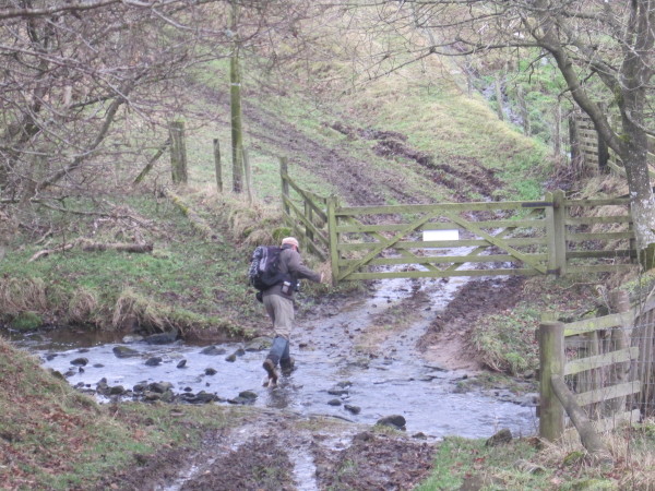
The plantation is also home to a small river, which meanders through the forest, adding a touch of tranquility to the already idyllic setting. Visitors can enjoy the soothing sound of flowing water as they stroll along the riverbank or find a peaceful spot to sit and relax.

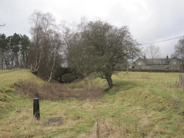
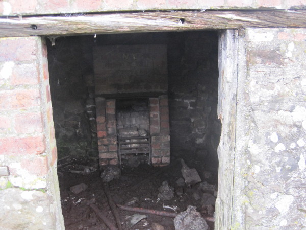
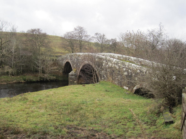
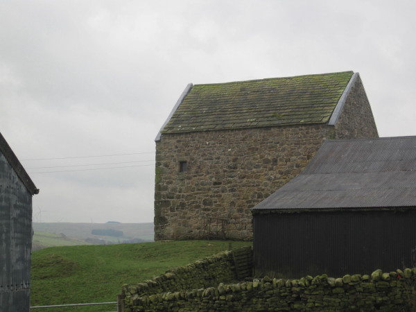
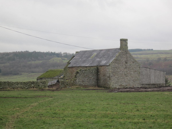
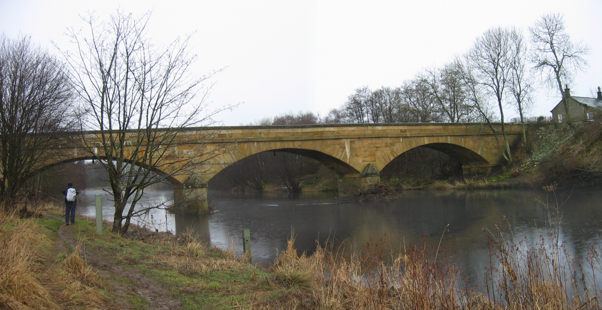
In addition to its natural beauty, Redebridge Plantation also holds historical significance. The woodland was once part of the larger Rede Bridge Estate, which dates back to medieval times. The remnants of a historic bridge can still be seen within the plantation, serving as a reminder of its past.

Overall, Redebridge Plantation offers a captivating blend of natural beauty, rich biodiversity, and historical charm. It is a haven for both nature lovers and history enthusiasts, providing a unique and memorable experience for all who visit.

If you have any feedback on the listing, please let us know in the comments section below.

Redebridge Plantation Images

Images are sourced within 2km of 55.143445/-2.2059259 or Grid Reference NY8683. Thanks to Geograph Open Source API. All images are credited.

Hot Hill Road crossing Hothill Burn at Hothill Wood.
Hot Hill
Road crossing Hothill Burn at Hothill Wood.
Bridgeford Island, River North Tyne
Disused Railway Line at Redesmouth Line from West Wood Burn
Disused Railway Line at Redesmouth
Line from West Wood Burn
Platelayer's Hut, Wannie Line near Redesmouth
Interior of Platelayer's Hut, Wannie Line near Redesmouth
Crossing Cottage near Rede Bridge
River Rede Valley and Rede Bridge
River Rede from Rede Bridge
Rede Bridge and the River Rede
By-way towards Rede Bridge
By-way towards Hole
By-way towards Hole
By-Way towards Redesmouth or Rede Bridge
Hole Bastle (Bellingham) This bastle is 16th century in date and is built partly over a Bronze Age round cairn. The bastle overlooks the valley of the River Rede and is well preserved. The building measures 10.5m by 6.6m in plan and stands two storeys high, measuring 14m tall to the tops of the gables. The original entrance into the ground floor lies through the west wall, but there is now another later entrance through the east side. On the outside of the bastle is a stone staircase which leads up to the first floor. Some of the windows were inserted in the 19th century, but original 16th century ones are visible in the east and north walls. Inside the bastle, the ground floor is covered by a barrel vault and there is a ladder hole for access to the first floor. Here there are wall cupboards, a fireplace and a stair to the attic. This is Grade II* Listed Building and a Scheduled Monument protected by law.
<span class="nowrap"><a title="http://www.keystothepast.info/durhamcc/K2P.nsf/K2PDetail?readform&PRN=N8064" rel="nofollow ugc noopener" href="http://www.keystothepast.info/durhamcc/K2P.nsf/K2PDetail?readform&PRN=N8064">Link</a><img style="margin-left:2px;" alt="External link" title="External link - shift click to open in new window" src="https://s1.geograph.org.uk/img/external.png" width="10" height="10"/></span>
Hole Bastle (Bellingham)
This bastle is 16th century in date and is built partly over a Bronze Age round cairn. The bastle overlooks the valley of the River Rede and is well preserved. The building measures 10.5m by 6.6m in plan and stands two storeys high, measuring 14m tall to the tops of the gables. The original entrance into the ground floor lies through the west wall, but there is now another later entrance through the east side. On the outside of the bastle is a stone staircase which leads up to the first floor. Some of the windows were inserted in the 19th century, but original 16th century ones are visible in the east and north walls. Inside the bastle, the ground floor is covered by a barrel vault and there is a ladder hole for access to the first floor. Here there are wall cupboards, a fireplace and a stair to the attic. This is Grade II* Listed Building and a Scheduled Monument protected by law. LinkExternal link
Shawbush near Hole, Bellingham
Ford and By-Way through Conheath Burn
Hole Farmhouse (Bellingham) A late 18th or early 19th century farmhouse.
<span class="nowrap"><a title="http://www.keystothepast.info/durhamcc/K2P.nsf/K2PDetail?readform&PRN=N14031" rel="nofollow ugc noopener" href="http://www.keystothepast.info/durhamcc/K2P.nsf/K2PDetail?readform&PRN=N14031">Link</a><img style="margin-left:2px;" alt="External link" title="External link - shift click to open in new window" src="https://s1.geograph.org.uk/img/external.png" width="10" height="10"/></span>
Hole Farmhouse (Bellingham)
A late 18th or early 19th century farmhouse. LinkExternal link
Show me another place!

Redebridge Plantation is located at Grid Ref: NY8683 (Lat: 55.143445, Lng: -2.2059259)

Unitary Authority: Northumberland

Police Authority: Northumbria

What 3 Words

///crumples.prowess.salon. Near Bellingham, Northumberland

Nearby Locations

Redebridge Plantation

Related Wikis

Redesmouth

Redesmouth is a village in Northumberland, England, just over 1 mile (1.6 km) to the south-east of Bellingham. == Governance == Redesmouth is in the parliamentary...

Reedsmouth railway station

Reedsmouth is a closed railway station in Northumberland, England. It was a junction station where the Wansbeck Railway (Morpeth to Reedsmouth) joined...

River Rede

The Rede is a river in Northumberland, England. The river rises on Carter Fell on the Anglo-Scottish border feeding Catcleugh Reservoir and joins the River...

Bellingham North Tyne railway station

Bellingham railway station served the village of Bellingham, Northumberland, England from 1861 to 1963 on the Border Counties Railway. == History == The...

Countess Park railway station

Countess Park railway station served the village of Bellingham, Northumberland, England from 1859 to 1861, during the construction of the Border Counties...

Bellingham Castle

Bellingham Castle was a motte and bailey fortress in Northumberland, founded by the De Bellingham family. Its remains lie 5 miles east of Dally Castle...

Bellingham, Northumberland

Bellingham ( BEL-in-jəm) is a village and civil parish in Northumberland, to the north-west of Newcastle upon Tyne and is situated on the Hareshaw Burn...

Bellingham Town Hall

Bellingham Town Hall is a municipal building in Front Street in Bellingham, Northumberland, England. The building, which is the meeting place of Bellingham...

Nearby Amenities

Located within 500m of 55.143445,-2.2059259
Power: pole
Lat/Long: 55.1397234/-2.210189
Power: pole
Lat/Long: 55.1397325/-2.2090119
Power: pole
Lat/Long: 55.139771/-2.2079422
Power: pole
Lat/Long: 55.140312/-2.2069863
Power: pole
Lat/Long: 55.1408825/-2.2060219
Power: pole
Lat/Long: 55.1413242/-2.2052786
Power: pole
Lat/Long: 55.1418332/-2.2044279
Power: pole
Lat/Long: 55.1423291/-2.2035751
Power: pole
Lat/Long: 55.1428393/-2.2027265
Power: pole
Lat/Long: 55.1433123/-2.2016337
Power: pole
Lat/Long: 55.1437864/-2.2005387
Power: pole
Lat/Long: 55.1442606/-2.1994396
Barrier: stile
Material: wood
Source: survey;gps
Stile: stepover
Lat/Long: 55.142671/-2.2094111
Barrier: stile
Material: wood
Source: survey;gps
Stile: stepover
Lat/Long: 55.1429726/-2.2056715
Ford: yes
Lat/Long: 55.1424418/-2.2103567
The data included in this document is from www.openstreetmap.org. The data is made available under ODbL.

Have you been to Redebridge Plantation?

Leave your review of Redebridge Plantation below (or comments, questions and feedback).