Boundary Plantation

Wood, Forest in Wiltshire

England

Boundary Plantation

Road junction, Easton Grey
Road junction, Easton Grey Credit: Vieve Forward

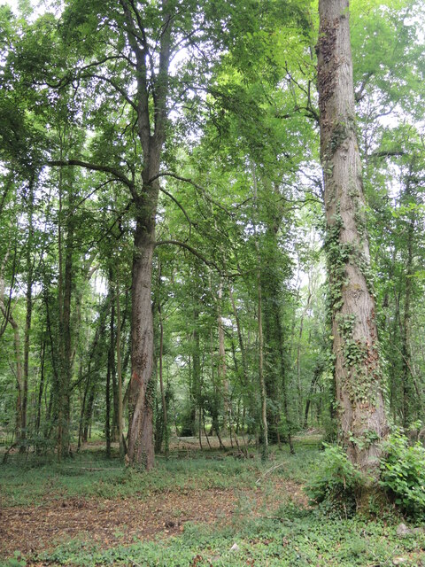
Boundary Plantation is a picturesque woodland located in Wiltshire, England. Situated near the village of Wood, this enchanting forest covers an area of approximately 100 acres. The plantation is known for its diverse and dense vegetation, providing a haven for various flora and fauna.

The woodland is primarily composed of native tree species, including oak, beech, and birch. These towering trees create a dense canopy, casting shade over the forest floor and creating a cool and tranquil atmosphere. The undergrowth is rich and varied, with a carpet of wildflowers, ferns, and mosses covering the forest floor.

Boundary Plantation is home to a wide range of wildlife. Visitors may spot small mammals such as squirrels, rabbits, and badgers, as well as a variety of bird species including woodpeckers, owls, and thrushes. The woodland provides a natural habitat for these creatures, offering shelter, food, and protection from predators.

The plantation is a popular destination for nature enthusiasts and outdoor lovers. It offers a network of well-maintained walking trails, allowing visitors to explore the woodland's beauty at their own pace. These trails meander through the trees, providing glimpses of sunlight filtering through the branches and the peaceful sound of birdsong.

Boundary Plantation is a cherished natural treasure in Wiltshire, offering a serene and captivating escape from the hustle and bustle of everyday life. Its diverse ecosystem and tranquil ambiance make it an ideal destination for nature lovers seeking solace in the beauty of the natural world.

If you have any feedback on the listing, please let us know in the comments section below.

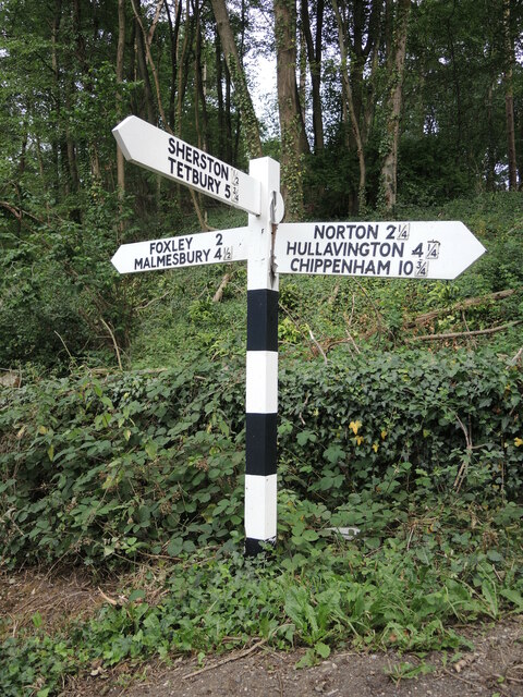
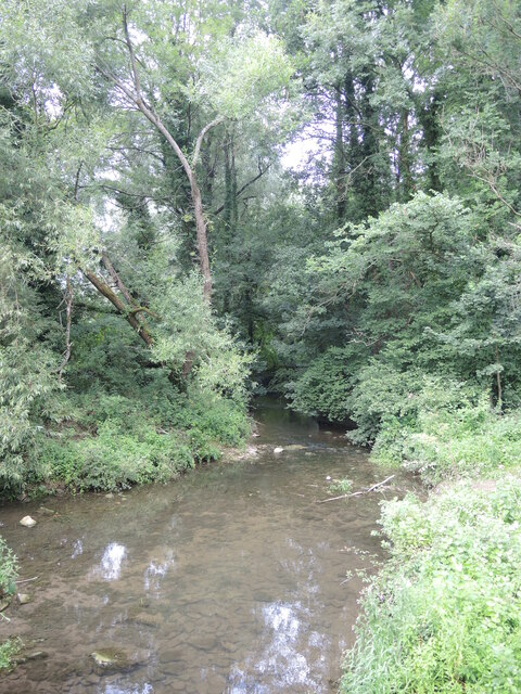
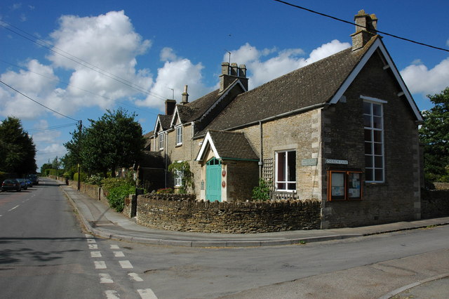
Boundary Plantation Images

Images are sourced within 2km of 51.586184/-2.1894191 or Grid Reference ST8687. Thanks to Geograph Open Source API. All images are credited.

Road junction, Easton Grey
Road junction near Rushmoor Covert
Signpost at Easton Town The post bears some wooden arms which have individual plastic lettering, tacked on. However, the fractional mileage are separate cast metal affairs, probably a left-over from when the whole arm was cast.
Signpost at Easton Town
The post bears some wooden arms which have individual plastic lettering, tacked on. However, the fractional mileage are separate cast metal affairs, probably a left-over from when the whole arm was cast.
The Avon at Pinkney Wood The fledgling Avon begins to gather momentum from Easton Town and there will be weirs coming up soon.
The Avon at Pinkney Wood
The fledgling Avon begins to gather momentum from Easton Town and there will be weirs coming up soon.
Pinkney Wood A mixture of mature deciduous specimens.
Pinkney Wood
A mixture of mature deciduous specimens.
Hortico garden centre Situated on the B4040 outside Sherston, which also appears to have a great interest in the Six Nations rugby.
Hortico garden centre
Situated on the B4040 outside Sherston, which also appears to have a great interest in the Six Nations rugby.
Bransdown Hill The B4040 from Sherston to Malmesbury, with a milestone to boot. See <a href="https://www.geograph.org.uk/photo/7051277">ST8586 : No mention of Sherston</a> for a closer look.
Bransdown Hill
The B4040 from Sherston to Malmesbury, with a milestone to boot. See ST8586 : No mention of Sherston for a closer look.
No mention of Sherston A milestone makes no reference to the village, just half a mile down the road.
No mention of Sherston
A milestone makes no reference to the village, just half a mile down the road.
Blocked to offside Sherston Magna Cricket Club were playing the game for many years before disbanding  after members disagreed over the running. The club reformed in 1990 and were grateful for the local landowner to allow them to return to the present ground in Pinkney Park.
Blocked to offside
Sherston Magna Cricket Club were playing the game for many years before disbanding after members disagreed over the running. The club reformed in 1990 and were grateful for the local landowner to allow them to return to the present ground in Pinkney Park.
Waiting for the wicket Play at Sherston's Pinkney Park ground await the return of the batsman making his way back from the middle.
Waiting for the wicket
Play at Sherston's Pinkney Park ground await the return of the batsman making his way back from the middle.
Entrance to Pinkney Park Sherston Magna C.C. hold their home matches here, courtesey of a local landowner. Note the stumps and ball on the top of the piers.
Entrance to Pinkney Park
Sherston Magna C.C. hold their home matches here, courtesey of a local landowner. Note the stumps and ball on the top of the piers.
Water pillar near Pinkney Wood Approaching Easton Town is an old water pillar - a public water source before piped supplies reached individual households. The ornate cast iron pillar is no longer in use, but see <a href="https://www.geograph.org.uk/photo/7053111">ST8686 : The workings of a water pillar</a> for a look down inside.
Water pillar near Pinkney Wood
Approaching Easton Town is an old water pillar - a public water source before piped supplies reached individual households. The ornate cast iron pillar is no longer in use, but see ST8686 : The workings of a water pillar for a look down inside.
The workings of a water pillar A piped water supply was a new dawn in villages used to wells. This pillar has not been used for many years now and the top is missing, allowing a glimpse into the internal workings. The knob to the right would have been turned, rotating the horizontal gearwheel, which opened the valve lower down. The pulley would have had a weight hanging on it which, upon release of the knob, would bring the valve back to its closed position. It's also a handy place for snails to rest. See <a href="https://www.geograph.org.uk/photo/7053109">ST8686 : Water pillar near Pinkney Wood</a> for a look at the lion emblem.
The workings of a water pillar
A piped water supply was a new dawn in villages used to wells. This pillar has not been used for many years now and the top is missing, allowing a glimpse into the internal workings. The knob to the right would have been turned, rotating the horizontal gearwheel, which opened the valve lower down. The pulley would have had a weight hanging on it which, upon release of the knob, would bring the valve back to its closed position. It's also a handy place for snails to rest. See ST8686 : Water pillar near Pinkney Wood for a look at the lion emblem.
Crossing the Sherston Avon A bridge over the river near Easton Town. On the far parapet is a rivet benchmark - see <a href="https://www.geograph.org.uk/photo/7053126">ST8685 : A rivet over the Avon</a>.
Crossing the Sherston Avon
A bridge over the river near Easton Town. On the far parapet is a rivet benchmark - see ST8685 : A rivet over the Avon.
A rivet over the Avon A rivet benchmark on a bridge parapet over the Sherston Avon. See <span class="nowrap"><a title="https://www.bench-marks.org.uk/bm160626" rel="nofollow ugc noopener" href="https://www.bench-marks.org.uk/bm160626">Link</a><img style="margin-left:2px;" alt="External link" title="External link - shift click to open in new window" src="https://s1.geograph.org.uk/img/external.png" width="10" height="10"/></span> for the entry in the Benchmark Database and <a href="https://www.geograph.org.uk/photo/7053125">ST8685 : Crossing the Sherston Avon</a> for a wider view.
A rivet over the Avon
A rivet benchmark on a bridge parapet over the Sherston Avon. See LinkExternal link for the entry in the Benchmark Database and ST8685 : Crossing the Sherston Avon for a wider view.
Stone Stile, Westonbirt Off Tetbury Road South of Westonbirt, looking into Gloucestershire footpath NWL15. The stile, being on the East side of the road means it is just in Gloucestershire. The view looking out is <a href="https://www.geograph.org.uk/photo/7055112">ST8588 : Stone Stile, Westonbirt</a>.
Stone Stile, Westonbirt
Off Tetbury Road South of Westonbirt, looking into Gloucestershire footpath NWL15. The stile, being on the East side of the road means it is just in Gloucestershire. The view looking out is ST8588 : Stone Stile, Westonbirt.
Stone Stile, Westonbirt Looking out to Tetbury Road South of Westonbirt, from Gloucestershire footpath NWL15. The stile, being on the East side of the road means it is just in Gloucestershire. The alternative view looking in is <a href="https://www.geograph.org.uk/photo/7055111">ST8588 : Stone Stile, Westonbirt</a>.
Stone Stile, Westonbirt
Looking out to Tetbury Road South of Westonbirt, from Gloucestershire footpath NWL15. The stile, being on the East side of the road means it is just in Gloucestershire. The alternative view looking in is ST8588 : Stone Stile, Westonbirt.
Stone Stile, Westonbirt Looking towards the road on Gloucestershire footpath NSM1. The view looking back is <a href="https://www.geograph.org.uk/photo/7055116">ST8789 : Stone Stile, Westonbirt</a>.
Stone Stile, Westonbirt
Looking towards the road on Gloucestershire footpath NSM1. The view looking back is ST8789 : Stone Stile, Westonbirt.
Show me another place!

Boundary Plantation is located at Grid Ref: ST8687 (Lat: 51.586184, Lng: -2.1894191)

Unitary Authority: Wiltshire

Police Authority: Wiltshire

What 3 Words

///remarried.caravans.embedded. Near Sherston, Wiltshire

Related Wikis

Nearby Amenities

Located within 500m of 51.586184,-2.1894191
Power: pole
Lat/Long: 51.58893/-2.184377
Power: pole
Lat/Long: 51.5884323/-2.1858559
Power: pole
Lat/Long: 51.5879672/-2.1872578
Power: pole
Lat/Long: 51.5874886/-2.1886782
Power: pole
Lat/Long: 51.5869851/-2.1901817
Power: pole
Lat/Long: 51.5861811/-2.1907609
Power: pole
Lat/Long: 51.5854058/-2.1913094
Power: pole
Lat/Long: 51.5845251/-2.1919595
Power: pole
Lat/Long: 51.5836502/-2.1925757
Power: pole
Lat/Long: 51.5831276/-2.1937311
Power: pole
Lat/Long: 51.5895318/-2.1933937
Power: pole
Lat/Long: 51.5886788/-2.1917501
Power: pole
Lat/Long: 51.5882137/-2.1918043
Power: pole
Lat/Long: 51.5879454/-2.1906461
The data included in this document is from www.openstreetmap.org. The data is made available under ODbL.

Have you been to Boundary Plantation?

Leave your review of Boundary Plantation below (or comments, questions and feedback).