Rabbit Osiers

Wood, Forest in Staffordshire South Staffordshire

England

Rabbit Osiers

Cave at Prestwood near Stourton, Staffordshire This cave in the Triassic sandstone is on land belonging to Prestwood Cave Nursery. The nursery grows a limited range of hardy shrubs and other plants. Quality is high, and the prices are very reasonable. The hard winter of 2010-2011 killed many plants in nurseries all over the West Midlands, but enough remains here to continue trading.
Cave at Prestwood near Stourton, Staffordshire Credit: Roger D Kidd

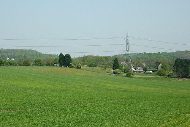
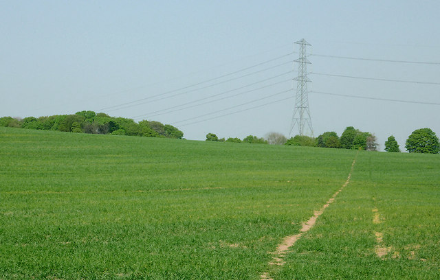
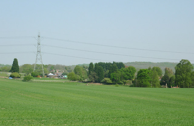
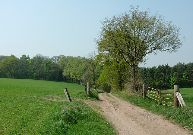
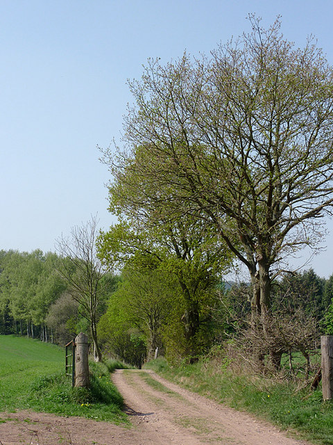
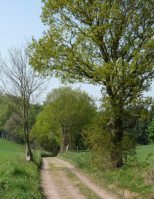
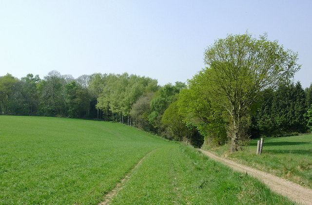
Rabbit Osiers is a small woodland area located in Staffordshire, England. Covering an approximate area of 200 acres, it is known for its diverse range of flora and fauna, making it a popular destination for nature enthusiasts and hikers alike.

The woodland consists primarily of oak and beech trees, which provide a dense canopy, creating a cool and shaded environment underneath. This makes it an ideal habitat for a variety of wildlife, including deer, foxes, and a rich array of bird species.

Rabbit Osiers is also home to a number of small streams and ponds, which further enhance its ecological diversity. These water sources attract various amphibians and insects, adding to the unique ecosystem of the area.

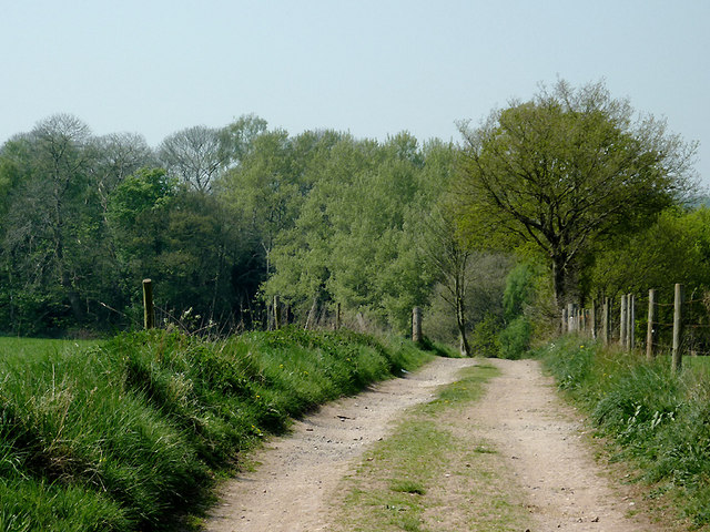
Visitors to Rabbit Osiers can enjoy a network of well-maintained footpaths and trails, providing opportunities for leisurely walks and exploration. The woodland is particularly beautiful during spring when the forest floor is covered in a carpet of bluebells, creating a picturesque scene.

The management of Rabbit Osiers is carried out by a dedicated team of conservationists, who ensure the preservation and protection of the woodland's natural beauty. This includes regular maintenance of footpaths, as well as monitoring and managing any potential threats to the local ecosystem.

Overall, Rabbit Osiers in Staffordshire offers visitors a chance to immerse themselves in a tranquil and unspoiled natural environment, providing a haven for wildlife and a peaceful escape for those seeking solace in nature.

If you have any feedback on the listing, please let us know in the comments section below.

Rabbit Osiers Images

Images are sourced within 2km of 52.469873/-2.2074301 or Grid Reference SO8685. Thanks to Geograph Open Source API. All images are credited.

Cave at Prestwood near Stourton, Staffordshire This cave in the Triassic sandstone is on land belonging to Prestwood Cave Nursery. The nursery grows a limited range of hardy shrubs and other plants. Quality is high, and the prices are very reasonable. The hard winter of 2010-2011 killed many plants in nurseries all over the West Midlands, but enough remains here to continue trading.
Cave at Prestwood near Stourton, Staffordshire
This cave in the Triassic sandstone is on land belonging to Prestwood Cave Nursery. The nursery grows a limited range of hardy shrubs and other plants. Quality is high, and the prices are very reasonable. The hard winter of 2010-2011 killed many plants in nurseries all over the West Midlands, but enough remains here to continue trading.
Prestwood Cave Nursery near Stourton, Staffordshire The nursery grows a limited range of hardy shrubs and other plants. Quality is high, and the prices are very reasonable. The hard winter of 2010-2011 killed many plants in nurseries all over the West Midlands, but enough remains here to continue trading.
Prestwood Cave Nursery near Stourton, Staffordshire
The nursery grows a limited range of hardy shrubs and other plants. Quality is high, and the prices are very reasonable. The hard winter of 2010-2011 killed many plants in nurseries all over the West Midlands, but enough remains here to continue trading.
Bridleway near Stourton, Staffordshire The bridleway links Wolverhampton Road (A449) at Prestwood with Greensforge Lane and Gothersley Farm.
Bridleway near Stourton, Staffordshire
The bridleway links Wolverhampton Road (A449) at Prestwood with Greensforge Lane and Gothersley Farm.
Bridleway near Stourton, Staffordshire The bridleway links Wolverhampton Road (A449) at Prestwood with Greensforge Lane and Gothersley Farm.
Bridleway near Stourton, Staffordshire
The bridleway links Wolverhampton Road (A449) at Prestwood with Greensforge Lane and Gothersley Farm.
Bridleway near Stourton, Staffordshire The bridleway links Wolverhampton Road (A449) at Prestwood with Greensforge Lane and Gothersley Farm.
Bridleway near Stourton, Staffordshire
The bridleway links Wolverhampton Road (A449) at Prestwood with Greensforge Lane and Gothersley Farm.
Staffordshire and Worcestershire Canal near Prestwood, Staffordshire Seen from the bridleway crossing Prestwood Bridge (No 34). The canal was opened in 1772, engineered by James Brindley. It joins the River Severn at Stourport to the Trent and Mersey Canal at Great Haywood Junction in Staffordshire. There are 43 locks (45 if you don't fancy the deep wide locks at Stourport) and the canal is 46 miles in length.
Staffordshire and Worcestershire Canal near Prestwood, Staffordshire
Seen from the bridleway crossing Prestwood Bridge (No 34). The canal was opened in 1772, engineered by James Brindley. It joins the River Severn at Stourport to the Trent and Mersey Canal at Great Haywood Junction in Staffordshire. There are 43 locks (45 if you don't fancy the deep wide locks at Stourport) and the canal is 46 miles in length.
Public footpath and stile near Prestwood, Staffordshire The path across this crop field seems little used. The bridleway from the Coach House which is mapped as being behind the camera does not exist at all now.
Public footpath and stile near Prestwood, Staffordshire
The path across this crop field seems little used. The bridleway from the Coach House which is mapped as being behind the camera does not exist at all now.
Farmland near Prestwood, Staffordshire Seen from the bridleway near Prestwood Cave Nursery.
Farmland near Prestwood, Staffordshire
Seen from the bridleway near Prestwood Cave Nursery.
Farmland near Prestwood, Staffordshire Looking across the fields from the bridleway between Prestwood and Greensforge Lane.
Farmland near Prestwood, Staffordshire
Looking across the fields from the bridleway between Prestwood and Greensforge Lane.
Crop field near Prestwood, Staffordshire What appear to be tractor wheel tracks actually follow almost exactly the course of a public footpath across the field to Foley Lane.
Crop field near Prestwood, Staffordshire
What appear to be tractor wheel tracks actually follow almost exactly the course of a public footpath across the field to Foley Lane.
Arable Land near Prestwood, Staffordshire Looking across the fields from the bridleway between Prestwood and Greensforge Lane. The tall dark green conifers in the centre of the image are by the A449 near Yew Tree Farm.
Arable Land near Prestwood, Staffordshire
Looking across the fields from the bridleway between Prestwood and Greensforge Lane. The tall dark green conifers in the centre of the image are by the A449 near Yew Tree Farm.
Bridleway north of Stourton, Staffordshire The bridleway links Wolverhampton Road (A449) at Prestwood with Greensforge Lane and Gothersley Farm. The woodland ahead is on the slope down to the Smestow River. To the right of the bridleway there is Gothersley Rough, and to the left, Colbourn's Rough.
Bridleway north of Stourton, Staffordshire
The bridleway links Wolverhampton Road (A449) at Prestwood with Greensforge Lane and Gothersley Farm. The woodland ahead is on the slope down to the Smestow River. To the right of the bridleway there is Gothersley Rough, and to the left, Colbourn's Rough.
Bridleway north of Stourton, Staffordshire The bridleway links Gothersley Farm and Greensforge Lane with the Wolverhampton Road (A449) at Prestwood. On the skyline are Lousy Wood and Crabtree Rough.
Bridleway north of Stourton, Staffordshire
The bridleway links Gothersley Farm and Greensforge Lane with the Wolverhampton Road (A449) at Prestwood. On the skyline are Lousy Wood and Crabtree Rough.
Bridleway north of Stourton, Staffordshire The bridleway links Wolverhampton Road (A449) at Prestwood with Greensforge Lane and Gothersley Farm, then on to The Million plantation and Enville. The woodland ahead is on the slope down to the Smestow River, east of the canal. To the right of the bridleway there is Gothersley Rough, and to the left, Colbourn's Rough.
Bridleway north of Stourton, Staffordshire
The bridleway links Wolverhampton Road (A449) at Prestwood with Greensforge Lane and Gothersley Farm, then on to The Million plantation and Enville. The woodland ahead is on the slope down to the Smestow River, east of the canal. To the right of the bridleway there is Gothersley Rough, and to the left, Colbourn's Rough.
Bridleway north of Stourton, Staffordshire The bridleway links Wolverhampton Road (A449) at Prestwood with Greensforge Lane and Gothersley Farm. The woodland ahead is on the slope down to the Smestow River. To the right of the bridleway there is Gothersley Rough, and to the left, Colbourn's Rough.
Bridleway north of Stourton, Staffordshire
The bridleway links Wolverhampton Road (A449) at Prestwood with Greensforge Lane and Gothersley Farm. The woodland ahead is on the slope down to the Smestow River. To the right of the bridleway there is Gothersley Rough, and to the left, Colbourn's Rough.
Bridleway north of Stourton, Staffordshire The bridleway links Wolverhampton Road (A449) at Prestwood with Greensforge Lane, Gothersley Farm and The Million. The woodland ahead is on the slope down to the canal and the Smestow River. To the right of the bridleway there is Gothersley Rough, and to the left, Colbourn's Rough.
Bridleway north of Stourton, Staffordshire
The bridleway links Wolverhampton Road (A449) at Prestwood with Greensforge Lane, Gothersley Farm and The Million. The woodland ahead is on the slope down to the canal and the Smestow River. To the right of the bridleway there is Gothersley Rough, and to the left, Colbourn's Rough.
Arable land north of Stourton, Staffordshire A bridleway crosses these fields, linking Wolverhampton Road (A449) at Prestwood with Greensforge Lane, Gothersley Farm and The Million. The woodland ahead is on the slope down to the Smestow River. To the right of the bridleway there is Gothersley Rough, and to the left, Colbourn's Rough.
Arable land north of Stourton, Staffordshire
A bridleway crosses these fields, linking Wolverhampton Road (A449) at Prestwood with Greensforge Lane, Gothersley Farm and The Million. The woodland ahead is on the slope down to the Smestow River. To the right of the bridleway there is Gothersley Rough, and to the left, Colbourn's Rough.
Show me another place!

Rabbit Osiers is located at Grid Ref: SO8685 (Lat: 52.469873, Lng: -2.2074301)

Administrative County: Staffordshire

District: South Staffordshire

Police Authority: Staffordshire

What 3 Words

///feuds.lure.fillings. Near Kinvere, Staffordshire

Related Wikis

Smestow Brook

The Smestow Brook, sometimes called the River Smestow, is a small river that plays an important part in the drainage of Wolverhampton, South Staffordshire...

Stourton, Staffordshire

Stourton is a hamlet in Staffordshire, England a few miles to the northwest of Stourbridge. There is a fair amount of dispute over the pronunciation, being...

Prestwood (Kinver)

Prestwood is a hamlet now in the parish of Kinver, but in the Kingswinford until the creation of Brierley Hill Urban District in the 1930s. == History... ==

Dunsley, Staffordshire

Dunsley is a hamlet in Kinver, Staffordshire, England. The settled part of the hamlet is the part of the village of Kinver, lying east of the River Stour...

Ashwood, Staffordshire

Ashwood is a small area of Staffordshire, England. It is situated in the South Staffordshire district, approximately two miles west of the West Midlands...

Kinver High School

Kinver High School (formerly Edgecliff High School) is a mixed secondary school and sixth form located in Kinver in the English county of Staffordshire...

Ridgewood High School, Wollaston

Ridgewood High School is a coeducational secondary school, a part of the Stour Vale Academy Trust situated in Wollaston (near Stourbridge), in the West...

Kinver

Kinver is a large village in the District of South Staffordshire in Staffordshire, England. It is in the far south-west of the county, at the end of the...

Related Videos

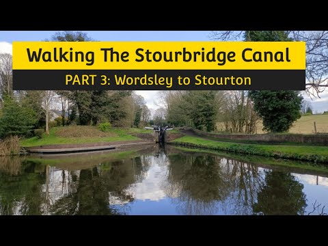
Walking The Stourbridge Canal (Part 3)

The final part of my walk along the Stourbridge Canal, the last bit of my Dudley and Stourbridge Canal series. Starting at Wordsley ...

UK Summer Vacation ( Staycation ) on a Narrow Boat..Pt3. Frm 12 Sep til 19 Sep 2020

DayThree of are Narrow Boat Adventure on HMS Ginger. Starting From Merry Hill today passing through lovely areas and ...

Walking Mum down the aisle! (Dunsley Hall, Kinver Wedding)

Our final wedding of 2021 was the wedding of Vicky and Paul at St Leonard's Church in Frankley, an unusal wedding in a way, ...

Kinver to Stourton in Staffordshire, England - May 2023

Kinver to Stourton. A walk from the Staffordshire town of Kinver to the nearby village of Stourton. The walk takes us along the tow ...

Nearby Amenities

Located within 500m of 52.469873,-2.2074301
Power Historic: tower
Source: OS 1:25k
Lat/Long: 52.4663444/-2.2050768
Power Historic: tower
Source: OS 1:25k
Lat/Long: 52.4715808/-2.2039809
The data included in this document is from www.openstreetmap.org. The data is made available under ODbL.

Have you been to Rabbit Osiers?

Leave your review of Rabbit Osiers below (or comments, questions and feedback).