Lodge Plantation

Wood, Forest in Staffordshire South Staffordshire

England

Lodge Plantation

Cave at Prestwood near Stourton, Staffordshire This cave in the Triassic sandstone is on land belonging to Prestwood Cave Nursery. The nursery grows a limited range of hardy shrubs and other plants. Quality is high, and the prices are very reasonable. The hard winter of 2010-2011 killed many plants in nurseries all over the West Midlands, but enough remains here to continue trading.
Cave at Prestwood near Stourton, Staffordshire Credit: Roger D Kidd

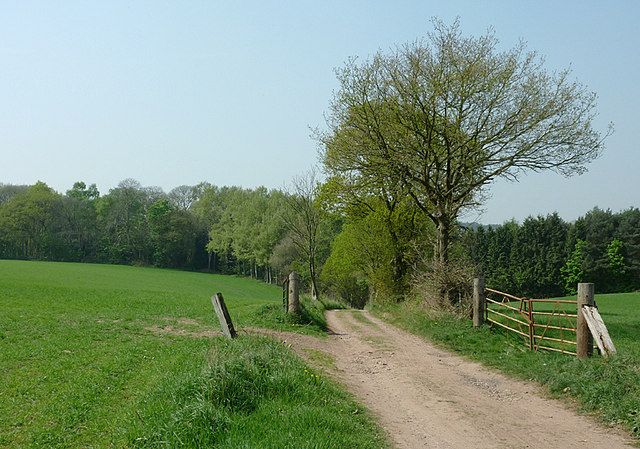
Lodge Plantation is a picturesque woodland located in the county of Staffordshire, England. Situated in the heart of the county, this expansive forest is a popular destination for nature lovers and outdoor enthusiasts.

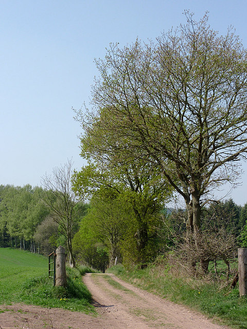
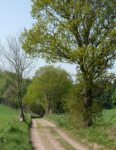
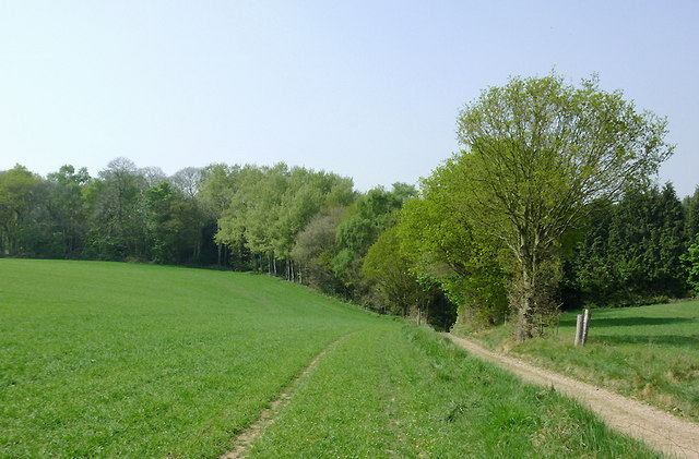
Spanning over several acres, Lodge Plantation offers a diverse range of flora and fauna, providing a habitat for various species of wildlife. The woodland is predominantly composed of mature trees, including oak, beech, and birch, which provide a lush green canopy during the summer months. The forest floor is covered with an array of wildflowers, ferns, and mosses, creating a vibrant and colorful undergrowth.

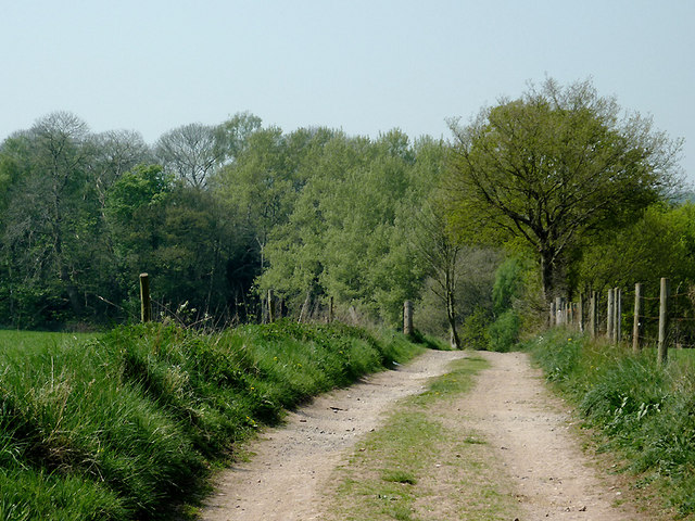
Visitors to Lodge Plantation can enjoy a range of recreational activities. There are several well-maintained walking trails that meander through the woodland, allowing visitors to explore the various corners of the plantation. These trails offer breathtaking views of the surrounding countryside and are suitable for both casual strolls and more challenging hikes.

The woodland is also home to a variety of wildlife, making it a haven for birdwatchers and nature photographers. Species such as woodpeckers, owls, and squirrels can often be spotted darting through the trees, adding to the charm and tranquility of the forest.

Lodge Plantation is easily accessible by car, with ample parking available for visitors. The site is well-maintained, with clear signage and information boards, ensuring a safe and enjoyable experience for all who visit. Whether you are seeking a peaceful retreat in nature or an active day exploring the great outdoors, Lodge Plantation in Staffordshire is a must-visit destination.

If you have any feedback on the listing, please let us know in the comments section below.

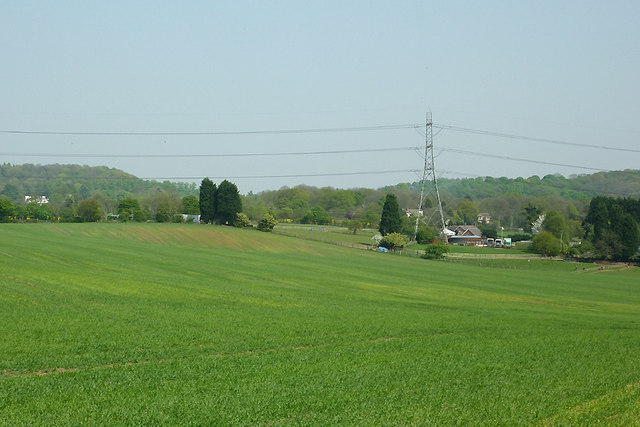
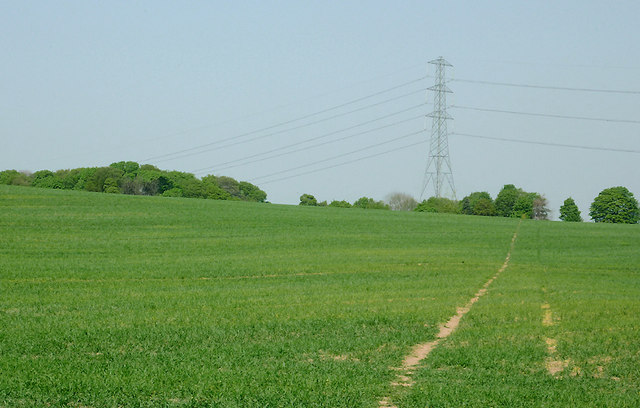
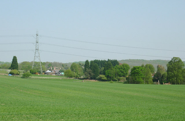
Lodge Plantation Images

Images are sourced within 2km of 52.47008/-2.1968762 or Grid Reference SO8685. Thanks to Geograph Open Source API. All images are credited.

Cave at Prestwood near Stourton, Staffordshire This cave in the Triassic sandstone is on land belonging to Prestwood Cave Nursery. The nursery grows a limited range of hardy shrubs and other plants. Quality is high, and the prices are very reasonable. The hard winter of 2010-2011 killed many plants in nurseries all over the West Midlands, but enough remains here to continue trading.
Cave at Prestwood near Stourton, Staffordshire
This cave in the Triassic sandstone is on land belonging to Prestwood Cave Nursery. The nursery grows a limited range of hardy shrubs and other plants. Quality is high, and the prices are very reasonable. The hard winter of 2010-2011 killed many plants in nurseries all over the West Midlands, but enough remains here to continue trading.
Prestwood Cave Nursery near Stourton, Staffordshire The nursery grows a limited range of hardy shrubs and other plants. Quality is high, and the prices are very reasonable. The hard winter of 2010-2011 killed many plants in nurseries all over the West Midlands, but enough remains here to continue trading.
Prestwood Cave Nursery near Stourton, Staffordshire
The nursery grows a limited range of hardy shrubs and other plants. Quality is high, and the prices are very reasonable. The hard winter of 2010-2011 killed many plants in nurseries all over the West Midlands, but enough remains here to continue trading.
Bridleway near Stourton, Staffordshire The bridleway links Wolverhampton Road (A449) at Prestwood with Greensforge Lane and Gothersley Farm.
Bridleway near Stourton, Staffordshire
The bridleway links Wolverhampton Road (A449) at Prestwood with Greensforge Lane and Gothersley Farm.
Bridleway near Stourton, Staffordshire The bridleway links Wolverhampton Road (A449) at Prestwood with Greensforge Lane and Gothersley Farm.
Bridleway near Stourton, Staffordshire
The bridleway links Wolverhampton Road (A449) at Prestwood with Greensforge Lane and Gothersley Farm.
Bridleway near Stourton, Staffordshire The bridleway links Wolverhampton Road (A449) at Prestwood with Greensforge Lane and Gothersley Farm.
Bridleway near Stourton, Staffordshire
The bridleway links Wolverhampton Road (A449) at Prestwood with Greensforge Lane and Gothersley Farm.
Staffordshire and Worcestershire Canal near Prestwood, Staffordshire Seen from the bridleway crossing Prestwood Bridge (No 34). The canal was opened in 1772, engineered by James Brindley. It joins the River Severn at Stourport to the Trent and Mersey Canal at Great Haywood Junction in Staffordshire. There are 43 locks (45 if you don't fancy the deep wide locks at Stourport) and the canal is 46 miles in length.
Staffordshire and Worcestershire Canal near Prestwood, Staffordshire
Seen from the bridleway crossing Prestwood Bridge (No 34). The canal was opened in 1772, engineered by James Brindley. It joins the River Severn at Stourport to the Trent and Mersey Canal at Great Haywood Junction in Staffordshire. There are 43 locks (45 if you don't fancy the deep wide locks at Stourport) and the canal is 46 miles in length.
Public footpath and stile near Prestwood, Staffordshire The path across this crop field seems little used. The bridleway from the Coach House which is mapped as being behind the camera does not exist at all now.
Public footpath and stile near Prestwood, Staffordshire
The path across this crop field seems little used. The bridleway from the Coach House which is mapped as being behind the camera does not exist at all now.
Farmland near Prestwood, Staffordshire Seen from the bridleway near Prestwood Cave Nursery.
Farmland near Prestwood, Staffordshire
Seen from the bridleway near Prestwood Cave Nursery.
Farmland near Prestwood, Staffordshire Looking across the fields from the bridleway between Prestwood and Greensforge Lane.
Farmland near Prestwood, Staffordshire
Looking across the fields from the bridleway between Prestwood and Greensforge Lane.
Crop field near Prestwood, Staffordshire What appear to be tractor wheel tracks actually follow almost exactly the course of a public footpath across the field to Foley Lane.
Crop field near Prestwood, Staffordshire
What appear to be tractor wheel tracks actually follow almost exactly the course of a public footpath across the field to Foley Lane.
Arable Land near Prestwood, Staffordshire Looking across the fields from the bridleway between Prestwood and Greensforge Lane. The tall dark green conifers in the centre of the image are by the A449 near Yew Tree Farm.
Arable Land near Prestwood, Staffordshire
Looking across the fields from the bridleway between Prestwood and Greensforge Lane. The tall dark green conifers in the centre of the image are by the A449 near Yew Tree Farm.
Bridleway north of Stourton, Staffordshire The bridleway links Wolverhampton Road (A449) at Prestwood with Greensforge Lane and Gothersley Farm. The woodland ahead is on the slope down to the Smestow River. To the right of the bridleway there is Gothersley Rough, and to the left, Colbourn's Rough.
Bridleway north of Stourton, Staffordshire
The bridleway links Wolverhampton Road (A449) at Prestwood with Greensforge Lane and Gothersley Farm. The woodland ahead is on the slope down to the Smestow River. To the right of the bridleway there is Gothersley Rough, and to the left, Colbourn's Rough.
Bridleway north of Stourton, Staffordshire The bridleway links Gothersley Farm and Greensforge Lane with the Wolverhampton Road (A449) at Prestwood. On the skyline are Lousy Wood and Crabtree Rough.
Bridleway north of Stourton, Staffordshire
The bridleway links Gothersley Farm and Greensforge Lane with the Wolverhampton Road (A449) at Prestwood. On the skyline are Lousy Wood and Crabtree Rough.
Bridleway north of Stourton, Staffordshire The bridleway links Wolverhampton Road (A449) at Prestwood with Greensforge Lane and Gothersley Farm, then on to The Million plantation and Enville. The woodland ahead is on the slope down to the Smestow River, east of the canal. To the right of the bridleway there is Gothersley Rough, and to the left, Colbourn's Rough.
Bridleway north of Stourton, Staffordshire
The bridleway links Wolverhampton Road (A449) at Prestwood with Greensforge Lane and Gothersley Farm, then on to The Million plantation and Enville. The woodland ahead is on the slope down to the Smestow River, east of the canal. To the right of the bridleway there is Gothersley Rough, and to the left, Colbourn's Rough.
Bridleway north of Stourton, Staffordshire The bridleway links Wolverhampton Road (A449) at Prestwood with Greensforge Lane and Gothersley Farm. The woodland ahead is on the slope down to the Smestow River. To the right of the bridleway there is Gothersley Rough, and to the left, Colbourn's Rough.
Bridleway north of Stourton, Staffordshire
The bridleway links Wolverhampton Road (A449) at Prestwood with Greensforge Lane and Gothersley Farm. The woodland ahead is on the slope down to the Smestow River. To the right of the bridleway there is Gothersley Rough, and to the left, Colbourn's Rough.
Bridleway north of Stourton, Staffordshire The bridleway links Wolverhampton Road (A449) at Prestwood with Greensforge Lane, Gothersley Farm and The Million. The woodland ahead is on the slope down to the canal and the Smestow River. To the right of the bridleway there is Gothersley Rough, and to the left, Colbourn's Rough.
Bridleway north of Stourton, Staffordshire
The bridleway links Wolverhampton Road (A449) at Prestwood with Greensforge Lane, Gothersley Farm and The Million. The woodland ahead is on the slope down to the canal and the Smestow River. To the right of the bridleway there is Gothersley Rough, and to the left, Colbourn's Rough.
Arable land north of Stourton, Staffordshire A bridleway crosses these fields, linking Wolverhampton Road (A449) at Prestwood with Greensforge Lane, Gothersley Farm and The Million. The woodland ahead is on the slope down to the Smestow River. To the right of the bridleway there is Gothersley Rough, and to the left, Colbourn's Rough.
Arable land north of Stourton, Staffordshire
A bridleway crosses these fields, linking Wolverhampton Road (A449) at Prestwood with Greensforge Lane, Gothersley Farm and The Million. The woodland ahead is on the slope down to the Smestow River. To the right of the bridleway there is Gothersley Rough, and to the left, Colbourn's Rough.
Show me another place!

Lodge Plantation is located at Grid Ref: SO8685 (Lat: 52.47008, Lng: -2.1968762)

Administrative County: Staffordshire

District: South Staffordshire

Police Authority: Staffordshire

What 3 Words

///wand.results.covertly. Near Kinvere, Staffordshire

Related Wikis

Prestwood (Kinver)

Prestwood is a hamlet now in the parish of Kinver, but in the Kingswinford until the creation of Brierley Hill Urban District in the 1930s. == History... ==

Stourton, Staffordshire

Stourton is a hamlet in Staffordshire, England a few miles to the northwest of Stourbridge. There is a fair amount of dispute over the pronunciation, being...

Smestow Brook

The Smestow Brook, sometimes called the River Smestow, is a small river that plays an important part in the drainage of Wolverhampton, South Staffordshire...

Ridgewood High School, Wollaston

Ridgewood High School is a coeducational secondary school, a part of the Stour Vale Academy Trust situated in Wollaston (near Stourbridge), in the West...

Nearby Amenities

Located within 500m of 52.47008,-2.1968762
Bus Stop
Prestwood House
Bus: yes
Naptan AtcoCode: 3800C612600
Naptan Bearing: SW
Naptan CommonName: Prestwood House
Naptan Indicator: Adj
Naptan Landmark: Prestwood House
Naptan Street: Boundary Lane
Naptan Verified: no
Public Transport: platform
Source: naptan_import
Lat/Long: 52.4730715/-2.1992504
The data included in this document is from www.openstreetmap.org. The data is made available under ODbL.

Have you been to Lodge Plantation?

Leave your review of Lodge Plantation below (or comments, questions and feedback).