Sarn Hill Wood

Wood, Forest in Worcestershire Malvern Hills

England

Sarn Hill Wood

Bishops Walk, Forthampton The tree-lined Bishops Walk, the road approaching the village of Forthampton.
Bishops Walk, Forthampton Credit: Philip Halling

Sarn Hill Wood is a picturesque woodland located in Worcestershire, England. Covering an area of approximately 30 acres, this forested area is a haven for nature enthusiasts and provides a tranquil escape from the bustling city life.

The wood is characterized by a diverse range of tree species, including oak, beech, and birch, which create a dense canopy during the summer months. This lush greenery provides a perfect habitat for a wide variety of wildlife, such as squirrels, deer, and an array of bird species.

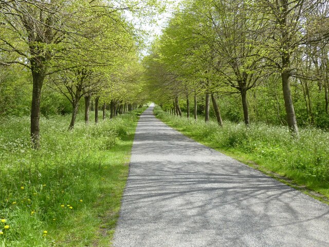
The wood is crisscrossed by a network of well-maintained footpaths and trails, allowing visitors to explore its natural beauty at their own pace. These paths wind through the trees, taking walkers on a journey through the changing seasons, from the vibrant colors of spring to the golden hues of autumn.

One of the highlights of Sarn Hill Wood is the presence of a small stream that meanders through the heart of the woodland. This babbling brook adds to the charm of the place and provides a serene soundtrack to accompany a peaceful walk.

The wood is open to the public year-round, offering a range of activities for visitors to enjoy. Whether it's a leisurely stroll, a picnic by the stream, or birdwatching from one of the designated viewing areas, Sarn Hill Wood has something to offer for everyone.

Overall, Sarn Hill Wood is a natural gem in Worcestershire, providing a much-needed sanctuary for both wildlife and humans alike. Its beauty and tranquility make it a popular destination for nature lovers seeking a peaceful retreat in the heart of the county.

If you have any feedback on the listing, please let us know in the comments section below.

Sarn Hill Wood Images

Images are sourced within 2km of 52.003241/-2.2059335 or Grid Reference SO8533. Thanks to Geograph Open Source API. All images are credited.

Bishops Walk, Forthampton The tree-lined Bishops Walk, the road approaching the village of Forthampton.
Bishops Walk, Forthampton
The tree-lined Bishops Walk, the road approaching the village of Forthampton.
The Hunter's Inn The Hunter's Inn on the B4211 at Buckbury between Forthampton and Longdon.
The Hunter's Inn
The Hunter's Inn on the B4211 at Buckbury between Forthampton and Longdon.
Hunter's Inn sign The inn sign of the Hunter's Inn and a couple of old farm implements.
Hunter's Inn sign
The inn sign of the Hunter's Inn and a couple of old farm implements.
Southfield House and Tewkesbury Abbey The Flemish bond red bricks structures are part of Southfield House, built around 1732 and extended in the 19th century. In the background is the largest Romanesque crossing tower in Europe, and that is at Tewkesbury Abbey (parish church of St. Mary the Virgin). Most of the buildings at Southfield House were grade II listed in January 1955, and the Tewkesbury Abbey church building was grade I listed in March 1952.
Southfield House and Tewkesbury Abbey
The Flemish bond red bricks structures are part of Southfield House, built around 1732 and extended in the 19th century. In the background is the largest Romanesque crossing tower in Europe, and that is at Tewkesbury Abbey (parish church of St. Mary the Virgin). Most of the buildings at Southfield House were grade II listed in January 1955, and the Tewkesbury Abbey church building was grade I listed in March 1952.
Forthampton House Situated south of St. Mary the Virgin parish church is Forthampton House, a Flemish bond red brick structure built in the 17th/18th century. The summer house east of Forthampton House was built in the 18th century, and these buildings were grade II listed in August 1985.
Forthampton House
Situated south of St. Mary the Virgin parish church is Forthampton House, a Flemish bond red brick structure built in the 17th/18th century. The summer house east of Forthampton House was built in the 18th century, and these buildings were grade II listed in August 1985.
The village of Forthampton Here is the first photograph I took of Forthampton on my first visit to the village. The village, situated in northernmost Gloucestershire, is complete with many historic buildings that have listed status, and the countryside views are fantastic.
The village of Forthampton
Here is the first photograph I took of Forthampton on my first visit to the village. The village, situated in northernmost Gloucestershire, is complete with many historic buildings that have listed status, and the countryside views are fantastic.
Path to St. Mary the Virgin church (Forthampton) The path to Forthampton parish church is a track that becomes a dead end at No. 14-17 Church Row. There are many trees of different specimen in the church grounds.
Path to St. Mary the Virgin church (Forthampton)
The path to Forthampton parish church is a track that becomes a dead end at No. 14-17 Church Row. There are many trees of different specimen in the church grounds.
Stocks and whipping post at Forthampton Situated around thirty-five metres to the west of Forthampton parish church are the village stocks and whipping post. These wooden structures, surrounded by an old iron gate, were restored in 1990. The stocks and whipping post were grade II listed in January 1955.
Stocks and whipping post at Forthampton
Situated around thirty-five metres to the west of Forthampton parish church are the village stocks and whipping post. These wooden structures, surrounded by an old iron gate, were restored in 1990. The stocks and whipping post were grade II listed in January 1955.
St. Mary the Virgin church (Forthampton) Here is the parish church of St. Mary the Virgin in Forthampton, which stands on a knoll that has brilliant views to the countryside. The building was first built in the 13th century, and was restored in 1788. The church was altered from 1863-66 by William Burges, and the building was grade II* listed in January 1955.
St. Mary the Virgin church (Forthampton)
Here is the parish church of St. Mary the Virgin in Forthampton, which stands on a knoll that has brilliant views to the countryside. The building was first built in the 13th century, and was restored in 1788. The church was altered from 1863-66 by William Burges, and the building was grade II* listed in January 1955.
St. Mary the Virgin church (Bell tower | Forthampton) Here is the west bell tower of three stages at St. Mary the Virgin parish church, built in the 13th century.
St. Mary the Virgin church (Bell tower | Forthampton)
Here is the west bell tower of three stages at St. Mary the Virgin parish church, built in the 13th century.
Detail inside St. Mary the Virgin church (South porch | Forthampton) Situated above the doorway in the south porch is an eroded hood, with a segmental section forming an arc over the door with beast-head stops; this dates from the 12th century.
Detail inside St. Mary the Virgin church (South porch | Forthampton)
Situated above the doorway in the south porch is an eroded hood, with a segmental section forming an arc over the door with beast-head stops; this dates from the 12th century.
St. Mary the Virgin church (Font | Forthampton) Here is the octagonal alabaster font in the nave at Forthampton parish church, built in the 19th century.
St. Mary the Virgin church (Font | Forthampton)
Here is the octagonal alabaster font in the nave at Forthampton parish church, built in the 19th century.
St. Mary the Virgin church (Pews | Forthampton) The pews in the nave dates from the 19th century, except these pews in the west end consists of reused linenfold panels from the 15th century.
St. Mary the Virgin church (Pews | Forthampton)
The pews in the nave dates from the 19th century, except these pews in the west end consists of reused linenfold panels from the 15th century.
Entrance to St. Mary the Virgin church (Bell tower | Forthampton) The arch in the distance frames the east entrance to the west bell tower from the nave.
Entrance to St. Mary the Virgin church (Bell tower | Forthampton)
The arch in the distance frames the east entrance to the west bell tower from the nave.
St. Mary the Virgin church (Forthampton) Here is the interior of Forthampton parish church, which consists of a nave, chancel, north aisle and organ chamber.
St. Mary the Virgin church (Forthampton)
Here is the interior of Forthampton parish church, which consists of a nave, chancel, north aisle and organ chamber.
Pyrography inside St. Mary the Virgin church (Forthampton) This splendid pyrography (pokerwork/wood burning) work is situated in the south wall of the nave, and this dates from 1845. This was built as the dossal (reredos) in the east end of the chancel, but its use as a dossal was short-lived.
Pyrography inside St. Mary the Virgin church (Forthampton)
This splendid pyrography (pokerwork/wood burning) work is situated in the south wall of the nave, and this dates from 1845. This was built as the dossal (reredos) in the east end of the chancel, but its use as a dossal was short-lived.
St. Mary the Virgin church (North aisle | Forthampton) Here is the west end of the north aisle at Forthampton parish church, with a three-light stained-glass window in view.
St. Mary the Virgin church (North aisle | Forthampton)
Here is the west end of the north aisle at Forthampton parish church, with a three-light stained-glass window in view.
Window inside St. Mary the Virgin church (North aisle | Forthampton) This three-light stained-glass window is situated in the west end of the north aisle.
Window inside St. Mary the Virgin church (North aisle | Forthampton)
This three-light stained-glass window is situated in the west end of the north aisle.
Show me another place!

Sarn Hill Wood is located at Grid Ref: SO8533 (Lat: 52.003241, Lng: -2.2059335)

Administrative County: Worcestershire

District: Malvern Hills

Police Authority: West Mercia

What 3 Words

///tastes.themes.crate. Near Tewkesbury, Gloucestershire

Related Wikis

Forthampton

Forthampton is a village in Gloucestershire, England The village is located three miles from the market town of Tewkesbury and features "a great number...
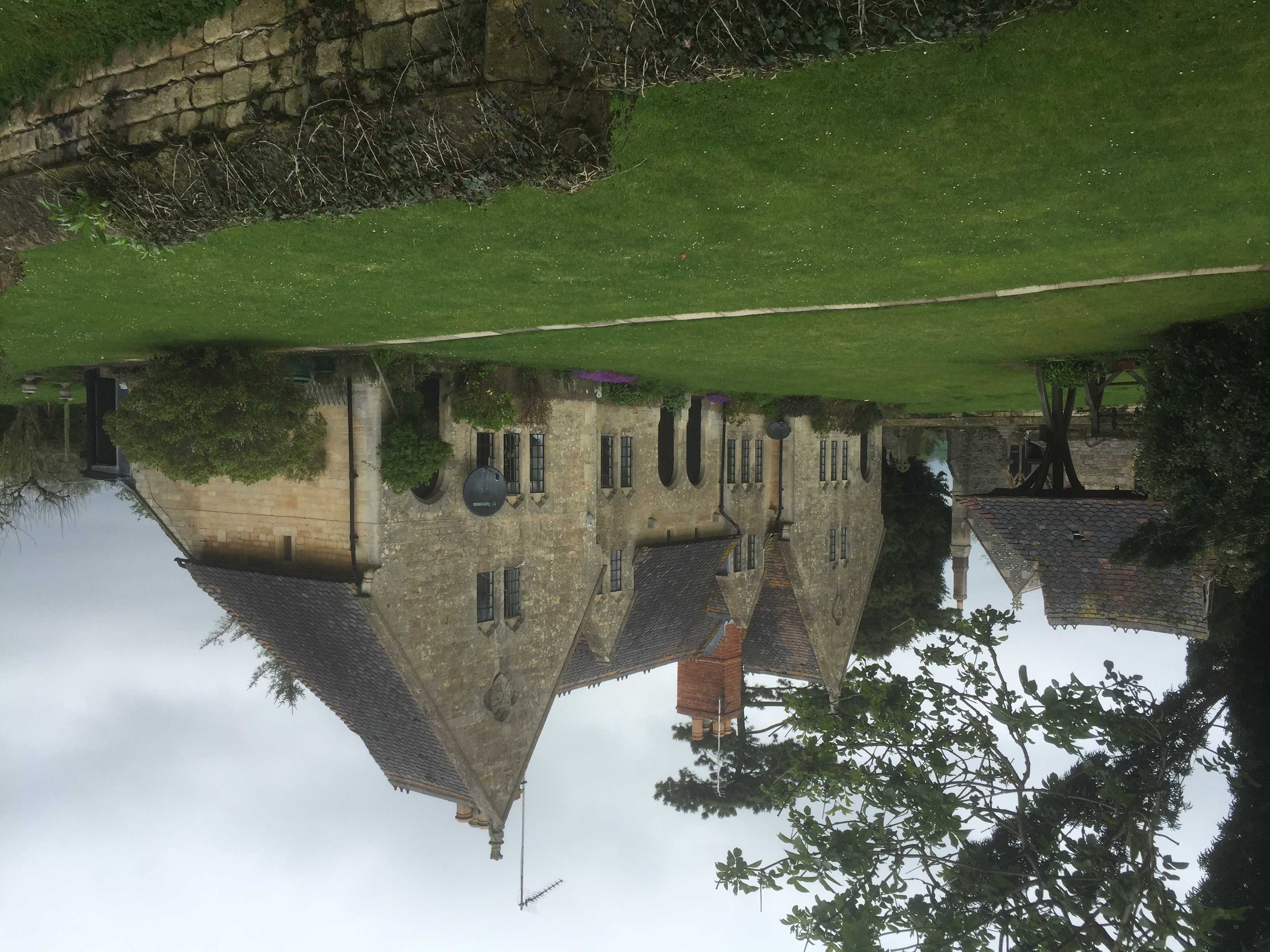
Yorke Almshouses

The Yorke Almshouses, Nos. 14–17 Church Row, Forthampton, Gloucestershire, England, are a range of four almshouses designed by the architect William Burges...

Bushley

Bushley is a small village and civil parish in the Malvern Hills district in Worcestershire, England. The church is dedicated to Saint Peter. At the 2021...

Old River Severn, Upper Lode

Old River Severn, Upper Lode (grid reference SO880331) is a 3.72-hectare (9.2-acre) biological Site of Special Scientific Interest in Gloucestershire,...
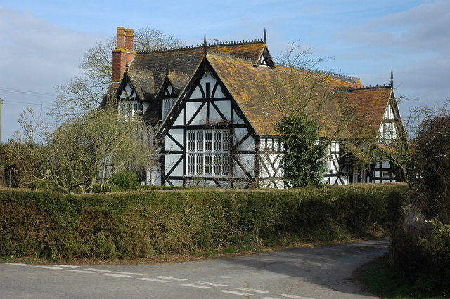
Bredon School

Bredon School, formerly Pull Court, is a private school in Bushley, Worcestershire, England. The house was built for the Reverend Canon E. C. Dowdeswell...

Borough of Tewkesbury

The Borough of Tewkesbury is a local government district with borough status in Gloucestershire, England. The borough is named after its largest town,...

Mythe Railway Nature Reserve

Mythe Railway Nature Reserve (grid reference SO887341) is a 2.8-hectare (6.9-acre) nature reserve in Gloucestershire. The site is listed in the ‘Tewkesbury...

Severn Ham, Tewkesbury

Severn Ham, Tewkesbury (grid reference SO885325) is a 70.82-hectare (175.0-acre) biological Site of Special Scientific Interest in Gloucestershire near...

Nearby Amenities

Located within 500m of 52.003241,-2.2059335
Sarn Hill
Natural: peak
Lat/Long: 52.0034936/-2.2067629
Sarn Hill Grange
Power: pole
Transformer: distribution
Voltage Primary: 11000
Lat/Long: 52.0073819/-2.2034086
Sarn Hill Reservoir
Power: pole
Transformer: distribution
Voltage Primary: 11000
Lat/Long: 52.0051785/-2.2066916
Power: pole
Lat/Long: 52.0055083/-2.2057374
Power: pole
Lat/Long: 52.0058319/-2.2047818
Power: pole
Lat/Long: 52.0061725/-2.2037599
Power: pole
Lat/Long: 52.0065588/-2.2030444
Power: pole
Lat/Long: 52.006965/-2.2022921
Wood Street
Power: pole
Transformer: distribution
Voltage Primary: 11000
Lat/Long: 52.0065477/-2.2011394
Massey Farm
Power: pole
Transformer: distribution
Voltage Primary: 11000
Lat/Long: 52.0010108/-2.2097285
Power: pole
Lat/Long: 52.0006352/-2.2100101
Power: pole
Lat/Long: 52.0002516/-2.2103186
The data included in this document is from www.openstreetmap.org. The data is made available under ODbL.

Have you been to Sarn Hill Wood?

Leave your review of Sarn Hill Wood below (or comments, questions and feedback).