Lucknow Plantation
Wood, Forest in Wiltshire
England
Lucknow Plantation
Lucknow Plantation is a picturesque woodland located in Wiltshire, England. Spread over an area of approximately 100 acres, this plantation is known for its diverse range of tree species and its breathtaking natural beauty. It is situated near the charming village of Lucknow, which adds to the overall charm of the area.
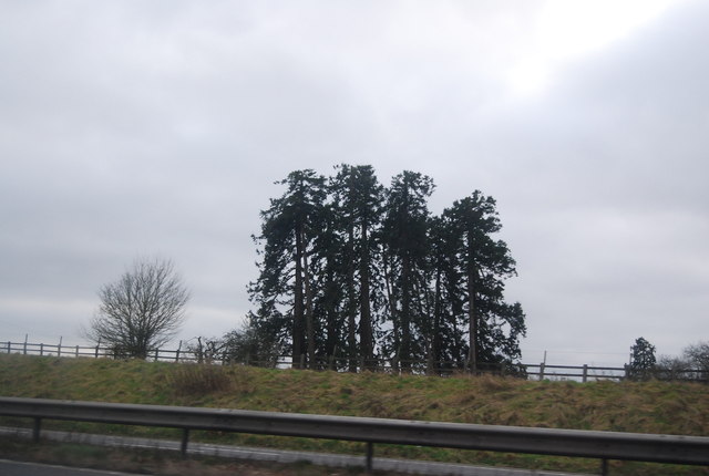
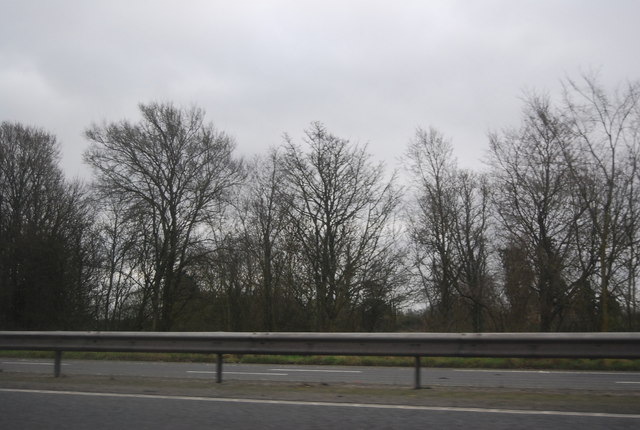
The plantation is predominantly covered with dense deciduous trees, including oak, beech, ash, and birch, which create a stunning canopy overhead. These trees provide a habitat for a variety of wildlife, making it a popular destination for nature enthusiasts and birdwatchers. Lucky visitors may spot deer, foxes, and a multitude of bird species, such as woodpeckers, owls, and thrushes.
The woodland is crisscrossed with several well-maintained trails, making it easily accessible for hikers and walkers. These trails offer stunning views of the surrounding countryside and lead visitors through lush green meadows and flower-filled clearings. In addition to the hiking trails, the plantation also features picnic areas, where visitors can relax and enjoy the tranquility of the surroundings.
Lucknow Plantation is not only a haven for nature lovers but also plays an essential role in the conservation of the local ecosystem. The careful management of the woodland ensures the preservation of the native flora and fauna, making it an important ecological resource for the region.
Overall, Lucknow Plantation in Wiltshire is a true gem of natural beauty, offering visitors a chance to immerse themselves in the peaceful ambiance of a thriving woodland.
If you have any feedback on the listing, please let us know in the comments section below.
Lucknow Plantation Images
Images are sourced within 2km of 51.508051/-2.2041948 or Grid Reference ST8578. Thanks to Geograph Open Source API. All images are credited.


Lucknow Plantation is located at Grid Ref: ST8578 (Lat: 51.508051, Lng: -2.2041948)
Unitary Authority: Wiltshire
Police Authority: Wiltshire
What 3 Words
///refreshed.rephrase.rate. Near Nettleton, Wiltshire
Nearby Locations
Related Wikis

Sevington Victorian School
Sevington School, near the village of Grittleton, Wiltshire, England, was built in 1848 by Joseph Neeld, a landowner, for the children of his estate workers...

Grittleton House
Grittleton House is a country house in the village of Grittleton, Wiltshire, England, about 5+1⁄2 miles (9 km) northwest of the town of Chippenham. It...
Grittleton House School
Grittleton House School was an independent school in Wiltshire, England, between 1951 and 2016, at Grittleton House. == History == A small, independent...

Grittleton
Grittleton is a village and civil parish in Wiltshire, England, 6 miles (10 km) northwest of Chippenham. The parish includes the hamlets of Foscote,...

Grittleton Strict Baptist Chapel
Grittleton Strict Baptist Chapel is a Baptist chapel in The Street, Grittleton, Wiltshire, England. It is recorded in the National Heritage List for England...
Broomfield, Wiltshire
Broomfield is a hamlet in Wiltshire, England. It is in Yatton Keynell parish, north of Yatton Keynell village and about 4 miles (6 km) northwest of the...
RAF Castle Combe
Royal Air Force Castle Combe or more simply RAF Castle Combe is a former Royal Air Force satellite airfield located 0.5 miles (0.80 km) southeast of Castle...

Castle Combe Circuit
Castle Combe Circuit is a motor racing circuit in Wiltshire, England, approximately 20-mile (32 km) from Bristol. The circuit is based on the perimeter...
Nearby Amenities
Located within 500m of 51.508051,-2.2041948Have you been to Lucknow Plantation?
Leave your review of Lucknow Plantation below (or comments, questions and feedback).