Haremere Wood
Wood, Forest in Dorset
England
Haremere Wood
![Wool features [5] In High Street is this K6 telephone box, designed in 1935 by Sir Giles Gilbert Scott. Listed, grade II, with details at: <span class="nowrap"><a title="https://historicengland.org.uk/listing/the-list/list-entry/1454418" rel="nofollow ugc noopener" href="https://historicengland.org.uk/listing/the-list/list-entry/1454418">Link</a><img style="margin-left:2px;" alt="External link" title="External link - shift click to open in new window" src="https://s1.geograph.org.uk/img/external.png" width="10" height="10"/></span>
Wool is a large village in Dorset, midway between Dorchester and Poole, both about 10 miles distant. Set on the south bank of the River Frome, the village includes Bovington Camp army base to the north. The place-name &#039;Wool&#039; is first recorded in Anglo-Saxon Writs in the first years of the 11th century. The ruins of Bindon Abbey are nearby, demolished in 1539, the stone was used to build castles in Portland, Lulworth and Sandsfoot.](https://s2.geograph.org.uk/geophotos/07/25/80/7258086_5b91a884.jpg)
Haremere Wood is a picturesque forest located in the county of Dorset, England. Spanning an area of approximately 200 acres, this woodland offers visitors a serene and enchanting escape from the hustle and bustle of city life.
The forest is predominantly composed of deciduous trees, including oak, beech, and ash, which provide a rich canopy of foliage during the summer months. The diverse flora and fauna found within Haremere Wood make it a haven for nature enthusiasts and wildlife lovers alike. Visitors can expect to encounter a variety of bird species, such as woodpeckers and songbirds, as well as small mammals like squirrels and rabbits.
Trails and footpaths wind their way through the forest, offering visitors the opportunity to explore the wood at their own pace. These pathways are well-maintained and provide easy access for walkers, joggers, and cyclists. The peaceful atmosphere and natural beauty of Haremere Wood make it an ideal location for leisurely strolls, family picnics, or even a tranquil spot for meditation.
In addition to its natural wonders, Haremere Wood also holds historical significance. The remains of ancient earthworks and a burial mound can be found within the forest, hinting at its rich past. Archaeological enthusiasts may find themselves captivated by the mysteries that lie hidden beneath the forest floor.
Overall, Haremere Wood is a charming and captivating woodland that offers visitors an opportunity to reconnect with nature and explore the history of the land. With its tranquil ambiance and diverse ecosystem, it is a must-visit destination for those seeking a peaceful retreat in the heart of Dorset.
If you have any feedback on the listing, please let us know in the comments section below.
Haremere Wood Images
Images are sourced within 2km of 50.663134/-2.2042105 or Grid Reference SY8584. Thanks to Geograph Open Source API. All images are credited.
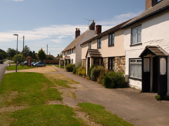
![Wool houses [17] Number 55 Spring Street is the former dairy house to Manor Farm, now a private dwelling. Built, probably, in the 18th century, of rubble stone with brick dressings, heightened in plastered cob, all under a thatch roof. There are four horizontally sliding sash windows. Listed, grade II, with details at: <span class="nowrap"><a title="https://historicengland.org.uk/listing/the-list/list-entry/1152940" rel="nofollow ugc noopener" href="https://historicengland.org.uk/listing/the-list/list-entry/1152940">Link</a><img style="margin-left:2px;" alt="External link" title="External link - shift click to open in new window" src="https://s1.geograph.org.uk/img/external.png" width="10" height="10"/></span>
Wool is a large village in Dorset, midway between Dorchester and Poole, both about 10 miles distant. Set on the south bank of the River Frome, the village includes Bovington Camp army base to the north. The place-name &#039;Wool&#039; is first recorded in Anglo-Saxon Writs in the first years of the 11th century. The ruins of Bindon Abbey are nearby, demolished in 1539, the stone was used to build castles in Portland, Lulworth and Sandsfoot.](https://s0.geograph.org.uk/geophotos/07/25/88/7258848_5dc0650d.jpg)
![Wool Buildings [3] At the rear of number 55 Spring Street, <a href="https://www.geograph.org.uk/photo/7258848">SY8486 : Wool houses [17]</a>, are a range of buildings of Manor Farm. There is a shelter shed, an open shelter and stables. Constructed of a mixture of brick, cob and stone, under roofs of corrugated iron and of tile. This view is to the left of number 55, the view from the right is at <a href="https://www.geograph.org.uk/photo/7258851">SY8486 : Wool Buildings [4]</a>. Listed, for group value, grade II, with details at: <span class="nowrap"><a title="https://historicengland.org.uk/listing/the-list/list-entry/1120377" rel="nofollow ugc noopener" href="https://historicengland.org.uk/listing/the-list/list-entry/1120377">Link</a><img style="margin-left:2px;" alt="External link" title="External link - shift click to open in new window" src="https://s1.geograph.org.uk/img/external.png" width="10" height="10"/></span>
Wool is a large village in Dorset, midway between Dorchester and Poole, both about 10 miles distant. Set on the south bank of the River Frome, the village includes Bovington Camp army base to the north. The place-name &#039;Wool&#039; is first recorded in Anglo-Saxon Writs in the first years of the 11th century. The ruins of Bindon Abbey are nearby, demolished in 1539, the stone was used to build castles in Portland, Lulworth and Sandsfoot.](https://s2.geograph.org.uk/geophotos/07/25/88/7258850_b434a352.jpg)
![Wool Buildings [4] At the rear of number 55 Spring Street, <a href="https://www.geograph.org.uk/photo/7258848">SY8486 : Wool houses [17]</a>, are a range of buildings of Manor Farm. There is a shelter shed, an open shelter and stables. Constructed of a mixture of brick, cob and stone, under roofs of corrugated iron and of tile. This view is to the right of number 55, the view from the left is at <a href="https://www.geograph.org.uk/photo/7258850">SY8486 : Wool Buildings [3]</a>. Listed, for group value, grade II, with details at: <span class="nowrap"><a title="https://historicengland.org.uk/listing/the-list/list-entry/1120377" rel="nofollow ugc noopener" href="https://historicengland.org.uk/listing/the-list/list-entry/1120377">Link</a><img style="margin-left:2px;" alt="External link" title="External link - shift click to open in new window" src="https://s1.geograph.org.uk/img/external.png" width="10" height="10"/></span>
Wool is a large village in Dorset, midway between Dorchester and Poole, both about 10 miles distant. Set on the south bank of the River Frome, the village includes Bovington Camp army base to the north. The place-name &#039;Wool&#039; is first recorded in Anglo-Saxon Writs in the first years of the 11th century. The ruins of Bindon Abbey are nearby, demolished in 1539, the stone was used to build castles in Portland, Lulworth and Sandsfoot.](https://s3.geograph.org.uk/geophotos/07/25/88/7258851_2eaad630.jpg)
![Wool houses [19] Almost hidden by the trees, Regency Cottage, number 56 Church Lane, was formerly Seaforth Cottage. Built, in Cottage Orné style, in the early 19th century in two parallel ranges. Constructed of plastered cob under a roof of thatch at the front and slates at the rear. Listed, grade II, with details at: <span class="nowrap"><a title="https://historicengland.org.uk/listing/the-list/list-entry/1152863" rel="nofollow ugc noopener" href="https://historicengland.org.uk/listing/the-list/list-entry/1152863">Link</a><img style="margin-left:2px;" alt="External link" title="External link - shift click to open in new window" src="https://s1.geograph.org.uk/img/external.png" width="10" height="10"/></span>
Wool is a large village in Dorset, midway between Dorchester and Poole, both about 10 miles distant. Set on the south bank of the River Frome, the village includes Bovington Camp army base to the north. The place-name &#039;Wool&#039; is first recorded in Anglo-Saxon Writs in the first years of the 11th century. The ruins of Bindon Abbey are nearby, demolished in 1539, the stone was used to build castles in Portland, Lulworth and Sandsfoot.](https://s1.geograph.org.uk/geophotos/07/25/88/7258853_54660aed.jpg)
![Wool houses [20] Gingerbread Cottage, number 58 Church Lane, (nearer the camera), and Midden Cottage, number 57 Church Lane, are a pair of semi-detached cottages, probably built in the 18th century. Number 57 has plastered cob walls under a thatch roof. Number 58 is of rubble stone, brick and cob on a stone base, all under a thatch roof. All the windows are horizontally sliding sashes. Listed, grade II, with details at: <span class="nowrap"><a title="https://historicengland.org.uk/listing/the-list/list-entry/1120364" rel="nofollow ugc noopener" href="https://historicengland.org.uk/listing/the-list/list-entry/1120364">Link</a><img style="margin-left:2px;" alt="External link" title="External link - shift click to open in new window" src="https://s1.geograph.org.uk/img/external.png" width="10" height="10"/></span>
Wool is a large village in Dorset, midway between Dorchester and Poole, both about 10 miles distant. Set on the south bank of the River Frome, the village includes Bovington Camp army base to the north. The place-name &#039;Wool&#039; is first recorded in Anglo-Saxon Writs in the first years of the 11th century. The ruins of Bindon Abbey are nearby, demolished in 1539, the stone was used to build castles in Portland, Lulworth and Sandsfoot.](https://s3.geograph.org.uk/geophotos/07/25/88/7258855_f9b4892d.jpg)
![Wool houses [21] Rowan Tree Cottage, number 60 Church Lane, was formerly two cottages. Built, probably, in the 18th century of plastered cob walls on a stone base under a thatch roof. The former attached barn, under a tile roof, is now part of the cottage. There is a rear extension. Some original internal features remain. Listed, grade II, with details at: <span class="nowrap"><a title="https://historicengland.org.uk/listing/the-list/list-entry/1152867" rel="nofollow ugc noopener" href="https://historicengland.org.uk/listing/the-list/list-entry/1152867">Link</a><img style="margin-left:2px;" alt="External link" title="External link - shift click to open in new window" src="https://s1.geograph.org.uk/img/external.png" width="10" height="10"/></span>
Wool is a large village in Dorset, midway between Dorchester and Poole, both about 10 miles distant. Set on the south bank of the River Frome, the village includes Bovington Camp army base to the north. The place-name &#039;Wool&#039; is first recorded in Anglo-Saxon Writs in the first years of the 11th century. The ruins of Bindon Abbey are nearby, demolished in 1539, the stone was used to build castles in Portland, Lulworth and Sandsfoot.](https://s3.geograph.org.uk/geophotos/07/25/88/7258859_a2c36b9e.jpg)
![Wool houses [22] Kingfisher Cottage, number 61 Church Lane, was probably built in the 18th century. Constructed of pebbledashed cob under a thatch roof. There is a later rear extension. Listed, grade II, with details at: <span class="nowrap"><a title="https://historicengland.org.uk/listing/the-list/list-entry/1120363" rel="nofollow ugc noopener" href="https://historicengland.org.uk/listing/the-list/list-entry/1120363">Link</a><img style="margin-left:2px;" alt="External link" title="External link - shift click to open in new window" src="https://s1.geograph.org.uk/img/external.png" width="10" height="10"/></span>
Wool is a large village in Dorset, midway between Dorchester and Poole, both about 10 miles distant. Set on the south bank of the River Frome, the village includes Bovington Camp army base to the north. The place-name &#039;Wool&#039; is first recorded in Anglo-Saxon Writs in the first years of the 11th century. The ruins of Bindon Abbey are nearby, demolished in 1539, the stone was used to build castles in Portland, Lulworth and Sandsfoot.](https://s3.geograph.org.uk/geophotos/07/25/88/7258863_3ec885ee.jpg)
![Wool houses [23] Melissa Cottage, number 62 Church Lane, was built in the 18th century, altered in the 19th century and extended in the late 20th century. Constructed of plastered cob on a stone base under a tile roof. Most of the windows are
horizontally sliding sashes. Listed, for group value, grade II, with details at: <span class="nowrap"><a title="https://historicengland.org.uk/listing/the-list/list-entry/1323394" rel="nofollow ugc noopener" href="https://historicengland.org.uk/listing/the-list/list-entry/1323394">Link</a><img style="margin-left:2px;" alt="External link" title="External link - shift click to open in new window" src="https://s1.geograph.org.uk/img/external.png" width="10" height="10"/></span>
Wool is a large village in Dorset, midway between Dorchester and Poole, both about 10 miles distant. Set on the south bank of the River Frome, the village includes Bovington Camp army base to the north. The place-name &#039;Wool&#039; is first recorded in Anglo-Saxon Writs in the first years of the 11th century. The ruins of Bindon Abbey are nearby, demolished in 1539, the stone was used to build castles in Portland, Lulworth and Sandsfoot.](https://s1.geograph.org.uk/geophotos/07/25/88/7258865_bea37e67.jpg)
![Wool houses [24] The Thatched Cottage, number 64 Church Lane, was probably built in the 18th century, possibly incorporating an earlier structure. Constructed partly of plastered cob, partly of brick, on a stone base, all under a thatch roof. Many of the windows are horizontally sliding sashes. Listed, grade II, with details at: <span class="nowrap"><a title="https://historicengland.org.uk/listing/the-list/list-entry/1323393" rel="nofollow ugc noopener" href="https://historicengland.org.uk/listing/the-list/list-entry/1323393">Link</a><img style="margin-left:2px;" alt="External link" title="External link - shift click to open in new window" src="https://s1.geograph.org.uk/img/external.png" width="10" height="10"/></span>
Wool is a large village in Dorset, midway between Dorchester and Poole, both about 10 miles distant. Set on the south bank of the River Frome, the village includes Bovington Camp army base to the north. The place-name &#039;Wool&#039; is first recorded in Anglo-Saxon Writs in the first years of the 11th century. The ruins of Bindon Abbey are nearby, demolished in 1539, the stone was used to build castles in Portland, Lulworth and Sandsfoot.](https://s1.geograph.org.uk/geophotos/07/25/89/7258905_89f5f701.jpg)
![Parish church [1] The Anglican parish church of The Holy Rood was built, nave only, in the 13th century, the chancel, north arcade and tower were added circa 1450. In 1865 the church was demolished except for the tower and north and east walls of the nave, and rebuilt. Constructed of rubble stone with free stone dressings under roofs of tile or of lead. The font is 15th century, other internal fittings are 19th century. Listed, grade II*, with details at: <span class="nowrap"><a title="https://historicengland.org.uk/listing/the-list/list-entry/1120365" rel="nofollow ugc noopener" href="https://historicengland.org.uk/listing/the-list/list-entry/1120365">Link</a><img style="margin-left:2px;" alt="External link" title="External link - shift click to open in new window" src="https://s1.geograph.org.uk/img/external.png" width="10" height="10"/></span>
Wool is a large village in Dorset, midway between Dorchester and Poole, both about 10 miles distant. Set on the south bank of the River Frome, the village includes Bovington Camp army base to the north. The place-name &#039;Wool&#039; is first recorded in Anglo-Saxon Writs in the first years of the 11th century. The ruins of Bindon Abbey are nearby, demolished in 1539, the stone was used to build castles in Portland, Lulworth and Sandsfoot.](https://s1.geograph.org.uk/geophotos/07/25/89/7258909_5d802de1.jpg)
![Parish church [2] The Anglican parish church of The Holy Rood was built, nave only, in the 13th century, the chancel, north arcade and tower were added circa 1450. In 1865 the church was demolished except for the tower and north and east walls of the nave, and rebuilt. Constructed of rubble stone with free stone dressings under roofs of tile or of lead. The font is 15th century, other internal fittings are 19th century. Listed, grade II*, with details at: <span class="nowrap"><a title="https://historicengland.org.uk/listing/the-list/list-entry/1120365" rel="nofollow ugc noopener" href="https://historicengland.org.uk/listing/the-list/list-entry/1120365">Link</a><img style="margin-left:2px;" alt="External link" title="External link - shift click to open in new window" src="https://s1.geograph.org.uk/img/external.png" width="10" height="10"/></span>
Wool is a large village in Dorset, midway between Dorchester and Poole, both about 10 miles distant. Set on the south bank of the River Frome, the village includes Bovington Camp army base to the north. The place-name &#039;Wool&#039; is first recorded in Anglo-Saxon Writs in the first years of the 11th century. The ruins of Bindon Abbey are nearby, demolished in 1539, the stone was used to build castles in Portland, Lulworth and Sandsfoot.](https://s2.geograph.org.uk/geophotos/07/25/89/7258910_36eaadd8.jpg)
![Parish church [3] The chancel.
The Anglican parish church of The Holy Rood was built, nave only, in the 13th century, the chancel, north arcade and tower were added circa 1450. In 1865 the church was demolished except for the tower and north and east walls of the nave, and rebuilt. Constructed of rubble stone with free stone dressings under roofs of tile or of lead. The font is 15th century, other internal fittings are 19th century. Listed, grade II*, with details at: <span class="nowrap"><a title="https://historicengland.org.uk/listing/the-list/list-entry/1120365" rel="nofollow ugc noopener" href="https://historicengland.org.uk/listing/the-list/list-entry/1120365">Link</a><img style="margin-left:2px;" alt="External link" title="External link - shift click to open in new window" src="https://s1.geograph.org.uk/img/external.png" width="10" height="10"/></span>
Wool is a large village in Dorset, midway between Dorchester and Poole, both about 10 miles distant. Set on the south bank of the River Frome, the village includes Bovington Camp army base to the north. The place-name &#039;Wool&#039; is first recorded in Anglo-Saxon Writs in the first years of the 11th century. The ruins of Bindon Abbey are nearby, demolished in 1539, the stone was used to build castles in Portland, Lulworth and Sandsfoot.](https://s3.geograph.org.uk/geophotos/07/25/89/7258911_cb7e2a3d.jpg)
![Parish church [4] The east window.
The Anglican parish church of The Holy Rood was built, nave only, in the 13th century, the chancel, north arcade and tower were added circa 1450. In 1865 the church was demolished except for the tower and north and east walls of the nave, and rebuilt. Constructed of rubble stone with free stone dressings under roofs of tile or of lead. The font is 15th century, other internal fittings are 19th century. Listed, grade II*, with details at: <span class="nowrap"><a title="https://historicengland.org.uk/listing/the-list/list-entry/1120365" rel="nofollow ugc noopener" href="https://historicengland.org.uk/listing/the-list/list-entry/1120365">Link</a><img style="margin-left:2px;" alt="External link" title="External link - shift click to open in new window" src="https://s1.geograph.org.uk/img/external.png" width="10" height="10"/></span>
Wool is a large village in Dorset, midway between Dorchester and Poole, both about 10 miles distant. Set on the south bank of the River Frome, the village includes Bovington Camp army base to the north. The place-name &#039;Wool&#039; is first recorded in Anglo-Saxon Writs in the first years of the 11th century. The ruins of Bindon Abbey are nearby, demolished in 1539, the stone was used to build castles in Portland, Lulworth and Sandsfoot.](https://s0.geograph.org.uk/geophotos/07/25/89/7258912_813e7f7c.jpg)
![Parish church [5] The organ.
The Anglican parish church of The Holy Rood was built, nave only, in the 13th century, the chancel, north arcade and tower were added circa 1450. In 1865 the church was demolished except for the tower and north and east walls of the nave, and rebuilt. Constructed of rubble stone with free stone dressings under roofs of tile or of lead. The font is 15th century, other internal fittings are 19th century. Listed, grade II*, with details at: <span class="nowrap"><a title="https://historicengland.org.uk/listing/the-list/list-entry/1120365" rel="nofollow ugc noopener" href="https://historicengland.org.uk/listing/the-list/list-entry/1120365">Link</a><img style="margin-left:2px;" alt="External link" title="External link - shift click to open in new window" src="https://s1.geograph.org.uk/img/external.png" width="10" height="10"/></span>
Wool is a large village in Dorset, midway between Dorchester and Poole, both about 10 miles distant. Set on the south bank of the River Frome, the village includes Bovington Camp army base to the north. The place-name &#039;Wool&#039; is first recorded in Anglo-Saxon Writs in the first years of the 11th century. The ruins of Bindon Abbey are nearby, demolished in 1539, the stone was used to build castles in Portland, Lulworth and Sandsfoot.](https://s1.geograph.org.uk/geophotos/07/25/89/7258913_eaf612ba.jpg)
![Parish church [6] The 15th century font, unusually built against a pier of the north arcade.
The Anglican parish church of The Holy Rood was built, nave only, in the 13th century, the chancel, north arcade and tower were added circa 1450. In 1865 the church was demolished except for the tower and north and east walls of the nave, and rebuilt. Constructed of rubble stone with free stone dressings under roofs of tile or of lead. The font is 15th century, other internal fittings are 19th century. Listed, grade II*, with details at: <span class="nowrap"><a title="https://historicengland.org.uk/listing/the-list/list-entry/1120365" rel="nofollow ugc noopener" href="https://historicengland.org.uk/listing/the-list/list-entry/1120365">Link</a><img style="margin-left:2px;" alt="External link" title="External link - shift click to open in new window" src="https://s1.geograph.org.uk/img/external.png" width="10" height="10"/></span>
Wool is a large village in Dorset, midway between Dorchester and Poole, both about 10 miles distant. Set on the south bank of the River Frome, the village includes Bovington Camp army base to the north. The place-name &#039;Wool&#039; is first recorded in Anglo-Saxon Writs in the first years of the 11th century. The ruins of Bindon Abbey are nearby, demolished in 1539, the stone was used to build castles in Portland, Lulworth and Sandsfoot.](https://s2.geograph.org.uk/geophotos/07/25/89/7258914_62191164.jpg)
![Parish church [7] Part of the large churchyard.
The Anglican parish church of The Holy Rood was built, nave only, in the 13th century, the chancel, north arcade and tower were added circa 1450. In 1865 the church was demolished except for the tower and north and east walls of the nave, and rebuilt. Constructed of rubble stone with free stone dressings under roofs of tile or of lead. The font is 15th century, other internal fittings are 19th century. Listed, grade II*, with details at: <span class="nowrap"><a title="https://historicengland.org.uk/listing/the-list/list-entry/1120365" rel="nofollow ugc noopener" href="https://historicengland.org.uk/listing/the-list/list-entry/1120365">Link</a><img style="margin-left:2px;" alt="External link" title="External link - shift click to open in new window" src="https://s1.geograph.org.uk/img/external.png" width="10" height="10"/></span>
Wool is a large village in Dorset, midway between Dorchester and Poole, both about 10 miles distant. Set on the south bank of the River Frome, the village includes Bovington Camp army base to the north. The place-name &#039;Wool&#039; is first recorded in Anglo-Saxon Writs in the first years of the 11th century. The ruins of Bindon Abbey are nearby, demolished in 1539, the stone was used to build castles in Portland, Lulworth and Sandsfoot.](https://s3.geograph.org.uk/geophotos/07/25/89/7258915_175d223f.jpg)
![Parish church [8] Part of the large churchyard.
The Anglican parish church of The Holy Rood was built, nave only, in the 13th century, the chancel, north arcade and tower were added circa 1450. In 1865 the church was demolished except for the tower and north and east walls of the nave, and rebuilt. Constructed of rubble stone with free stone dressings under roofs of tile or of lead. The font is 15th century, other internal fittings are 19th century. Listed, grade II*, with details at: <span class="nowrap"><a title="https://historicengland.org.uk/listing/the-list/list-entry/1120365" rel="nofollow ugc noopener" href="https://historicengland.org.uk/listing/the-list/list-entry/1120365">Link</a><img style="margin-left:2px;" alt="External link" title="External link - shift click to open in new window" src="https://s1.geograph.org.uk/img/external.png" width="10" height="10"/></span>
Wool is a large village in Dorset, midway between Dorchester and Poole, both about 10 miles distant. Set on the south bank of the River Frome, the village includes Bovington Camp army base to the north. The place-name &#039;Wool&#039; is first recorded in Anglo-Saxon Writs in the first years of the 11th century. The ruins of Bindon Abbey are nearby, demolished in 1539, the stone was used to build castles in Portland, Lulworth and Sandsfoot.](https://s0.geograph.org.uk/geophotos/07/25/89/7258916_38c2ad12.jpg)
Haremere Wood is located at Grid Ref: SY8584 (Lat: 50.663134, Lng: -2.2042105)
Unitary Authority: Dorset
Police Authority: Dorset
What 3 Words
///party.masters.scored. Near Wool, Dorset
Related Wikis

Coombe Keynes
Coombe Keynes is a hamlet, civil parish and depopulated village in the Purbeck district of Dorset, England. The village is about 2 miles (3 km) south of...
Holy Rood Church, Coombe Keynes
Holy Rood Church is a former Church of England church in Coombe Keynes, Dorset, England. Most of the church dates to a rebuild of 1860–61, but the tower...
Wool, Dorset
Wool is a large village, civil parish and electoral ward in south Dorset, England. In the 2011 census the parish – which includes Bovington Camp army base...

East Stoke, Dorset
East Stoke is a village in the English county of Dorset. It lies three miles west of the small town of Wareham and two miles east of Wool. In 2013 the...

Bindon Abbey
Bindon Abbey (Bindonium) was a Cistercian monastery, of which only ruins remain, on the River Frome about half a mile east of Wool in the Purbeck District...

Wool railway station
Wool railway station serves the village of Wool in Dorset, England. It is on the South West Main Line, 125 miles 69 chains (202.6 km) down the line from...

Woolbridge Manor House
Woolbridge Manor is a 17th-century manor house just outside the village of Wool, in Dorset, England. English Heritage have designated it a Grade II* listed...

East Lulworth
East Lulworth is a village and civil parish nine miles east of Dorchester, near Lulworth Cove, in the county of Dorset, South West England. It consists...
Nearby Amenities
Located within 500m of 50.663134,-2.2042105Have you been to Haremere Wood?
Leave your review of Haremere Wood below (or comments, questions and feedback).