Stourton Gorse

Wood, Forest in Staffordshire South Staffordshire

England

Stourton Gorse

Canal near Prestwood in Staffordshire This is the Staffordshire and Worcestershire Canal, looking south-west as the canal meanders towards Stourton Junction and Kinver. Woodland of Gothersley Rough is off to the left.
Canal near Prestwood in Staffordshire Credit: Roger Kidd

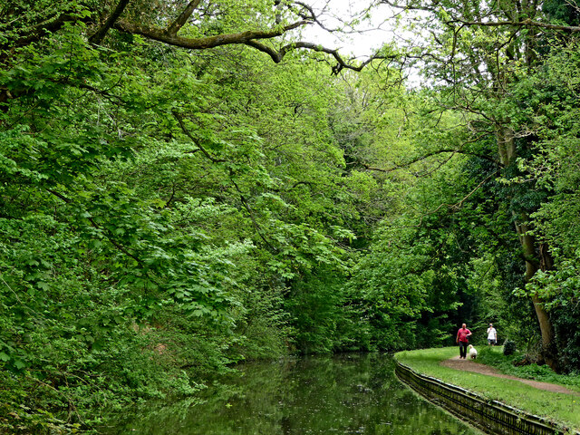
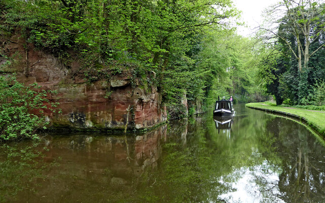
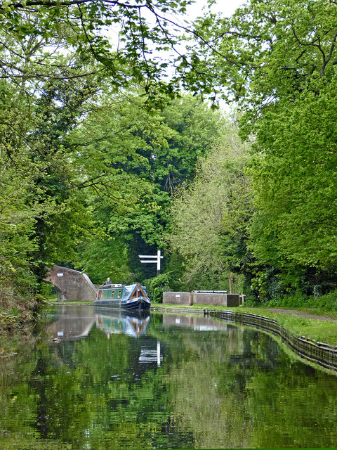
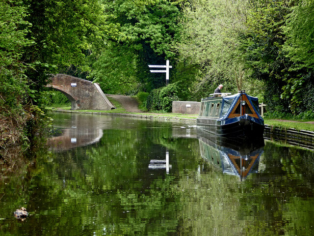
Stourton Gorse is a woodland area located in Staffordshire, England. Spanning over several acres, it is a picturesque forest that offers a serene and tranquil environment for nature enthusiasts and visitors alike.

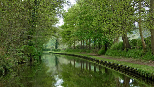
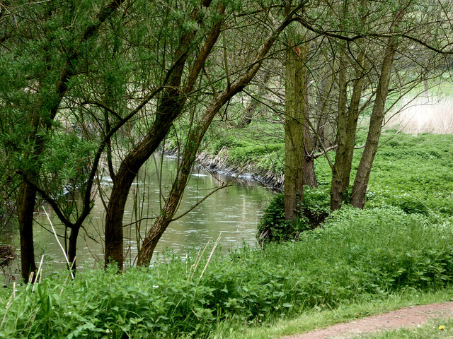
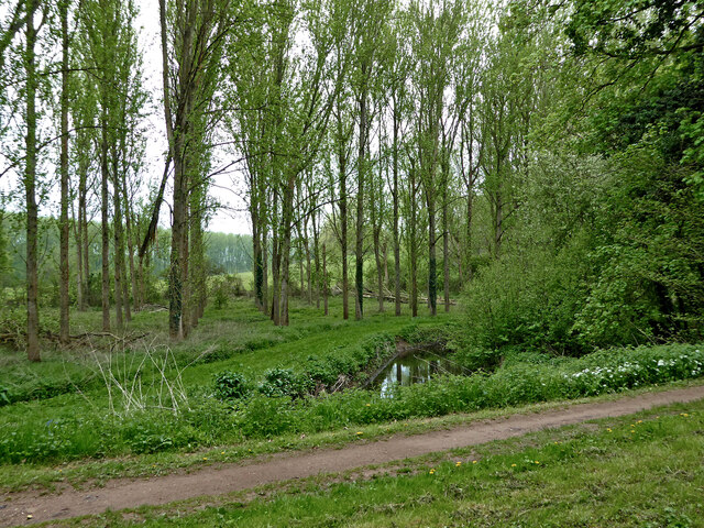
The woodland is primarily composed of a mixture of broadleaf and coniferous trees, creating a diverse and vibrant ecosystem. These trees include oak, beech, birch, and pine, among others. The forest floor is covered with a thick carpet of moss, ferns, and wildflowers, adding to the natural beauty of the area.

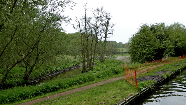
Stourton Gorse is home to a variety of wildlife, including mammals such as deer, foxes, and rabbits. The forest also provides a habitat for numerous bird species, making it a popular spot for birdwatchers. Visitors may catch a glimpse of woodpeckers, owls, and various songbirds as they explore the woodland.

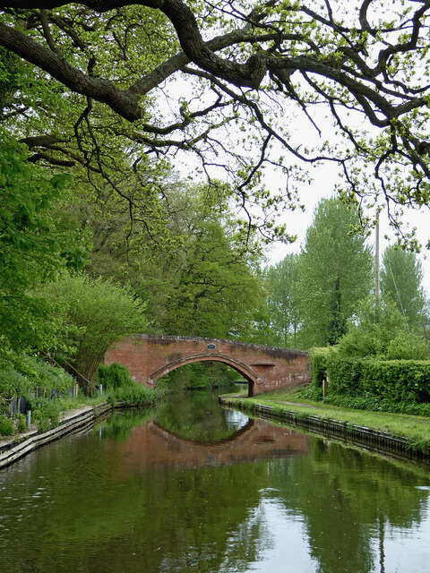
The woodland is crisscrossed with well-maintained trails and footpaths, allowing visitors to explore the area on foot. These paths lead to scenic viewpoints and tranquil spots, where one can relax and enjoy the beauty of nature. The forest is also a popular destination for hiking and cycling enthusiasts, with designated routes and tracks available for these activities.

Stourton Gorse is easily accessible, with ample parking facilities and nearby amenities. It is a popular destination for locals and tourists alike, offering a peaceful escape from the hustle and bustle of city life. Whether one is seeking a leisurely stroll, a picnic in nature, or an opportunity to observe wildlife, Stourton Gorse is a delightful destination that showcases the natural splendor of Staffordshire's woodlands.

If you have any feedback on the listing, please let us know in the comments section below.

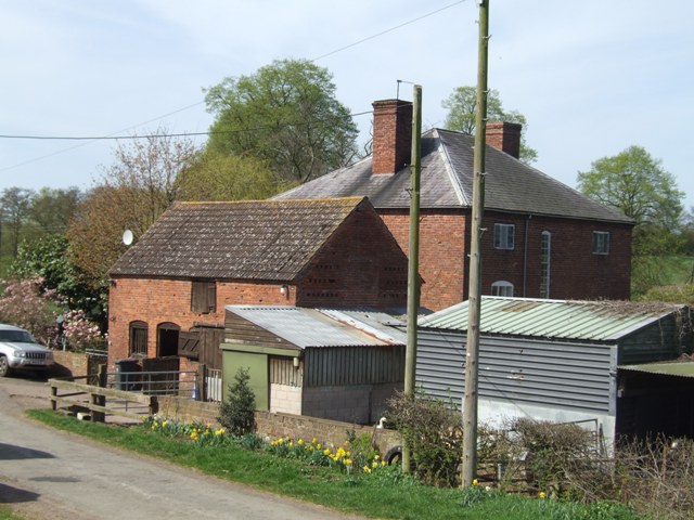
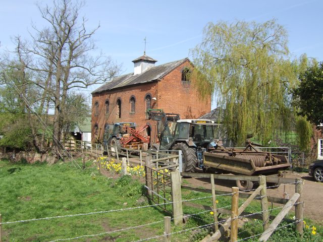
Stourton Gorse Images

Images are sourced within 2km of 52.474143/-2.2124999 or Grid Reference SO8586. Thanks to Geograph Open Source API. All images are credited.

Canal near Prestwood in Staffordshire This is the Staffordshire and Worcestershire Canal, looking south-west as the canal meanders towards Stourton Junction and Kinver. Woodland of Gothersley Rough is off to the left.
Canal near Prestwood in Staffordshire
This is the Staffordshire and Worcestershire Canal, looking south-west as the canal meanders towards Stourton Junction and Kinver. Woodland of Gothersley Rough is off to the left.
Staffordshire and Worcestershire Canal near Prestwood This is the Staffordshire and Worcestershire Canal, looking south-west as the canal meanders towards Stourton Junction and Kinver. Woodland of Gothersley Rough is off to the left.
Staffordshire and Worcestershire Canal near Prestwood
This is the Staffordshire and Worcestershire Canal, looking south-west as the canal meanders towards Stourton Junction and Kinver. Woodland of Gothersley Rough is off to the left.
Prestwood Bridge north of Stourton in Staffordshire Prestwood Bridge is No 34 across the Staffordshire and Worcestershire Canal, and carries a farm track and bridleway.
Prestwood Bridge north of Stourton in Staffordshire
Prestwood Bridge is No 34 across the Staffordshire and Worcestershire Canal, and carries a farm track and bridleway.
Canal and Smestow River near Prestwood in Staffordshire Looking north-north-west from the Staffordshire and Worcestershire Canal.
Canal and Smestow River near Prestwood in Staffordshire
Looking north-north-west from the Staffordshire and Worcestershire Canal.
Smestow River near Prestwood in Staffordshire Looking upstream, the river (often still called Smestow Brook) is close by the Staffordshire and Worcestershire Canal here.
Smestow River near Prestwood in Staffordshire
Looking upstream, the river (often still called Smestow Brook) is close by the Staffordshire and Worcestershire Canal here.
Staffordshire and Worcestershire Canal near Stourton, Staffordshire Looking east here, as the canal meanders southwards towards Stourton Junction, Kinver, Kidderminster and Stourport.
Staffordshire and Worcestershire Canal near Stourton, Staffordshire
Looking east here, as the canal meanders southwards towards Stourton Junction, Kinver, Kidderminster and Stourport.
Farm land, woodland and river near Stourton, Staffordshire This shows the Smestow River (locally often still called Smestow Brook), seen from the Staffordshire and Worcestershire Canal. About a hundred metres south-east of here (off to the left) it flows into the River Stour.
Farm land, woodland and river near Stourton, Staffordshire
This shows the Smestow River (locally often still called Smestow Brook), seen from the Staffordshire and Worcestershire Canal. About a hundred metres south-east of here (off to the left) it flows into the River Stour.
Canal by the Devil's Den near Stourton, Staffordshire Looking south-east here, the canal meanders towards Stourto Junction, Kinver and Stourport. The canal is cut into Triassic red sandstone (Kidderminster Formation, formerly Bunter Pebble Beds).
Canal by the Devil's Den near Stourton, Staffordshire
Looking south-east here, the canal meanders towards Stourto Junction, Kinver and Stourport. The canal is cut into Triassic red sandstone (Kidderminster Formation, formerly Bunter Pebble Beds).
Canal at Stourton Junction in Staffordshire This is the Staffordshire and Worcestershire Canal, approaching Stourton Junction, where the Stourbridge Canal leads off to the left, up a flight of four locks.
Canal at Stourton Junction in Staffordshire
This is the Staffordshire and Worcestershire Canal, approaching Stourton Junction, where the Stourbridge Canal leads off to the left, up a flight of four locks.
Stourton Bridge north-east of Kinver, Staffordshire Stourton Bridge is No 33 across the Staffordshire and Worcestershire Canal at Stourton Junction. The Stourbridge Canal leads off to the left, up a flight of four locks.
Stourton Bridge north-east of Kinver, Staffordshire
Stourton Bridge is No 33 across the Staffordshire and Worcestershire Canal at Stourton Junction. The Stourbridge Canal leads off to the left, up a flight of four locks.
Overflow weir at Stewponey Lock near Stourton, Staffordshire Several of the locks on the Staffordshire and Worcestershire Canal have more elaborate overflow facilities than are usual.
Overflow weir at Stewponey Lock near Stourton, Staffordshire
Several of the locks on the Staffordshire and Worcestershire Canal have more elaborate overflow facilities than are usual.
Towpath tunnel by Stewponey Lock near Stourton, Staffordshire Horses would be led under the original bridge carrying Bridgnorth Road. There also used to be a light railway crossing the canal close to the bridge (tracks removed in 1930). <span class="nowrap"><a title="https://en.wikipedia.org/wiki/Kinver_Light_Railway" rel="nofollow ugc noopener" href="https://en.wikipedia.org/wiki/Kinver_Light_Railway">Link</a><img style="margin-left:2px;" alt="External link" title="External link - shift click to open in new window" src="https://s1.geograph.org.uk/img/external.png" width="10" height="10"/></span>
The A458 to Bridgnorth now has a newer bridge a few metres to the south.
Towpath tunnel by Stewponey Lock near Stourton, Staffordshire
Horses would be led under the original bridge carrying Bridgnorth Road. There also used to be a light railway crossing the canal close to the bridge (tracks removed in 1930). LinkExternal link The A458 to Bridgnorth now has a newer bridge a few metres to the south.
Enville windmill The tower mill on the edge of Enville Common built in 1800-1801 remained in use until 1870. The mill had four sails, boat cap and fantail. Little remains inside the shell except for sections of the turning ring for the boat cap. 

See <span class="nowrap"><a title="http://www.search.staffspasttrack.org.uk/engine/resource/default.asp?resource=11298" rel="nofollow ugc noopener" href="http://www.search.staffspasttrack.org.uk/engine/resource/default.asp?resource=11298">Link</a><img style="margin-left:2px;" alt="External link" title="External link - shift click to open in new window" src="https://s1.geograph.org.uk/img/external.png" width="10" height="10"/></span>
Enville windmill
The tower mill on the edge of Enville Common built in 1800-1801 remained in use until 1870. The mill had four sails, boat cap and fantail. Little remains inside the shell except for sections of the turning ring for the boat cap. See LinkExternal link
Enville windmill The tower mill on the edge of Enville Common built in 1800-1801 remained in use until 1870. The mill had four sails, boat cap and fantail. Little remains inside the shell except for sections of the turning ring for the boat cap. 

<span class="nowrap"><a title="http://www.search.staffspasttrack.org.uk/engine/resource/default.asp?resource=11298" rel="nofollow ugc noopener" href="http://www.search.staffspasttrack.org.uk/engine/resource/default.asp?resource=11298">Link</a><img style="margin-left:2px;" alt="External link" title="External link - shift click to open in new window" src="https://s1.geograph.org.uk/img/external.png" width="10" height="10"/></span>
Enville windmill
The tower mill on the edge of Enville Common built in 1800-1801 remained in use until 1870. The mill had four sails, boat cap and fantail. Little remains inside the shell except for sections of the turning ring for the boat cap. LinkExternal link
Mill farm Estate farm in Mill Lane.
Mill farm
Estate farm in Mill Lane.
Spittlebrook Mill Estate property on the Enville Estate.
Spittlebrook Mill
Estate property on the Enville Estate.
Cave at Prestwood near Stourton, Staffordshire This cave in the Triassic sandstone is on land belonging to Prestwood Cave Nursery. The nursery grows a limited range of hardy shrubs and other plants. Quality is high, and the prices are very reasonable. The hard winter of 2010-2011 killed many plants in nurseries all over the West Midlands, but enough remains here to continue trading.
Cave at Prestwood near Stourton, Staffordshire
This cave in the Triassic sandstone is on land belonging to Prestwood Cave Nursery. The nursery grows a limited range of hardy shrubs and other plants. Quality is high, and the prices are very reasonable. The hard winter of 2010-2011 killed many plants in nurseries all over the West Midlands, but enough remains here to continue trading.
Show me another place!

Stourton Gorse is located at Grid Ref: SO8586 (Lat: 52.474143, Lng: -2.2124999)

Administrative County: Staffordshire

District: South Staffordshire

Police Authority: Staffordshire

What 3 Words

///prefix.spun.workbook. Near Kinvere, Staffordshire

Nearby Locations

Stourton Gorse Radway Hill

Related Wikis

Prestwood (Kinver)

Prestwood is a hamlet now in the parish of Kinver, but in the Kingswinford until the creation of Brierley Hill Urban District in the 1930s. == History... ==

Smestow Brook

The Smestow Brook, sometimes called the River Smestow, is a small river that plays an important part in the drainage of Wolverhampton, South Staffordshire...

Stourton, Staffordshire

Stourton is a hamlet in Staffordshire, England a few miles to the northwest of Stourbridge. There is a fair amount of dispute over the pronunciation, being...

Ashwood, Staffordshire

Ashwood is a small area of Staffordshire, England. It is situated in the South Staffordshire district, approximately two miles west of the West Midlands...

Dunsley, Staffordshire

Dunsley is a hamlet in Kinver, Staffordshire, England. The settled part of the hamlet is the part of the village of Kinver, lying east of the River Stour...

Greensforge

Greensforge is a scattered hamlet on the boundary of Kinver and Swindon parishes, in South Staffordshire, England. It is noted for its Roman associations...

Kinver High School

Kinver High School (formerly Edgecliff High School) is a mixed secondary school and sixth form located in Kinver in the English county of Staffordshire...

Summerhill School, Kingswinford

Summerhill School is a mixed community secondary school located in Kingswinford, West Midlands, England. == History == The school was built by Brierley...

Nearby Amenities

Located within 500m of 52.474143,-2.2124999
The data included in this document is from www.openstreetmap.org. The data is made available under ODbL.

Have you been to Stourton Gorse?

Leave your review of Stourton Gorse below (or comments, questions and feedback).