Grotto Wood

Wood, Forest in Cheshire

England

Grotto Wood

Fence Lane from Mow Lane
Fence Lane from Mow Lane Credit: Ian S

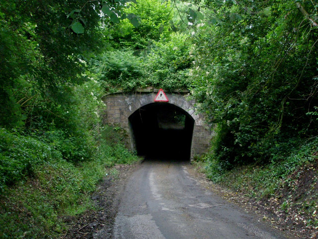
Grotto Wood is a picturesque woodland located in Cheshire, England. Spanning over an area of approximately 50 acres, it is a popular natural attraction for locals and tourists alike. The woodland is characterized by its diverse range of tree species, including oak, birch, beech, and ash, creating a vibrant and lush environment.

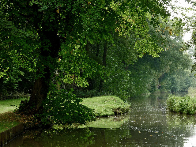
Grotto Wood is known for its tranquil atmosphere and peaceful ambiance. The dense canopy of trees provides shade and shelter, making it an ideal place for nature enthusiasts to explore and enjoy the great outdoors. Walking trails wind through the wood, allowing visitors to immerse themselves in the beauty of the surroundings.

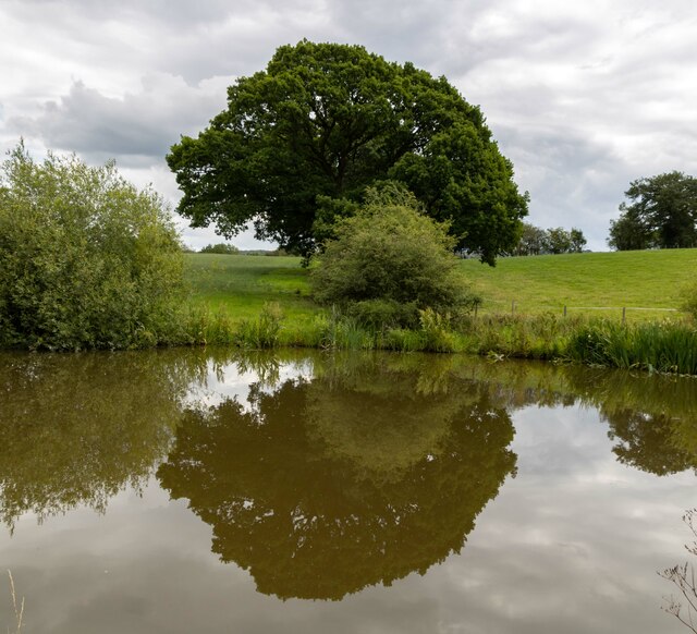
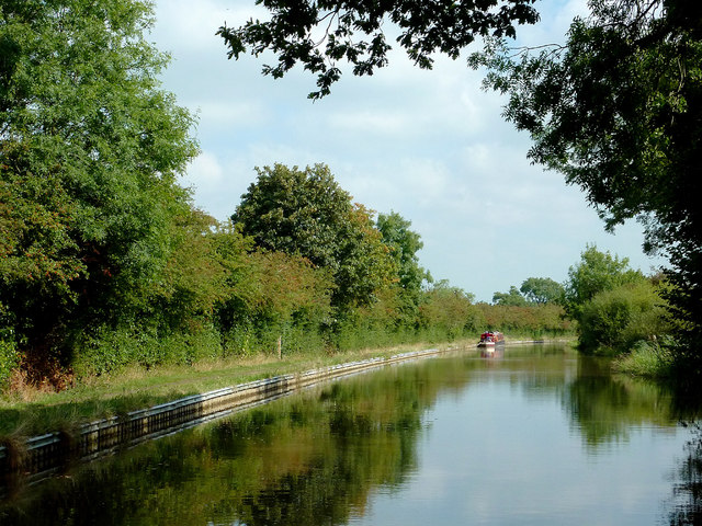
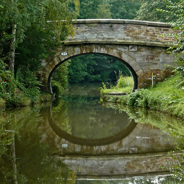
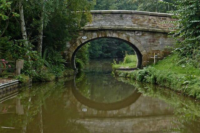
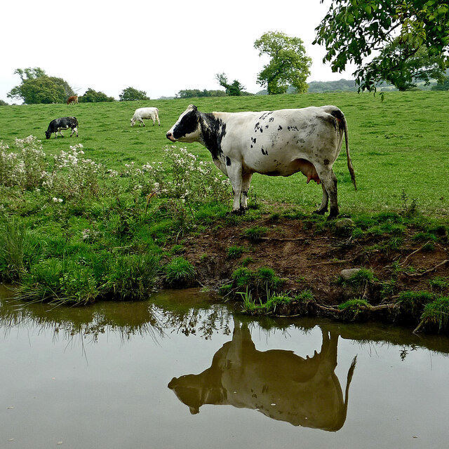
One of the highlights of Grotto Wood is a small stream that meanders through the forest, adding to its natural charm. The babbling sound of water creates a soothing and relaxing ambiance, further enhancing the overall experience. The stream also provides a habitat for various aquatic plants and animals, adding to the biodiversity of the woodland.

The wood is home to a wide range of wildlife, including birds, squirrels, and rabbits. Birdwatchers can spot species such as woodpeckers, owls, and thrushes, among others. The woodland floor is adorned with a carpet of wildflowers during the spring and summer months, creating a colorful and vibrant display.

Overall, Grotto Wood offers visitors a chance to reconnect with nature and escape the hustle and bustle of everyday life. Its natural beauty, diverse flora and fauna, and tranquil atmosphere make it a haven for those seeking a peaceful retreat in the heart of Cheshire.

If you have any feedback on the listing, please let us know in the comments section below.
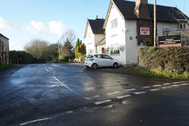
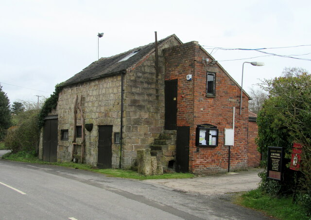
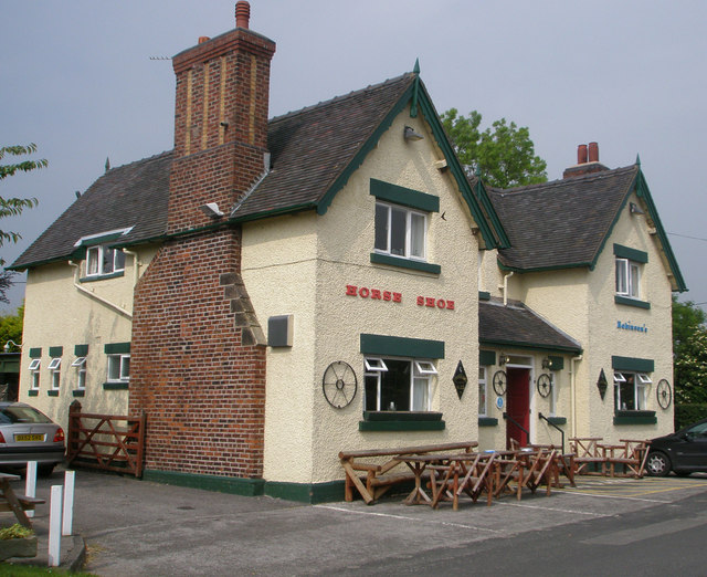
Grotto Wood Images

Images are sourced within 2km of 53.123462/-2.2180235 or Grid Reference SJ8558. Thanks to Geograph Open Source API. All images are credited.

Fence Lane from Mow Lane
Mile Marker, Macclesfield Canal Milestone on the bank of the towpath. In the parish of Newbold Astbury, NE of Watery Lane.

Inscription: ¼ // o

Milestone Society National ID: MAC-23¼
Mile Marker, Macclesfield Canal
Milestone on the bank of the towpath. In the parish of Newbold Astbury, NE of Watery Lane. Inscription: ¼ // o Milestone Society National ID: MAC-23¼
Macclesfield Canal Tree alongside the Macclesfield Canal.
Macclesfield Canal
Tree alongside the Macclesfield Canal.
Mill House Farm Mill House Farm seen from the Macclesfield.
Mill House Farm
Mill House Farm seen from the Macclesfield.
Macclesfield Canal & towpath N of Watery Ln Aqueduct
Aqueduct Carrying the Macclesfield Canal over a minor road.
Aqueduct
Carrying the Macclesfield Canal over a minor road.
Barn with parish council notice board Opposite the Horse Shoe Inn.
Barn with parish council notice board
Opposite the Horse Shoe Inn.
Mill House Farm - with cows Taken from the bank of Macclesfield Canal looking across to the farm
Mill House Farm - with cows
Taken from the bank of Macclesfield Canal looking across to the farm
Horse Shoe Inn A pleasant isolated country pub with beer garden and play area in Newbold Astbury. It dates from 1774.
Horse Shoe Inn
A pleasant isolated country pub with beer garden and play area in Newbold Astbury. It dates from 1774.
A very narrow canal bridge. Possibly not built with milk tankers in mind.
A very narrow canal bridge.
Possibly not built with milk tankers in mind.
Cattle by the Macclesfield Canal, Cheshire Near Hemshalls Bridge, No 80.
Cattle by the Macclesfield Canal, Cheshire
Near Hemshalls Bridge, No 80.
Time for a Pint! Cattle by the Macclesfield Canal, Cheshire Near Bridge 80 (Hemshalls Bridge).
Time for a Pint! Cattle by the Macclesfield Canal, Cheshire
Near Bridge 80 (Hemshalls Bridge).
Macclesfield Canal south of Astbury, Cheshire There is a winding hole here in which boats up to seventy feet in length can turn round.
Macclesfield Canal south of Astbury, Cheshire
There is a winding hole here in which boats up to seventy feet in length can turn round.
Simpson Bridge north-east of Scholar Green, Cheshire Looking south-south-west towards Kidsgrove, Simpson Bridge is No 85, and carries New Road over the Macclesfield Canal near Ackers Crossing.
Simpson Bridge north-east of Scholar Green, Cheshire
Looking south-south-west towards Kidsgrove, Simpson Bridge is No 85, and carries New Road over the Macclesfield Canal near Ackers Crossing.
Macclesfield Canal at Ackers Crossing in Cheshire Looking south-south-west towards Kidsgrove, Simpson Bridge is No 85 across the Macclesfield Canal near Ackers Crossing, and carries New Road.
Macclesfield Canal at Ackers Crossing in Cheshire
Looking south-south-west towards Kidsgrove, Simpson Bridge is No 85 across the Macclesfield Canal near Ackers Crossing, and carries New Road.
Canalside grazing near Ackers Crossing in Cheshire These cattle are grazing by the Macclesfield Canal, north of Rowndes No 2 Bridge, No 86.
Canalside grazing near Ackers Crossing in Cheshire
These cattle are grazing by the Macclesfield Canal, north of Rowndes No 2 Bridge, No 86.
Macclesfield Canal near Scholar Green in Cheshire Looking south-south-west near Ramsdell Hall.
The bridge half a mile to the north is called Rowndes No 2 Bridge, No 86 on current Macclesfield Canal numbering. Is the narrowing ahead here the site of a former Rowndes No 1 Bridge? The position is not included as No 87, which is allocated to Kent Green Bridge, to the south-west. Late Victorian OS maps show a track leading directly to this spot, but already no bridge.
Macclesfield Canal near Scholar Green in Cheshire
Looking south-south-west near Ramsdell Hall. The bridge half a mile to the north is called Rowndes No 2 Bridge, No 86 on current Macclesfield Canal numbering. Is the narrowing ahead here the site of a former Rowndes No 1 Bridge? The position is not included as No 87, which is allocated to Kent Green Bridge, to the south-west. Late Victorian OS maps show a track leading directly to this spot, but already no bridge.
Macclesfield Canal at Kent Green in Cheshire Looking north-north-east at the site where the Foundry Lane Swing Bridge, No 88 has been removed. Ahead is Kent Green Bridge, No 87. The house on the left is the former Bird-in-Hand public house, closed in the 1990s. <a title="https://www.geograph.org.uk/photo/603995" href="https://www.geograph.org.uk/photo/603995">Link</a>
Macclesfield Canal at Kent Green in Cheshire
Looking north-north-east at the site where the Foundry Lane Swing Bridge, No 88 has been removed. Ahead is Kent Green Bridge, No 87. The house on the left is the former Bird-in-Hand public house, closed in the 1990s. Link
Show me another place!

Grotto Wood is located at Grid Ref: SJ8558 (Lat: 53.123462, Lng: -2.2180235)

Unitary Authority: Cheshire East

Police Authority: Cheshire

What 3 Words

///bolt.tests.wages. Near Biddulph, Staffordshire

Related Wikis

Limekiln Wood Nature Reserve

Limekiln Wood Nature Reserve is a 13.1-hectare (32-acre) nature reserve in Cheshire, England, north of the village of Mow Cop. A Site of Special Scientific...

Mow Cop

Mow Cop is a village split between Cheshire and Staffordshire, and therefore divided between the North West and West Midlands regions of England. It is...

Mow Cop Castle

Mow Cop Castle is a folly at Mow Cop in the civil parish of Odd Rode, Cheshire, England. It is designated as a Grade II listed building on the National...

Mow Cop and Scholar Green railway station

Mow Cop and Scholar Green railway station was a station on the North Staffordshire Railway between Stoke-on-Trent and Congleton. It served the village...
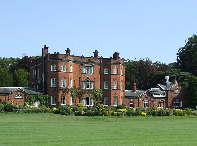
Ramsdell Hall

Ramsdell Hall is a country house in the parish of Odd Rode in Cheshire, England, overlooking the Macclesfield Canal. It was built in two phases during...

Moreton cum Alcumlow

Moreton cum Alcumlow is a small civil parish in the unitary authority of Cheshire East and the ceremonial county of Cheshire, England. In the census of...

Great Moreton Hall

Great Moreton Hall is a former country house in Moreton cum Alcumlow near Congleton, in Cheshire, England, less than a mile (1.6 km) from its better-known...

Little Moreton Hall

Little Moreton Hall, also known as Old Moreton Hall, is a moated half-timbered manor house 4.5 miles (7.2 km) south-west of Congleton in Cheshire, England...

Nearby Amenities

Located within 500m of 53.123462,-2.2180235
The data included in this document is from www.openstreetmap.org. The data is made available under ODbL.

Have you been to Grotto Wood?

Leave your review of Grotto Wood below (or comments, questions and feedback).