Quarry Wood

Wood, Forest in Cheshire

England

Quarry Wood

Simpson Bridge north-east of Scholar Green, Cheshire Looking south-south-west towards Kidsgrove, Simpson Bridge is No 85, and carries New Road over the Macclesfield Canal near Ackers Crossing.
Simpson Bridge north-east of Scholar Green, Cheshire Credit: Roger Kidd

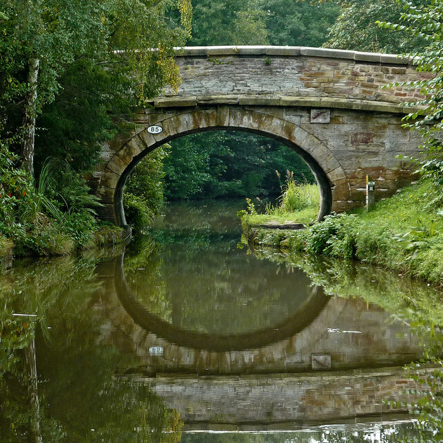
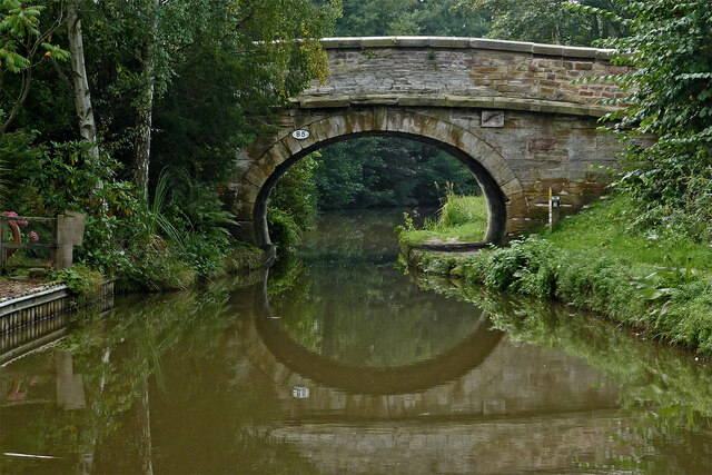
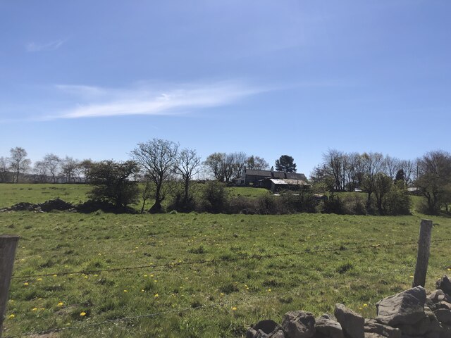
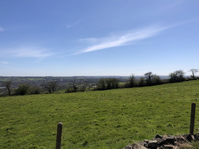
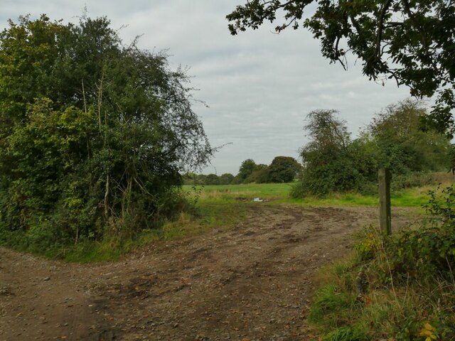
Quarry Wood, located in Cheshire, is a picturesque woodland that covers an area of approximately 10 hectares. It is situated near the village of Norley and is known for its abundant wildlife, tranquil atmosphere, and diverse range of flora.

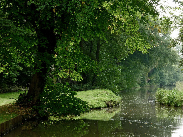
The wood consists of a mix of deciduous and coniferous trees, including oak, beech, birch, and pine, providing a rich and varied habitat for many species. The woodland floor is adorned with carpets of bluebells in the spring, creating a breathtaking sight for visitors.

Quarry Wood is managed by the local council and offers a network of well-maintained walking trails, making it a popular destination for nature enthusiasts, hikers, and families alike. The trails wind through the wood, allowing visitors to explore its beauty and discover the hidden treasures it holds.

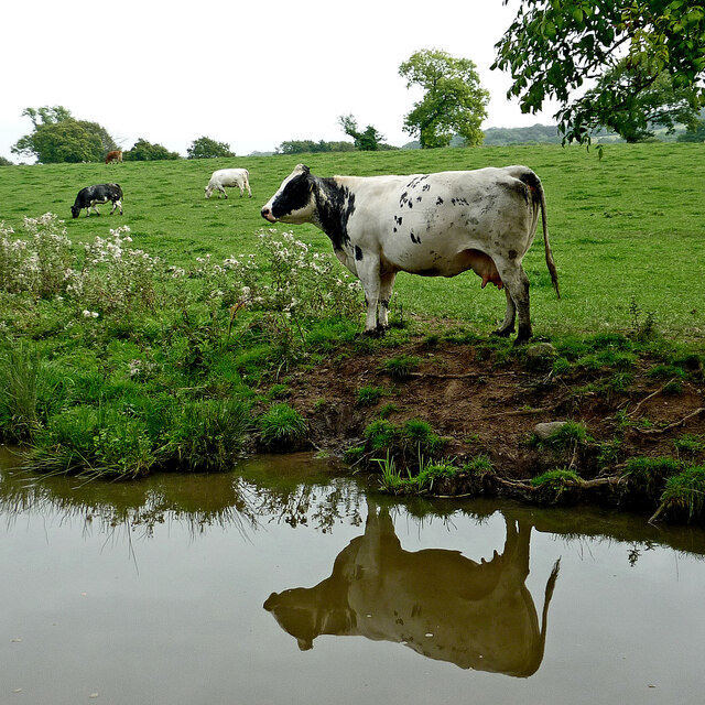
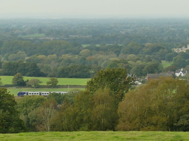
The wood is home to a diverse array of wildlife. Birdwatchers can spot various species, including woodpeckers, owls, and nuthatches. Mammals such as foxes, badgers, and squirrels can also be observed, adding to the charm of the woodland experience.

In addition to its natural beauty, Quarry Wood also holds historical significance. The remains of a 19th-century sandstone quarry can still be seen, serving as a reminder of the area's industrial past.

Overall, Quarry Wood offers a peaceful and natural retreat for individuals seeking solace in nature. Its stunning scenery, well-maintained trails, and abundant wildlife make it a must-visit destination for those looking to immerse themselves in the beauty of Cheshire's woodlands.

If you have any feedback on the listing, please let us know in the comments section below.
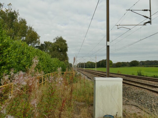
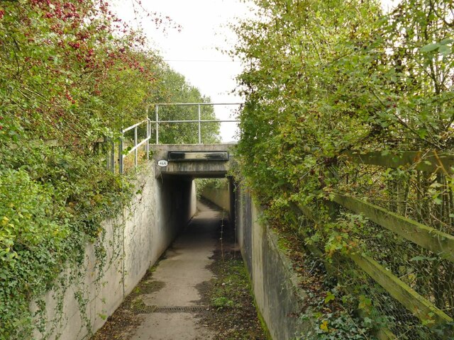
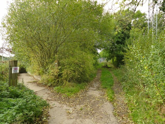
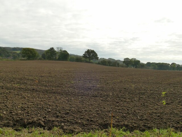
Quarry Wood Images

Images are sourced within 2km of 53.119002/-2.2188675 or Grid Reference SJ8558. Thanks to Geograph Open Source API. All images are credited.

Simpson Bridge north-east of Scholar Green, Cheshire Looking south-south-west towards Kidsgrove, Simpson Bridge is No 85, and carries New Road over the Macclesfield Canal near Ackers Crossing.
Simpson Bridge north-east of Scholar Green, Cheshire
Looking south-south-west towards Kidsgrove, Simpson Bridge is No 85, and carries New Road over the Macclesfield Canal near Ackers Crossing.
Macclesfield Canal at Ackers Crossing in Cheshire Looking south-south-west towards Kidsgrove, Simpson Bridge is No 85 across the Macclesfield Canal near Ackers Crossing, and carries New Road.
Macclesfield Canal at Ackers Crossing in Cheshire
Looking south-south-west towards Kidsgrove, Simpson Bridge is No 85 across the Macclesfield Canal near Ackers Crossing, and carries New Road.
Canalside grazing near Ackers Crossing in Cheshire These cattle are grazing by the Macclesfield Canal, north of Rowndes No 2 Bridge, No 86.
Canalside grazing near Ackers Crossing in Cheshire
These cattle are grazing by the Macclesfield Canal, north of Rowndes No 2 Bridge, No 86.
Macclesfield Canal near Scholar Green in Cheshire Looking south-south-west near Ramsdell Hall.
The bridge half a mile to the north is called Rowndes No 2 Bridge, No 86 on current Macclesfield Canal numbering. Is the narrowing ahead here the site of a former Rowndes No 1 Bridge? The position is not included as No 87, which is allocated to Kent Green Bridge, to the south-west. Late Victorian OS maps show a track leading directly to this spot, but already no bridge.
Macclesfield Canal near Scholar Green in Cheshire
Looking south-south-west near Ramsdell Hall. The bridge half a mile to the north is called Rowndes No 2 Bridge, No 86 on current Macclesfield Canal numbering. Is the narrowing ahead here the site of a former Rowndes No 1 Bridge? The position is not included as No 87, which is allocated to Kent Green Bridge, to the south-west. Late Victorian OS maps show a track leading directly to this spot, but already no bridge.
Macclesfield Canal at Kent Green in Cheshire Looking north-north-east at the site where the Foundry Lane Swing Bridge, No 88 has been removed. Ahead is Kent Green Bridge, No 87. The house on the left is the former Bird-in-Hand public house, closed in the 1990s. <a title="https://www.geograph.org.uk/photo/603995" href="https://www.geograph.org.uk/photo/603995">Link</a>
Macclesfield Canal at Kent Green in Cheshire
Looking north-north-east at the site where the Foundry Lane Swing Bridge, No 88 has been removed. Ahead is Kent Green Bridge, No 87. The house on the left is the former Bird-in-Hand public house, closed in the 1990s. Link
Macclesfield Canal at Kent Green in Cheshire A telephoto image, looking north-north-east at the site where the Foundry Lane Swing Bridge, No 88 has been removed.  A house off to the left is the former Bird-in-Hand public house, closed in the 1990s. <a title="https://www.geograph.org.uk/photo/603995Ahead" href="https://www.geograph.org.uk/photo/603995Ahead">Link</a> is Kent Green Bridge, No 87.
Macclesfield Canal at Kent Green in Cheshire
A telephoto image, looking north-north-east at the site where the Foundry Lane Swing Bridge, No 88 has been removed. A house off to the left is the former Bird-in-Hand public house, closed in the 1990s. Link is Kent Green Bridge, No 87.
Farm on the Staffordshire/Cheshire border
View south-east from Mow Lane Biddulph in the valley below
View south-east from Mow Lane
Biddulph in the valley below
New Road, Ackers Crossing Ackers Crossing seems to be a settlement that has grown up near to, and taken its name from, a railway level crossing.  The red phone box now contains a defibrillator rather than a phone.
New Road, Ackers Crossing
Ackers Crossing seems to be a settlement that has grown up near to, and taken its name from, a railway level crossing. The red phone box now contains a defibrillator rather than a phone.
Ackers Crossing closed A former railway level crossing, now closed and replaced by a pedestrian subway.  The pedestrian gate here is just for railway workers.
Ackers Crossing closed
A former railway level crossing, now closed and replaced by a pedestrian subway. The pedestrian gate here is just for railway workers.
Railway north of Ackers Crossing The twin-track electrified main line from Stoke on Trent to Stockport and Manchester.
Railway north of Ackers Crossing
The twin-track electrified main line from Stoke on Trent to Stockport and Manchester.
Pedestrian subway at Ackers Crossing The underpass takes the South Cheshire Way under the main line from Stoke on Trent to Stockport and Manchester. It replaces the former level crossing <a href="https://www.geograph.org.uk/photo/6995593">SJ8458 : Ackers Crossing closed</a>.
Pedestrian subway at Ackers Crossing
The underpass takes the South Cheshire Way under the main line from Stoke on Trent to Stockport and Manchester. It replaces the former level crossing SJ8458 : Ackers Crossing closed.
Diverted footpath at Ackers Crossing The track forming part of the South Cheshire Way that used to cross the railway by means of a level crossing <a href="https://www.geograph.org.uk/photo/6995593">SJ8458 : Ackers Crossing closed</a> is now diverted through a subway <a href="https://www.geograph.org.uk/photo/6995597">SJ8458 : Pedestrian subway at Ackers Crossing</a>.
Diverted footpath at Ackers Crossing
The track forming part of the South Cheshire Way that used to cross the railway by means of a level crossing SJ8458 : Ackers Crossing closed is now diverted through a subway SJ8458 : Pedestrian subway at Ackers Crossing.
Rich Cheshire loam This field marks effectively the eastern edge of the fertile Cheshire Plain as the land starts to rise into the Staffordshire Hills.
Rich Cheshire loam
This field marks effectively the eastern edge of the fertile Cheshire Plain as the land starts to rise into the Staffordshire Hills.
Field entrance near Wood Farm The path to the left is the South Cheshire Way; there's no right of way across the fields straight ahead.
Field entrance near Wood Farm
The path to the left is the South Cheshire Way; there's no right of way across the fields straight ahead.
View from near Wood Cottage A view across the Cheshire plain on a rather dull October day. The train bottom left is on the Stoke to Manchester line.
View from near Wood Cottage
A view across the Cheshire plain on a rather dull October day. The train bottom left is on the Stoke to Manchester line.
Field below Wood Farm Seen from the South Cheshire Way.
Field below Wood Farm
Seen from the South Cheshire Way.
Old quarry behind Wood Farm It's labelled 'old quarry' even on the 1898 map.  It may only have been used for the buildings at the nearby farm.
Old quarry behind Wood Farm
It's labelled 'old quarry' even on the 1898 map. It may only have been used for the buildings at the nearby farm.
Show me another place!

Quarry Wood is located at Grid Ref: SJ8558 (Lat: 53.119002, Lng: -2.2188675)

Unitary Authority: Cheshire East

Police Authority: Cheshire

What 3 Words

///shine.funny.pinch. Near Biddulph, Staffordshire

Related Wikis

Mow Cop

Mow Cop is a village split between Cheshire and Staffordshire, and therefore divided between the North West and West Midlands regions of England. It is...

Mow Cop Castle

Mow Cop Castle is a folly at Mow Cop in the civil parish of Odd Rode, Cheshire, England. It is designated as a Grade II listed building on the National...

Limekiln Wood Nature Reserve

Limekiln Wood Nature Reserve is a 13.1-hectare (32-acre) nature reserve in Cheshire, England, north of the village of Mow Cop. A Site of Special Scientific...

Mow Cop and Scholar Green railway station

Mow Cop and Scholar Green railway station was a station on the North Staffordshire Railway between Stoke-on-Trent and Congleton. It served the village...
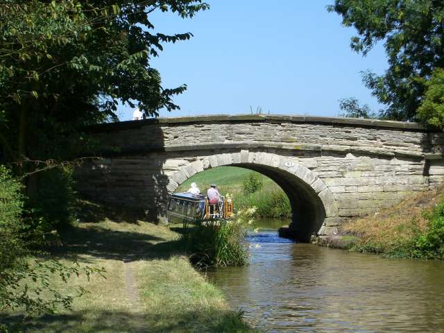
Ramsdell Hall

Ramsdell Hall is a country house in the parish of Odd Rode in Cheshire, England, overlooking the Macclesfield Canal. It was built in two phases during...

Moreton cum Alcumlow

Moreton cum Alcumlow is a small civil parish in the unitary authority of Cheshire East and the ceremonial county of Cheshire, England. In the census of...
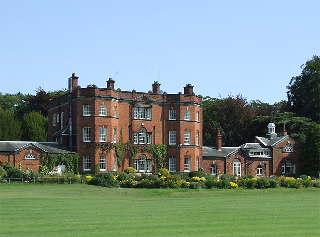
Great Moreton Hall

Great Moreton Hall is a former country house in Moreton cum Alcumlow near Congleton, in Cheshire, England, less than a mile (1.6 km) from its better-known...

Harriseahead

Harriseahead is a village in the county of Staffordshire, England, just north of the Potteries (Stoke on Trent) and about 2 miles (3.2 km) south-west of...

Nearby Amenities

Located within 500m of 53.119002,-2.2188675
The data included in this document is from www.openstreetmap.org. The data is made available under ODbL.

Have you been to Quarry Wood?

Leave your review of Quarry Wood below (or comments, questions and feedback).