Kennel Hill Plantation
Wood, Forest in Dorset
England
Kennel Hill Plantation
Kennel Hill Plantation is a picturesque woodland located in the county of Dorset, England. Covering an extensive area, it is renowned for its natural beauty and rich biodiversity. The plantation is nestled in a tranquil setting, surrounded by rolling hills and stunning landscapes, making it a popular destination for nature enthusiasts and outdoor enthusiasts alike.
The woodland is primarily composed of a variety of trees, including oak, beech, and birch. These trees create a dense canopy, providing shade and shelter for the diverse wildlife that calls Kennel Hill Plantation home. Visitors can expect to spot a wide range of bird species, such as woodpeckers, owls, and songbirds, as well as small mammals like foxes, badgers, and deer.
The plantation offers a network of well-maintained walking trails, enabling visitors to explore the area at their leisure. These paths wind through the woodland, leading to enchanting clearings and tranquil ponds. Along the way, hikers can admire the vibrant wildflowers and ferns that carpet the forest floor, adding a splash of color to the green surroundings.
Kennel Hill Plantation also holds historical significance, with remnants of ancient settlements and archaeological sites scattered throughout the woodland. These remnants provide a glimpse into the area's past, inviting visitors to imagine the lives of those who once inhabited the land.
Overall, Kennel Hill Plantation is a captivating destination that offers a harmonious blend of natural beauty, wildlife, and history. Whether it's for a leisurely stroll, birdwatching, or simply enjoying the serenity of nature, this Dorset woodland is sure to leave visitors with lasting memories.
If you have any feedback on the listing, please let us know in the comments section below.
Kennel Hill Plantation Images
Images are sourced within 2km of 50.652531/-2.2091295 or Grid Reference SY8583. Thanks to Geograph Open Source API. All images are credited.
![A short walk to Belhuish Farm [1] From the B3071 road, this track, a public footpath and permissive bridleway, runs alongside Burngate Wood towards Coombe Keynes.
From the B3071 road, the walk follows the long distance Hardy Way to the cluster of buildings at Belhuish Farm and returns the same way. Almost exactly 1 mile.](https://s2.geograph.org.uk/geophotos/07/26/01/7260186_994ce584.jpg)
![A short walk to Belhuish Farm [2] A notice giving details of the access along the track seen at <a href="https://www.geograph.org.uk/photo/7260186">SY8383 : A short walk to Belhuish Farm [1]</a>.
From the B3071 road, the walk follows the long distance Hardy Way to the cluster of buildings at Belhuish Farm and returns the same way. Almost exactly 1 mile.](https://s0.geograph.org.uk/geophotos/07/26/01/7260188_79530c33.jpg)
![A short walk to Belhuish Farm [3] Looking across the B3071 road to the track leading to Belhuish Farm.
From the B3071 road, the walk follows the long distance Hardy Way to the cluster of buildings at Belhuish Farm and returns the same way. Almost exactly 1 mile.](https://s1.geograph.org.uk/geophotos/07/26/01/7260189_3a57f18f.jpg)
![A short walk to Belhuish Farm [4] Looking across the B3071 road to the track leading to Coombe Keynes.
From the B3071 road, the walk follows the long distance Hardy Way to the cluster of buildings at Belhuish Farm and returns the same way. Almost exactly 1 mile.](https://s0.geograph.org.uk/geophotos/07/26/01/7260192_c2ff5405.jpg)
![Coombe Keynes hamlet [1] East Coombe Farmhouse was probably built in the early 19th century in two builds. Constructed of brick with a stone gable wall, under a tile roof.
There are various lean-to later extensions. Listed, grade II, with details at: <span class="nowrap"><a title="https://historicengland.org.uk/listing/the-list/list-entry/1172277" rel="nofollow ugc noopener" href="https://historicengland.org.uk/listing/the-list/list-entry/1172277">Link</a><img style="margin-left:2px;" alt="External link" title="External link - shift click to open in new window" src="https://s1.geograph.org.uk/img/external.png" width="10" height="10"/></span>
Coombe Keynes is a hamlet, and depopulated village in Dorset, some 1½ miles south of Wool and about 5 miles southwest of Wareham. Extensive settlement remains have been found by excavation to the east of the church, indicating that once there were many more buildings. The area of earthworks, extending to some 20 acres, is a Scheduled Ancient Monument with details at: <span class="nowrap"><a title="https://historicengland.org.uk/listing/the-list/list-entry/1017260" rel="nofollow ugc noopener" href="https://historicengland.org.uk/listing/the-list/list-entry/1017260">Link</a><img style="margin-left:2px;" alt="External link" title="External link - shift click to open in new window" src="https://s1.geograph.org.uk/img/external.png" width="10" height="10"/></span>](https://s3.geograph.org.uk/geophotos/07/26/08/7260803_c2052567.jpg)
![Coombe Keynes hamlet [2] This early 19th century boundary wall, east of East Coombe Farmhouse, is constructed of brick and stone, with tiled capping. There is a similar, but lower wall in front of the house. Listed, for group value, grade II, with details at: <span class="nowrap"><a title="https://historicengland.org.uk/listing/the-list/list-entry/1120494" rel="nofollow ugc noopener" href="https://historicengland.org.uk/listing/the-list/list-entry/1120494">Link</a><img style="margin-left:2px;" alt="External link" title="External link - shift click to open in new window" src="https://s1.geograph.org.uk/img/external.png" width="10" height="10"/></span>
Coombe Keynes is a hamlet, and depopulated village in Dorset, some 1½ miles south of Wool and about 5 miles southwest of Wareham. Extensive settlement remains have been found by excavation to the east of the church, indicating that once there were many more buildings. The area of earthworks, extending to some 20 acres, is a Scheduled Ancient Monument with details at: <span class="nowrap"><a title="https://historicengland.org.uk/listing/the-list/list-entry/1017260" rel="nofollow ugc noopener" href="https://historicengland.org.uk/listing/the-list/list-entry/1017260">Link</a><img style="margin-left:2px;" alt="External link" title="External link - shift click to open in new window" src="https://s1.geograph.org.uk/img/external.png" width="10" height="10"/></span>](https://s2.geograph.org.uk/geophotos/07/26/08/7260806_92c91272.jpg)
![Coombe Keynes hamlet [3] Dairy Barn is a barn and other farm buildings converted into a house. The main building is probably late 18th century. Constructed of rubble stone with brick dressings, quoins and buttresses, all under a slate roof with stone eaves courses. A lean-to with a catslide roof has pigeonholes. Listed, grade II, with details at: <span class="nowrap"><a title="https://historicengland.org.uk/listing/the-list/list-entry/1120493" rel="nofollow ugc noopener" href="https://historicengland.org.uk/listing/the-list/list-entry/1120493">Link</a><img style="margin-left:2px;" alt="External link" title="External link - shift click to open in new window" src="https://s1.geograph.org.uk/img/external.png" width="10" height="10"/></span>
Coombe Keynes is a hamlet, and depopulated village in Dorset, some 1½ miles south of Wool and about 5 miles southwest of Wareham. Extensive settlement remains have been found by excavation to the east of the church, indicating that once there were many more buildings. The area of earthworks, extending to some 20 acres, is a Scheduled Ancient Monument with details at: <span class="nowrap"><a title="https://historicengland.org.uk/listing/the-list/list-entry/1017260" rel="nofollow ugc noopener" href="https://historicengland.org.uk/listing/the-list/list-entry/1017260">Link</a><img style="margin-left:2px;" alt="External link" title="External link - shift click to open in new window" src="https://s1.geograph.org.uk/img/external.png" width="10" height="10"/></span>](https://s3.geograph.org.uk/geophotos/07/26/08/7260811_e8145a33.jpg)
![Coombe Keynes hamlet [4] The curiously named Odd Nod is a cottage in a terrace, probably built in the early 19th century. Constructed of rubble stone with brick dressings under a thatch roof. Some original internal features remain. Listed, grade II, with details at: <span class="nowrap"><a title="https://historicengland.org.uk/listing/the-list/list-entry/1172303" rel="nofollow ugc noopener" href="https://historicengland.org.uk/listing/the-list/list-entry/1172303">Link</a><img style="margin-left:2px;" alt="External link" title="External link - shift click to open in new window" src="https://s1.geograph.org.uk/img/external.png" width="10" height="10"/></span>
Coombe Keynes is a hamlet, and depopulated village in Dorset, some 1½ miles south of Wool and about 5 miles southwest of Wareham. Extensive settlement remains have been found by excavation to the east of the church, indicating that once there were many more buildings. The area of earthworks, extending to some 20 acres, is a Scheduled Ancient Monument with details at: <span class="nowrap"><a title="https://historicengland.org.uk/listing/the-list/list-entry/1017260" rel="nofollow ugc noopener" href="https://historicengland.org.uk/listing/the-list/list-entry/1017260">Link</a><img style="margin-left:2px;" alt="External link" title="External link - shift click to open in new window" src="https://s1.geograph.org.uk/img/external.png" width="10" height="10"/></span>](https://s1.geograph.org.uk/geophotos/07/26/08/7260813_fc3c6530.jpg)
![Coombe Keynes hamlet [5] The curiously named Mini Nod is a cottage in a terrace, probably built in the early 19th century. Constructed of rubble stone with brick dressings under a thatch roof. Some original internal features remain. Listed, grade II, with details at: <span class="nowrap"><a title="https://historicengland.org.uk/listing/the-list/list-entry/1305228" rel="nofollow ugc noopener" href="https://historicengland.org.uk/listing/the-list/list-entry/1305228">Link</a><img style="margin-left:2px;" alt="External link" title="External link - shift click to open in new window" src="https://s1.geograph.org.uk/img/external.png" width="10" height="10"/></span>
Coombe Keynes is a hamlet, and depopulated village in Dorset, some 1½ miles south of Wool and about 5 miles southwest of Wareham. Extensive settlement remains have been found by excavation to the east of the church, indicating that once there were many more buildings. The area of earthworks, extending to some 20 acres, is a Scheduled Ancient Monument with details at: <span class="nowrap"><a title="https://historicengland.org.uk/listing/the-list/list-entry/1017260" rel="nofollow ugc noopener" href="https://historicengland.org.uk/listing/the-list/list-entry/1017260">Link</a><img style="margin-left:2px;" alt="External link" title="External link - shift click to open in new window" src="https://s1.geograph.org.uk/img/external.png" width="10" height="10"/></span>](https://s3.geograph.org.uk/geophotos/07/26/08/7260815_de05cc56.jpg)
![Coombe Keynes hamlet [6] The curiously named Cuckoo Nod is a cottage in a terrace, probably built in the early 19th century. Constructed of rubble stone with brick dressings under a thatch roof. A single-storey extension is of brick under a tile roof. Some original internal features remain. Listed, grade II, with details at: <span class="nowrap"><a title="https://historicengland.org.uk/listing/the-list/list-entry/1120492" rel="nofollow ugc noopener" href="https://historicengland.org.uk/listing/the-list/list-entry/1120492">Link</a><img style="margin-left:2px;" alt="External link" title="External link - shift click to open in new window" src="https://s1.geograph.org.uk/img/external.png" width="10" height="10"/></span>
Coombe Keynes is a hamlet, and depopulated village in Dorset, some 1½ miles south of Wool and about 5 miles southwest of Wareham. Extensive settlement remains have been found by excavation to the east of the church, indicating that once there were many more buildings. The area of earthworks, extending to some 20 acres, is a Scheduled Ancient Monument with details at: <span class="nowrap"><a title="https://historicengland.org.uk/listing/the-list/list-entry/1017260" rel="nofollow ugc noopener" href="https://historicengland.org.uk/listing/the-list/list-entry/1017260">Link</a><img style="margin-left:2px;" alt="External link" title="External link - shift click to open in new window" src="https://s1.geograph.org.uk/img/external.png" width="10" height="10"/></span>](https://s2.geograph.org.uk/geophotos/07/26/08/7260818_0aefff55.jpg)
![Coombe Keynes hamlet [7] The centre of the hamlet has this delightful small green, complete with a shady seat. Listed, grade II, with details at: <span class="nowrap"><a title="https://historicengland.org.uk/listing/the-list/list-entry/1120492" rel="nofollow ugc noopener" href="https://historicengland.org.uk/listing/the-list/list-entry/1120492">Link</a><img style="margin-left:2px;" alt="External link" title="External link - shift click to open in new window" src="https://s1.geograph.org.uk/img/external.png" width="10" height="10"/></span>
Coombe Keynes is a hamlet, and depopulated village in Dorset, some 1½ miles south of Wool and about 5 miles southwest of Wareham. Extensive settlement remains have been found by excavation to the east of the church, indicating that once there were many more buildings. The area of earthworks, extending to some 20 acres, is a Scheduled Ancient Monument with details at: <span class="nowrap"><a title="https://historicengland.org.uk/listing/the-list/list-entry/1017260" rel="nofollow ugc noopener" href="https://historicengland.org.uk/listing/the-list/list-entry/1017260">Link</a><img style="margin-left:2px;" alt="External link" title="External link - shift click to open in new window" src="https://s1.geograph.org.uk/img/external.png" width="10" height="10"/></span>](https://s0.geograph.org.uk/geophotos/07/26/08/7260820_06eefbbf.jpg)
![Coombe Keynes hamlet [8] Numbers 7 and 8 Main Street, were originally built in the 17th century and converted to two cottages in the 19th century. Constructed of rubble stone, partly roughcast, under a thatch roof. The extension on the right is of brick under a tile roof. Some windows are horizontally sliding sashes. Listed, grade II, with details at: <span class="nowrap"><a title="https://historicengland.org.uk/listing/the-list/list-entry/1323337" rel="nofollow ugc noopener" href="https://historicengland.org.uk/listing/the-list/list-entry/1323337">Link</a><img style="margin-left:2px;" alt="External link" title="External link - shift click to open in new window" src="https://s1.geograph.org.uk/img/external.png" width="10" height="10"/></span>
Coombe Keynes is a hamlet, and depopulated village in Dorset, some 1½ miles south of Wool and about 5 miles southwest of Wareham. Extensive settlement remains have been found by excavation to the east of the church, indicating that once there were many more buildings. The area of earthworks, extending to some 20 acres, is a Scheduled Ancient Monument with details at: <span class="nowrap"><a title="https://historicengland.org.uk/listing/the-list/list-entry/1017260" rel="nofollow ugc noopener" href="https://historicengland.org.uk/listing/the-list/list-entry/1017260">Link</a><img style="margin-left:2px;" alt="External link" title="External link - shift click to open in new window" src="https://s1.geograph.org.uk/img/external.png" width="10" height="10"/></span>](https://s0.geograph.org.uk/geophotos/07/26/08/7260824_dadf443a.jpg)
![Coombe Keynes hamlet [9] The Longhouse, nearer the camera, and Carter Barn, were originally built in the 16th century and altered in the early 17th century and in the 18th. The Longhouse is constructed of brick and stone, raised in plastered cob, all under a thatch roof. Long-house plan with byre at west end, cross-passage, hall and inner room - all originally open to roof. Originally an attached barn to The Longhouse, now a private house, Carters Barn has a stone front wall, and had a series of brick piers on the north, carrying the thatch roof. Listed, grade II, with details at: <span class="nowrap"><a title="https://historicengland.org.uk/listing/the-list/list-entry/1323336" rel="nofollow ugc noopener" href="https://historicengland.org.uk/listing/the-list/list-entry/1323336">Link</a><img style="margin-left:2px;" alt="External link" title="External link - shift click to open in new window" src="https://s1.geograph.org.uk/img/external.png" width="10" height="10"/></span>
Coombe Keynes is a hamlet, and depopulated village in Dorset, some 1½ miles south of Wool and about 5 miles southwest of Wareham. Extensive settlement remains have been found by excavation to the east of the church, indicating that once there were many more buildings. The area of earthworks, extending to some 20 acres, is a Scheduled Ancient Monument with details at: <span class="nowrap"><a title="https://historicengland.org.uk/listing/the-list/list-entry/1017260" rel="nofollow ugc noopener" href="https://historicengland.org.uk/listing/the-list/list-entry/1017260">Link</a><img style="margin-left:2px;" alt="External link" title="External link - shift click to open in new window" src="https://s1.geograph.org.uk/img/external.png" width="10" height="10"/></span>](https://s0.geograph.org.uk/geophotos/07/26/14/7261428_a90f47dd.jpg)
![Coombe Keynes hamlet [10] West Coombe Farmhouse Front has a 17th century wing at the rear and a 19th century wing. The front wing is of stone, plastered on the gable to the street. The rear wing is of brick on a stone base, raised in plastered cob. Both wings have slate roofs. Some original internal features remain. Listed, grade II, with details at: <span class="nowrap"><a title="https://historicengland.org.uk/listing/the-list/list-entry/1172225" rel="nofollow ugc noopener" href="https://historicengland.org.uk/listing/the-list/list-entry/1172225">Link</a><img style="margin-left:2px;" alt="External link" title="External link - shift click to open in new window" src="https://s1.geograph.org.uk/img/external.png" width="10" height="10"/></span>
Coombe Keynes is a hamlet, and depopulated village in Dorset, some 1½ miles south of Wool and about 5 miles southwest of Wareham. Extensive settlement remains have been found by excavation to the east of the church, indicating that once there were many more buildings. The area of earthworks, extending to some 20 acres, is a Scheduled Ancient Monument with details at: <span class="nowrap"><a title="https://historicengland.org.uk/listing/the-list/list-entry/1017260" rel="nofollow ugc noopener" href="https://historicengland.org.uk/listing/the-list/list-entry/1017260">Link</a><img style="margin-left:2px;" alt="External link" title="External link - shift click to open in new window" src="https://s1.geograph.org.uk/img/external.png" width="10" height="10"/></span>](https://s2.geograph.org.uk/geophotos/07/26/14/7261430_43384e14.jpg)
![Coombe Keynes hamlet [11] Glimpsed behind its hedge, April Thatch is an 18th century detached cottage, largely reconstructed in the late 20th century. Constructed of plastered stone under a thatch roof. Listed, grade II, with details at: <span class="nowrap"><a title="https://historicengland.org.uk/listing/the-list/list-entry/1172294" rel="nofollow ugc noopener" href="https://historicengland.org.uk/listing/the-list/list-entry/1172294">Link</a><img style="margin-left:2px;" alt="External link" title="External link - shift click to open in new window" src="https://s1.geograph.org.uk/img/external.png" width="10" height="10"/></span>
Coombe Keynes is a hamlet, and depopulated village in Dorset, some 1½ miles south of Wool and about 5 miles southwest of Wareham. Extensive settlement remains have been found by excavation to the east of the church, indicating that once there were many more buildings. The area of earthworks, extending to some 20 acres, is a Scheduled Ancient Monument with details at: <span class="nowrap"><a title="https://historicengland.org.uk/listing/the-list/list-entry/1017260" rel="nofollow ugc noopener" href="https://historicengland.org.uk/listing/the-list/list-entry/1017260">Link</a><img style="margin-left:2px;" alt="External link" title="External link - shift click to open in new window" src="https://s1.geograph.org.uk/img/external.png" width="10" height="10"/></span>](https://s3.geograph.org.uk/geophotos/07/26/14/7261431_05f9fc6f.jpg)
Kennel Hill Plantation is located at Grid Ref: SY8583 (Lat: 50.652531, Lng: -2.2091295)
Unitary Authority: Dorset
Police Authority: Dorset
What 3 Words
///posting.amazed.rotations. Near Wool, Dorset
Nearby Locations
Related Wikis

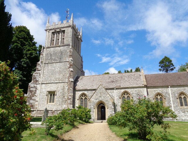
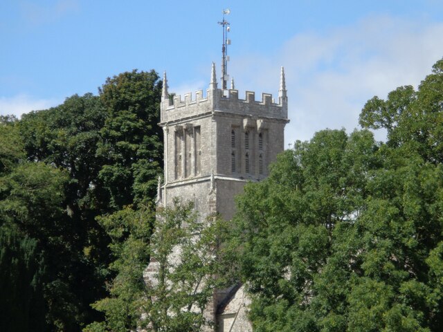
Holy Rood Church, Coombe Keynes
Holy Rood Church is a former Church of England church in Coombe Keynes, Dorset, England. Most of the church dates to a rebuild of 1860–61, but the tower...
Coombe Keynes
Coombe Keynes is a hamlet, civil parish and depopulated village in the Purbeck district of Dorset, England. The village is about 2 miles (3 km) south of...

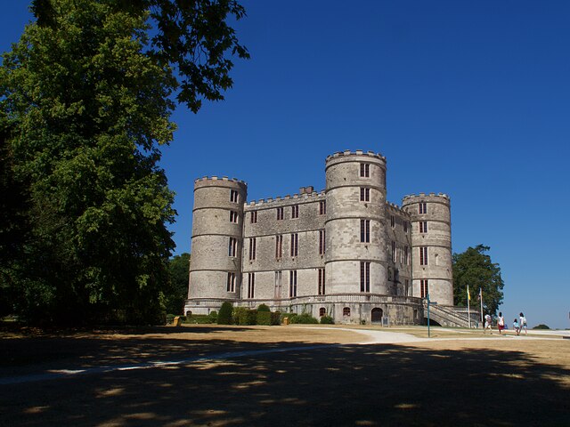
East Lulworth
East Lulworth is a village and civil parish nine miles east of Dorchester, near Lulworth Cove, in the county of Dorset, South West England. It consists...

Bestival
Bestival was a four-day music festival held in the south of England. The name Bestival is a portmanteau of the words best and festival. It had been held...
Nearby Amenities
Located within 500m of 50.652531,-2.2091295Have you been to Kennel Hill Plantation?
Leave your review of Kennel Hill Plantation below (or comments, questions and feedback).