Thorny Mire Wood

Wood, Forest in Yorkshire Richmondshire

England

Thorny Mire Wood

Dry stone wall on north side of road into Hardraw from the west Ordnance Survey documents indicate that a benchmark levelled at 232.477m above Newlyn Datum was verified in 1954 on a stone at the base of the wall
Dry stone wall on north side of road into Hardraw from the west Credit: Roger Templeman

Thorny Mire Wood is a captivating woodland located in the picturesque county of Yorkshire, England. Situated in the heart of the region, this enchanting forest covers an area of approximately 100 acres, making it a haven for nature enthusiasts and outdoor adventurers alike.

As its name suggests, Thorny Mire Wood is characterized by its dense vegetation and abundant thorny shrubs, creating a unique and somewhat mysterious atmosphere within the forest. The woodland is predominantly composed of towering oak and beech trees, their sprawling branches providing a natural canopy that filters the sunlight, casting dappled shadows on the forest floor.

A network of meandering trails and footpaths wind their way through the woodland, allowing visitors to explore its diverse ecosystems and discover its hidden treasures. Moss-covered rocks, babbling brooks, and small meadows bursting with wildflowers can be found scattered throughout Thorny Mire Wood, adding to the charm and natural beauty of the area.

The wood is home to a rich variety of wildlife, including deer, rabbits, squirrels, and a myriad of bird species. The tranquil ambiance and abundance of food sources make Thorny Mire Wood an ideal habitat for these creatures, providing a safe haven for them to thrive.

Whether it's a leisurely stroll, a peaceful picnic, or a nature photography expedition, Thorny Mire Wood offers something for everyone. Its idyllic setting and serene atmosphere make it a popular destination for both locals and tourists seeking solace in nature's embrace.

If you have any feedback on the listing, please let us know in the comments section below.

Thorny Mire Wood Images

Images are sourced within 2km of 54.305044/-2.2289916 or Grid Reference SD8589. Thanks to Geograph Open Source API. All images are credited.
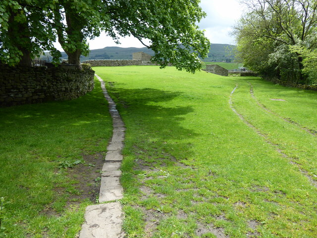
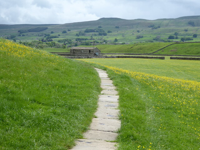
Dry stone wall on north side of road into Hardraw from the west Ordnance Survey documents indicate that a benchmark levelled at 232.477m above Newlyn Datum was verified in 1954 on a stone at the base of the wall
Dry stone wall on north side of road into Hardraw from the west
Ordnance Survey documents indicate that a benchmark levelled at 232.477m above Newlyn Datum was verified in 1954 on a stone at the base of the wall
Hardraw Beck
Hardraw Beck
Hardraw Bridge
Hardraw Bridge
The Pennine Way near Hardraw
Pry House, Appersett Farmland in upper Wensleydale.
[Image formed from 2 photos merged together.]
Pry House, Appersett
Farmland in upper Wensleydale. [Image formed from 2 photos merged together.]
The Cart House, Hardraw Tea room, shop and campsite office. The name gives a clue to its probable earlier use.
The Cart House, Hardraw
Tea room, shop and campsite office. The name gives a clue to its probable earlier use.
Bridge over Hardraw Beck Bellow Hill is carried over Hardraw Beck here. This view is from the Pennine Way.
Bridge over Hardraw Beck
Bellow Hill is carried over Hardraw Beck here. This view is from the Pennine Way.
Hardraw Beck at Hardraw Bellow Hill is carried over Hardraw Beck here. This view is from a garden next to the Pennine Way.
Hardraw Beck at Hardraw
Bellow Hill is carried over Hardraw Beck here. This view is from a garden next to the Pennine Way.
Sheep next to the Pennine Way These Swaledale sheep are in Wensleydale, just outside Hardraw.
Sheep next to the Pennine Way
These Swaledale sheep are in Wensleydale, just outside Hardraw.
Swaledale sheep in Wensleydale These Swaledale sheep are in Wensleydale, just outside Hardraw. They are standing next to the Pennine Way.
Swaledale sheep in Wensleydale
These Swaledale sheep are in Wensleydale, just outside Hardraw. They are standing next to the Pennine Way.
Appersett Viaduct The viaduct carried the former North Eastern Railway.
Appersett Viaduct
The viaduct carried the former North Eastern Railway.
Appersett Bridge
Appersett Bridge
Old Limekiln Situated on the outskirts of Appersett village.
Old Limekiln
Situated on the outskirts of Appersett village.
Market House, Hawes A bequest of £1500 was left to Hawes by Robert William Atkinson so that the town could build a covered market hall. This generous bequest was in litigation in 1893 and as a result the amount was considerably reduced. In the end the parish council had to make up the shortfall. By 1898 a list of trustees had been drawn up. Atkinson had specified that there should also be a reading room, a library, a coffee and refreshment room and housing for a caretaker. The intention was that farmers and local stall holders could sell goods like butter, eggs and poultry undercover and local people could buy in the comfort of the covered hall. Stall holders were charged a set toll. As it turned out, most of these goods went direct to local shop keepers and people seemed to prefer the outdoor stalls.
Market House, Hawes
A bequest of £1500 was left to Hawes by Robert William Atkinson so that the town could build a covered market hall. This generous bequest was in litigation in 1893 and as a result the amount was considerably reduced. In the end the parish council had to make up the shortfall. By 1898 a list of trustees had been drawn up. Atkinson had specified that there should also be a reading room, a library, a coffee and refreshment room and housing for a caretaker. The intention was that farmers and local stall holders could sell goods like butter, eggs and poultry undercover and local people could buy in the comfort of the covered hall. Stall holders were charged a set toll. As it turned out, most of these goods went direct to local shop keepers and people seemed to prefer the outdoor stalls.
Four Fells House Turfy Hill, Hawes
Four Fells House
Turfy Hill, Hawes
Hawes Community Primary School Opened in 1879. Architect F. Bartram Payton of Bradford.
Hawes Community Primary School
Opened in 1879. Architect F. Bartram Payton of Bradford.
View from Wensleydale Creamery, Hawes A view looking north from the cafe garden at the Wensleydale Creamery in Hawes, over the rooftops of Hawes to North Rakes Hill.
View from Wensleydale Creamery, Hawes
A view looking north from the cafe garden at the Wensleydale Creamery in Hawes, over the rooftops of Hawes to North Rakes Hill.
Show me another place!

Thorny Mire Wood is located at Grid Ref: SD8589 (Lat: 54.305044, Lng: -2.2289916)

Division: North Riding

Administrative County: North Yorkshire

District: Richmondshire

Police Authority: North Yorkshire

What 3 Words

///arming.transit.prank. Near Sedbergh, Cumbria

Nearby Locations

Thorny Mire Wood

Related Wikis

Appersett

Appersett is a hamlet in the Yorkshire Dales in the Richmondshire district of North Yorkshire, England one mile (1.6 km) west of Hawes. It lies on the...

Cotter Force

Cotter Force is a small waterfall on Cotterdale Beck, a minor tributary of the River Ure, near the mouth of Cotterdale, a side dale in Wensleydale, North...

Hardraw

Hardraw is a hamlet near Hawes within the Yorkshire Dales in North Yorkshire, England. It takes its name from the nearby Hardraw Force waterfall. The old...

Gayle Mill, North Yorkshire

Gayle Mill, dating from about 1784, is thought to be the oldest structurally unaltered cotton mill in existence. It is located in the Wensleydale hamlet...

Gayle, North Yorkshire

Gayle is a hamlet 0.4-mile (0.64 km) south of Hawes in Wensleydale, North Yorkshire, England. It is noted for the beck that flows through it and the old...

St Margaret's Church, Hawes

St Margaret's Church is a Grade II listed parish church in the Church of England: 184  in Hawes, North Yorkshire. == History == Also known as Church of...

St Mary and St John's Church, Hardraw

St Mary and St John's Church, Hardraw (also Hardrow) is a Grade II listed parish church in the Church of England: 181  in Hardraw, North Yorkshire. �...

Hawes

Hawes is a market town and civil parish in North Yorkshire, England, at the head of Wensleydale in the Yorkshire Dales, and historically in the North Riding...

Nearby Amenities

Located within 500m of 54.305044,-2.2289916
Power: pole
Lat/Long: 54.3033132/-2.2230148
Power: pole
Lat/Long: 54.3027052/-2.2353208
Power: pole
Lat/Long: 54.3031121/-2.2336766
Power: pole
Lat/Long: 54.3035119/-2.2319694
Power: pole
Lat/Long: 54.3039157/-2.2302219
Power: pole
Lat/Long: 54.3040018/-2.224946
Power: pole
Lat/Long: 54.3038719/-2.223326
Power: pole
Lat/Long: 54.3075456/-2.2256313
Power: pole
Lat/Long: 54.3066686/-2.2250989
Power: pole
Lat/Long: 54.3049392/-2.2239845
Power: pole
Lat/Long: 54.3057726/-2.2244927
Power: pole
Lat/Long: 54.3091762/-2.2268819
Power: pole
Lat/Long: 54.3084963/-2.2262214
Power: pole
Lat/Long: 54.3043086/-2.2285995
Power: pole
Lat/Long: 54.3041508/-2.2267201
The data included in this document is from www.openstreetmap.org. The data is made available under ODbL.

Have you been to Thorny Mire Wood?

Leave your review of Thorny Mire Wood below (or comments, questions and feedback).