Coombe Wood

Wood, Forest in Dorset

England

Coombe Wood

Smuggler's Lane The Stepleton end where it becomes a holloway.
Smuggler's Lane Credit: Richard Webb

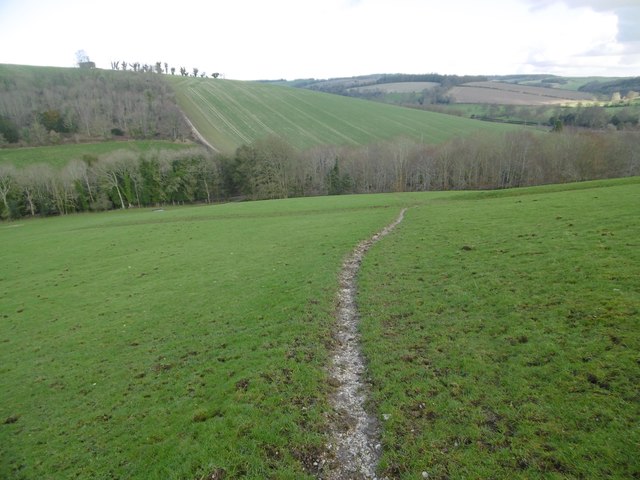
Coombe Wood is a picturesque woodland located in the county of Dorset, England. It is situated near the village of Coombe Bissett, approximately five miles southwest of the city of Salisbury. Covering an area of around 80 hectares, Coombe Wood is a mixture of ancient woodland and plantation, making it a diverse and ecologically rich habitat.

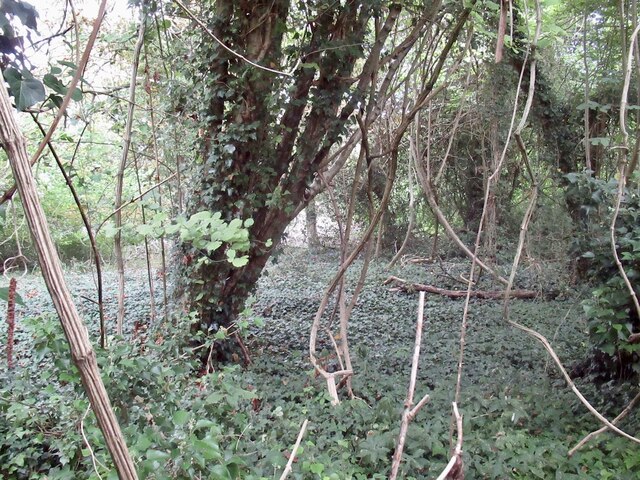
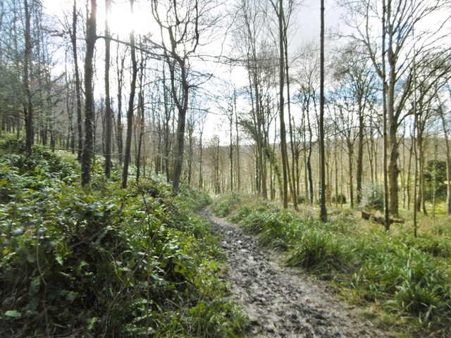
The woodland is predominantly made up of broadleaf trees, including oak, beech, ash, and hazel. These majestic trees create a dense canopy, providing shelter for a variety of wildlife species. Visitors to Coombe Wood can expect to see an array of birdlife, such as woodpeckers, nuthatches, and warblers. Mammals like deer, foxes, and badgers also call this woodland home.

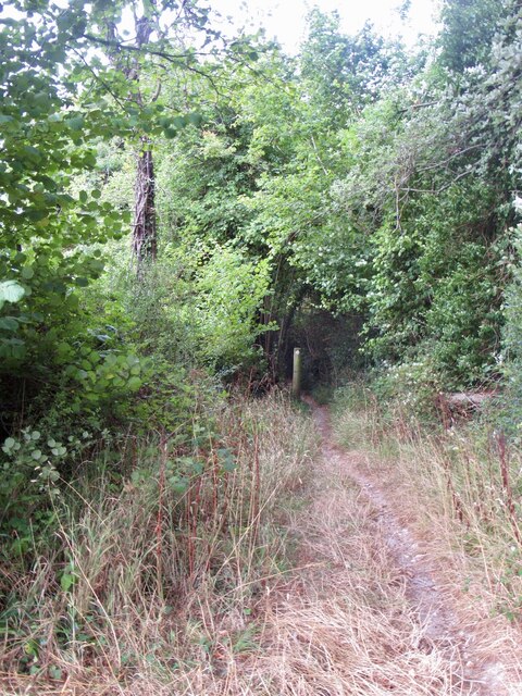
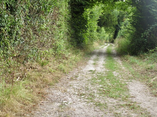
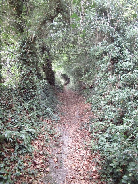
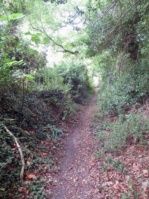
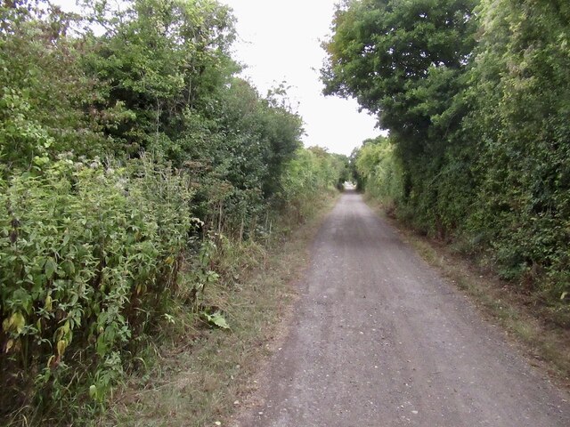
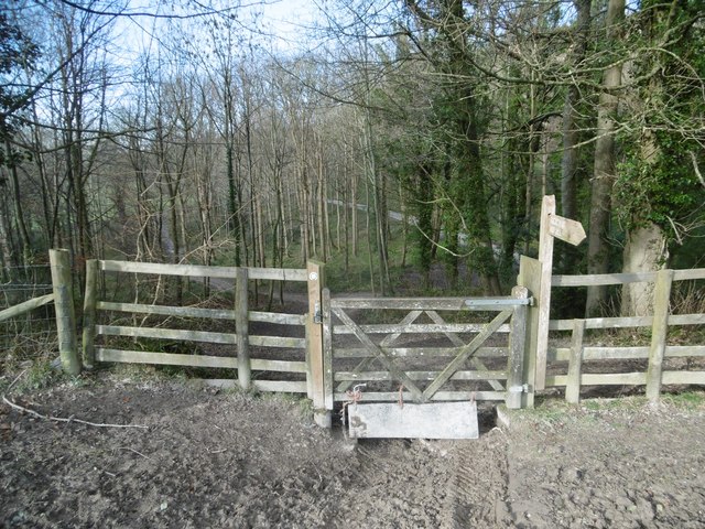
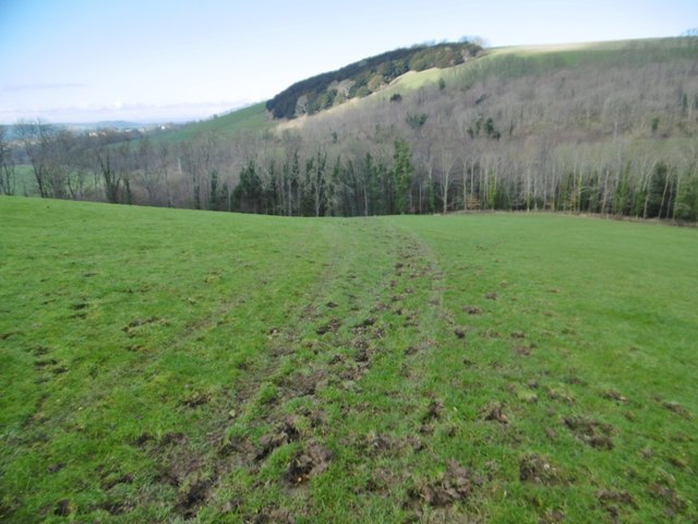
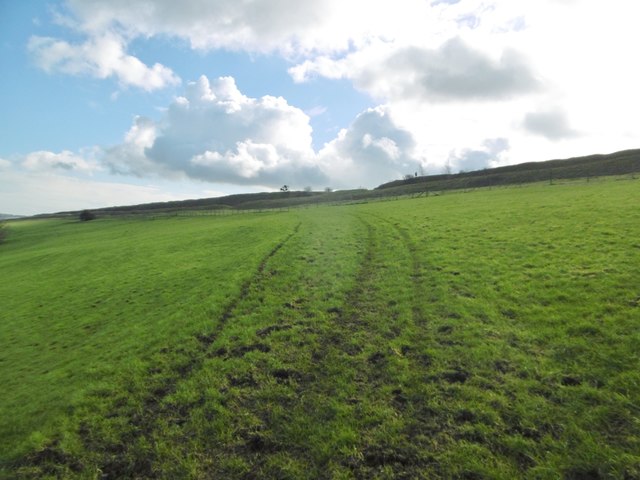
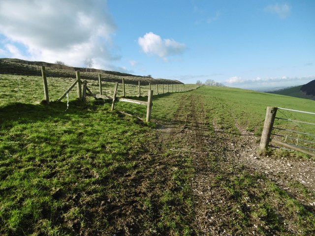
A network of footpaths and trails wind their way through Coombe Wood, allowing visitors to explore its natural beauty. These paths offer stunning views of the surrounding countryside and provide an opportunity to appreciate the tranquility and serenity of the woodland. In spring, the forest floor comes alive with a vibrant carpet of bluebells, creating a breathtaking spectacle.

Coombe Wood is a popular destination for nature lovers, walkers, and photographers. It offers a peaceful retreat away from the hustle and bustle of everyday life, providing an opportunity to connect with nature and enjoy the beauty of the Dorset countryside. Whether you are seeking a leisurely stroll, a spot of birdwatching, or simply a moment of reflection in a natural setting, Coombe Wood is a perfect choice.

If you have any feedback on the listing, please let us know in the comments section below.

Coombe Wood Images

Images are sourced within 2km of 50.906843/-2.2132265 or Grid Reference ST8511. Thanks to Geograph Open Source API. All images are credited.

Smuggler's Lane The Stepleton end where it becomes a holloway.
Smuggler's Lane
The Stepleton end where it becomes a holloway.
Smuggler's Lane
Smuggler's Lane
Smuggler's Lane The descent past Stepleton is a holloway.
Smuggler's Lane
The descent past Stepleton is a holloway.
A shrubbery! Stepleton Shrubbery, a small woodland.
A shrubbery!
Stepleton Shrubbery, a small woodland.
The western end of Smuggler's Lane
Parched field, Stepleton
Hambledon Hill View from the Stour floodplain.
Hambledon Hill
View from the Stour floodplain.
Fields near Shillingstone Within a meander of the Stour.
Fields near Shillingstone
Within a meander of the Stour.
Blandford Forum to Sturminster Newton path The former Somerset and Dorset railway.
Blandford Forum to Sturminster Newton path
The former Somerset and Dorset railway.
Hanford, Nutcombe Wood On the lower slopes of Hod Hill.
Hanford, Nutcombe Wood
On the lower slopes of Hod Hill.
Hanford, gate On the bridleway from Hod Hill to the Child Okeford road.
Hanford, gate
On the bridleway from Hod Hill to the Child Okeford road.
Hod Hill, bridleway From the hill to Nutcombe Wood; not shown as bridleway on OS, but with track marks and plenty of churned-up hoof prints.
Hod Hill, bridleway
From the hill to Nutcombe Wood; not shown as bridleway on OS, but with track marks and plenty of churned-up hoof prints.
Hod Hill, bridleway One of two routes from the hill to the Child Okeford road; this route is on the Stour Valley Way.
Hod Hill, bridleway
One of two routes from the hill to the Child Okeford road; this route is on the Stour Valley Way.
Hod Hill, bridleway From the Child Okeford road to the hill; not shown as bridleway on OS, but track marks and hoof prints show it is used as such.
Hod Hill, bridleway
From the Child Okeford road to the hill; not shown as bridleway on OS, but track marks and hoof prints show it is used as such.
Hod Hill, gate On the informal bridleway from the hill to Nutcombe Wood; the outer embankment of the Iron Age hillfort to the left.
Hod Hill, gate
On the informal bridleway from the hill to Nutcombe Wood; the outer embankment of the Iron Age hillfort to the left.
Hod Hill, gate At a (modern) entrance to the hillfort; as the sign indicates, this is National Trust property. <span class="nowrap"><a title="http://www.nationaltrust.org.uk/hod-hill" rel="nofollow ugc noopener" href="http://www.nationaltrust.org.uk/hod-hill">Link</a><img style="margin-left:2px;" alt="External link" title="External link - shift click to open in new window" src="https://s1.geograph.org.uk/img/external.png" width="10" height="10"/></span>
Hod Hill, gate
At a (modern) entrance to the hillfort; as the sign indicates, this is National Trust property. LinkExternal link
Hod Hill, entrance At the south-western corner of the Iron Age hillfort; according to Richard Wainwright, probably not original, but medieval.
Hod Hill, entrance
At the south-western corner of the Iron Age hillfort; according to Richard Wainwright, probably not original, but medieval.
Hod Hill, outer ditch Outer ditch of the Iron Age hillfort; for most of its circumference, the fort had two ditches, except where it overlooked the River Stour. <span class="nowrap"><a title="http://www.pastscape.org.uk/hob.aspx?hob_id=206122&sort=4&search=all&criteria=hod" rel="nofollow ugc noopener" href="http://www.pastscape.org.uk/hob.aspx?hob_id=206122&sort=4&search=all&criteria=hod">Link</a><img style="margin-left:2px;" alt="External link" title="External link - shift click to open in new window" src="https://s1.geograph.org.uk/img/external.png" width="10" height="10"/></span> hill&rational=q&recordsperpage=10#aRt
Hod Hill, outer ditch
Outer ditch of the Iron Age hillfort; for most of its circumference, the fort had two ditches, except where it overlooked the River Stour. LinkExternal link hill&rational=q&recordsperpage=10#aRt
Show me another place!

Coombe Wood is located at Grid Ref: ST8511 (Lat: 50.906843, Lng: -2.2132265)

Unitary Authority: Dorset

Police Authority: Dorset

What 3 Words

///gift.vent.reinvest. Near Child Okeford, Dorset

Related Wikis

Hanford, Dorset

Hanford is a village and civil parish in the administrative area North Dorset, in the English county Dorset. The parish had 154 inhabitants in 2001....

Hambledon Hill

Hambledon Hill is a prehistoric hill fort in Dorset, England, in the Blackmore Vale five miles northwest of Blandford Forum. The hill itself is a chalk...

Hanford School

Hanford School is a girls' boarding preparatory school located in Hanford, Child Okeford, Dorset, England, established in 1947 and located in a grade II...

Iwerne Courtney

Iwerne Courtney (), also known as Shroton, is a village and civil parish in the English county of Dorset. It lies approximately 4 miles (6 kilometres)...
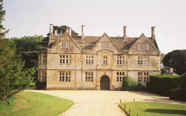
Stepleton House

Stepleton House is a 17th-century country house in the parish of Iwerne Stepleton in Dorset, situated about 5 kilometres (3 mi) north of Blandford Forum...

Hod Hill

Hod Hill (or Hodd Hill) is a large hill fort in the Blackmore Vale, 3 miles (5 km) north-west of Blandford Forum, Dorset, England. The fort sits on a 143...

Child Okeford

Child Okeford (sometimes written Childe Okeford) is a village and civil parish in the county of Dorset in southern England, 3 miles (5 kilometres) east...

Ash (near Stourpaine)

Ash is a hamlet approximately 0.5 miles (1 km) north of the village of Stourpaine, Dorset, England.Ash was listed in the Domesday Book of 1086. == References... ==

Nearby Amenities

Located within 500m of 50.906843,-2.2132265
Man Made: survey_point
Lat/Long: 50.9094634/-2.2169154
The data included in this document is from www.openstreetmap.org. The data is made available under ODbL.

Have you been to Coombe Wood?

Leave your review of Coombe Wood below (or comments, questions and feedback).