Blackhill Plantation

Wood, Forest in Staffordshire South Staffordshire

England

Blackhill Plantation

Oak and birch on Highgate Common, Staffordshire Highgate Common is a Staffordshire Wildlife Trust reserve of about 129 hectares (320 acres) in area and is a Site of Special Scientific Interest. This is a very popular venue for walkers (including dog-walkers) at any time of the year. Several car parks are provided, as are picnic areas and benches, so contemplative visitors can admire the view.

There are areas of woodland, with silver birch and pedunculate oak as canopy and common bracken as ground cover, as well as coniferous plantation. There are roadside verges, areas of acidic grassland, patches of bare sand and earth, and small areas of wet heath, including two artificial ponds. The varied habitat results in a wide variety of animal life. Highgate Common also contains one of the few lowland heaths in Staffordshire, covered mainly with heather, broom and gorse.(Wikipedia - good article) <span class="nowrap"><a title="http://en.wikipedia.org/wiki/Highgate_Common" rel="nofollow ugc noopener" href="http://en.wikipedia.org/wiki/Highgate_Common">Link</a><img style="margin-left:2px;" alt="External link" title="External link - shift click to open in new window" src="https://s1.geograph.org.uk/img/external.png" width="10" height="10"/></span>
Oak and birch on Highgate Common, Staffordshire Credit: Roger D Kidd

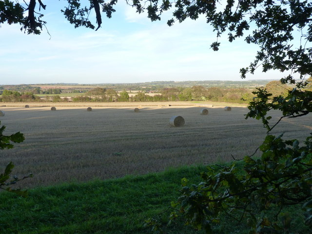
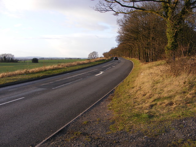
Blackhill Plantation is a picturesque woodland located in Staffordshire, England. Covering an area of approximately 100 acres, this forested area offers a serene and tranquil escape for nature enthusiasts and outdoor lovers.

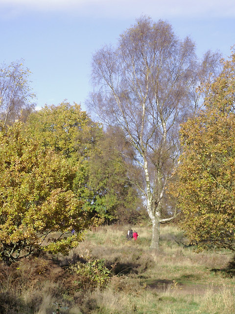
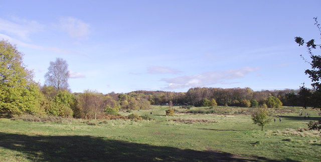
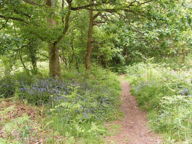
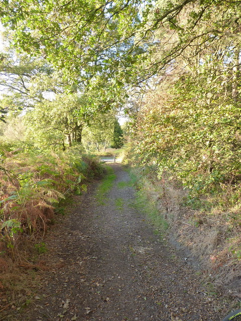
The woodland is predominantly composed of a variety of trees, including oak, beech, and birch, creating a diverse and rich ecosystem. The dense canopy of foliage provides shade and shelter for an array of wildlife, making it a haven for birdwatchers and animal lovers. Visitors can expect to spot species such as woodpeckers, squirrels, and deer as they explore the plantation's network of trails.

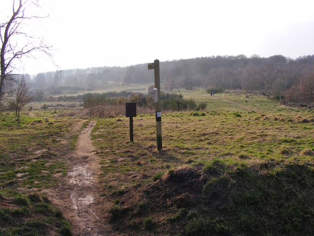
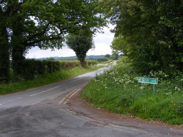
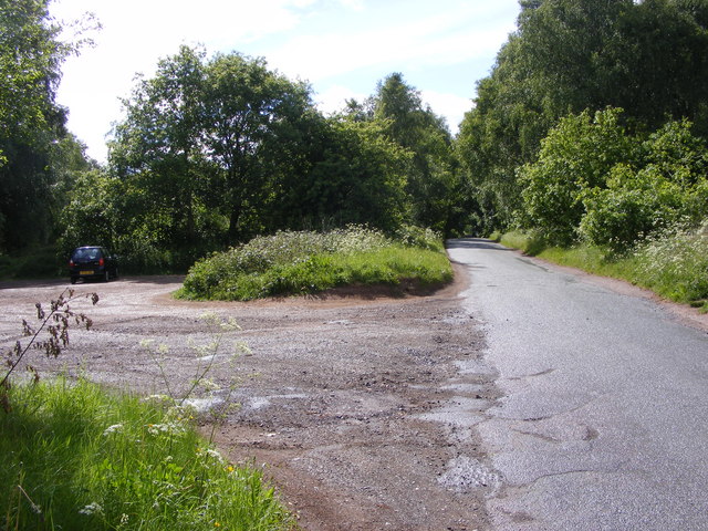
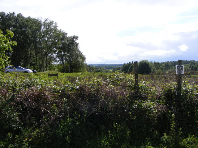
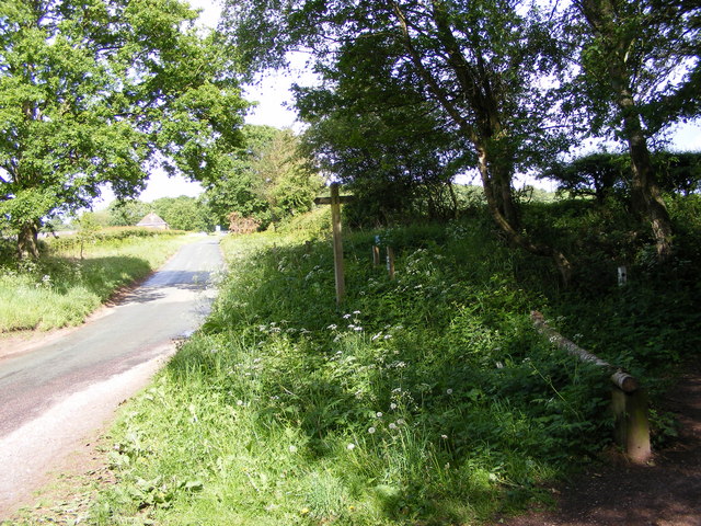
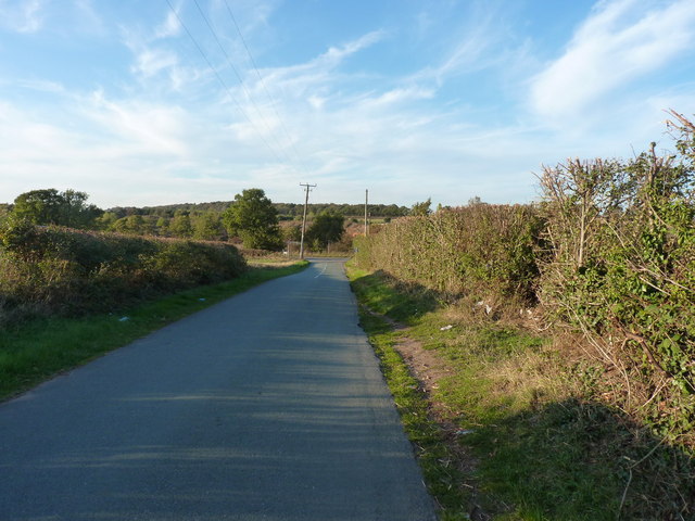
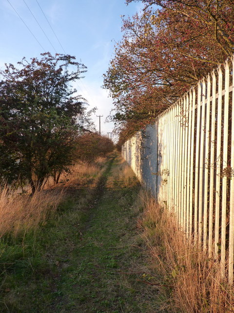
The plantation features a well-maintained footpath system, allowing visitors to easily navigate through the forest. These trails wind through the woodland, offering breathtaking views of the surrounding countryside and providing an opportunity to immerse oneself in the beauty of nature. The plantation is also equipped with information boards along the paths, providing educational insights into the local flora and fauna.

Blackhill Plantation is a popular destination for outdoor activities, such as walking, jogging, and cycling. The forest's peaceful atmosphere and well-kept trails make it an ideal location for both leisurely strolls and more vigorous exercise. Additionally, the plantation offers picnic areas and benches, allowing visitors to relax and enjoy a meal amidst the natural surroundings.

Overall, Blackhill Plantation is a charming woodland that showcases the beauty of Staffordshire's natural landscape. With its diverse range of trees, abundant wildlife, and well-maintained trails, it offers an enchanting experience for individuals seeking solace in nature's embrace.

If you have any feedback on the listing, please let us know in the comments section below.

Blackhill Plantation Images

Images are sourced within 2km of 52.524925/-2.2372564 or Grid Reference SO8491. Thanks to Geograph Open Source API. All images are credited.

Oak and birch on Highgate Common, Staffordshire Highgate Common is a Staffordshire Wildlife Trust reserve of about 129 hectares (320 acres) in area and is a Site of Special Scientific Interest. This is a very popular venue for walkers (including dog-walkers) at any time of the year. Several car parks are provided, as are picnic areas and benches, so contemplative visitors can admire the view.

There are areas of woodland, with silver birch and pedunculate oak as canopy and common bracken as ground cover, as well as coniferous plantation. There are roadside verges, areas of acidic grassland, patches of bare sand and earth, and small areas of wet heath, including two artificial ponds. The varied habitat results in a wide variety of animal life. Highgate Common also contains one of the few lowland heaths in Staffordshire, covered mainly with heather, broom and gorse.(Wikipedia - good article) <span class="nowrap"><a title="http://en.wikipedia.org/wiki/Highgate_Common" rel="nofollow ugc noopener" href="http://en.wikipedia.org/wiki/Highgate_Common">Link</a><img style="margin-left:2px;" alt="External link" title="External link - shift click to open in new window" src="https://s1.geograph.org.uk/img/external.png" width="10" height="10"/></span>
Oak and birch on Highgate Common, Staffordshire
Highgate Common is a Staffordshire Wildlife Trust reserve of about 129 hectares (320 acres) in area and is a Site of Special Scientific Interest. This is a very popular venue for walkers (including dog-walkers) at any time of the year. Several car parks are provided, as are picnic areas and benches, so contemplative visitors can admire the view. There are areas of woodland, with silver birch and pedunculate oak as canopy and common bracken as ground cover, as well as coniferous plantation. There are roadside verges, areas of acidic grassland, patches of bare sand and earth, and small areas of wet heath, including two artificial ponds. The varied habitat results in a wide variety of animal life. Highgate Common also contains one of the few lowland heaths in Staffordshire, covered mainly with heather, broom and gorse.(Wikipedia - good article) LinkExternal link
Highgate Common south-west of Wombourne, Staffordshire This is a cropped wide angle view looking towards the eastern White House Lane car park. Swindon village is beyond the skyline forestry.

Highgate Common is a Staffordshire Wildlife Trust reserve of about 129 hectares (320 acres) in area and is a Site of Special Scientific Interest. This is a very popular venue for walkers (including dog-walkers) at any time of the year. Several car parks are provided, as are picnic areas and benches, so contemplative visitors can admire the view.

There are areas of woodland, with silver birch and pedunculate oak as canopy and common bracken as ground cover, as well as coniferous plantation. There are roadside verges, areas of acidic grassland, patches of bare sand and earth, and small areas of wet heath, including two artificial ponds. The varied habitat results in a wide variety of animal life. Highgate Common also contains one of the few lowland heaths in Staffordshire, covered mainly with heather, broom and gorse.(Wikipedia - good article) <span class="nowrap"><a title="http://en.wikipedia.org/wiki/Highgate_Common" rel="nofollow ugc noopener" href="http://en.wikipedia.org/wiki/Highgate_Common">Link</a><img style="margin-left:2px;" alt="External link" title="External link - shift click to open in new window" src="https://s1.geograph.org.uk/img/external.png" width="10" height="10"/></span>
Highgate Common south-west of Wombourne, Staffordshire
This is a cropped wide angle view looking towards the eastern White House Lane car park. Swindon village is beyond the skyline forestry. Highgate Common is a Staffordshire Wildlife Trust reserve of about 129 hectares (320 acres) in area and is a Site of Special Scientific Interest. This is a very popular venue for walkers (including dog-walkers) at any time of the year. Several car parks are provided, as are picnic areas and benches, so contemplative visitors can admire the view. There are areas of woodland, with silver birch and pedunculate oak as canopy and common bracken as ground cover, as well as coniferous plantation. There are roadside verges, areas of acidic grassland, patches of bare sand and earth, and small areas of wet heath, including two artificial ponds. The varied habitat results in a wide variety of animal life. Highgate Common also contains one of the few lowland heaths in Staffordshire, covered mainly with heather, broom and gorse.(Wikipedia - good article) LinkExternal link
Highgate Common View The view from Birches Coppice Car Park off White House Lane over Highgate Common Country Park.
Highgate Common View
The view from Birches Coppice Car Park off White House Lane over Highgate Common Country Park.
Crash Gate View The view from Water Lane of Bobbington's Halfpenny Green Airport.
Crash Gate View
The view from Water Lane of Bobbington's Halfpenny Green Airport.
Watery Lane The view alongside Bobbington's Halfpenny Green Airport, the name is changed from the OS maps and the local street atlas (Water Lane).
Watery Lane
The view alongside Bobbington's Halfpenny Green Airport, the name is changed from the OS maps and the local street atlas (Water Lane).
Highgate Bluebells The view in Forest Covert part of Highgate Common Country Park.
Highgate Bluebells
The view in Forest Covert part of Highgate Common Country Park.
Highgate Car Park The view from White House Lane on Highgate Common Country Park.
Highgate Car Park
The view from White House Lane on Highgate Common Country Park.
Birches Coppice View The view from White House Lane over Highgate Common Country Park.
Birches Coppice View
The view from White House Lane over Highgate Common Country Park.
Highgate Signpost The view from White House Lane near the footpath onto Highgate Common Country Park.
Highgate Signpost
The view from White House Lane near the footpath onto Highgate Common Country Park.
Devon Cottage, Close To Halfpenny Green Airport.
The Royal Oak, Six Ashes Road, Halfpenny Green Halfpenny Green is a hamlet of about twelve or so residences, and the Royal Oak pub. The pub displays the traditional Banks's sign outside, with the golden lion.
The Royal Oak, Six Ashes Road, Halfpenny Green
Halfpenny Green is a hamlet of about twelve or so residences, and the Royal Oak pub. The pub displays the traditional Banks's sign outside, with the golden lion.
Junction of Six Ashes Road and Gospel Ash Road, Halfpenny Green Six Ashes Road is the one in the foreground. The junction is very near the Royal Oak pub.
Junction of Six Ashes Road and Gospel Ash Road, Halfpenny Green
Six Ashes Road is the one in the foreground. The junction is very near the Royal Oak pub.
Farmland and baled straw Open country to the east of the ridgetop bridleway along Abbot's Castle Hill
Farmland and baled straw
Open country to the east of the ridgetop bridleway along Abbot's Castle Hill
Road junction near the War Stone
The bridleway at New Lodge A late summer evening light on the changing trees beside the bridleway from New Lodge to Highgate.
The bridleway at New Lodge
A late summer evening light on the changing trees beside the bridleway from New Lodge to Highgate.
Bridleway to Trysull Along the bridleway between Smestow and Trysull
Bridleway to Trysull
Along the bridleway between Smestow and Trysull
B4176 View The new year view from the Staffordshire Way.
B4176 View
The new year view from the Staffordshire Way.
Show me another place!

Blackhill Plantation is located at Grid Ref: SO8491 (Lat: 52.524925, Lng: -2.2372564)

Administrative County: Staffordshire

District: South Staffordshire

Police Authority: Staffordshire

What 3 Words

///rashers.published.louder. Near Wombourn, Staffordshire

Nearby Locations

Blackhill Plantation

Related Wikis

Wolverhampton Airport

Wolverhampton Halfpenny Green Airport (ICAO: EGBO), formerly Halfpenny Green Airport and Wolverhampton Business Airport, locally Bobbington Airport, is...

Highgate Common

Highgate Common is a Staffordshire Wildlife Trust reserve containing a mix of heathland and woodland. It is about 129 hectares or 320 acres in size. The...

Trysull and Seisdon

Trysull and Seisdon is a conjoined civil parish in the South Staffordshire non-metropolitan district, in the county of Staffordshire, England. The population...

Swindon, Staffordshire

Swindon is a village and civil parish located in the West Midlands. The nearest major town is Dudley, approximately five miles eastwards. It stands halfway...

Trysull

Trysull is a rural village in the county of Staffordshire, England approximately five miles south-west of Wolverhampton. With the adjacent village of...

Seisdon Rural District

Seisdon was a rural district in Staffordshire, England from 1894 to 1974. It lay to the west of Wolverhampton and was formed under the Local Government...

Wombourne High School

Wombourne High School (formerly Ounsdale High School) is a coeducational secondary school and sixth form located in Wombourne, Staffordshire, England....

Seisdon

Seisdon is a rural village in the parish of Trysull and Seisdon, Staffordshire approximately six miles west of Wolverhampton and the name of one of the...

Nearby Amenities

Located within 500m of 52.524925,-2.2372564
The data included in this document is from www.openstreetmap.org. The data is made available under ODbL.

Have you been to Blackhill Plantation?

Leave your review of Blackhill Plantation below (or comments, questions and feedback).