Painley Rookery

Wood, Forest in Yorkshire Ribble Valley

England

Painley Rookery

Ordnance Survey Cut Mark This mark can be found on a field gatepost beside knot Lane at White Hill.
The benchmark has a recorded height of 153.6954 metres above sea level.
For more detail see : <span class="nowrap"><a title="https://www.bench-marks.org.uk/bm121976" rel="nofollow ugc noopener" href="https://www.bench-marks.org.uk/bm121976">Link</a><img style="margin-left:2px;" alt="External link" title="External link - shift click to open in new window" src="https://s1.geograph.org.uk/img/external.png" width="10" height="10"/></span>
Ordnance Survey Cut Mark Credit: Peter Wood

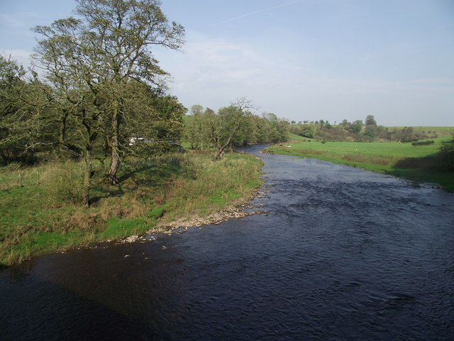
Painley Rookery is a picturesque woodland area located in Yorkshire, England. Situated on the outskirts of a small village, it covers approximately 100 acres of land, making it a significant natural attraction for both locals and visitors alike. The forest is rich in biodiversity and boasts a diverse range of flora and fauna.

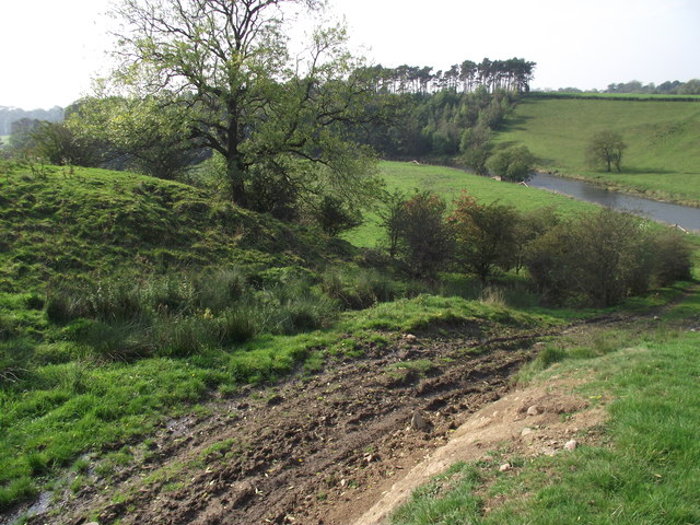
The woodland is predominantly comprised of mature oak, beech, and birch trees, which create a dense canopy that provides shade and shelter for the various wildlife species that call the area home. The forest floor is carpeted with a vibrant array of wildflowers and ferns, adding to its natural beauty.

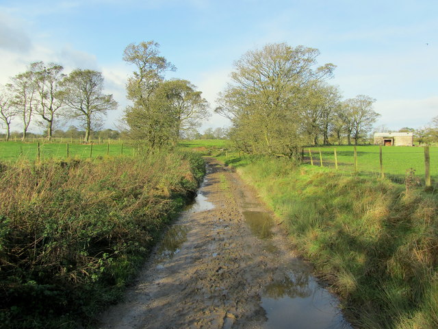
Painley Rookery is also renowned for its network of walking trails and paths, which wind their way through the forest. These well-maintained trails offer visitors the opportunity to explore the woodland and discover its hidden gems. Along the way, hikers may encounter enchanting streams, small waterfalls, and even a hidden pond that is frequented by local wildlife.

The forest is a haven for birdwatching enthusiasts, with a plethora of species such as woodpeckers, owls, and various songbirds making their home here. Additionally, the area is a popular habitat for mammals like deer, foxes, and rabbits, which can often be spotted roaming freely in the early mornings or evenings.

Painley Rookery is a cherished natural gem within the Yorkshire countryside, offering visitors a tranquil and immersive experience in the heart of nature. Whether hiking, birdwatching, or simply enjoying a peaceful stroll, this woodland is a must-visit destination for nature lovers seeking solace and serenity.

If you have any feedback on the listing, please let us know in the comments section below.

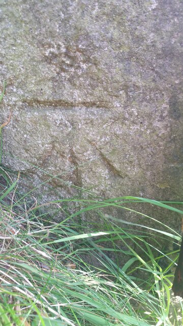
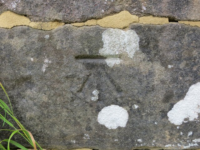
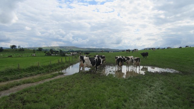
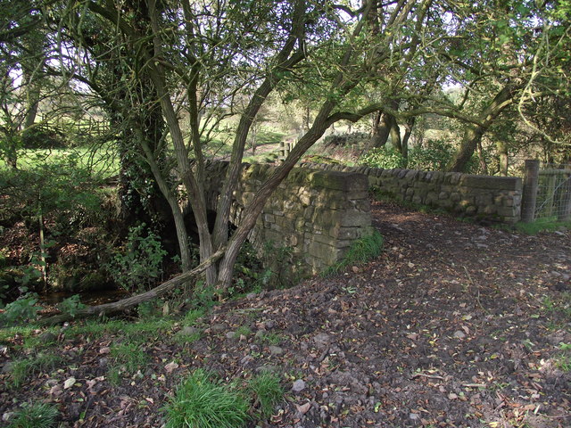
Painley Rookery Images

Images are sourced within 2km of 53.945277/-2.2463326 or Grid Reference SD8349. Thanks to Geograph Open Source API. All images are credited.

Ordnance Survey Cut Mark This mark can be found on a field gatepost beside knot Lane at White Hill.
The benchmark has a recorded height of 153.6954 metres above sea level.
For more detail see : <span class="nowrap"><a title="https://www.bench-marks.org.uk/bm121976" rel="nofollow ugc noopener" href="https://www.bench-marks.org.uk/bm121976">Link</a><img style="margin-left:2px;" alt="External link" title="External link - shift click to open in new window" src="https://s1.geograph.org.uk/img/external.png" width="10" height="10"/></span>
Ordnance Survey Cut Mark
This mark can be found on a field gatepost beside knot Lane at White Hill. The benchmark has a recorded height of 153.6954 metres above sea level. For more detail see : LinkExternal link
Ordnance Survey Cut Mark This mark can be found on the parapet wall of Paythorne Bridge
The benchmark has a recorded height of 104.7627 metres above sea level.
For more detail see : <span class="nowrap"><a title="https://www.bench-marks.org.uk/bm45450" rel="nofollow ugc noopener" href="https://www.bench-marks.org.uk/bm45450">Link</a><img style="margin-left:2px;" alt="External link" title="External link - shift click to open in new window" src="https://s1.geograph.org.uk/img/external.png" width="10" height="10"/></span>
Ordnance Survey Cut Mark
This mark can be found on the parapet wall of Paythorne Bridge The benchmark has a recorded height of 104.7627 metres above sea level. For more detail see : LinkExternal link
Cows on Bridleway / footpath junction Looking South back towards footpath / bridleway junction near Horton
Cows on Bridleway / footpath junction
Looking South back towards footpath / bridleway junction near Horton
Ordnance Survey Cut Mark This mark can be found on the wall of St Mary's Church, Gisburn
The benchmark has a recorded height of 138.3304 metres above sea level.
For more detail see : <span class="nowrap"><a title="https://www.bench-marks.org.uk/bm36317" rel="nofollow ugc noopener" href="https://www.bench-marks.org.uk/bm36317">Link</a><img style="margin-left:2px;" alt="External link" title="External link - shift click to open in new window" src="https://s1.geograph.org.uk/img/external.png" width="10" height="10"/></span>
Ordnance Survey Cut Mark
This mark can be found on the wall of St Mary's Church, Gisburn The benchmark has a recorded height of 138.3304 metres above sea level. For more detail see : LinkExternal link
Horton bridge The benchmark is cut into the eastern parapet of the bridge.
Horton bridge
The benchmark is cut into the eastern parapet of the bridge.
Horton bridge There is a benchmark cut into the eastern parapet of the bridge. It is located to the right of the small concrete support seen in the centre of the picture.
Horton bridge
There is a benchmark cut into the eastern parapet of the bridge. It is located to the right of the small concrete support seen in the centre of the picture.
Delicious Deli and Café - Gisburn
Gutteridge Farm
Gutteridge Farm
Fields East of Gisburn
West Portal Gisburne Park  Railway Tunnel A cut and cover short tunnel required by the landowner and decorated appropriately. The turrets of the east portal can be seen as well across this part of Gisburne Park
West Portal Gisburne Park Railway Tunnel
A cut and cover short tunnel required by the landowner and decorated appropriately. The turrets of the east portal can be seen as well across this part of Gisburne Park
Gisburne Park Railway Tunnel Turrets A curious view of mock castle turrets in parkland, disguising a railway line
Gisburne Park Railway Tunnel Turrets
A curious view of mock castle turrets in parkland, disguising a railway line
Old milestone This milestone which would have stood at the southeast corner of the A59/B6265 Bracewll Lane is now built into steps at the back of the White Bull PH in Gisburn.  This face is engraved with a hand pointing left/To/SKipton/9 Miles/hand pointing right/Gisbor(n)/2 Ms.  The other visible face is engraved with a hand pointing left To/Settle 11 ms/hand to right/Colne 7 ms.
Old milestone
This milestone which would have stood at the southeast corner of the A59/B6265 Bracewll Lane is now built into steps at the back of the White Bull PH in Gisburn. This face is engraved with a hand pointing left/To/SKipton/9 Miles/hand pointing right/Gisbor(n)/2 Ms. The other visible face is engraved with a hand pointing left To/Settle 11 ms/hand to right/Colne 7 ms.
Gisburne Park Entrance Lodges At the south entrance at the end of Park Road from the centre of Gisburn
Gisburne Park Entrance Lodges
At the south entrance at the end of Park Road from the centre of Gisburn
Bridge over a stream near Paythorne Bridge The bridge is part of a public footpath. The stream is only metres away from its confluence with the River Ribble
Bridge over a stream near Paythorne Bridge
The bridge is part of a public footpath. The stream is only metres away from its confluence with the River Ribble
River Ribble at Paythorne Bridge Looking north east.
River Ribble at Paythorne Bridge
Looking north east.
Looking down to the Ribble From the Ribble Way. Heavy vehicles have recently churned up the ground.
Looking down to the Ribble
From the Ribble Way. Heavy vehicles have recently churned up the ground.
Muddy Track near Paythorne Recent heavy rain has rendered this track to a rather sloppy state
Muddy Track near Paythorne
Recent heavy rain has rendered this track to a rather sloppy state
Entering Paythorne Climbing up towards Paythorne from the River Ribble
Entering Paythorne
Climbing up towards Paythorne from the River Ribble
Show me another place!

Painley Rookery is located at Grid Ref: SD8349 (Lat: 53.945277, Lng: -2.2463326)

Division: West Riding

Administrative County: Lancashire

District: Ribble Valley

Police Authority: Lancashire

What 3 Words

///relegate.connector.hesitate. Near Barnoldswick, Lancashire

Related Wikis

Stock Beck

Stock Beck is a minor river in the West Craven area of Pendle, Lancashire (formerly in Yorkshire). It is 8.25 miles (13.27 km) long and has a catchment...

Gisburne Park

Gisburne Park is an 18th-century country house and associated park in Gisburn, Lancashire, England, in the Ribble Valley some 6 miles (10 km) north-east...

Newsholme railway station

Newsholme railway station was a railway station that served the small village of Newsholme in Lancashire. It was built by the Lancashire and Yorkshire...

Gisburn Tunnel

Gisburn Tunnel is a short railway tunnel on the Ribble Valley line in Lancashire, England. The tunnel is 157 yards (144 m) long, just to the east of Gisburn...

Newsholme, Lancashire

Newsholme is a small village and civil parish in the Ribble Valley, Lancashire, England, but lies within the historic West Riding of Yorkshire. According...

A59 road

The A59 is a major road in England which is around 109 miles (175 km) long and runs from Wallasey, Merseyside to York, North Yorkshire. The alignment formed...

Horton, Lancashire

Horton, historically known as Horton-in-Craven, is a village and a civil parish in the Ribble Valley district of the English county of Lancashire (historically...

Gisburn railway station

Gisburn railway station served the small village of Gisburn, which is now in Lancashire, England, but was in the West Riding of Yorkshire at the time....

Nearby Amenities

Located within 500m of 53.945277,-2.2463326
Painley
Building: yes
Source: NPE
Lat/Long: 53.9458922/-2.2437186
Crow Park
Building: yes
Source: NPE
Lat/Long: 53.943139/-2.2482247
Ha-ha Hill
Natural: peak
Source: OS 1:25k
Lat/Long: 53.9443219/-2.2532484
Power: pole
Lat/Long: 53.9463452/-2.2431582
Power: pole
Lat/Long: 53.9466167/-2.2444671
Power: pole
Lat/Long: 53.946874/-2.2457895
Power: pole
Lat/Long: 53.9415049/-2.2497296
Power: pole
Lat/Long: 53.9423117/-2.2499335
Power: pole
Lat/Long: 53.9438099/-2.2502714
Power: pole
Lat/Long: 53.9471502/-2.2471547
Power: pole
Lat/Long: 53.9474281/-2.2485065
Power: pole
Lat/Long: 53.9476901/-2.2498879
Power: pole
Lat/Long: 53.9479482/-2.2513081
Power: pole
Lat/Long: 53.9480752/-2.2519129
Power: pole
Lat/Long: 53.9446908/-2.2505155
Power: pole
Lat/Long: 53.9453759/-2.2506952
Power: pole
Lat/Long: 53.9460784/-2.2508562
Power: pole
Lat/Long: 53.9468424/-2.25106
Power: pole
Lat/Long: 53.9475196/-2.2512263
Power: pole
Lat/Long: 53.9477454/-2.2520551
The data included in this document is from www.openstreetmap.org. The data is made available under ODbL.

Have you been to Painley Rookery?

Leave your review of Painley Rookery below (or comments, questions and feedback).