Ankerton Covert

Wood, Forest in Staffordshire Stafford

England

Ankerton Covert

Factory Mill Factory near to Coldmeece.
Factory Mill Credit: Andy and Hilary

Ankerton Covert is a picturesque wooded area located in Staffordshire, England. Situated within the heart of the county, this forested landscape provides a tranquil escape from the hustle and bustle of nearby urban centers. Spanning an area of approximately 200 hectares, Ankerton Covert is a haven for nature enthusiasts and outdoor adventurers.

The woodland is primarily composed of ancient broadleaf trees, including oak, ash, and beech, which create a dense canopy overhead. These towering trees not only provide a stunning visual spectacle but also support a diverse ecosystem of flora and fauna. The forest floor is carpeted with a rich undergrowth of bluebells, primroses, and ferns, adding to the enchanting ambiance.

Several walking trails wind their way through the covert, allowing visitors to explore its hidden corners and discover its natural treasures. For those seeking a more immersive experience, there are designated camping areas where one can spend a night under the stars, surrounded by the soothing sounds of nature.

Ankerton Covert is also home to a variety of wildlife, making it an ideal location for birdwatchers and animal lovers. The forest provides a habitat for species such as deer, foxes, badgers, and a multitude of bird species, including woodpeckers and owls.

Overall, Ankerton Covert is a captivating woodland environment that offers a peaceful retreat for visitors. Whether one chooses to hike the trails, observe wildlife, or simply bask in the serenity of nature, this Staffordshire forest is sure to leave a lasting impression.

If you have any feedback on the listing, please let us know in the comments section below.

Ankerton Covert Images

Images are sourced within 2km of 52.881987/-2.2403322 or Grid Reference SJ8331. Thanks to Geograph Open Source API. All images are credited.

Factory Mill Factory near to Coldmeece.
Factory Mill
Factory near to Coldmeece.
Byanna  Lodge Paradise in the country, just outside of Eccleshall.
Byanna Lodge
Paradise in the country, just outside of Eccleshall.
Slindon (Staffs) St Chad's Church
Brockton Farm
Brockton Farm
Mainline Near Millmeece From the Road Bridge
Mainline Near Millmeece
From the Road Bridge
Railway Bridge Near Millmeece
Industrial unit that has grown a pylon 30mts training tower with array of aerials
Industrial unit that has grown a pylon
30mts training tower with array of aerials
Baden Hall A large, historic, timber-framed granary function centre, home of Baden Hall Fishery and Eccelshall RUFC.
Baden Hall
A large, historic, timber-framed granary function centre, home of Baden Hall Fishery and Eccelshall RUFC.
Baden Hall Fishery BADEN HALL FISHERY is now one of the largest pleasure fisheries in the Midlands - if not the Country - comprising eight individual pools, covering over 30 acres of water and holding over 275 pegs, specialising in pleasure and club anglers.

All of the pools are stocked with coarse fish - carp, bream, roach, tench, barble, orfe, golden orfe, etc.
Baden Hall Fishery
BADEN HALL FISHERY is now one of the largest pleasure fisheries in the Midlands - if not the Country - comprising eight individual pools, covering over 30 acres of water and holding over 275 pegs, specialising in pleasure and club anglers. All of the pools are stocked with coarse fish - carp, bream, roach, tench, barble, orfe, golden orfe, etc.
Brookside Business Park The office complex was previously owned by BT for use as a training college now converted to offices and workshops.
Brookside Business Park
The office complex was previously owned by BT for use as a training college now converted to offices and workshops.
Hilcote Farm Hilcote Farm Sturbridge Road
Hilcote Farm
Hilcote Farm Sturbridge Road
Drake Hall Prison During  World War 2, Drake Hall was used to provide accommodation for female munitions workers. It became a male open prison in the 1960s, but has been female since 1974. Most accommodation was re-constructed 1994/95. In January 2002, following erection of a perimeter fence, Drake Hall was re-designated from open to semi-open.
Drake Hall Prison
During World War 2, Drake Hall was used to provide accommodation for female munitions workers. It became a male open prison in the 1960s, but has been female since 1974. Most accommodation was re-constructed 1994/95. In January 2002, following erection of a perimeter fence, Drake Hall was re-designated from open to semi-open.
Little Ankerton Cats Hill Little Ankerton on Ankerton Lane Sturbridge
Little Ankerton Cats Hill
Little Ankerton on Ankerton Lane Sturbridge
Ankerton House High Above Eccleshall (121m) Ankerton House and Farm
Ankerton House
High Above Eccleshall (121m) Ankerton House and Farm
Rail tracks The view along the tracks from the bridge
Rail tracks
The view along the tracks from the bridge
Railway bridge
Railway bridge
A loco for Birmingham 47635 runs south towards Birmingham
A loco for Birmingham
47635 runs south towards Birmingham
Evening light A northbound express from Euston heads away from Heamies Farm just before the sun went down.
Evening light
A northbound express from Euston heads away from Heamies Farm just before the sun went down.
Show me another place!

Ankerton Covert is located at Grid Ref: SJ8331 (Lat: 52.881987, Lng: -2.2403322)

Administrative County: Staffordshire

District: Stafford

Police Authority: Staffordshire

What 3 Words

///soda.mondays.swatting. Near Eccleshall, Staffordshire

Nearby Locations

Ankerton Covert

Related Wikis

HM Prison Drake Hall

HMP Prison Drake Hall is a women's closed prison, located near the town of Eccleshall in Staffordshire, England. The prison is operated by His Majesty...

A519 road

The A519 is a road in the Midlands, United Kingdom. == Route == It that runs between Newcastle-under-Lyme, Staffordshire and Newport, Shropshire. At Newport...

Cold Meece railway station

Cold Meece railway station was a short-lived railway station built during the Second World War by the London, Midland and Scottish Railway (LMS) to serve...

ROF Swynnerton

ROF Swynnerton was a Royal Ordnance Factory, more specifically a filling factory, located south of the village of Swynnerton in Staffordshire, United Kingdom...

Mill Meece Pumping Station

Mill Meece Pumping Station is a pumping station, located in the village of Mill Meece in Staffordshire, England. Its function, powered by steam engines...

Eccleshall Castle

Eccleshall Castle is located in Eccleshall, Staffordshire, England (grid reference SJ827295). It was originally built in the 13th century. It is a Scheduled...

Eccleshall

Eccleshall () is a town and civil parish in the Stafford district, in the county of Staffordshire, England. It is located seven miles northwest of Stafford...

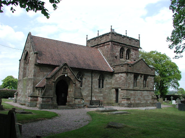
Holy Trinity Church, Eccleshall

Holy Trinity Church in Eccleshall, Staffordshire, England, is a Grade I listed Anglican church. The building dates mostly from the 13th century, and there...

Nearby Amenities

Located within 500m of 52.881987,-2.2403322
Bus Stop
Drake Hall Prison
Bus: yes
Naptan AtcoCode: 3800C702800
Naptan Bearing: NE
Naptan CommonName: Drake Hall Prison
Naptan Indicator: Adj
Naptan Landmark: Drake Hall Prison
Naptan Street: Main Rd
Naptan Verified: no
Public Transport: platform
Source: naptan_import
Lat/Long: 52.8787913/-2.2401167
Bus Stop
Drake Hall Prison
Bus: yes
Naptan AtcoCode: 3800C702801
Naptan Bearing: SW
Naptan CommonName: Drake Hall Prison
Naptan Indicator: Opp
Naptan Landmark: Drake Hall Prison
Naptan Street: Main Rd
Naptan Verified: no
Public Transport: platform
Source: naptan_import
Lat/Long: 52.8787945/-2.2398542
Barrier: stile
Lat/Long: 52.8855445/-2.2391392
Barrier: stile
Lat/Long: 52.8851489/-2.2372366
Barrier: stile
Lat/Long: 52.8845239/-2.2355976
Barrier: stile
Lat/Long: 52.8844034/-2.2351019
Access: designated
Barrier: stile
Lat/Long: 52.884266/-2.2345618
Man Made: utility_pole
Material: wood
Operator: BT
Utility: telecom
Lat/Long: 52.8860353/-2.2406149
The data included in this document is from www.openstreetmap.org. The data is made available under ODbL.

Have you been to Ankerton Covert?

Leave your review of Ankerton Covert below (or comments, questions and feedback).