Redcliff Covert

Wood, Forest in Staffordshire South Staffordshire

England

Redcliff Covert

The Old Grammar School The school from 1511 stands alongside the Holloway in Kinver and is now a private house.
The Old Grammar School Credit: Gordon Griffiths

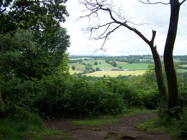
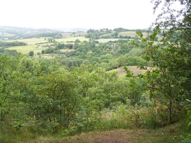
Redcliff Covert, located in Staffordshire, is a picturesque woodland area known for its natural beauty and serene ambiance. Situated near the town of Stafford, this forested area covers a vast expanse of land, offering a peaceful retreat for nature lovers and outdoor enthusiasts.

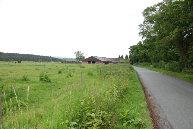
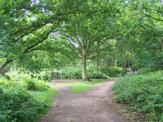
Redcliff Covert is characterized by its rich biodiversity, boasting a diverse array of plant and animal species. The woodland is predominantly composed of deciduous trees, including oak, birch, and beech, which create a stunning canopy that filters sunlight and provides a cool shade during the summer months. The forest floor is adorned with a vibrant carpet of wildflowers, adding a burst of color to the landscape.

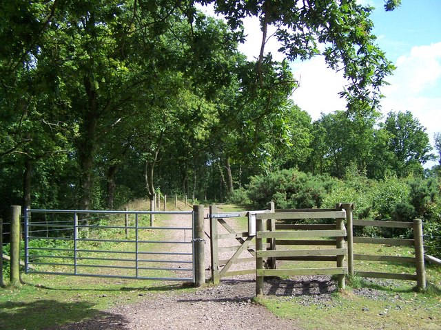
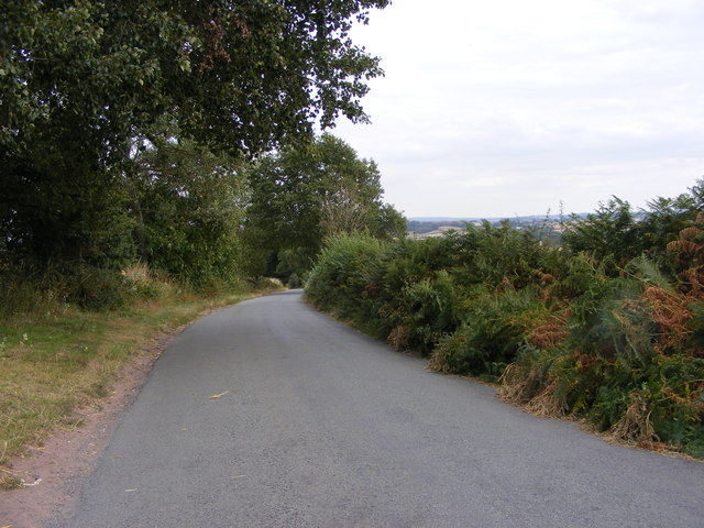
The woodland is crisscrossed by numerous walking trails, making it an ideal destination for hikers and nature walkers. These trails offer a chance to explore the forest at a leisurely pace, allowing visitors to immerse themselves in the tranquil surroundings and observe the local flora and fauna. Redcliff Covert is also home to a variety of wildlife, such as deer, foxes, and various bird species, which can often be spotted by keen-eyed observers.

In addition to its natural beauty, Redcliff Covert provides various recreational activities for visitors. The forest features designated picnic areas, where families and friends can enjoy a packed lunch amidst the peaceful ambiance. There are also facilities for camping and barbecuing, allowing visitors to extend their stay and fully experience the tranquility of the woodland.

Overall, Redcliff Covert in Staffordshire is a captivating woodland area that offers a haven of tranquility and natural beauty. Its lush vegetation, diverse wildlife, and recreational opportunities make it an ideal destination for those seeking a peaceful retreat in the heart of Staffordshire's countryside.

If you have any feedback on the listing, please let us know in the comments section below.

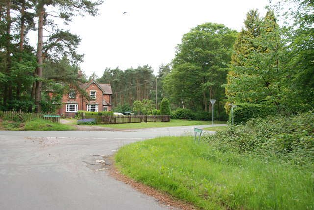
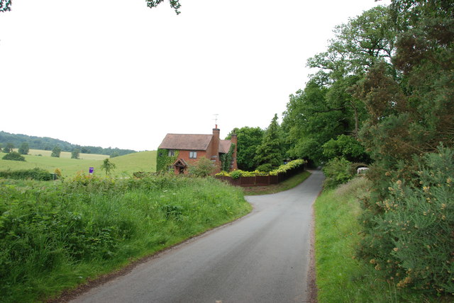
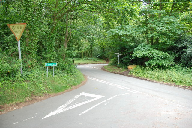
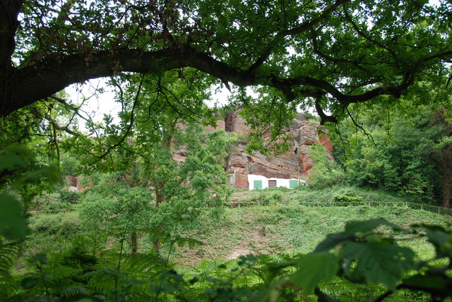
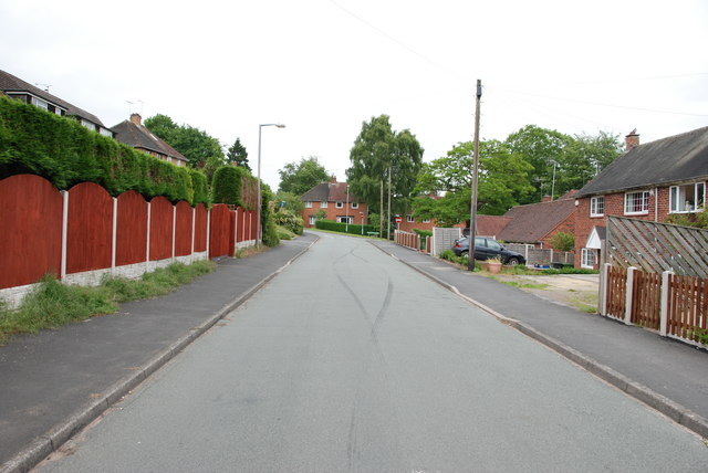
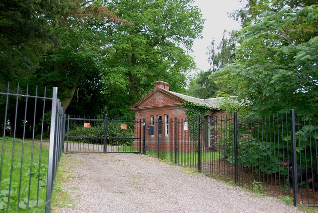
Redcliff Covert Images

Images are sourced within 2km of 52.451968/-2.2477968 or Grid Reference SO8383. Thanks to Geograph Open Source API. All images are credited.

The Old Grammar School The school from 1511 stands alongside the Holloway in Kinver and is now a private house.
The Old Grammar School
The school from 1511 stands alongside the Holloway in Kinver and is now a private house.
The Cross Inn The Kinver Pub stands on the corner of Church Hill and Dark Lane.
The Cross Inn
The Kinver Pub stands on the corner of Church Hill and Dark Lane.
Inside the Cross Inn The Kinver Pub on Church Hill.
Inside the Cross Inn
The Kinver Pub on Church Hill.
Grammar School Plaque The plaque on the front of the former school house in Dark Lane Kinver. See <a href="https://www.geograph.org.uk/photo/2338355">SO8483 : The Old Grammar School</a>
Grammar School Plaque
The plaque on the front of the former school house in Dark Lane Kinver. See SO8483 : The Old Grammar School
Gamekeepers Cottages. These Cottages are on the Enville Road, Compton Road crossroads. Just outside Kinver.
Gamekeepers Cottages.
These Cottages are on the Enville Road, Compton Road crossroads. Just outside Kinver.
House On The Outskirts Of Kinver. This house replaced an old Cottage, around 1990
House On The Outskirts Of Kinver.
This house replaced an old Cottage, around 1990
Crossroads Near Holy Austin Rock, Kinver. These Crossroads are at the Kinver end of Kingsford Lane.
Crossroads Near Holy Austin Rock, Kinver.
These Crossroads are at the Kinver end of Kingsford Lane.
Holy Austin Rock, Kinver. One of the Rock houses has been restored, and is open to the public at certain times.The others have been closed off, as is evident from the Photo, for Health & Safety reasons.
Holy Austin Rock, Kinver.
One of the Rock houses has been restored, and is open to the public at certain times.The others have been closed off, as is evident from the Photo, for Health & Safety reasons.
Entrance To Huntsmans Drive, Kinver
Falcon Farm, Enville. Falcon Farm is part of the Enville Estate.
Falcon Farm, Enville.
Falcon Farm is part of the Enville Estate.
Brindley Hall, Compton, Kinver This house was once owned by James Brindley, the man who played such a big part in the building of the Canals. Up until recent years it was owned by the Enville Estate and fell into disrepair, squatters moved in for a while, then it was sold to Developers, but when they came to renovate it, Bats were found in the roof and work had to stop. If anyone lives in it now I don't know, but with iron fence and Doberman dogs I will leave that to someone else to find out. The farm nextdoor is Union Hall Farm named after The Grand Union Canal.
Brindley Hall, Compton, Kinver
This house was once owned by James Brindley, the man who played such a big part in the building of the Canals. Up until recent years it was owned by the Enville Estate and fell into disrepair, squatters moved in for a while, then it was sold to Developers, but when they came to renovate it, Bats were found in the roof and work had to stop. If anyone lives in it now I don't know, but with iron fence and Doberman dogs I will leave that to someone else to find out. The farm nextdoor is Union Hall Farm named after The Grand Union Canal.
Gate House, Brindley Hall, Compton, Kinver High security, note one of the dogs in right hand corner.
Gate House, Brindley Hall, Compton, Kinver
High security, note one of the dogs in right hand corner.
Staffordshire Way Nearing Kinver
Staffordshire Way On Kinver Edge
View From Kinver Edge
View From Kingsford Forest Park
Gipsy Lane The lane runs from Kinver Edge towards Cookley Lane.
Gipsy Lane
The lane runs from Kinver Edge towards Cookley Lane.
Kinver Edge Car Park The car and picnic site at the junction of Sandy Lane and Gipsy Lane.
Kinver Edge Car Park
The car and picnic site at the junction of Sandy Lane and Gipsy Lane.
Show me another place!

Redcliff Covert is located at Grid Ref: SO8383 (Lat: 52.451968, Lng: -2.2477968)

Administrative County: Staffordshire

District: South Staffordshire

Police Authority: Staffordshire

What 3 Words

///drooling.blueberry.demand. Near Kinvere, Staffordshire

Related Wikis

Kinver Edge

Kinver Edge is a high heath and woodland escarpment just west of Kinver, about four miles west of Stourbridge, and four miles north of Kidderminster, and...

Kinver Edge Hillfort

Kinver Edge Hillfort, is a univallate Iron Age hillfort with a massive rampart and outer ditch along the south-west and south-east sides, with natural...

Kinver High School

Kinver High School (formerly Edgecliff High School) is a mixed secondary school and sixth form located in Kinver in the English county of Staffordshire...

Kingsford Country Park

Kingsford Country Park, officially Kingsford Forest Park, was in Worcestershire, England, U.K. and managed by Worcestershire County Council. It adjoined...

Kinver

Kinver is a large village in the District of South Staffordshire in Staffordshire, England. It is in the far south-west of the county, at the end of the...

Dunsley, Staffordshire

Dunsley is a hamlet in Kinver, Staffordshire, England. The settled part of the hamlet is the part of the village of Kinver, lying east of the River Stour...

Kingsford, Worcestershire

Kingsford is a large hamlet in Worcestershire, England. == Location == Kingsford is located one mile (1.6 km) north of the village of Wolverley, Worcestershire...

Enville Hall

Enville Hall is an English Tudor country house in the village of Enville, Staffordshire. It is a Grade II listed building.The house has a 16th and 17th...

Nearby Amenities

Located within 500m of 52.451968,-2.2477968
Bus Stop
Meddins Lane
Bus: yes
Naptan AtcoCode: 3800C615701
Naptan Bearing: NW
Naptan CommonName: Meddins Lane
Naptan Indicator: Adj
Naptan Landmark: Meddins Lane
Naptan Street: Windsor Cresent
Naptan Verified: no
Public Transport: platform
Source: naptan_import
Lat/Long: 52.4524161/-2.2405367
Holy Austin Rock House
Historic: monument
Source: www.geograph.org.uk
Lat/Long: 52.4501262/-2.2418116
Cafe
Lat/Long: 52.4499543/-2.2419271
Barrier: kissing_gate
Source: survey
Lat/Long: 52.4482442/-2.2444823
Crossing: informal
Lat/Long: 52.4502525/-2.2444858
Information: guidepost
Tourism: information
Lat/Long: 52.4489746/-2.2460286
Crossing: informal
Lat/Long: 52.4478518/-2.2498442
Power: pole
Lat/Long: 52.4540679/-2.2532982
Power: pole
Lat/Long: 52.4548949/-2.2531426
Power: pole
Lat/Long: 52.4530739/-2.2529591
Bench
Backrest: yes
Material: wood
Seats: 2
Lat/Long: 52.4502296/-2.2410252
The data included in this document is from www.openstreetmap.org. The data is made available under ODbL.

Have you been to Redcliff Covert?

Leave your review of Redcliff Covert below (or comments, questions and feedback).