Kinver Edge

Hill, Mountain in Staffordshire South Staffordshire

England

Kinver Edge

The Old Grammar School The school from 1511 stands alongside the Holloway in Kinver and is now a private house.
The Old Grammar School Credit: Gordon Griffiths

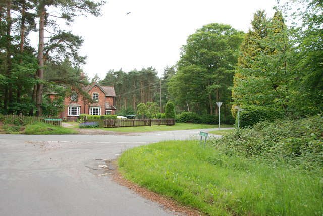
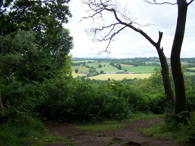
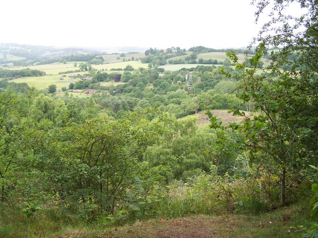
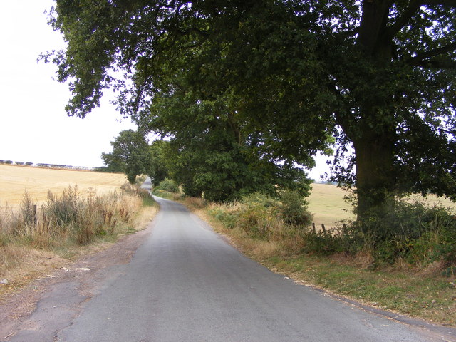
Kinver Edge is a prominent hill and woodland area located in Staffordshire, England. Rising to a height of 240 meters (787 feet) above sea level, it offers breathtaking panoramic views of the surrounding countryside. The site is managed by the National Trust and is a popular destination for outdoor enthusiasts and nature lovers.

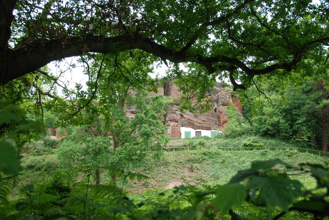
Covering an area of approximately 200 acres, Kinver Edge is characterized by its unique sandstone rock houses, known as cave houses, which were carved into the sandstone cliffs during the 18th and 19th centuries. These cave houses were inhabited until the mid-20th century and now serve as a fascinating tourist attraction, offering a glimpse into a bygone era.

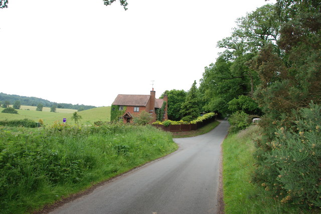
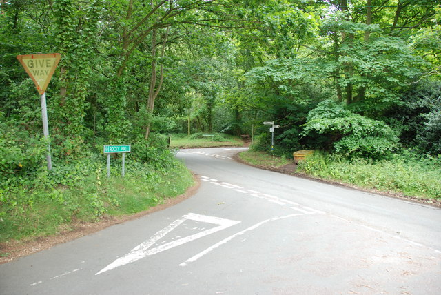
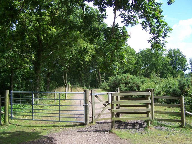
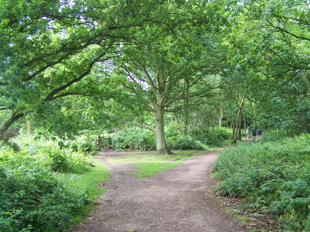
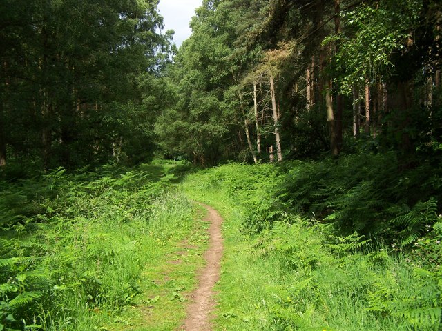
The hill is covered with a mix of deciduous and coniferous woodlands, making it a haven for wildlife. Visitors can explore the numerous walking trails that wind through the woods, providing opportunities to spot a variety of bird species, including woodpeckers and owls. The hill also supports a diverse range of flora, with carpets of bluebells and wild garlic adding a splash of color during the spring months.

In addition to its natural and historical features, Kinver Edge offers amenities such as a visitor center, picnic areas, and a café. The site is a popular spot for families, offering opportunities for children to engage in outdoor activities and explore the natural environment.

Overall, Kinver Edge in Staffordshire provides a unique blend of natural beauty, historical interest, and recreational opportunities, making it a must-visit destination for locals and tourists alike.

If you have any feedback on the listing, please let us know in the comments section below.
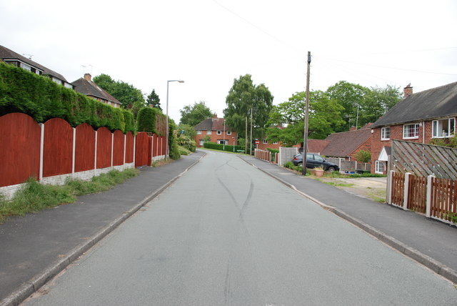
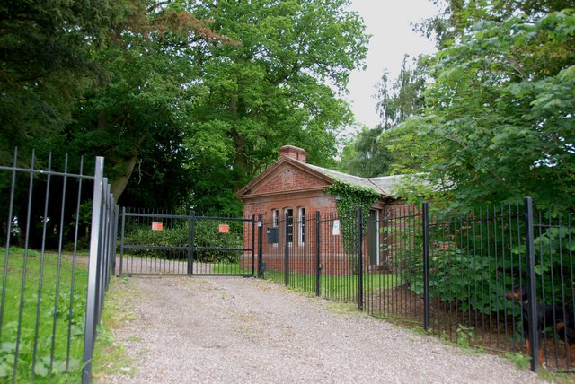
Kinver Edge Images

Images are sourced within 2km of 52.44483/-2.2476096 or Grid Reference SO8383. Thanks to Geograph Open Source API. All images are credited.

The Old Grammar School The school from 1511 stands alongside the Holloway in Kinver and is now a private house.
The Old Grammar School
The school from 1511 stands alongside the Holloway in Kinver and is now a private house.
The Cross Inn The Kinver Pub stands on the corner of Church Hill and Dark Lane.
The Cross Inn
The Kinver Pub stands on the corner of Church Hill and Dark Lane.
Inside the Cross Inn The Kinver Pub on Church Hill.
Inside the Cross Inn
The Kinver Pub on Church Hill.
Grammar School Plaque The plaque on the front of the former school house in Dark Lane Kinver. See <a href="https://www.geograph.org.uk/photo/2338355">SO8483 : The Old Grammar School</a>
Grammar School Plaque
The plaque on the front of the former school house in Dark Lane Kinver. See SO8483 : The Old Grammar School
Gamekeepers Cottages. These Cottages are on the Enville Road, Compton Road crossroads. Just outside Kinver.
Gamekeepers Cottages.
These Cottages are on the Enville Road, Compton Road crossroads. Just outside Kinver.
House On The Outskirts Of Kinver. This house replaced an old Cottage, around 1990
House On The Outskirts Of Kinver.
This house replaced an old Cottage, around 1990
Crossroads Near Holy Austin Rock, Kinver. These Crossroads are at the Kinver end of Kingsford Lane.
Crossroads Near Holy Austin Rock, Kinver.
These Crossroads are at the Kinver end of Kingsford Lane.
Holy Austin Rock, Kinver. One of the Rock houses has been restored, and is open to the public at certain times.The others have been closed off, as is evident from the Photo, for Health & Safety reasons.
Holy Austin Rock, Kinver.
One of the Rock houses has been restored, and is open to the public at certain times.The others have been closed off, as is evident from the Photo, for Health & Safety reasons.
Entrance To Huntsmans Drive, Kinver
Brindley Hall, Compton, Kinver This house was once owned by James Brindley, the man who played such a big part in the building of the Canals. Up until recent years it was owned by the Enville Estate and fell into disrepair, squatters moved in for a while, then it was sold to Developers, but when they came to renovate it, Bats were found in the roof and work had to stop. If anyone lives in it now I don't know, but with iron fence and Doberman dogs I will leave that to someone else to find out. The farm nextdoor is Union Hall Farm named after The Grand Union Canal.
Brindley Hall, Compton, Kinver
This house was once owned by James Brindley, the man who played such a big part in the building of the Canals. Up until recent years it was owned by the Enville Estate and fell into disrepair, squatters moved in for a while, then it was sold to Developers, but when they came to renovate it, Bats were found in the roof and work had to stop. If anyone lives in it now I don't know, but with iron fence and Doberman dogs I will leave that to someone else to find out. The farm nextdoor is Union Hall Farm named after The Grand Union Canal.
Gate House, Brindley Hall, Compton, Kinver High security, note one of the dogs in right hand corner.
Gate House, Brindley Hall, Compton, Kinver
High security, note one of the dogs in right hand corner.
Staffordshire Way Nearing Kinver
Staffordshire Way On Kinver Edge
View From Kinver Edge
Footpath In Kingsford Forest Park
View From Kingsford Forest Park
Gipsy Lane The lane runs from Kinver Edge to Cookley Lane.
Gipsy Lane
The lane runs from Kinver Edge to Cookley Lane.
Gipsy Lane View The Kinver Edge lane at its junction with Cookley Lane.
Gipsy Lane View
The Kinver Edge lane at its junction with Cookley Lane.
Show me another place!

Kinver Edge is located at Grid Ref: SO8383 (Lat: 52.44483, Lng: -2.2476096)

Administrative County: Staffordshire

District: South Staffordshire

Police Authority: Staffordshire

What 3 Words

///extensive.trip.survive. Near Kinvere, Staffordshire

Related Wikis

Kinver Edge Hillfort

Kinver Edge Hillfort, is a univallate Iron Age hillfort with a massive rampart and outer ditch along the south-west and south-east sides, with natural...

Kingsford Country Park

Kingsford Country Park, officially Kingsford Forest Park, was in Worcestershire, England, U.K. and managed by Worcestershire County Council. It adjoined...

Kinver Edge

Kinver Edge is a high heath and woodland escarpment just west of Kinver, about four miles west of Stourbridge, and four miles north of Kidderminster, and...

Kinver

Kinver is a large village in the District of South Staffordshire in Staffordshire, England. It is in the far south-west of the county, at the end of the...

Kinver High School

Kinver High School (formerly Edgecliff High School) is a mixed secondary school and sixth form located in Kinver in the English county of Staffordshire...

Kingsford, Worcestershire

Kingsford is a large hamlet in Worcestershire, England. == Location == Kingsford is located one mile (1.6 km) north of the village of Wolverley, Worcestershire...

Dunsley, Staffordshire

Dunsley is a hamlet in Kinver, Staffordshire, England. The settled part of the hamlet is the part of the village of Kinver, lying east of the River Stour...

Blakeshall

Blakeshall is a hamlet in Worcestershire, England. It is one of the ancient townships of the manor of Wolverley, whose extent was similar to that of the...

Nearby Amenities

Located within 500m of 52.44483,-2.2476096
Kinver Edge
Natural: cliff
Wikidata: Q6414440
Wikipedia: en:Kinver Edge
Lat/Long: 52.4439853/-2.2506095
Barrier: kissing_gate
Source: survey
Lat/Long: 52.4482442/-2.2444823
Kinver Edge
OS Ref: S2291
Ele: 164
Man Made: survey_point
Natural: peak
Source: survey
Lat/Long: 52.4448999/-2.2476343
Information: guidepost
Tourism: information
Lat/Long: 52.4489746/-2.2460286
Crossing: informal
Lat/Long: 52.4478518/-2.2498442
Bench
Backrest: no
Material: wood
Seats: 2
Lat/Long: 52.4411434/-2.2500833
Bench
Backrest: no
Material: wood
Seats: 1
Lat/Long: 52.4410785/-2.2503728
Bench
Backrest: no
Material: wood
Seats: 1
Lat/Long: 52.44099/-2.2513043
Bench
Backrest: no
Material: wood
Seats: 2
Lat/Long: 52.4441627/-2.2479804
Bench
Backrest: no
Material: wood
Seats: 1
Lat/Long: 52.4443832/-2.2481994
Bench
Backrest: no
Material: wood
Seats: 1
Lat/Long: 52.4445198/-2.2481281
Bench
Backrest: no
Material: wood
Seats: 2
Lat/Long: 52.4449018/-2.2475632
Bench
Backrest: no
Material: wood
Seats: 2
Lat/Long: 52.4450667/-2.2473159
Bench
Backrest: no
Material: wood
Seats: 2
Lat/Long: 52.4453443/-2.2465377
Bench
Backrest: no
Material: wood
Seats: 2
Lat/Long: 52.4457249/-2.246099
Bench
Backrest: no
Material: wood
Seats: 2
Lat/Long: 52.4457895/-2.2461143
The data included in this document is from www.openstreetmap.org. The data is made available under ODbL.

Have you been to Kinver Edge?

Leave your review of Kinver Edge below (or comments, questions and feedback).