Ash's Covert

Wood, Forest in Staffordshire Stafford

England

Ash's Covert

Benchmark, 1 High Street, Gnosall Detail of the Ordnance Survey flush bracket benchmark 2453 on the west angle of 1 High Street, Gnosall. The benchmark marks a height of 94.652m above mean sea level (Ordnance Datum Newlyn) last levelled in 1956 and verified in 1969 (location photograph <a href="https://www.geograph.org.uk/photo/6971154">SJ8220 : The corner of 1 High Street</a>).
Benchmark, 1 High Street, Gnosall Credit: Adrian Taylor

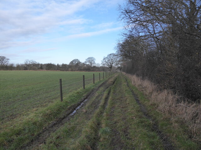
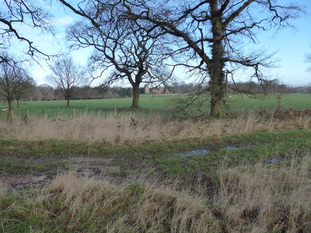
Ash's Covert is a vast woodland located in the county of Staffordshire, England. Covering an extensive area, it is a remarkable example of a mature forest with a diverse range of flora and fauna. The woodland is situated in a tranquil and secluded location, making it an ideal destination for nature enthusiasts and walkers alike.

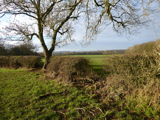
The forest is characterized by its dense canopy, comprised mainly of oak, beech, and birch trees, which provide shelter and a thriving habitat for numerous species. The forest floor is covered with a rich carpet of mosses, ferns, and wildflowers, creating a vibrant display throughout the seasons.

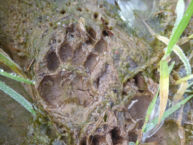
Ash's Covert is home to a variety of wildlife, including deer, foxes, badgers, and a multitude of bird species. It is particularly renowned for being a haven for birdwatching enthusiasts, with regular sightings of owls, woodpeckers, and various songbirds.

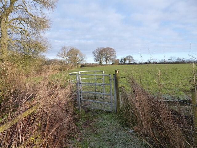
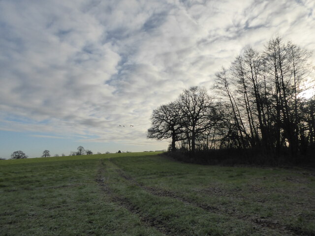
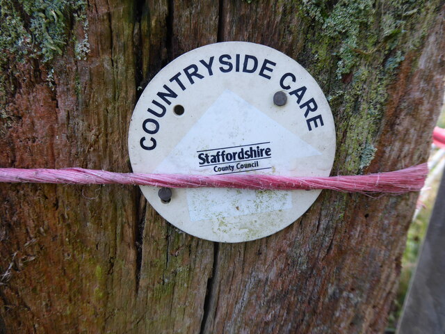
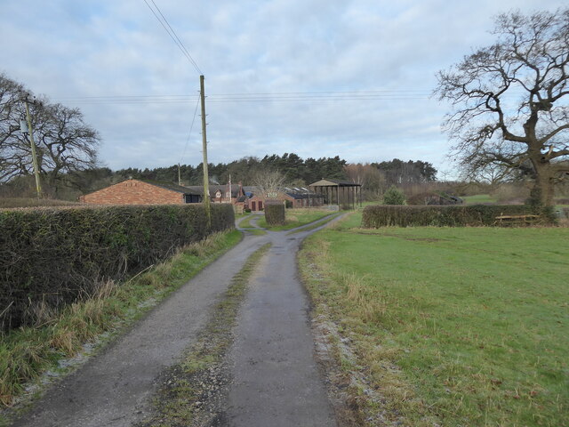
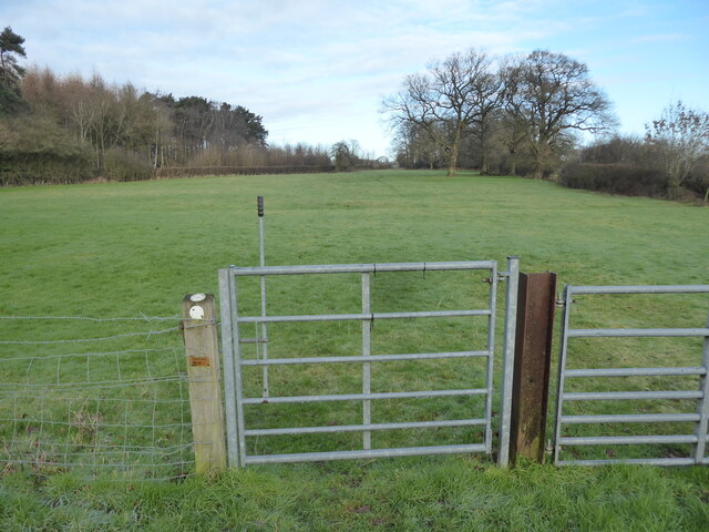
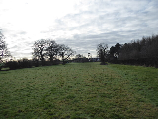
The woodland is crisscrossed by a network of footpaths and trails, allowing visitors to explore its beauty and discover its hidden gems. These paths wind their way through the forest, providing scenic views of ancient trees, babbling brooks, and picturesque meadows.

Ash's Covert also boasts a picnic area, providing a perfect spot for visitors to relax and enjoy the peaceful surroundings. The forest is managed by local conservation authorities, ensuring the preservation of its natural beauty and the protection of its inhabitants.

Overall, Ash's Covert is a captivating and enchanting woodland, offering a tranquil escape from the hustle and bustle of city life. Its stunning scenery, diverse wildlife, and peaceful ambiance make it a must-visit destination for nature lovers and those seeking solace in the beauty of the great outdoors.

If you have any feedback on the listing, please let us know in the comments section below.

Ash's Covert Images

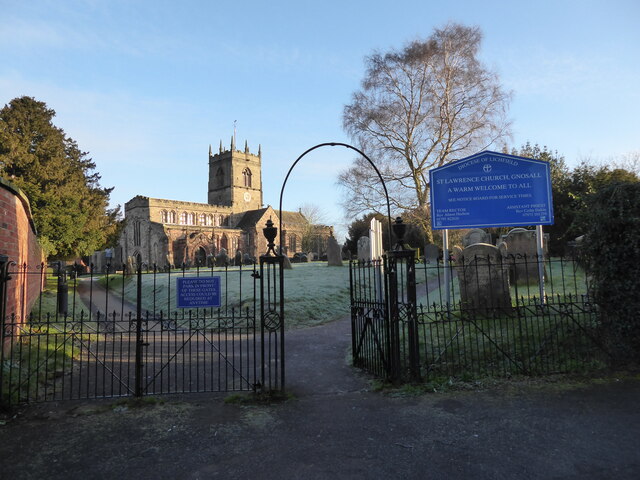
Images are sourced within 2km of 52.801242/-2.2503283 or Grid Reference SJ8322. Thanks to Geograph Open Source API. All images are credited.

Benchmark, 1 High Street, Gnosall Detail of the Ordnance Survey flush bracket benchmark 2453 on the west angle of 1 High Street, Gnosall. The benchmark marks a height of 94.652m above mean sea level (Ordnance Datum Newlyn) last levelled in 1956 and verified in 1969 (location photograph <a href="https://www.geograph.org.uk/photo/6971154">SJ8220 : The corner of 1 High Street</a>).
Benchmark, 1 High Street, Gnosall
Detail of the Ordnance Survey flush bracket benchmark 2453 on the west angle of 1 High Street, Gnosall. The benchmark marks a height of 94.652m above mean sea level (Ordnance Datum Newlyn) last levelled in 1956 and verified in 1969 (location photograph SJ8220 : The corner of 1 High Street).
The corner of 1 High Street Formerly the police station, the south west face of 1 High Street faces onto the A518, Stafford Road.
There is an Ordnance Survey flush bracket benchmark low down near the corner of the wall (photograph <a href="https://www.geograph.org.uk/photo/6971120">SJ8220 : Benchmark, 1 High Street, Gnosall</a>).
The corner of 1 High Street
Formerly the police station, the south west face of 1 High Street faces onto the A518, Stafford Road. There is an Ordnance Survey flush bracket benchmark low down near the corner of the wall (photograph SJ8220 : Benchmark, 1 High Street, Gnosall).
St Lawrence church in Gnosall Beautiful church on a hilltop.
St Lawrence church in Gnosall
Beautiful church on a hilltop.
The Horns pub in Gnosall Public house.
The Horns pub in Gnosall
Public house.
Footpath line across fields I can't wait to get along here.
Footpath line across fields
I can't wait to get along here.
Hedgerow with distant views View from the footpath line. 

That must be the Wrekin way down thereaways.
Hedgerow with distant views
View from the footpath line. That must be the Wrekin way down thereaways.
A January morning in the fields A skein of geese fly past, plaintively honking, the lovely sound cascading down to me. They had been heading on a course right overhead, but sadly of course they evaded me and passed me by.
A January morning in the fields
A skein of geese fly past, plaintively honking, the lovely sound cascading down to me. They had been heading on a course right overhead, but sadly of course they evaded me and passed me by.
Animal footprint in the field A badger of course.
Animal footprint in the field
A badger of course.
Footpath way marker Always reassuring to spot these friendly little discs.
Footpath way marker
Always reassuring to spot these friendly little discs.
Farm drive at Hollybank Farm Nice place.
Farm drive at Hollybank Farm
Nice place.
Footpath across the field Off we go again after getting slightly 'locationally embarrassed', some say 'lost', and having to get my bearings again. Met a nice Postie. Had a better look around. Win/win.
Footpath across the field
Off we go again after getting slightly 'locationally embarrassed', some say 'lost', and having to get my bearings again. Met a nice Postie. Had a better look around. Win/win.
January day in the fields More geese fly past, honking and enjoying flight.
January day in the fields
More geese fly past, honking and enjoying flight.
Track and footpath Beside the woodland.
Track and footpath
Beside the woodland.
Distant view to Ranton Abbey ruins There is the ruin of both an old medieval abbey and a Georgian country house down there. Not the sort of view I see every day. 

Let's go and explore.
Distant view to Ranton Abbey ruins
There is the ruin of both an old medieval abbey and a Georgian country house down there. Not the sort of view I see every day. Let's go and explore.
Ruins at Ranton Quite a sight. It stopped me in my tracks. I could see Ranton Abbey (remains of) marked on my Ordnance Survey 1:25,000 scale map, but I was not expecting two ruins for the price of one. Here is a rare sight indeed; a ruined medieval priory or abbey and hugger-mugger bang right next door, a gloriously ruined country house of some import too! 

My mind raced. How had this juxtaposition come to be? What was the story here? How were two ruins so closely sited and who, what and when were involved.

A mystery. Not being remotely local I have no knowledge to draw upon. Google and Wikipedia will be my friends, teachers and enlighteners. 

Meanwhile, what a jaw-dropping spectacle. 

Both buildings have their own Wikpedia articles, as might be expected, <span class="nowrap"><a title="https://en.wikipedia.org/wiki/Abbey_House,_Ranton" rel="nofollow ugc noopener" href="https://en.wikipedia.org/wiki/Abbey_House,_Ranton">Link</a><img style="margin-left:2px;" alt="External link" title="External link - shift click to open in new window" src="https://s1.geograph.org.uk/img/external.png" width="10" height="10"/></span> here.
Ruins at Ranton
Quite a sight. It stopped me in my tracks. I could see Ranton Abbey (remains of) marked on my Ordnance Survey 1:25,000 scale map, but I was not expecting two ruins for the price of one. Here is a rare sight indeed; a ruined medieval priory or abbey and hugger-mugger bang right next door, a gloriously ruined country house of some import too! My mind raced. How had this juxtaposition come to be? What was the story here? How were two ruins so closely sited and who, what and when were involved. A mystery. Not being remotely local I have no knowledge to draw upon. Google and Wikipedia will be my friends, teachers and enlighteners. Meanwhile, what a jaw-dropping spectacle. Both buildings have their own Wikpedia articles, as might be expected, LinkExternal link here.
Ruins at Ranton The abbey ruins are due to the ravages of time since the Dissolution of the Monasteries in the 1530s and the country house was gutted by a fire started during the Second World War. 

The estate encompassing both was once owned by Lord Lichfield, the famous photographer, aristocrat, Earl of Lichfield and member of the royal circle. 

I would have thought that the building would have been insured? Apparently the bodyguard of Wilhelmina, the Queen of the Netherlands, were billeted here during 1942 and it is then that fire caught hold of the whole building. Tragic. 

Lord Lichfield did intend to renovate the house, but sadly died before he was able to realise his plans. It has since been sold on a few times, recently for £3.5 million in 2011, I believe. 

Suitably interesting tale.
Ruins at Ranton
The abbey ruins are due to the ravages of time since the Dissolution of the Monasteries in the 1530s and the country house was gutted by a fire started during the Second World War. The estate encompassing both was once owned by Lord Lichfield, the famous photographer, aristocrat, Earl of Lichfield and member of the royal circle. I would have thought that the building would have been insured? Apparently the bodyguard of Wilhelmina, the Queen of the Netherlands, were billeted here during 1942 and it is then that fire caught hold of the whole building. Tragic. Lord Lichfield did intend to renovate the house, but sadly died before he was able to realise his plans. It has since been sold on a few times, recently for £3.5 million in 2011, I believe. Suitably interesting tale.
Buildings at Ranton The building on the right is an estate house, or flats. The church tower is the remains of Ranton Abbey. The ivy coated ruin is that of Abbery House, Ranton, a country house to my uneducated eye, but apparently just a shooting lodge to the Earls of Lichfield. It hosted many grand shooting parties in its heyday in the 1830s and 1840s, when Prime Ministers and influential politicians regularly attended.

If walls could talk. 

It was gutted by fire when Dutch soldiers were stationed here in 1942. Not arson. Could have been electrical, or a smoker forgetting a cigarette etc etc. 

Sad it has never been restored. But then again, what a sight to behold.
Buildings at Ranton
The building on the right is an estate house, or flats. The church tower is the remains of Ranton Abbey. The ivy coated ruin is that of Abbery House, Ranton, a country house to my uneducated eye, but apparently just a shooting lodge to the Earls of Lichfield. It hosted many grand shooting parties in its heyday in the 1830s and 1840s, when Prime Ministers and influential politicians regularly attended. If walls could talk. It was gutted by fire when Dutch soldiers were stationed here in 1942. Not arson. Could have been electrical, or a smoker forgetting a cigarette etc etc. Sad it has never been restored. But then again, what a sight to behold.
Ruined Ranton Abbey The tower remains really. I can imagine when the abbey was sited here and managed the landscape around and the people. Now it is just a lonely prong. I feel its pain.
Ruined Ranton Abbey
The tower remains really. I can imagine when the abbey was sited here and managed the landscape around and the people. Now it is just a lonely prong. I feel its pain.
Show me another place!

Ash's Covert is located at Grid Ref: SJ8322 (Lat: 52.801242, Lng: -2.2503283)

Administrative County: Staffordshire

District: Stafford

Police Authority: Staffordshire

What 3 Words

///chap.intrigued.hydrant. Near Gnosall, Staffordshire

Related Wikis

Ranton Green

Ranton Green is a small village in Staffordshire about a mile southwest of Ranton, Staffordshire and a mile northeast of Gnosall. It consists of a few...
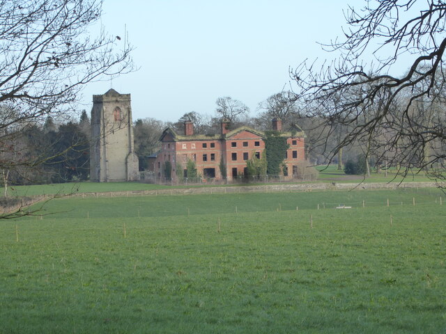
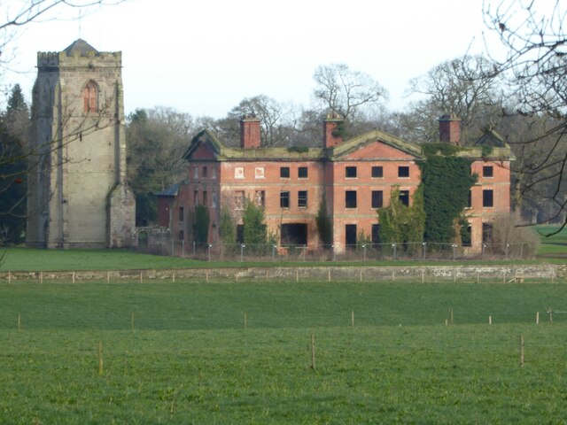
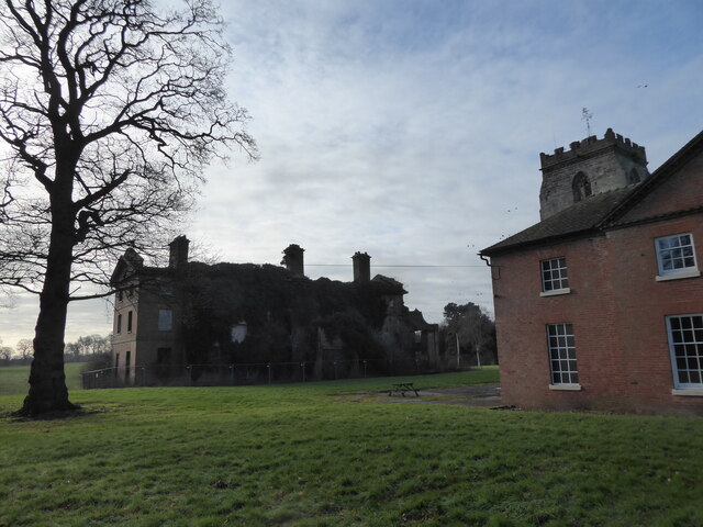
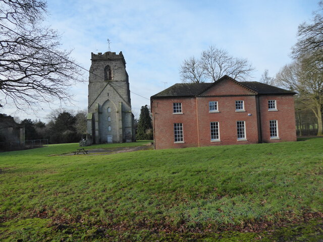
Abbey House, Ranton

Abbey House is an early 19th-century ruined stately home in Ranton, Staffordshire, England. == History == The red-brick Regency house was built in 1820...
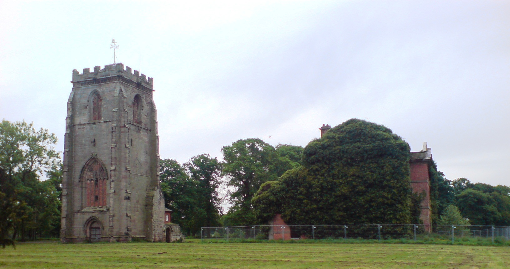
Ranton Abbey

Ranton Abbey or Ranton Priory was an Augustinian Priory in Ranton, Staffordshire, England, built c.1150 by Robert fitz Noel of Ellenhall. The priory flourished...

St Lawrence's Church, Gnosall

St Lawrence's Church is an Anglican church in Gnosall, Staffordshire, England. It is a Grade I listed building. The earliest parts of the church are of...
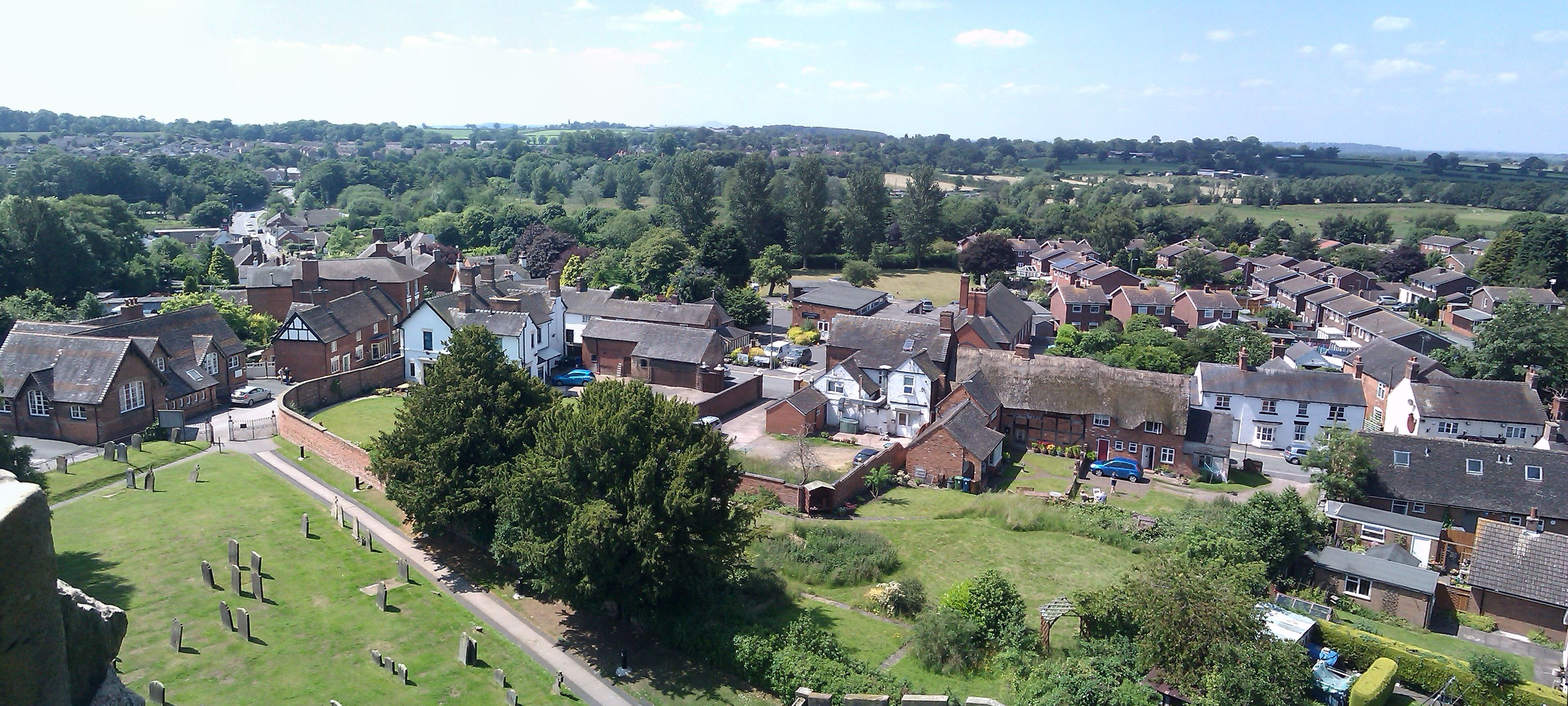
Gnosall

Gnosall () is a village and civil parish in the Borough of Stafford, Staffordshire, England, with a population of 4,736 across 2,048 households (2011 census...

Gnosall railway station

Gnosall railway station was a station in Gnosall, Staffordshire, England. The station was opened in June 1849 and closed on 7 September 1964. == References... ==

Knightley, Staffordshire

Knightley is a hamlet and former manor in Staffordshire, England. It is situated near the villages of Gnosall and Woodseaves, now on the B5405 road. There...

Coton, Staffordshire

Coton is a hamlet in the English county of Staffordshire.It lies on the A518 road some two miles west of Gnosall. == See also == Listed buildings in Gnosall...

Have you been to Ash's Covert?

Leave your review of Ash's Covert below (or comments, questions and feedback).