Chambers Grove

Wood, Forest in Gloucestershire Stroud

England

Chambers Grove

Stone Stile, Horsley Off Narrowcut Lane, on Gloucestershire footpath MHO75 looking West. The view looking East is <a href="https://www.geograph.org.uk/photo/7067457">ST8398 : Stone Stile, Horsley</a>.
Stone Stile, Horsley Credit: Mr Red

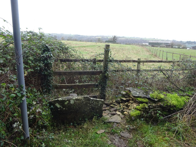
Chambers Grove is an enchanting woodland area located in the county of Gloucestershire, England. Nestled within the captivating Forest of Dean, this ancient woodland boasts an array of natural wonders and breathtaking beauty.

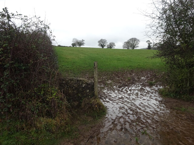
Covering an expansive area of approximately 200 acres, Chambers Grove is a haven for nature enthusiasts and outdoor adventurers. The woodland is characterized by a diverse range of tree species, including majestic oak, beech, and birch trees. The forest floor is carpeted with a rich tapestry of wildflowers, ferns, and mosses, creating a vibrant and picturesque landscape.

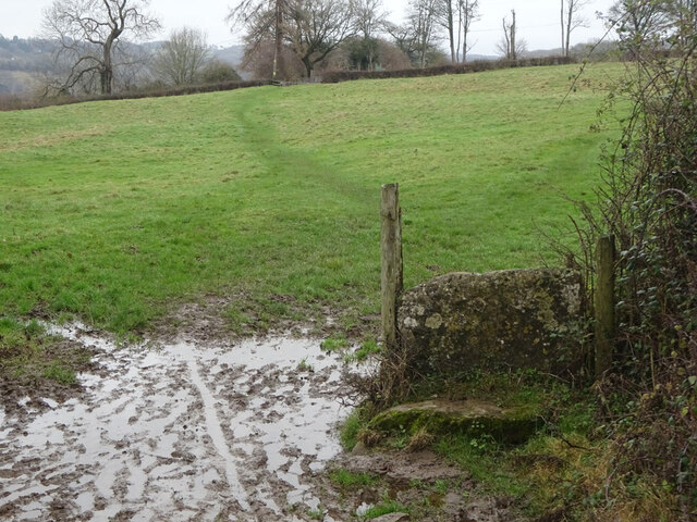
The woodland is crisscrossed by a network of well-maintained walking trails, allowing visitors to explore its hidden treasures at their own pace. As one strolls through Chambers Grove, they may encounter an abundance of wildlife, such as squirrels, rabbits, and a variety of bird species, providing a delightful experience for nature lovers and birdwatchers alike.

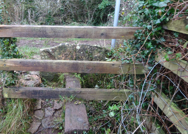
Chambers Grove is also home to several historic features, adding to its charm and allure. Ancient stone walls, remnants of old mining activities, and a disused quarry offer glimpses into the area's rich past and provide a sense of the forest's historical significance.

Whether it's a leisurely stroll, a picnic amidst nature's splendor, or a more adventurous hike, Chambers Grove offers an idyllic setting for outdoor activities. With its tranquil atmosphere, picturesque scenery, and abundant wildlife, this woodland gem in Gloucestershire is a must-visit destination for those seeking solace in nature's embrace.

If you have any feedback on the listing, please let us know in the comments section below.

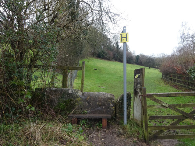
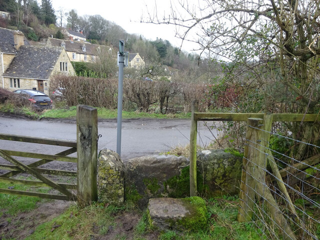
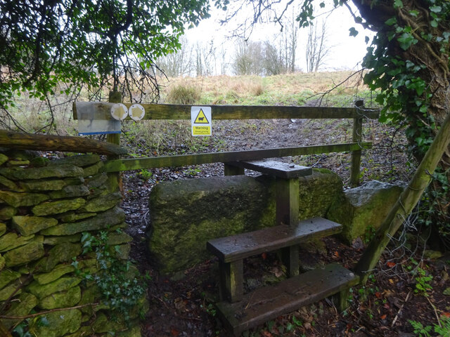
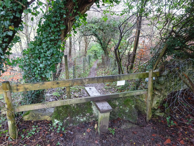
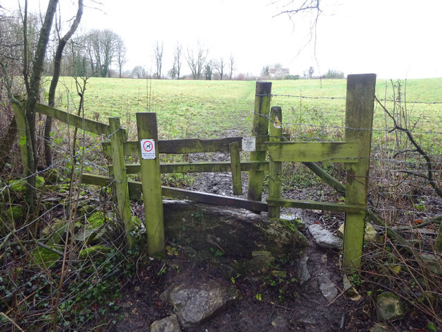
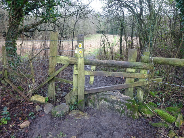
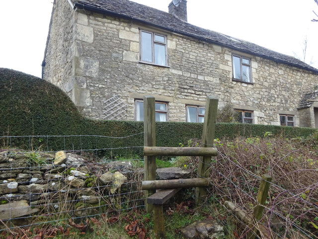
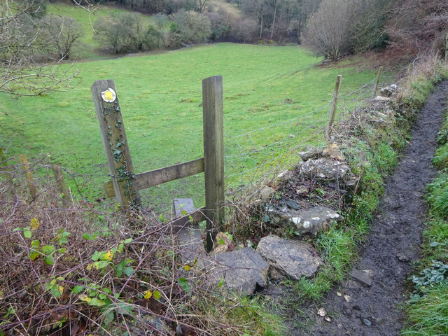
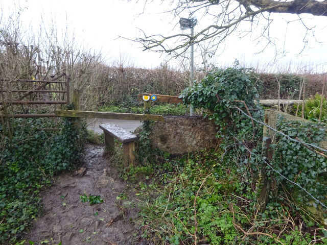
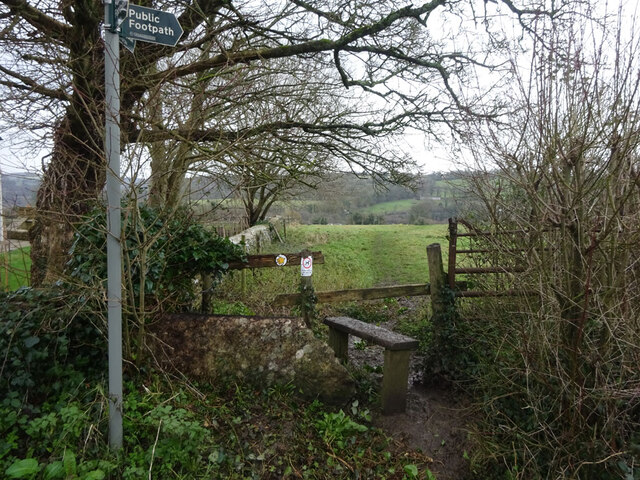
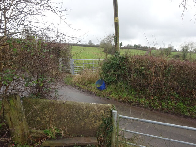
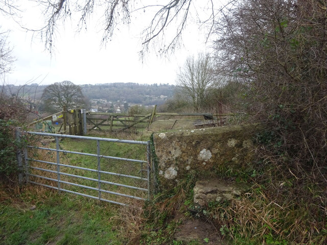
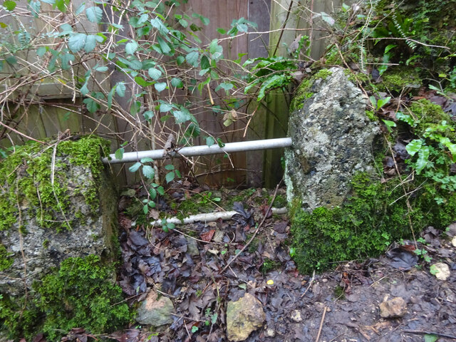
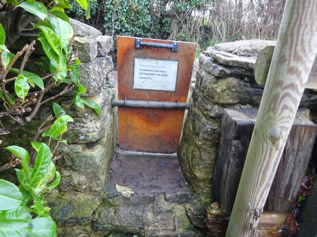
Chambers Grove Images

Images are sourced within 2km of 51.680006/-2.2484303 or Grid Reference ST8297. Thanks to Geograph Open Source API. All images are credited.

Stone Stile, Horsley Off Narrowcut Lane, on Gloucestershire footpath MHO75 looking West. The view looking East is <a href="https://www.geograph.org.uk/photo/7067457">ST8398 : Stone Stile, Horsley</a>.
Stone Stile, Horsley
Off Narrowcut Lane, on Gloucestershire footpath MHO75 looking West. The view looking East is ST8398 : Stone Stile, Horsley.
Stone Stile, Horsley Off Narrowcut Lane, on Gloucestershire footpath MHO75 looking East. The view looking West is <a href="https://www.geograph.org.uk/photo/7067455">ST8398 : Stone Stile, Horsley</a>.
Stone Stile, Horsley
Off Narrowcut Lane, on Gloucestershire footpath MHO75 looking East. The view looking West is ST8398 : Stone Stile, Horsley.
Stone Stile, Horsley At the junction of Gloucestershire footpaths MHO19 & MHO18, looking into the field. The view looking SW along MHO18 is <a href="https://www.geograph.org.uk/photo/7067498">ST8398 : Stone Stile, Horsley</a>.
Stone Stile, Horsley
At the junction of Gloucestershire footpaths MHO19 & MHO18, looking into the field. The view looking SW along MHO18 is ST8398 : Stone Stile, Horsley.
Stone Stile, Horsley At the junction of Gloucestershire footpaths MHO19 & MHO18, looking SW along MHO18. The view looking NE into the field is <a href="https://www.geograph.org.uk/photo/7067495">ST8398 : Stone Stile, Horsley</a>.
Stone Stile, Horsley
At the junction of Gloucestershire footpaths MHO19 & MHO18, looking SW along MHO18. The view looking NE into the field is ST8398 : Stone Stile, Horsley.
Stone Stile, Horsley Looking North into the top (rented by Ben) field on Gloucestershire footpaths MHO18 & MHO17. The view looking South is <a href="https://www.geograph.org.uk/photo/7067517">ST8398 : Stone Stile, Horsley</a>.
Stone Stile, Horsley
Looking North into the top (rented by Ben) field on Gloucestershire footpaths MHO18 & MHO17. The view looking South is ST8398 : Stone Stile, Horsley.
Stone Stile, Horsley Looking South from the top field (rented by Ben) on Gloucestershire footpaths MHO18 & MHO17. The view looking North is <a href="https://www.geograph.org.uk/photo/7067514">ST8398 : Stone Stile, Horsley</a>.
Stone Stile, Horsley
Looking South from the top field (rented by Ben) on Gloucestershire footpaths MHO18 & MHO17. The view looking North is ST8398 : Stone Stile, Horsley.
Stone Stile, Horsley A "gap in the wall" stile under the wooden structure. Looking NE on  Gloucestershire footpath MHO62 to MHO70. The view looking into the field is <a href="https://www.geograph.org.uk/photo/7067535">ST8398 : Stone Stile, Horsley</a>.
Stone Stile, Horsley
A "gap in the wall" stile under the wooden structure. Looking NE on Gloucestershire footpath MHO62 to MHO70. The view looking into the field is ST8398 : Stone Stile, Horsley.
Stone Stile, Horsley A "gap in the wall" stile under the wooden structure. Looking SW to  Gloucestershire footpath MHO62 from MHO70. The view looking from the field is <a href="https://www.geograph.org.uk/photo/7067532">ST8398 : Stone Stile, Horsley</a>.
Stone Stile, Horsley
A "gap in the wall" stile under the wooden structure. Looking SW to Gloucestershire footpath MHO62 from MHO70. The view looking from the field is ST8398 : Stone Stile, Horsley.
Stone Stile, Horsley Stile to Gloucestershire footpath MHO68, off a farm track looking SE. The view looking to the track is <a href="https://www.geograph.org.uk/photo/7067615">ST8398 : Stone Stile, Horsley</a>.
Stone Stile, Horsley
Stile to Gloucestershire footpath MHO68, off a farm track looking SE. The view looking to the track is ST8398 : Stone Stile, Horsley.
Stone Stile, Horsley Stile to Gloucestershire footpath MHO68, looking NW to a farm track. The view looking from the track is <a href="https://www.geograph.org.uk/photo/7067609">ST8398 : Stone Stile, Horsley</a>.
Stone Stile, Horsley
Stile to Gloucestershire footpath MHO68, looking NW to a farm track. The view looking from the track is ST8398 : Stone Stile, Horsley.
Stone Stile, Nailsworth On Gloucestershire footpath ZNA19 looking West. The view looking East is <a href="https://www.geograph.org.uk/photo/7067668">ST8499 : Stone Stile, Nailsworth</a>. The gap is the source of a spring running downhill to the right.
Stone Stile, Nailsworth
On Gloucestershire footpath ZNA19 looking West. The view looking East is ST8499 : Stone Stile, Nailsworth. The gap is the source of a spring running downhill to the right.
Stone Stile, Nailsworth On Gloucestershire footpath ZNA19 looking East. The view looking West is <a href="https://www.geograph.org.uk/photo/7067662">ST8499 : Stone Stile, Nailsworth</a>. The gap is the source of a spring running downhill to the left.
Stone Stile, Nailsworth
On Gloucestershire footpath ZNA19 looking East. The view looking West is ST8499 : Stone Stile, Nailsworth. The gap is the source of a spring running downhill to the left.
Stone Stile, Nailsworth Looking West on Gloucestershire footpaths ZNA19 & MHO14 to the u/c road. The view from the road is <a href="https://www.geograph.org.uk/photo/7067689">ST8499 : Stone Stile, Nailsworth</a>.
Stone Stile, Nailsworth
Looking West on Gloucestershire footpaths ZNA19 & MHO14 to the u/c road. The view from the road is ST8499 : Stone Stile, Nailsworth.
Stone Stile, Nailsworth Looking East on Gloucestershire footpaths ZNA19 & MHO14 from the u/c road. The view from the field is <a href="https://www.geograph.org.uk/photo/7067687">ST8499 : Stone Stile, Nailsworth</a>.
Stone Stile, Nailsworth
Looking East on Gloucestershire footpaths ZNA19 & MHO14 from the u/c road. The view from the field is ST8499 : Stone Stile, Nailsworth.
Stone Stile, Nailsworth To the North of "Cleves" on Gloucestershire footpath ZNA20. The view from the road is <a href="https://www.geograph.org.uk/photo/7067716">ST8499 : Stone Stile, Nailsworth</a>.
Stone Stile, Nailsworth
To the North of "Cleves" on Gloucestershire footpath ZNA20. The view from the road is ST8499 : Stone Stile, Nailsworth.
Stone Stile, Nailsworth To the North of "Cleves" on Gloucestershire footpath ZNA20. The view from the field is <a href="https://www.geograph.org.uk/photo/7067714">ST8499 : Stone Stile, Nailsworth</a>.
Stone Stile, Nailsworth
To the North of "Cleves" on Gloucestershire footpath ZNA20. The view from the field is ST8499 : Stone Stile, Nailsworth.
Stone Stile, Nailsworth Private "gap in the wall" stile off Gloucestershire footpath ZNA18. There is a door to a subsequently built shed coincident with it, obviously intended as an emergency exit.
Stone Stile, Nailsworth
Private "gap in the wall" stile off Gloucestershire footpath ZNA18. There is a door to a subsequently built shed coincident with it, obviously intended as an emergency exit.
Stone Stile, Horsley A "gap in the wall" stile with a removable gate on  Gloucestershire footpath MHO15. The inscription reads "Please replace board. To prevent our dogs getting onto the road. Thank You."
The view from the road is <a href="https://www.geograph.org.uk/photo/7067751">ST8498 : Stone Stile, Horsley</a>.
Stone Stile, Horsley
A "gap in the wall" stile with a removable gate on Gloucestershire footpath MHO15. The inscription reads "Please replace board. To prevent our dogs getting onto the road. Thank You." The view from the road is ST8498 : Stone Stile, Horsley.
Show me another place!

Chambers Grove is located at Grid Ref: ST8297 (Lat: 51.680006, Lng: -2.2484303)

Administrative County: Gloucestershire

District: Stroud

Police Authority: Gloucestershire

What 3 Words

///awakening.backers.bottle. Near Nailsworth, Gloucestershire

Related Wikis

Kingscote and Horsley Woods

Kingscote and Horsley Woods (grid reference ST831971) is a 43.79-hectare (108.2-acre) biological Site of Special Scientific Interest in Gloucestershire...

Horsley Priory

Horsley Priory was a medieval, monastic house in Gloucestershire, England. Goda owned an estate at Horsley, in 1066. It was granted to Troarn Abbey by...

Horsley, Gloucestershire

Horsley is a village and civil parish about one and a half miles south-west of the small Cotswold market town of Nailsworth. The origins of the name Horsley...

Shortwood United F.C.

Shortwood United Football Club is a football club based in Nailsworth, Gloucestershire, England. The club are currently members of the Hellenic League...

Barton End

Barton End is a village just south of Nailsworth, Gloucestershire, England.

Kingscote, Gloucestershire

Kingscote is a village and civil parish in the Cotswold district of Gloucestershire, England, set on the uplands near the south western edge of the Cotswold...

Newmarket, Gloucestershire

Newmarket is a hamlet in the parish of Horsley, Gloucestershire, England. == References ==

The New Lawn

The New Lawn, also known as The Bolt New Lawn for sponsorship reasons, is a football stadium in Nailsworth, Gloucestershire. It has been the home stadium...

Nearby Amenities

Located within 500m of 51.680006,-2.2484303
Nupend
Is In: Gloucestershire, England, UK
Is In Parish: Horsley
Place: hamlet
Lat/Long: 51.6822268/-2.2490316
Bus Stop
Sallywood Farm
Naptan AtcoCode: 1600GLA06083
Naptan Bearing: W
Naptan CommonName: Sallywood Farm
Naptan NaptanCode: glogpdmj
Naptan Street: B4058
Naptan Verified: no
Source: naptan_import
Lat/Long: 51.6837181/-2.2519913
Bus Stop
Sallywood Farm
Naptan AtcoCode: 1600GLS716
Naptan Bearing: E
Naptan CommonName: Sallywood Farm
Naptan NaptanCode: gloawmtw
Naptan Street: B4058
Naptan Verified: no
Source: naptan_import
Lat/Long: 51.6837901/-2.2519917
Bus Stop
Boscombe Lane
Bus: yes
Naptan AtcoCode: 1600GLS717
Naptan Bearing: W
Naptan CommonName: Boscombe Lane
Naptan NaptanCode: glodadma
Naptan Street: B4058 Nupend
Naptan Verified: no
Public Transport: platform
Source: naptan_import
Lat/Long: 51.6819945/-2.2421316
Bus Stop
Boscombe Lane
Bus: yes
Naptan AtcoCode: 1600GLS718
Naptan Bearing: E
Naptan CommonName: Boscombe Lane
Naptan Indicator: Opp
Naptan NaptanCode: glodadjg
Naptan Street: B4058 Nupend
Naptan Verified: no
Public Transport: platform
Source: naptan_import
Lat/Long: 51.6821379/-2.2423782
Barrier: stile
Lat/Long: 51.6782747/-2.2526487
Barrier: stile
Bicycle: no
Foot: yes
Material: wood
Stile: stepover
Lat/Long: 51.6788511/-2.248577
Barrier: stile
Bicycle: no
Foot: yes
Material: wood
Stile: stepover
Lat/Long: 51.679228/-2.2492166
Barrier: stile
Bicycle: no
Foot: yes
Material: wood
Stile: stepover
Lat/Long: 51.6796516/-2.2444139
Material: wood
Power: pole
Lat/Long: 51.684357/-2.2483832
Material: wood
Power: pole
Lat/Long: 51.683291/-2.2486299
Power: pole
Lat/Long: 51.6824778/-2.2488177
Power: pole
Lat/Long: 51.6816501/-2.2490012
Power: pole
Lat/Long: 51.6811448/-2.249095
Power: pole
Lat/Long: 51.6793579/-2.2490966
Power: pole
Lat/Long: 51.6777679/-2.2454891
Power: pole
Lat/Long: 51.6772278/-2.2442432
The data included in this document is from www.openstreetmap.org. The data is made available under ODbL.

Have you been to Chambers Grove?

Leave your review of Chambers Grove below (or comments, questions and feedback).