Crawley End

Settlement in Essex Uttlesford

England

Crawley End

Heydon, Cambridgeshire - village green
Heydon, Cambridgeshire - village green Credit: Colin Park

Crawley End is a small village located in the county of Essex, England. Situated approximately 30 miles northeast of London, it is nestled amidst the picturesque countryside and offers a peaceful and serene environment for its residents. The village is part of the Uttlesford district and falls within the civil parish of Quendon and Rickling.

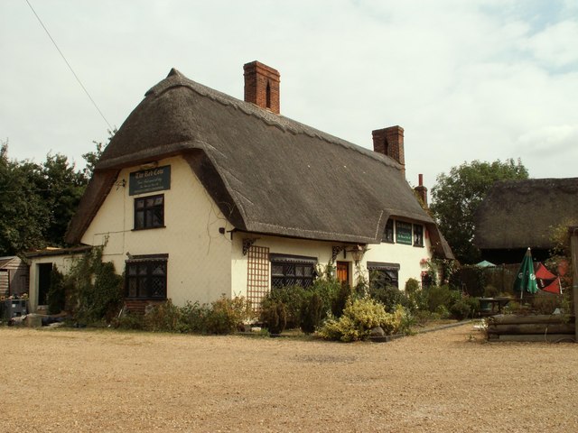
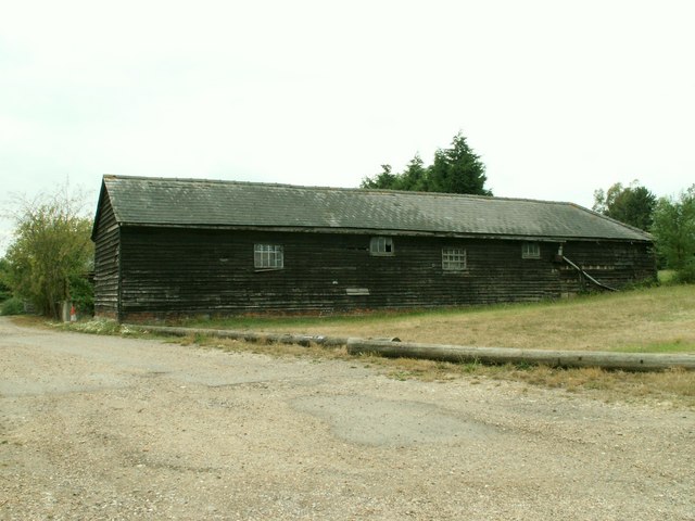
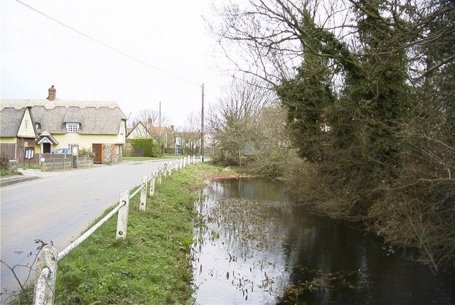
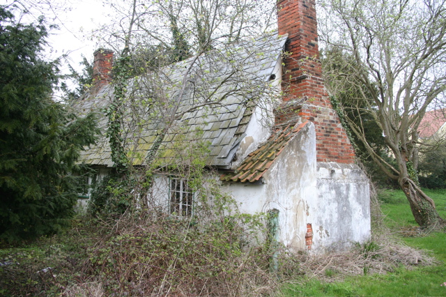
Crawley End is known for its charming and historic architecture, with several beautiful period houses and cottages dotting the landscape. The village has retained much of its rural charm, making it a popular destination for those seeking a tranquil retreat from the bustling city life.

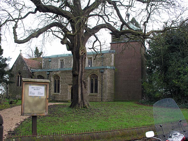
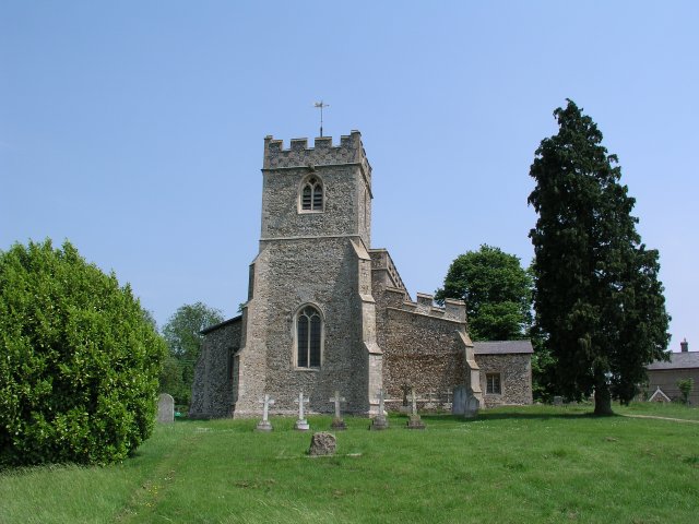
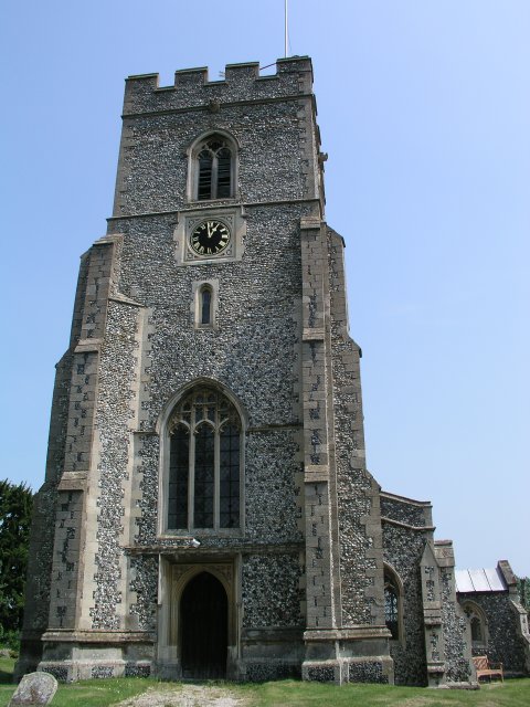
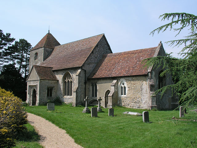
The village is home to a close-knit community who actively participate in various local events and activities. There is a village hall that serves as a hub for social gatherings, meetings, and cultural events. The nearby St. Mary's Church, a Grade I listed building, is a prominent landmark and offers a glimpse into the village's rich history.

Despite its small size, Crawley End benefits from excellent transport links. The nearby town of Saffron Walden provides access to various amenities such as shops, schools, and healthcare facilities. The village is also well-connected by road, with easy access to major towns and cities in the region.

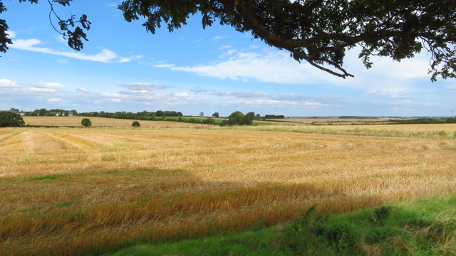
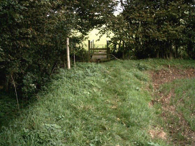
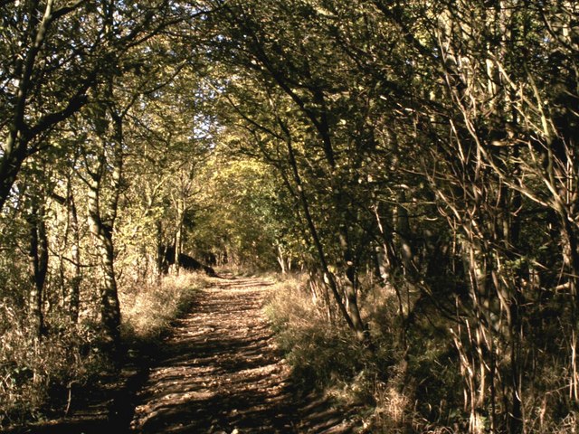
Surrounded by rolling countryside, Crawley End offers ample opportunities for outdoor activities. The village is located near several nature reserves and walking trails, making it a haven for nature enthusiasts and walkers.

In conclusion, Crawley End is a delightful village in Essex, offering a tranquil and idyllic setting for its residents. With its rich history, picturesque landscapes, and strong community spirit, it continues to be a cherished place to call home.

If you have any feedback on the listing, please let us know in the comments section below.

Crawley End Images

Images are sourced within 2km of 52.037735/0.105305 or Grid Reference TL4439. Thanks to Geograph Open Source API. All images are credited.

Heydon, Cambridgeshire - village green
Heydon - Holy Trinity Church
On Icknield Way Trail looking west from Cane's Walk near Chrishall
Elmdon - St Nicholas' Church
Elmdon - village centre
Heydon, Holy Trinity <span class="nowrap"><a title="http://www.druidic.org/camchurch/churches/heydon.htm" rel="nofollow ugc noopener" href="http://www.druidic.org/camchurch/churches/heydon.htm">Link</a><img style="margin-left:2px;" alt="External link" title="External link - shift click to open in new window" src="https://s1.geograph.org.uk/img/external.png" width="10" height="10"/></span>
Heydon, Holy Trinity
Heydon, Holy Trinity 1940
Chrishall church
Chrishall church
Elmdon, St Nicholas
Elmdon, St Nicholas
'The Red Cow' inn, Chrishall, Essex
Barn at Parsonage Farm, Chrishall, Essex
Footpath bridge by Barnard's Wood Bridge over the stream on the footpath between the B1039 and Chrishall, nearby Barnard's Wood.
Footpath bridge by Barnard's Wood
Bridge over the stream on the footpath between the B1039 and Chrishall, nearby Barnard's Wood.
Dark Lane path Dark Lane path near to its junction with Parkhouse Lane by-road.
Dark Lane path
Dark Lane path near to its junction with Parkhouse Lane by-road.
Autumn colours frame the climb up to Chrishall village View north on Hollow Rd, Chrishall at the entrance to New Farm. (The highest point in Essex is within the parish boundary).
Autumn colours frame the climb up to Chrishall village
View north on Hollow Rd, Chrishall at the entrance to New Farm. (The highest point in Essex is within the parish boundary).
Wire Farm, Crawley End, Chrishall There are five ponds in Chrishall Village but it is difficult to capture the reflections of buildings in any of them. This was taken on a bright, still February morning from the edge of an open field. See <span class="nowrap"><a title="http://www.chrishallessex.com" rel="nofollow ugc noopener" href="http://www.chrishallessex.com">Link</a><img style="margin-left:2px;" alt="External link" title="External link - shift click to open in new window" src="https://s1.geograph.org.uk/img/external.png" width="10" height="10"/></span> for more photos of this village.
Wire Farm, Crawley End, Chrishall
There are five ponds in Chrishall Village but it is difficult to capture the reflections of buildings in any of them. This was taken on a bright, still February morning from the edge of an open field. See LinkExternal link for more photos of this village.
Crawley End Pond, Chrishall The frozen pond supports a light snow covering. The thatched roof of Faerie Cottage is just visible through the trees.
Crawley End Pond, Chrishall
The frozen pond supports a light snow covering. The thatched roof of Faerie Cottage is just visible through the trees.
Crawley End Pond, Chrishall, looking North This pond gets overgrown quite quickly but it had recently been cleared when this photo was taken in May 2002
Crawley End Pond, Chrishall, looking North
This pond gets overgrown quite quickly but it had recently been cleared when this photo was taken in May 2002
A Hovel in Chrishall Dilapidated unoccupied cottage
A Hovel in Chrishall
Dilapidated unoccupied cottage
Show me another place!

Crawley End is located at Grid Ref: TL4439 (Lat: 52.037735, Lng: 0.105305)

Administrative County: Essex

District: Uttlesford

Police Authority: Essex

What 3 Words

///over.distorts.policy. Near Fowlmere, Cambridgeshire

Related Wikis

Nearby Amenities

Located within 500m of 52.037735,0.105305
Chrishall
Is In: Essex,England,UK
Place: village
Wikidata: Q125781
Wikipedia: en:Chrishall
Lat/Long: 52.0335395/0.1064111
Townhall
Chrishall Village Hall
Townhall Type: village
Lat/Long: 52.0343381/0.1053703
Post Box
Operator: Royal Mail
Operator Wikidata: Q638098
Post Box Mounting: pier
Post Box Type: lamp
Ref: SG8 424
Royal Cypher: EIIR
Lat/Long: 52.0343421/0.1056861
Bus Stop
Pinkneys
Bus: yes
Local Ref: adj
Naptan AtcoCode: 150018004004
Naptan Bearing: SW
Naptan BusStopType: CUS
Naptan CommonName: Crawley End
Naptan Crossing: Pinkneys
Naptan Indicator: adj
Naptan Landmark: Crawley End
Naptan NaptanCode: esxdatwg
Naptan Street: Crawley End Road
Naptan Verified: no
Public Transport: platform
Source: naptan_import
Lat/Long: 52.0403652/0.1096416
Bus Stop
Church
Bus: yes
Fixme: This is the o/s bus stop; o/s a church: where's the church?
Naptan AtcoCode: 150018004006
Naptan Bearing: S
Naptan BusStopType: CUS
Naptan CommonName: Church
Naptan Indicator: o/s
Naptan Landmark: Church
Naptan NaptanCode: esxdatwd
Naptan Street: Crawley End Road
Naptan Verified: no
Public Transport: platform
Source: naptan_import
Lat/Long: 52.0369941/0.1065667
Bus Stop
Pinkneys
Bus: yes
Local Ref: opp
Naptan AtcoCode: 1500180040Y4
Naptan Bearing: NE
Naptan BusStopType: CUS
Naptan CommonName: Crawley End
Naptan Crossing: Pinkneys
Naptan Indicator: opp
Naptan Landmark: Crawley End
Naptan NaptanCode: esxgpdgt
Naptan Street: Crawley End Road
Naptan Verified: no
Public Transport: platform
Source: naptan_import
Lat/Long: 52.0403763/0.1095254
Bus Stop
Church
Bus: yes
Naptan AtcoCode: 1500180040Y6
Naptan Bearing: N
Naptan BusStopType: CUS
Naptan CommonName: Church
Naptan Indicator: Opp
Naptan Landmark: Church
Naptan NaptanCode: esxgtgtw
Naptan Street: Crawley End Road
Naptan Verified: no
Public Transport: platform
Source: naptan_import
Lat/Long: 52.0370136/0.10648
Bus Stop
Engleric
Bus: yes
Naptan AtcoCode: 150018005005
Naptan Bearing: SW
Naptan BusStopType: CUS
Naptan CommonName: Engleric
Naptan Indicator: Adj
Naptan Landmark: Engleric
Naptan NaptanCode: esxdawgt
Naptan Street: Crawley End Road
Naptan Verified: no
Public Transport: platform
Source: naptan_import
Lat/Long: 52.0395374/0.1086694
Bus Stop
Engleric
Bus: yes
Naptan AtcoCode: 1500180050Y5
Naptan Bearing: NE
Naptan BusStopType: CUS
Naptan CommonName: Engleric
Naptan Indicator: Opp
Naptan Landmark: Engleric
Naptan NaptanCode: esxgpdgw
Naptan Street: Crawley End Road
Naptan Verified: no
Public Transport: platform
Source: naptan_import
Lat/Long: 52.0395569/0.1085828
Bus Stop
School
Bus: yes
Naptan AtcoCode: 1500CHRISHL2
Naptan Bearing: NW
Naptan BusStopType: CUS
Naptan CommonName: School
Naptan Indicator: o/s
Naptan Landmark: School
Naptan NaptanCode: esxdawgp
Naptan Street: Palmers Lane
Naptan Verified: no
Public Transport: platform
Source: naptan_import
Lat/Long: 52.0344174/0.1055062
Bus Stop
School
Bus: yes
Naptan AtcoCode: 1500IM651
Naptan Bearing: S
Naptan BusStopType: CUS
Naptan CommonName: Garage
Naptan Indicator: o/s
Naptan Landmark: Garage
Naptan NaptanCode: esxadgda
Naptan Street: Crawley End Road
Naptan Verified: no
Public Transport: platform
Source: naptan_import
Lat/Long: 52.0344482/0.1061262
Bus Stop
School
Bus: yes
Naptan AtcoCode: 1500IM651B
Naptan Bearing: E
Naptan BusStopType: CUS
Naptan CommonName: Garage
Naptan Indicator: Opp
Naptan Landmark: Garage
Naptan NaptanCode: esxadwag
Naptan Street: Crawley End Road
Naptan Verified: no
Public Transport: platform
Source: naptan_import
Lat/Long: 52.0345389/0.1059992
Note Splitway: Split the way here, owing to turning 31 (Village Link) buses.
Lat/Long: 52.0344346/0.1057014
Chrishall War Memorial
Historic: memorial
Lat/Long: 52.0339004/0.1063245
Power: pole
Lat/Long: 52.0354392/0.1074654
Power: pole
Lat/Long: 52.0378283/0.1093
Power: pole
Lat/Long: 52.0356044/0.109123
Power: pole
Lat/Long: 52.035888/0.1063871
Power: pole
Lat/Long: 52.0344162/0.1099437
Power: pole
Lat/Long: 52.0371056/0.1093697
Power: pole
Lat/Long: 52.0348947/0.1087957
Power: pole
Lat/Long: 52.0363667/0.1094127
Crawley End
Place: hamlet
Lat/Long: 52.0401854/0.1079989
Post Box
Ref: SG8 416
Lat/Long: 52.0392096/0.1082628
The data included in this document is from www.openstreetmap.org. The data is made available under ODbL.

Have you been to Crawley End?

Leave your review of Crawley End below (or comments, questions and feedback).