Kennel Plantation

Wood, Forest in Gloucestershire Stroud

England

Kennel Plantation

Stone Stile, Forest Green Adjacent to Gloucestershire footpath ZNA88, probably a private entrance to what was a quarry in ancient times. South of the football stadium. Looking in a Southerly direction, the alternative view looking SW is <a href="https://www.geograph.org.uk/photo/7211833">ST8399 : Stone Stile, Forest Green</a>.
Stone Stile, Forest Green Credit: Ian M Bryant

Kennel Plantation is a charming woodland area located in Gloucestershire, England. Situated near the town of Wood and surrounded by a vast forest, this plantation offers a serene and picturesque escape for nature enthusiasts and outdoor lovers.

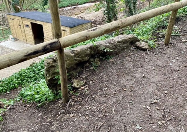
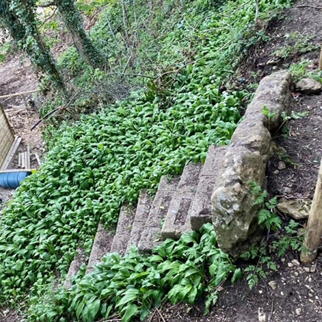
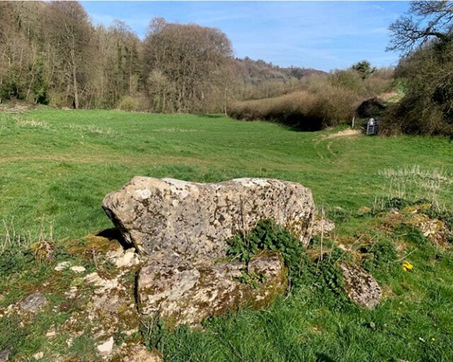
Covering an area of approximately 50 acres, Kennel Plantation is home to a diverse range of flora and fauna. The woodland is primarily composed of deciduous trees, including oak, beech, and birch, creating a beautiful tapestry of colors during the autumn months. The forest floor is adorned with a variety of wildflowers, adding to the enchanting atmosphere of the area.

Visitors to Kennel Plantation can explore the numerous walking trails that wind their way through the woodland. These paths allow visitors to immerse themselves in the peaceful surroundings, providing an opportunity to observe the local wildlife, such as deer, squirrels, and a myriad of bird species that call this woodland their home.

The plantation is also well-known for its historical significance. In the past, Kennel Plantation was used as a hunting ground for the local gentry, who would gather here to hunt deer and other game. Today, remnants of this history can still be seen, with the presence of old hunting lodges and carefully preserved landmarks.

Overall, Kennel Plantation offers a tranquil and captivating experience for those seeking a connection with nature. Whether it's a leisurely stroll, birdwatching, or simply enjoying the peaceful ambiance, this woodland retreat in Gloucestershire provides a haven for outdoor enthusiasts and nature lovers alike.

If you have any feedback on the listing, please let us know in the comments section below.

Kennel Plantation Images

Images are sourced within 2km of 51.70685/-2.2542649 or Grid Reference SO8200. Thanks to Geograph Open Source API. All images are credited.

Stone Stile, Forest Green Adjacent to Gloucestershire footpath ZNA88, probably a private entrance to what was a quarry in ancient times. South of the football stadium. Looking in a Southerly direction, the alternative view looking SW is <a href="https://www.geograph.org.uk/photo/7211833">ST8399 : Stone Stile, Forest Green</a>.
Stone Stile, Forest Green
Adjacent to Gloucestershire footpath ZNA88, probably a private entrance to what was a quarry in ancient times. South of the football stadium. Looking in a Southerly direction, the alternative view looking SW is ST8399 : Stone Stile, Forest Green.
Stone Stile, Forest Green Adjacent to Gloucestershire footpath ZNA88, probably a private entrance to what was a quarry in ancient times. South of the football stadium. Looking in a SW direction, the alternative view looking South is <a href="https://www.geograph.org.uk/photo/7211830">ST8399 : Stone Stile, Forest Green</a>.
Stone Stile, Forest Green
Adjacent to Gloucestershire footpath ZNA88, probably a private entrance to what was a quarry in ancient times. South of the football stadium. Looking in a SW direction, the alternative view looking South is ST8399 : Stone Stile, Forest Green.
Stone Stile, Lower Lutheridge Farm GS1414 On Gloucestershire footpath CNY13, near Lower Lutheridge Farm, Horsley.
Stone Stile, Lower Lutheridge Farm GS1414
On Gloucestershire footpath CNY13, near Lower Lutheridge Farm, Horsley.
Stone Stile, Nympsfield On Gloucestershire footpath CNY13 looking West in the direction of Nympsfield.
Stone Stile, Nympsfield
On Gloucestershire footpath CNY13 looking West in the direction of Nympsfield.
Stone Stile, Nympsfield A "Fallen Idle" on Gloucestershire footpath CNY13 looking East. A large slab left to stabalise the ground at the field boundary/stile.
Stone Stile, Nympsfield
A "Fallen Idle" on Gloucestershire footpath CNY13 looking East. A large slab left to stabalise the ground at the field boundary/stile.
The dressing room entrance at the New Lawn Stadium The New Lawn Stadium is home to Forest Green Rovers.
The dressing room entrance at the New Lawn Stadium
The New Lawn Stadium is home to Forest Green Rovers.
The rear of the South Stand at the New Lawn Stadium The New Lawn Stadium is home to Forest Green Rovers.
The rear of the South Stand at the New Lawn Stadium
The New Lawn Stadium is home to Forest Green Rovers.
Stone Stile, Horsley NE of Sally Wood Farm on Gloucestershire footpath MHO9 looking SE.
Stone Stile, Horsley
NE of Sally Wood Farm on Gloucestershire footpath MHO9 looking SE.
All Saints Church All Saints church is in Shortwood on the outskirts of Nailsworth.  It was completed in 1866, but its simple style is much earlier.
All Saints Church
All Saints church is in Shortwood on the outskirts of Nailsworth. It was completed in 1866, but its simple style is much earlier.
Countryside near Sallywood Farm A view along the southern edge of the square, taken from a meadow beside the restricted byway between Upper and Lower Lutheredge Farms. The valley is a tributary of the Miry Brook. The farm in the distance is Twatley.
Countryside near Sallywood Farm
A view along the southern edge of the square, taken from a meadow beside the restricted byway between Upper and Lower Lutheredge Farms. The valley is a tributary of the Miry Brook. The farm in the distance is Twatley.
Road through Forest Green Road through Forest Green to Nailsworth.
Road through Forest Green
Road through Forest Green to Nailsworth.
Footpath through High Wood This attractive path was within earshot of the nearby Forest Green Rovers ground.
Footpath through High Wood
This attractive path was within earshot of the nearby Forest Green Rovers ground.
Farmland near Upper Lutheridge Farm Farmland between Upper Lutheridge Farm and Lower Lutheridge Farm near Horsley.
Farmland near Upper Lutheridge Farm
Farmland between Upper Lutheridge Farm and Lower Lutheridge Farm near Horsley.
Tree at Lower Lutheridge Farm Afternoon sun highlighting the golden leaves on a tree at Lower Lutheridge Farm.
Tree at Lower Lutheridge Farm
Afternoon sun highlighting the golden leaves on a tree at Lower Lutheridge Farm.
Valley at Shortwood Low afternoon sun highlighting the autumn colours near Shortwood.
Valley at Shortwood
Low afternoon sun highlighting the autumn colours near Shortwood.
Track to Upper Lutheredge Farm Track between Upper Lutheredge Farm and Lower Lutheridge Farm.  There does appear to be two spellings of the word Lutheredge, also spelt 'Lutheridge'.
Track to Upper Lutheredge Farm
Track between Upper Lutheredge Farm and Lower Lutheridge Farm. There does appear to be two spellings of the word Lutheredge, also spelt 'Lutheridge'.
Track approaching Lower Lutheridge Farm Track approaching Lower Lutheridge Farm to the east of Nailsworth.  Depending on the map the spelling of 'Lutheredge' changes, sometimes it spelt 'Lutheridge'.
Track approaching Lower Lutheridge Farm
Track approaching Lower Lutheridge Farm to the east of Nailsworth. Depending on the map the spelling of 'Lutheredge' changes, sometimes it spelt 'Lutheridge'.
Gloucester cattle Gloucester cattle are an ancient breed, here they are pictured in a valley below High Wood above Nailsworth.
Gloucester cattle
Gloucester cattle are an ancient breed, here they are pictured in a valley below High Wood above Nailsworth.
Show me another place!

Kennel Plantation is located at Grid Ref: SO8200 (Lat: 51.70685, Lng: -2.2542649)

Administrative County: Gloucestershire

District: Stroud

Police Authority: Gloucestershire

What 3 Words

///skirting.ballroom.hypocrite. Near Nailsworth, Gloucestershire

Related Wikis

The New Lawn

The New Lawn, also known as The Bolt New Lawn for sponsorship reasons, is a football stadium in Nailsworth, Gloucestershire. It has been the home stadium...

Convent of Poor Clares, Woodchester

A former Convent of Poor Clares is located in Woodchester, near Stroud in Gloucestershire. The convent was home to nuns of the Poor Clares order from 1850...

Easter Park Farm Quarry

Easter Park Farm Quarry (grid reference SO810009) is a 0.15-hectare (0.37-acre) geological Site of Special Scientific Interest in Gloucestershire, notified...

Woodchester Park SSSI

Woodchester Park (grid reference SO820014) is a 214.9-hectare (531-acre) biological Site of Special Scientific Interest in Gloucestershire, notified in...

The Lawn Ground

The Lawn Ground was located in Nailsworth, Gloucestershire, England, and was, from 1890 to 2006, home to the English football club, Forest Green Rovers...

Woodchester

Woodchester is a Gloucestershire village in the Nailsworth (or Woodchester) Valley, a valley in the South Cotswolds in England, running southwards from...

Whitstone Hundred

Whitstone was an ancient hundred of Gloucestershire, England. From the 13th century it comprised two adjacent divisions, which included the ancient parishes...

Newmarket, Gloucestershire

Newmarket is a hamlet in the parish of Horsley, Gloucestershire, England. == References ==

Nearby Amenities

Located within 500m of 51.70685,-2.2542649
Noexit: yes
Note: Track appears to end here. Possibly a turning point for vehicles previously
Lat/Long: 51.7062785/-2.2568601
Noexit: yes
Note: This track goes no further. It is used by the National Trust for parking/storing works vehicles.
Lat/Long: 51.7099617/-2.2547209
The data included in this document is from www.openstreetmap.org. The data is made available under ODbL.

Have you been to Kennel Plantation?

Leave your review of Kennel Plantation below (or comments, questions and feedback).