Shutlanehead Wood

Wood, Forest in Staffordshire Newcastle-under-Lyme

England

Shutlanehead Wood

Keele Redwoods in the Snow
Keele Redwoods in the Snow Credit: Brian Deegan

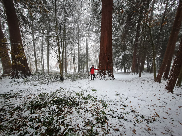
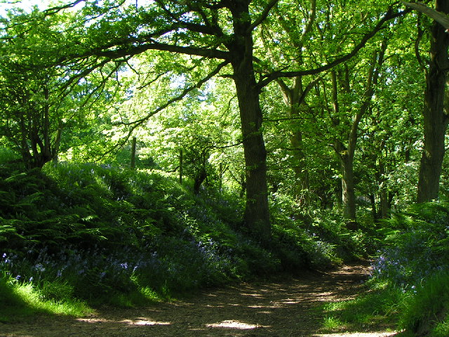
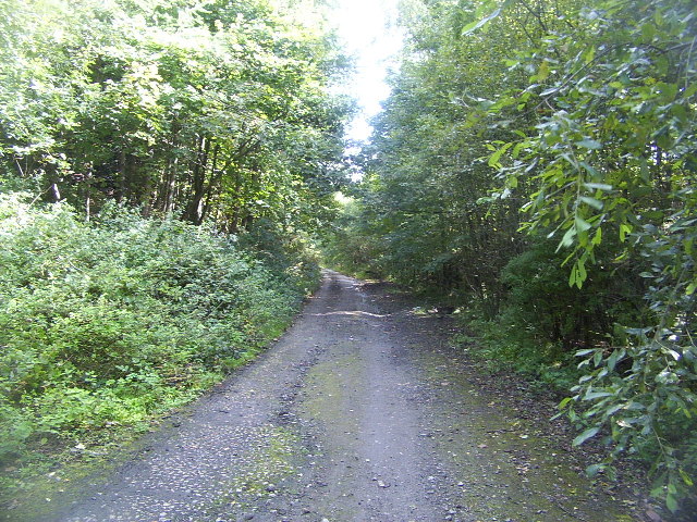
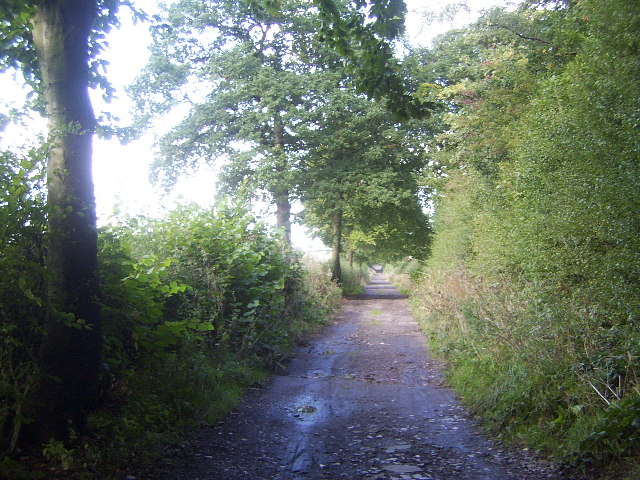
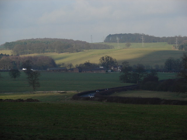
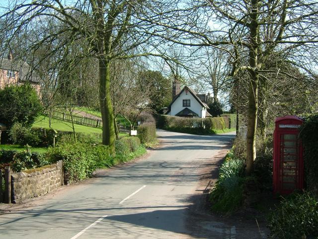
Shutlanehead Wood is a beautiful forest located in Staffordshire, England. Covering an area of approximately 500 acres, it is a popular destination for nature enthusiasts and outdoor lovers.

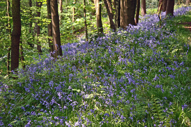
The wood is characterized by its diverse range of tree species, including oak, beech, birch, and conifers. These trees create a dense canopy, providing a cool and shady environment even on the hottest summer days. The forest floor is covered in a thick layer of ferns, wildflowers, and moss, creating a picturesque and serene atmosphere.

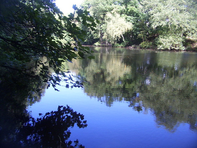
The wood is home to a variety of wildlife, making it a haven for nature lovers. Visitors may spot deer, foxes, badgers, and a wide array of bird species. The tranquil surroundings make it an ideal spot for birdwatching and wildlife photography.

There are several well-maintained walking trails that wind through the forest, offering visitors the opportunity to explore the wood's natural beauty. These trails range in difficulty, catering to both casual walkers and more experienced hikers. Along the way, there are picnic areas and benches where visitors can relax and enjoy a packed lunch or simply take in the peaceful surroundings.

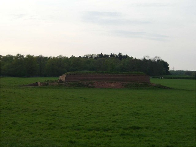
Shutlanehead Wood is also known for its historical significance. It is believed to have been in existence since medieval times, and remnants of ancient structures and earthworks can still be found within the wood, adding an element of intrigue to the area.

Overall, Shutlanehead Wood is a wonderful destination for those seeking a peaceful and scenic escape in the heart of Staffordshire.

If you have any feedback on the listing, please let us know in the comments section below.

Shutlanehead Wood Images

Images are sourced within 2km of 52.978855/-2.261899 or Grid Reference SJ8242. Thanks to Geograph Open Source API. All images are credited.

Keele Redwoods in the Snow
Dirt bike track in Hanchurch Woods
Whitmore Church Whitmore Church in the charming village of Whitmore.
Whitmore Church
Whitmore Church in the charming village of Whitmore.
Whitmore Hall Picture taken from the grounds of Whitmore church
Whitmore Hall
Picture taken from the grounds of Whitmore church
Woodland path - Hanchurch Hills
Pool near Keele Hall This is the lowermost of the ponds that extend south-east from Keele Hall <a href="https://www.geograph.org.uk/photo/14295">SJ8144 : Keele Hall, Keele</a> towards Springpool Wood. There are many possible walks around the area.
Pool near Keele Hall
This is the lowermost of the ponds that extend south-east from Keele Hall SJ8144 : Keele Hall, Keele towards Springpool Wood. There are many possible walks around the area.
The Lymes Road According to the 1940s map, this was originally a B-road, leading down to The Lymes, also in this square. Now it is only a loose-cobbled track running between Keele village and The Lymes. It also serves as a bridleway. Here is it seen just before it passes underneath the M6, which it now runs next to.
The Lymes Road
According to the 1940s map, this was originally a B-road, leading down to The Lymes, also in this square. Now it is only a loose-cobbled track running between Keele village and The Lymes. It also serves as a bridleway. Here is it seen just before it passes underneath the M6, which it now runs next to.
The Lymes Road More of The Lymes Road (see <a href="https://www.geograph.org.uk/gridref/SJ8243">SJ8243</a>), which runs between Keele village and The Lymes farm.
The Lymes Road
More of The Lymes Road (see SJ8243), which runs between Keele village and The Lymes farm.
M6 Northbound Congestion. Just after junction 15 north on Friday 2 Dec 2005 note the lack of traffic on the southbound carriageway.
M6 Northbound Congestion.
Just after junction 15 north on Friday 2 Dec 2005 note the lack of traffic on the southbound carriageway.
Green Fields near The Lymes Looking down over some very "English" green fields over the A53 towards The Lymes farm from the road up to Shutlanehead. For anyone wishing to travel along the track from Shutlanehead to The Pleck, be warned that there's not really a track and it's pretty inaccessible at the best of times.
Green Fields near The Lymes
Looking down over some very "English" green fields over the A53 towards The Lymes farm from the road up to Shutlanehead. For anyone wishing to travel along the track from Shutlanehead to The Pleck, be warned that there's not really a track and it's pretty inaccessible at the best of times.
Footbridge over the M6
Reservoir This small reservoir is in a field alongside the A534. The small wood behind it is the entertainingly named "Pie Rough".
Reservoir
This small reservoir is in a field alongside the A534. The small wood behind it is the entertainingly named "Pie Rough".
Keele Woods in spring The lower part of the woods of Keele University are full of bluebells in early spring. Here they are seen at their best in dappled sunshine.
Keele Woods in spring
The lower part of the woods of Keele University are full of bluebells in early spring. Here they are seen at their best in dappled sunshine.
National Angling Centre Two of the six designers pools forming the National Angling Centre at Whitmore near Newcastle under Lyme.
National Angling Centre
Two of the six designers pools forming the National Angling Centre at Whitmore near Newcastle under Lyme.
National Angling Centre This part of a huge fishing centre which includes lakes, designer match pools an arena and even an artificial canal!
National Angling Centre
This part of a huge fishing centre which includes lakes, designer match pools an arena and even an artificial canal!
Fisheries Sign For more info on this fabulous complex see <span class="nowrap"><a title="www.browningcudmorefisheries.com" rel="nofollow ugc noopener" href="http://www.browningcudmorefisheries.com">Link</a><img style="margin-left:2px;" alt="External link" title="External link - shift click to open in new window" src="https://s1.geograph.org.uk/img/external.png" width="10" height="10"/></span> Happy Fishing
Fisheries Sign
For more info on this fabulous complex see LinkExternal link Happy Fishing
New Hayes Farm
New Hayes Farm
North Stafford Sports Club
Show me another place!

Shutlanehead Wood is located at Grid Ref: SJ8242 (Lat: 52.978855, Lng: -2.261899)

Administrative County: Staffordshire

District: Newcastle-under-Lyme

Police Authority: Staffordshire

What 3 Words

///pass.ritual.bunk. Near Newcastle under Lyme, Staffordshire

Related Wikis

Acton, Staffordshire

Acton is a hamlet in the Borough of Newcastle-under-Lyme, Staffordshire. It lies four miles south west of Newcastle close to the junction of the A53 and...

Loggerheads and Whitmore (ward)

Loggerheads and Whitmore ward was a ward in the Borough of Newcastle-under-Lyme, in the county of Staffordshire, England. It covered, amongst others, the...

Seabridge

Seabridge is a suburb of Newcastle-under-Lyme in Staffordshire, England. The origin of the name "Seabridge" is unknown as it is situated in the midlands...
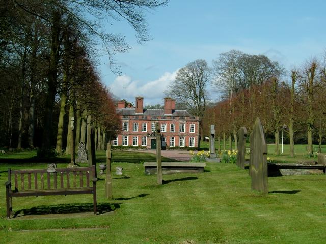
Whitmore Hall

Whitmore Hall is the home of the Cavenagh-Mainwaring family at Whitmore, Staffordshire. A Grade I listed building, the hall was designated a house of...

Whitmore, Staffordshire

Whitmore is a village and small curacy in the county of Staffordshire, England, near Newcastle-under-Lyme. The name Whitmore can be found in the Domesday...

Keele (ward)

Keele Ward is a local council ward in the borough of Newcastle-under-Lyme. It covers the village of Keele and the neighbouring University of Keele's campus...

Keele Hall

Keele Hall is a 19th-century mansion house at Keele, Staffordshire, England, now standing on the campus of Keele University and serving as the university...

Keele services

Keele services is a motorway service station, between junctions 15 and 16 of the M6 motorway near Keele in England. Operated by Welcome Break, it was built...

Nearby Amenities

Located within 500m of 52.978855,-2.261899
Bus Stop
Shutlanehead
Naptan AtcoCode: 3800C525901
Naptan Bearing: NE
Naptan CommonName: Shutlanehead
Naptan Indicator: Adj
Naptan Landmark: Shutlanehead
Naptan Street: Whitmore Road
Naptan Verified: no
Source: naptan_import
Lat/Long: 52.9758016/-2.2641184
Bus Stop
Shutlanehead
Naptan AtcoCode: 3800C525902
Naptan Bearing: SW
Naptan CommonName: Shutlanehead
Naptan Indicator: Opp
Naptan Landmark: Shutlanehead
Naptan Street: Whitmore Road
Naptan Verified: no
Source: naptan_import
Lat/Long: 52.9757649/-2.2638809
Butterton
Place: hamlet
Lat/Long: 52.979955/-2.2578151
Shutlanehead
Place: locality
Source: OS_OpenData_StreetView
Lat/Long: 52.9797607/-2.2661434
The data included in this document is from www.openstreetmap.org. The data is made available under ODbL.

Have you been to Shutlanehead Wood?

Leave your review of Shutlanehead Wood below (or comments, questions and feedback).