Cowpasture Plantation

Wood, Forest in Yorkshire Craven

England

Cowpasture Plantation

Settle, Holy Ascension church The bolt and benchmark is cut into the tower of the church and is to the left of the main church access door.
Settle, Holy Ascension church Credit: Mel Towler

Cowpasture Plantation is a sprawling woodland located in Yorkshire, England. Covering a vast area, it is renowned for its picturesque beauty and rich biodiversity. The plantation primarily consists of dense wood and forest, making it a haven for various flora and fauna species.

The woodland is characterized by towering oak, beech, and pine trees that create a majestic canopy, providing shelter and nesting sites for numerous bird species. The forest floor is adorned with a diverse range of plant life including bluebells, wild garlic, and ferns, creating a vibrant and colorful environment.

Cowpasture Plantation is not only a haven for nature lovers and photographers, but also serves as an important ecological habitat. The woodland provides a home for a wide array of wildlife, including deer, foxes, badgers, and various species of birds, such as woodpeckers and owls. It is also home to several rare and protected species, contributing to its ecological significance.

The plantation offers various walking trails and paths, allowing visitors to explore the woodland and immerse themselves in the natural beauty it offers. It is a popular destination for hikers, cyclists, and nature enthusiasts, who can enjoy the tranquil surroundings and spot the diverse wildlife.

In addition to its natural beauty, Cowpasture Plantation holds historical significance. It is believed that the woodland has been in existence for centuries, and remnants of past human activity, such as old stone walls and ruins, can still be found within its boundaries.

Overall, Cowpasture Plantation in Yorkshire is a captivating woodland that offers a unique blend of natural beauty, ecological importance, and historical charm.

If you have any feedback on the listing, please let us know in the comments section below.

Cowpasture Plantation Images

Images are sourced within 2km of 54.056155/-2.2685888 or Grid Reference SD8262. Thanks to Geograph Open Source API. All images are credited.

Settle, Holy Ascension church The bolt and benchmark is cut into the tower of the church and is to the left of the main church access door.
Settle, Holy Ascension church
The bolt and benchmark is cut into the tower of the church and is to the left of the main church access door.
Settle, Holy Ascension church A wider angle showing the main access door to the church. There is a bolt and benchmark cut into the stone just above the wooden seats, to the left of the main church access door.
Settle, Holy Ascension church
A wider angle showing the main access door to the church. There is a bolt and benchmark cut into the stone just above the wooden seats, to the left of the main church access door.
Settle Bridge This parapet is on the west side of the road. Flush Bracket 1479 is on the north-east facing parapet, and is fixed into the 2nd course of stone of the bridge.
Settle Bridge
This parapet is on the west side of the road. Flush Bracket 1479 is on the north-east facing parapet, and is fixed into the 2nd course of stone of the bridge.
Settle Bridge A wider angle showing both parapets of the busy road bridge through Settle, and looking towards Giggleswick. The parapet on the west side of the road has a Flush Bracket 1479 fixed into the 2nd course of stone of the bridge.
Settle Bridge
A wider angle showing both parapets of the busy road bridge through Settle, and looking towards Giggleswick. The parapet on the west side of the road has a Flush Bracket 1479 fixed into the 2nd course of stone of the bridge.
Settle, Town Hall This is the south facing wall of the Town Hall. The local Tourist Information bureau is currently resident in this area of the building. There is a fine benchmark cut into the 2nd course of stone at the corner.
Settle, Town Hall
This is the south facing wall of the Town Hall. The local Tourist Information bureau is currently resident in this area of the building. There is a fine benchmark cut into the 2nd course of stone at the corner.
Settle, Town Hall A wider angle showing the complete Town Hall. On the right angled corner of the building, to the right of the drainpipe is a benchmark cut into 2nd course of stone.
Settle, Town Hall
A wider angle showing the complete Town Hall. On the right angled corner of the building, to the right of the drainpipe is a benchmark cut into 2nd course of stone.
Settle, Victoria Street This is number 7 Victoria Street, and the wall faces north-east. There is a benchmark cut into the corner stone of the 2nd course, just above the airbrick.
Settle, Victoria Street
This is number 7 Victoria Street, and the wall faces north-east. There is a benchmark cut into the corner stone of the 2nd course, just above the airbrick.
Settle, Victoria Street A wider angle showing the front facia of number 7 Victoria Street. This wall faces north-east, and there is a benchmark cut into the corner stone of the 2nd course, just above the airbrick.
Settle, Victoria Street
A wider angle showing the front facia of number 7 Victoria Street. This wall faces north-east, and there is a benchmark cut into the corner stone of the 2nd course, just above the airbrick.
Settle, Albert Hill This is a north -east facing wall of a property on Albert Hill. There is an indistinct benchmark cut into a right-hand cornerstone. It looks as if the front facia may have been painted white previously, and the paint still remains in the cut depressions on the stonework.
Settle, Albert Hill
This is a north -east facing wall of a property on Albert Hill. There is an indistinct benchmark cut into a right-hand cornerstone. It looks as if the front facia may have been painted white previously, and the paint still remains in the cut depressions on the stonework.
Settle, Albert Hill A wider angle showing the north -east facing wall of a property on Albert Hill. There is an indistinct benchmark cut into a right-hand cornerstone, to the right of the road sign. It looks as if the front facia may have been painted white previously, and the paint still remains in the cut depressions on the stonework.
Settle, Albert Hill
A wider angle showing the north -east facing wall of a property on Albert Hill. There is an indistinct benchmark cut into a right-hand cornerstone, to the right of the road sign. It looks as if the front facia may have been painted white previously, and the paint still remains in the cut depressions on the stonework.
Cross-platform bridge at Settle 
The platforms at Settle are linked by an ex-North British Railway footbridge that was formerly located at Drem station in East Lothian until electrification of the ECML made it redundant. It was then dismantled and re-erected here in 1993.
Cross-platform bridge at Settle
The platforms at Settle are linked by an ex-North British Railway footbridge that was formerly located at Drem station in East Lothian until electrification of the ECML made it redundant. It was then dismantled and re-erected here in 1993.
Settle Station 
The previous train to Carlisle has long gone as have the passengers who disembarked here. The next is not due for some time so the platform is temporarily deserted but that situation won't last for long. The station buildings are Grade II listed <span class="nowrap"><a title="https://historicengland.org.uk/listing/the-list/list-entry/1132349" rel="nofollow ugc noopener" href="https://historicengland.org.uk/listing/the-list/list-entry/1132349">Link</a><img style="margin-left:2px;" alt="External link" title="External link - shift click to open in new window" src="https://s1.geograph.org.uk/img/external.png" width="10" height="10"/></span>
Settle Station
The previous train to Carlisle has long gone as have the passengers who disembarked here. The next is not due for some time so the platform is temporarily deserted but that situation won't last for long. The station buildings are Grade II listed LinkExternal link
Settle & District Conservative Club 
The club on Station Road dates from 1901. The front ground floor units are occupied by the iprint shop.
Settle & District Conservative Club
The club on Station Road dates from 1901. The front ground floor units are occupied by the iprint shop.
Station Road, Settle
Moneypennys & Lavender Lounge 
Beauty & Skincare shop on Station Road <a href="https://www.geograph.org.uk/photo/6963985">SD8163 : Station Road, Settle</a>.
Moneypennys & Lavender Lounge
Beauty & Skincare shop on Station Road SD8163 : Station Road, Settle.
Settle Post Office, Duke Street Duke Street was originally part of the A65 but after the bypass was built it became part of the B6480.
Settle Post Office, Duke Street
Duke Street was originally part of the A65 but after the bypass was built it became part of the B6480.
Settle Social Club Castleberg Settle Working Men's Club and Institute was founded in 1932, previously being situated at Bank Buildings, High Street. It moved premises in 1973/74 to 10 Duke Street Settle, which was formerly the Ashfield Hotel, an imposing Grade II listed <span class="nowrap"><a title="https://historicengland.org.uk/listing/the-list/list-entry/1166701" rel="nofollow ugc noopener" href="https://historicengland.org.uk/listing/the-list/list-entry/1166701">Link</a><img style="margin-left:2px;" alt="External link" title="External link - shift click to open in new window" src="https://s1.geograph.org.uk/img/external.png" width="10" height="10"/></span> building on the junction of Duke Street and Chapel Street.  Many local sports teams use the club as their HQ.
Settle Social Club
Castleberg Settle Working Men's Club and Institute was founded in 1932, previously being situated at Bank Buildings, High Street. It moved premises in 1973/74 to 10 Duke Street Settle, which was formerly the Ashfield Hotel, an imposing Grade II listed LinkExternal link building on the junction of Duke Street and Chapel Street. Many local sports teams use the club as their HQ.
Barclays Bank, Settle
Show me another place!

Cowpasture Plantation is located at Grid Ref: SD8262 (Lat: 54.056155, Lng: -2.2685888)

Division: West Riding

Administrative County: North Yorkshire

District: Craven

Police Authority: North Yorkshire

What 3 Words

///graduated.newlywed.discount. Near Settle, North Yorkshire

Related Wikis

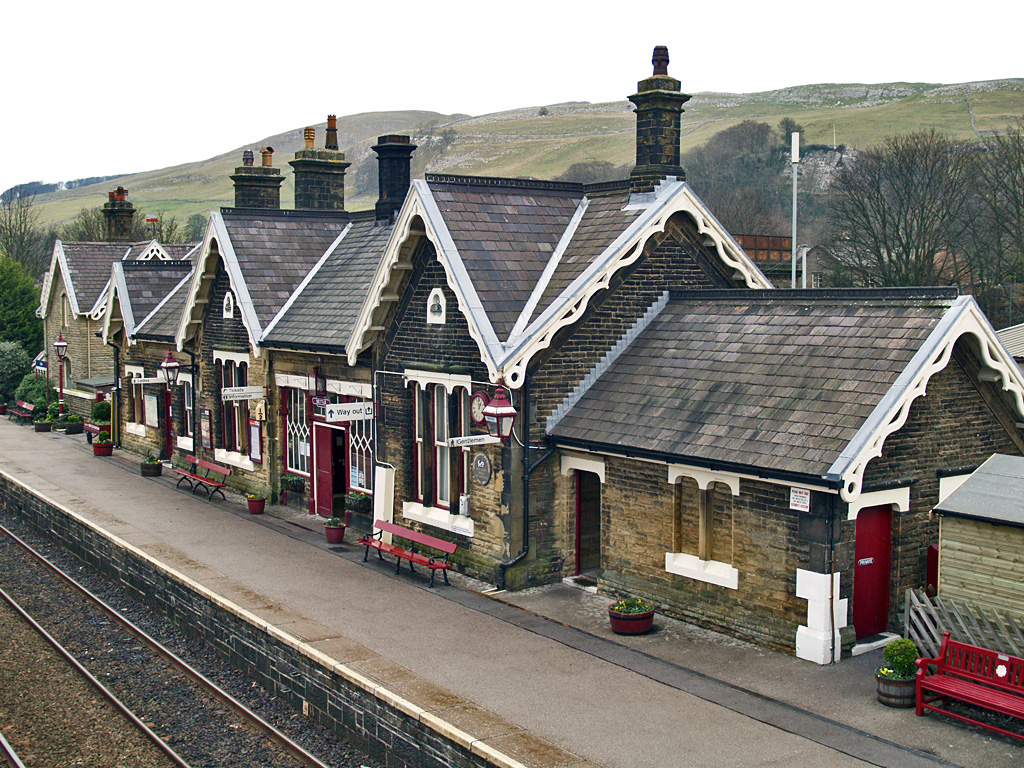
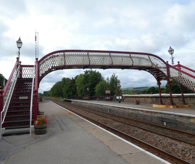
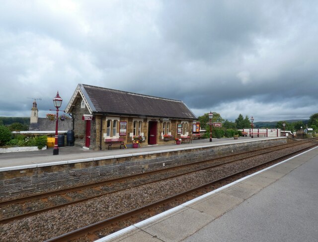
Settle railway station

Settle is a railway station on the Settle and Carlisle Line, which runs between Carlisle and Leeds via Settle. The station, situated 41 miles 37 chains...

Settle Town Hall

Settle Town Hall is a municipal building in Cheapside in Settle, North Yorkshire, England. The structure, which was the meeting place of Settle Rural District...

Settle, North Yorkshire

Settle is a market town and civil parish in the Craven district of North Yorkshire, England. Historically in the West Riding of Yorkshire, the town had...

Settle Victoria Hall

Settle Victoria Hall is a Grade II listed concert hall in Kirkgate, Settle, North Yorkshire, England. It is the UK's oldest surviving music hall.Built...

Scaleber Force

Scaleber Force (also known as Scaleber Foss and Scaleber Waterfall), is a 40-foot (12 m) high waterfall on Stockdale Beck, later the Long Preston Beck...

Settle rail crash

The Settle rail crash was a railway accident that occurred at Langcliffe near Settle, England, on the night of 21 January 1960 in which two trains collided...

Settle Junction railway station

Settle Junction railway station was located near the town of Settle, North Yorkshire, England, immediately to south of the junction between the Midland...

Settle Rural District

Settle Rural District was an administrative district in the West Riding of Yorkshire, England. The rural district was named after the town of Settle and...

Nearby Amenities

Located within 500m of 54.056155,-2.2685888
Tar
Ele: 278.43
Wpt Description: 21-MAR-10 11:05:49
Wpt Symbol: Block, Red
Lat/Long: 54.0583898/-2.2642307
Barrier: stile
Lat/Long: 54.0565099/-2.2642221
Barrier: stile
Lat/Long: 54.0600813/-2.2707518
Barrier: stile
Lat/Long: 54.0591072/-2.2699986
Image: https://www.geograph.org.uk/photo/6285197
Information: guidepost
Tourism: information
Lat/Long: 54.0582221/-2.2637536
The data included in this document is from www.openstreetmap.org. The data is made available under ODbL.

Have you been to Cowpasture Plantation?

Leave your review of Cowpasture Plantation below (or comments, questions and feedback).